After many failed travel plans in 2020, I was left with a week off work in the beginning of August with no solid travel plans. International travel was not an option at this point, and my options were even further limited because I wanted to avoid Covid hot spots. Almost every destination I considered ended up being a hot spot, and I started to wonder if I should give up those dates. I finally realized that southern Utah had very few cases, so I started looking into a possible visit. I had been wanting to visit the Mighty 5 National Parks in Utah for many years, but because of my focus on international travel, I have never had the time for it. I don’t want to associate any positives with coronavirus because it is affecting so many people around the world negatively, but in this case, it allowed me to visit one of my dream destinations that I otherwise wouldn’t have found time for. I asked HR at work about this trip because I wanted to make sure they were fine with it before booking anything, and once it got approved, I made my plans. The Mighty 5 are a group of five national parks in southern Utah that are considered some of the best in the country: Arches, Canyonlands, Capitol Reef, Bryce Canyon, and Zion. And I intended to visit each one, spending a day at each. Below, I’ll share my experiences in Utah, my 34th state!
Arches National Park
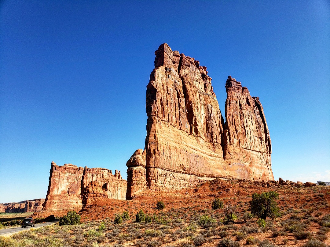
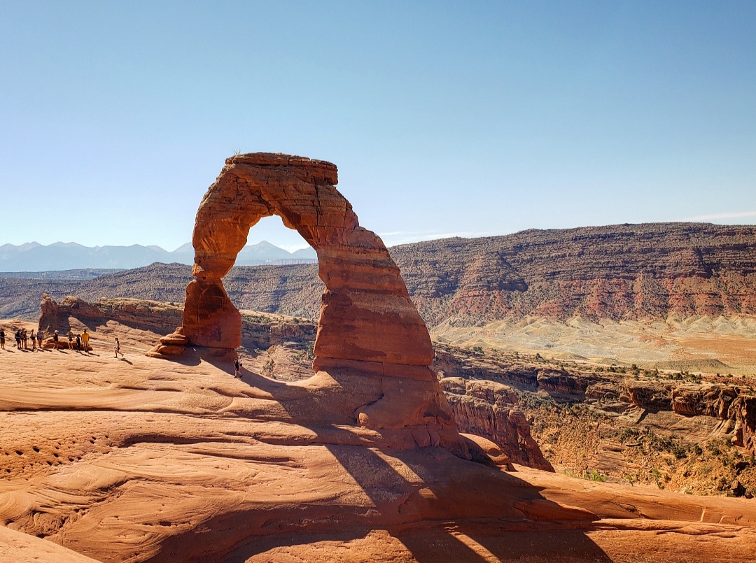
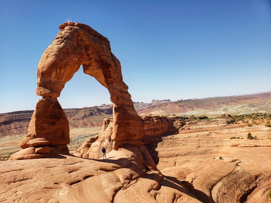
After a 6-hour drive through the middle of nowhere, I reached Moab, the base for visiting Arches and Canyonlands, and I decided to visit Arches first. Driving through the park, I was amazed at the tall rock structures surrounding me in the middle of this desert. I pulled off at many different overlooks on my way to the Delicate Arch, my main priority at the park. The hike to Delicate Arch is about 3 miles round trip, and it’s mostly uphill. I started walking up to the arch and didn’t realize just how steep much of the walk would be. It was 108° in direct sunlight with very little shade directly uphill, and I had a gallon of water on my back. There was a slick rock portion of the hike that was just brutal trying to climb up, and I watched many people turn around at this point. This was probably the toughest hike I’ve ever done, but I was determined to keep moving. I finally reached Delicate Arch, and there were swarms of people around it waiting in line to take pictures.
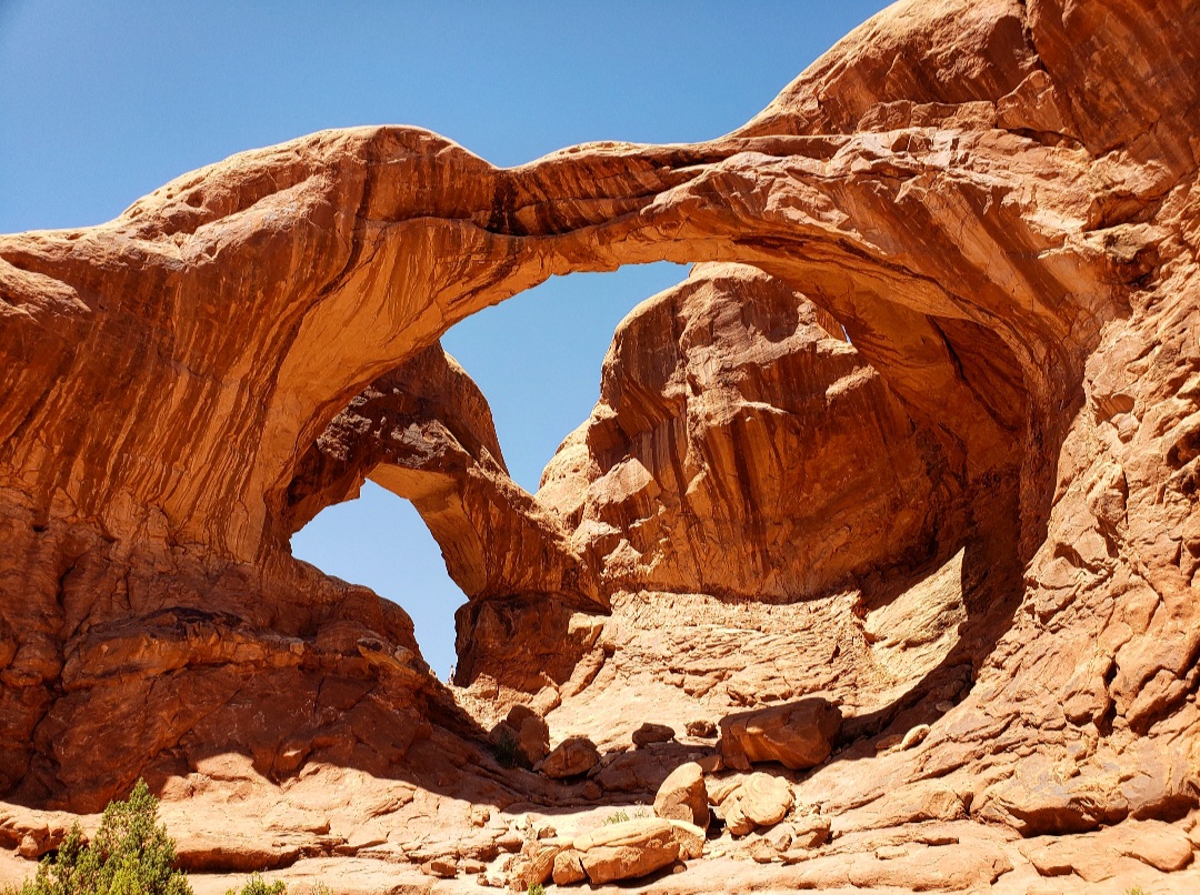
While the trail was only 3 miles long, the 480 feet of elevation change, plus the 108° temperatures and direct sunlight made me completely exhausted. I started dealing with heat exhaustion and didn’t have much energy left, but I didn’t want to leave yet. I hiked a couple miles to Landscape Arch and then, feeling nauseous, I struggled to go only a half mile to Double Arch. At that point I knew I needed to leave. No matter how much water I drank, the heat was getting to me. But I accomplished everything I wanted at Arches, so I was happy with my time there.
Canyonlands National Park
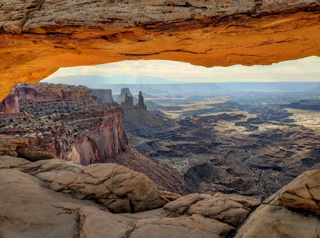
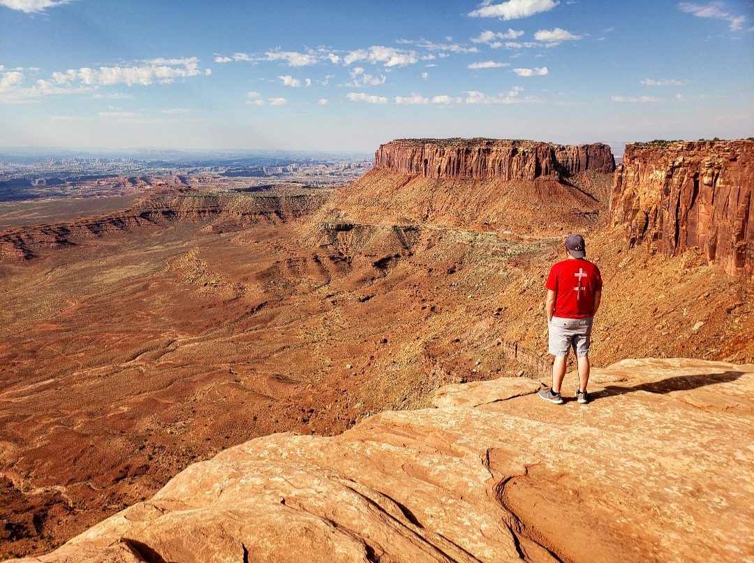
When I arrived at Canyonlands, I was shocked at how different it was from Arches, considering they are right next to each other. The landscape here is more prairie than desert. The park is located on top of a high plateau overlooking the surrounding canyons. The first place I wanted to visit was Mesa Arch. There’s a half mile hike to the arch, and it was an amazing place! The arch sits on the edge of a cliff and the distant canyons can be seen through it. I was lucky to be there at a time when the sun was shining on it creating an orange glow.
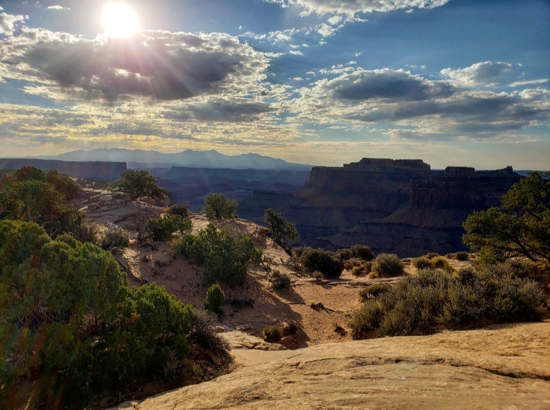
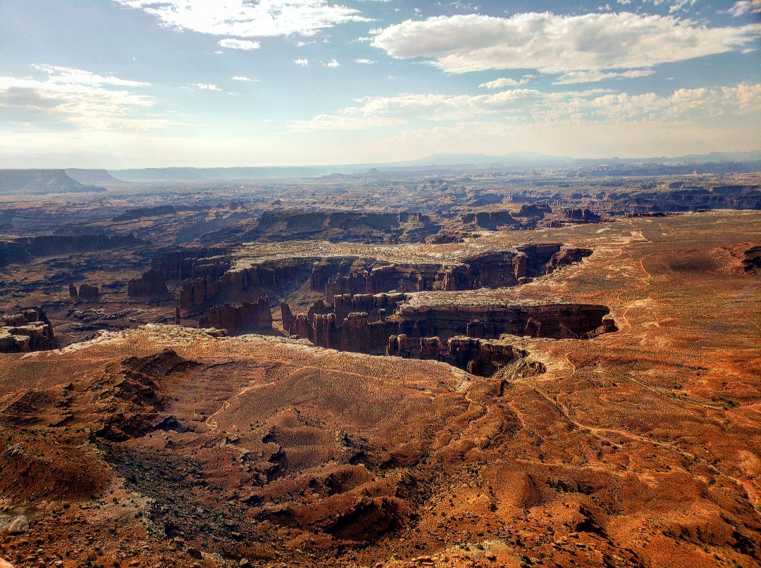
From there, I drove to the Grand View Point, and this was probably my favorite place in the park. There was a hike along the canyon offering some amazing views, and there was a cool breeze coming up from the canyon. This was the perfect contradiction from the extreme heat at Arches. From there I drove to several other overlooks before leaving the park to make the 2 hour drive to Torrey, Utah for my next park.
Capitol Reef National Park
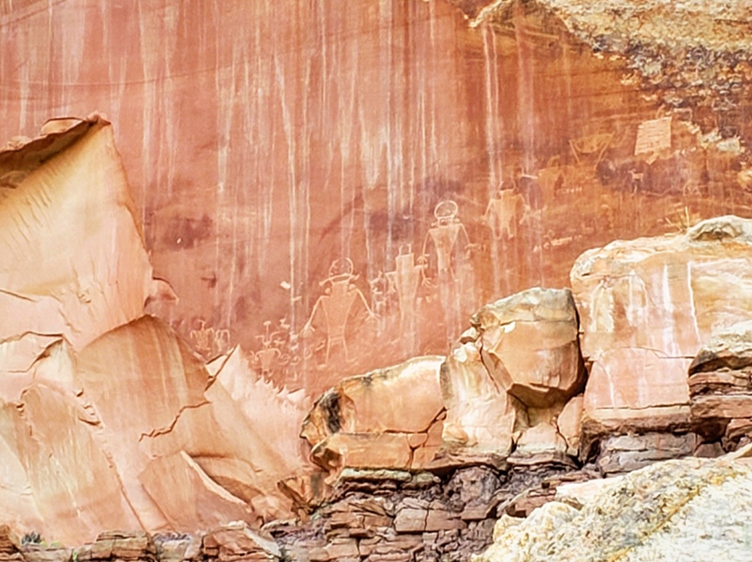
Capitol Reef is the least visited of the five parks, and many people that come here skip over it completely. The main rock formation that the park is built around is the Waterpocket Fold, which is basically a large wrinkle in the Earth’s crust. The other thing I found interesting about this park is the fact that Highway 24 passes right through it. I started Capitol Reef early in the morning, right after sunrise, and it was empty! I felt like I had the whole park to myself. I drove along Highway 24, stopping at several points along the way, including an area where there are ancient Native American petroglyphs carved into the rock.
From there I headed to the hike to Hickman Bridge, a natural rock bridge at the end of a trail straight uphill. After that, I drove along the 10-mile scenic drive that starts in the town of Fruita.
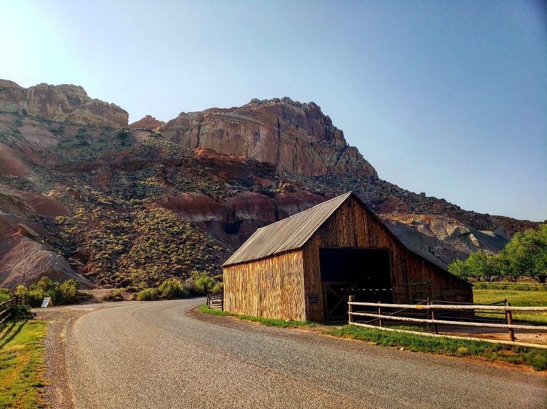
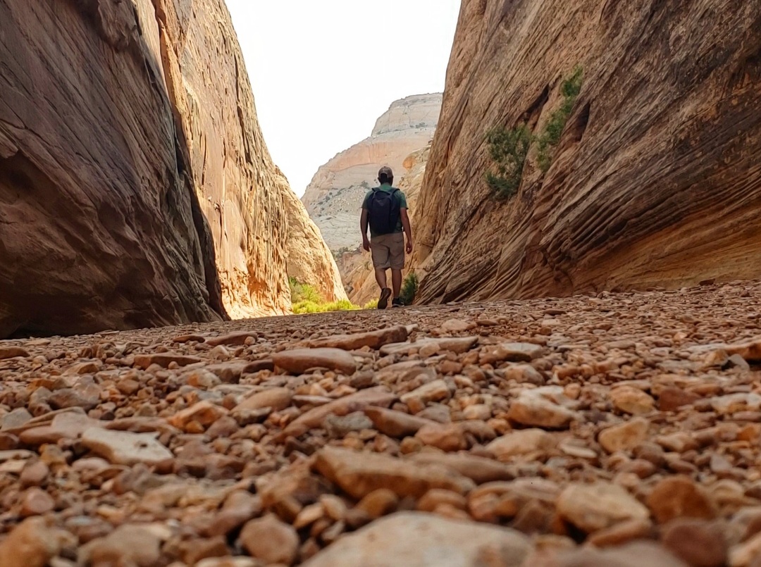
Fruita is a small town in the middle of the park that was settled by Mormon pioneers. There are many fruit orchards in the area giving this a much different feel than the other parks. After reaching the end of the scenic drive, I had to go off-roading to reach my last trail. I drove into Capitol Gorge, a narrow slot canyon and started hiking through the canyon completely alone. It was a really cool trail, and I ended up hiking a couple miles of it. From there, I had another 2 hour drive to Bryce, Utah.
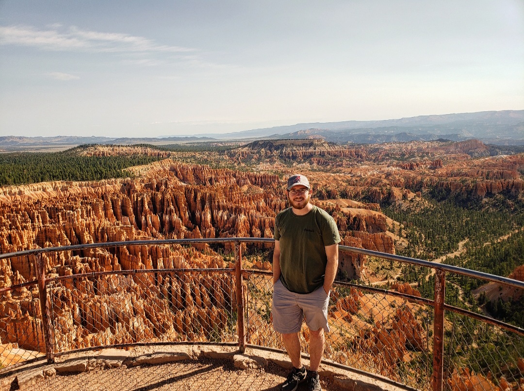
Bryce Canyon National Park
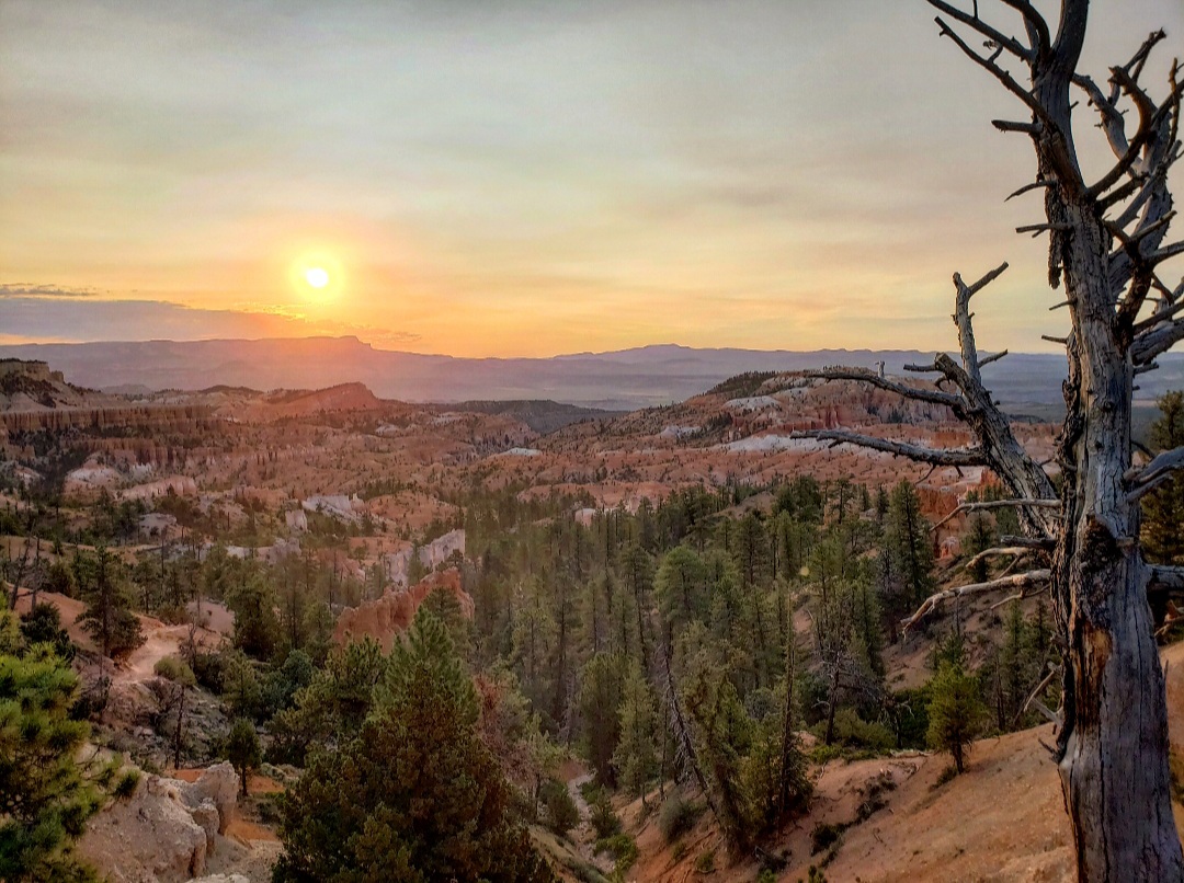
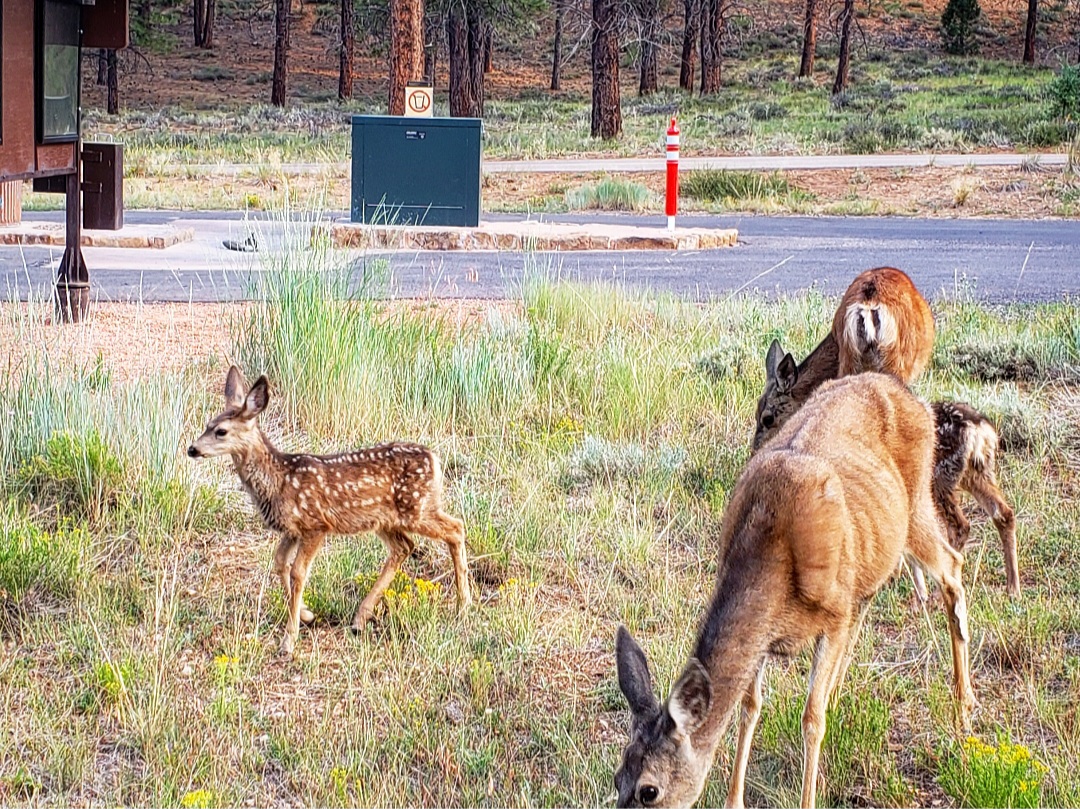
I visited Bryce Canyon the night before I originally planned to because I wanted to visit Sunset Point at sunset. While this was nice, I much preferred seeing Sunrise Point at sunrise the next morning. I got there early before the sun rose, and when it did finally pop up behind the distant mountains, the entire canyon exploded in an orange glow. The canyon is made up of unique rock formations called hoodoos, and each one casts shadows into the canyon giving it a really cool view at sunrise. Right after leaving Sunrise Point, I saw several deer and fawns, and I was surprised at how close they let me get to them. I watched them eat for a while before moving on.
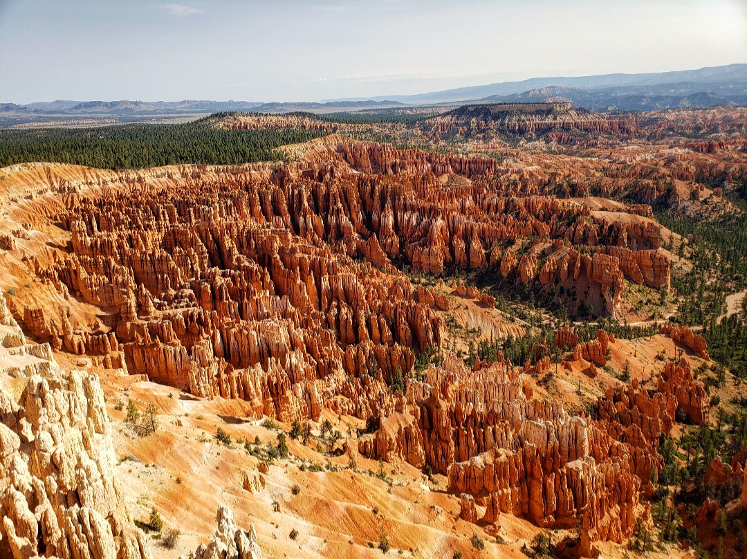
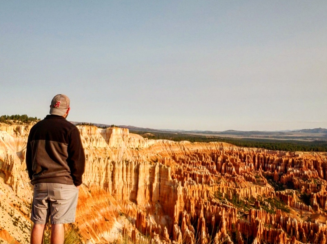
I then went and visited Bryce Point and Inspiration Point. Inspiration Point actually became my favorite overlook of the canyon because it perfectly displays the canyon in my opinion. After staying here for a while, I wanted to hike down into the canyon. So I headed back to Sunrise Point where the trail starts and started heading down to the bottom. The trail was easy on the way down, and it offered a much different perspective of the canyon. I walked through many unique rock formations before reaching the point where the trail starts climbing back up.
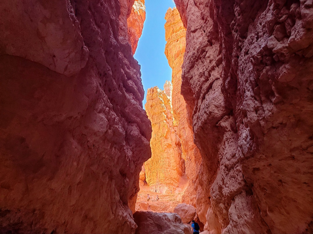
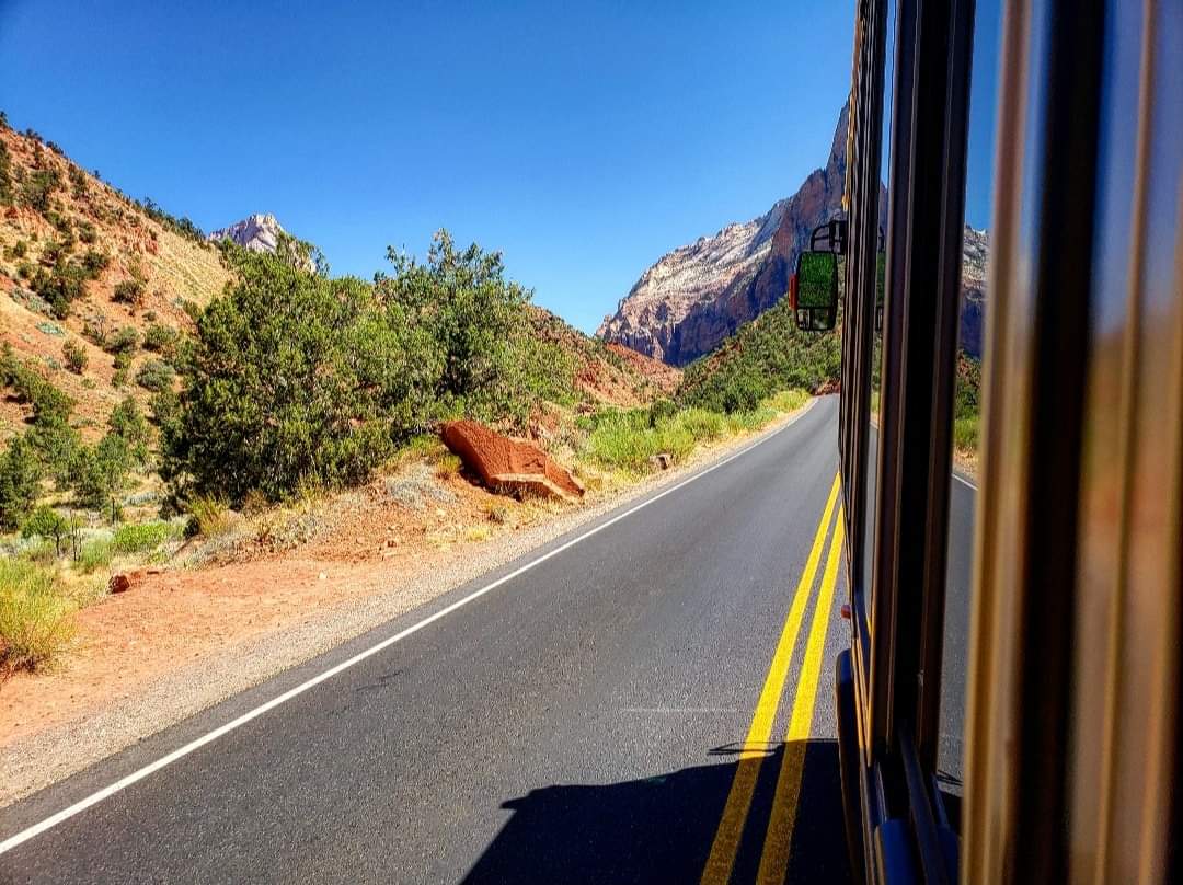
The coolest part of the hike was passing through Wall Street, another narrow slot canyon. The hike up was strenuous, but much more doable than the trails at Arches because of the abundance of shade available here. The trail was 3 miles overall and definitely worth doing. From there, I had one last 2 hour drive to the town of Springdale for my last park.
Zion National Park
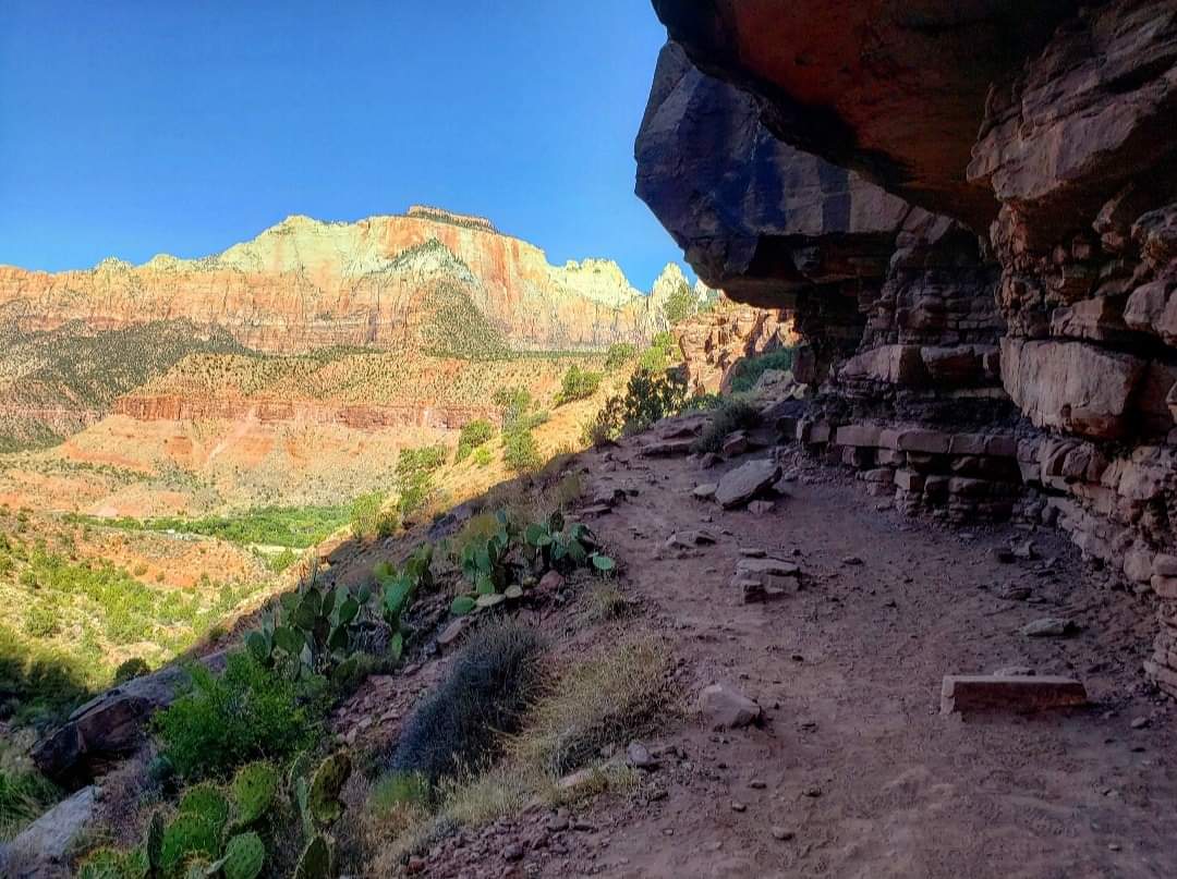
Zion is the third most visited national park in the United States, and because of its popularity, visiting can be difficult. Due to limited parking spaces within Zion Canyon which is where all the popular trails are located, personal vehicles are not allowed into the canyon. I had a shuttle reservation for 11:00, but I arrived much earlier because I heard that parking at the visitor center is also limited. I drove around in the areas I was able to and did a small hike while waiting for 11:00 to come. But by far the coolest part of the park was getting to hike the Narrows.
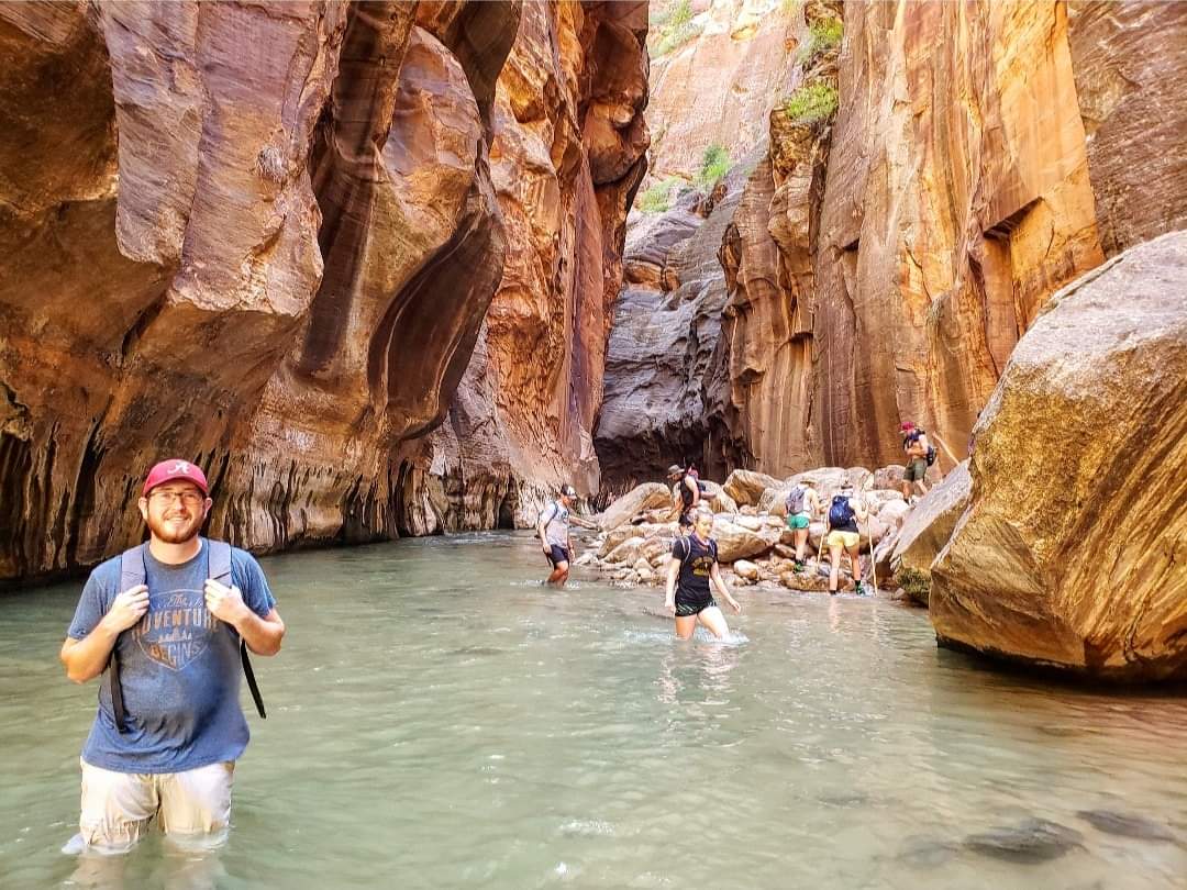
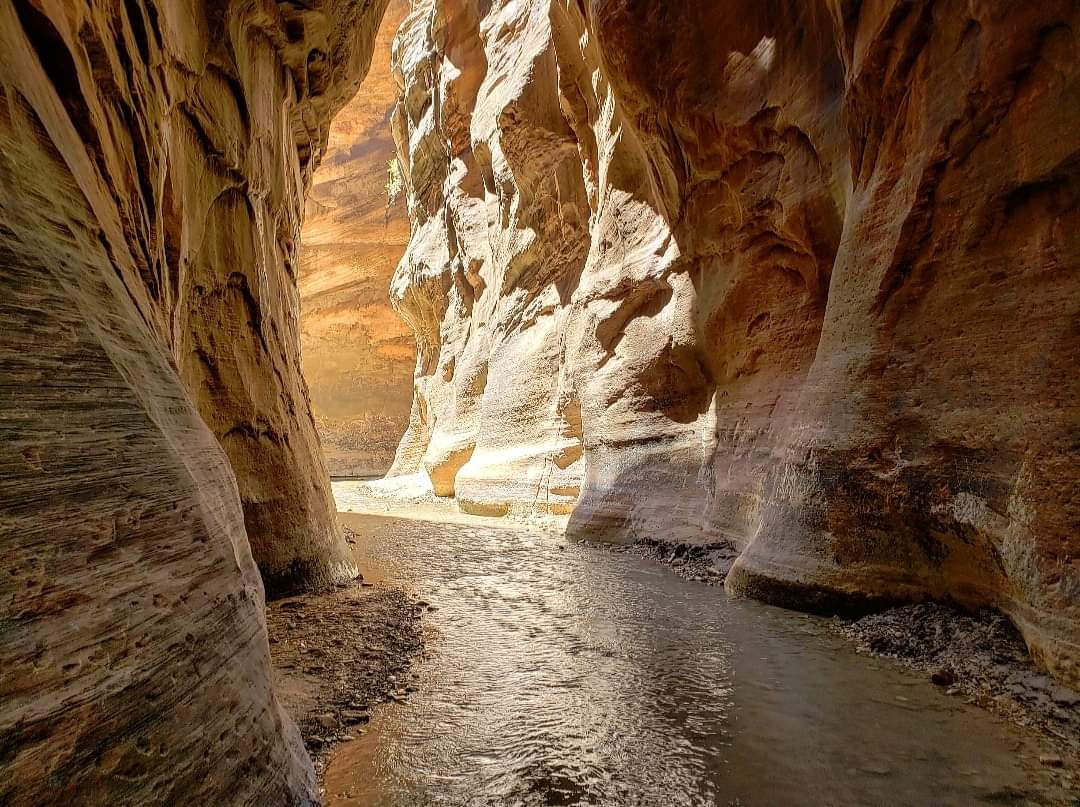
The shuttle dropped me off right at the trailhead, and I walked along the Virgin River for about a mile until the trail disappeared and the only way forward was through the river itself. I loved this hike! The Virgin River cuts through a narrow canyon for miles, and I walked through much of it! At the beginning there were large crowds of people attempting the same trail as me, but the farther I went, the fewer people I saw. But the views kept getting better too. The path continues to get narrower as the walls slowly close in on you. At some points, it becomes so narrow, and the walls are so high that the trail only see about 6 minutes of sunlight a day.
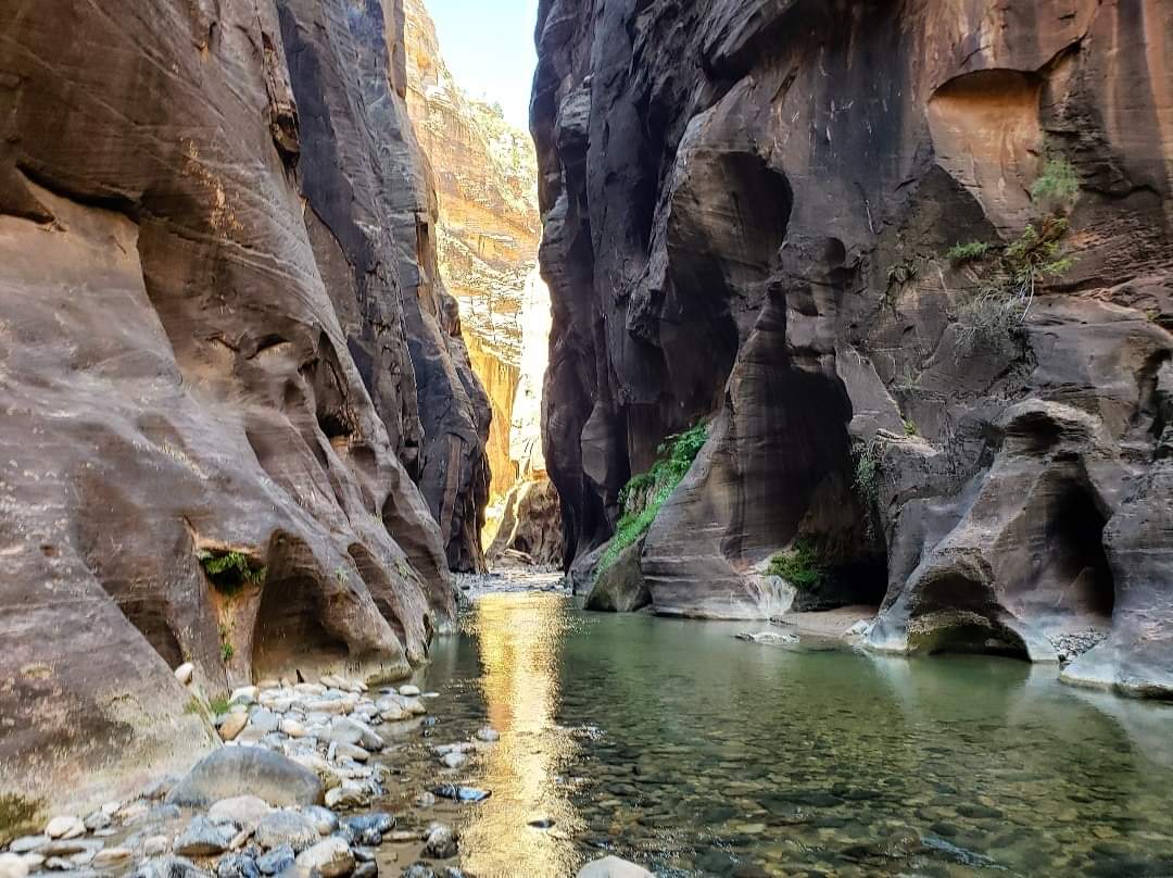
And I was determined to see as much as I could. I always wanted to know what was around the next corner, so I kept going until eventually everyone else had turned around at some point and it was just me and one other couple left! On average, the water level was around my knees and occasionally it reached chest deep where I had to carry my backpack over my head in order to keep it dry. And the trail is definitely strenuous as I had to walk on top of slippery rocks against the current of the river for several miles, but I loved every second of it! I ended up hiking for 10-12 miles, and while it was a tough trail, I never reached the same level of exhaustion as I did on other trails before it. This was my favorite hike I did the whole week, and I’m glad I was able to come!
Overall, this was a great trip! I’m glad I had the opportunity to come. I ended every day exhausted from all the hiking I did, but I wanted to fully experience each one. I’ve had a lot of questions about this trip, so I’ll be writing a travel guide on what to expect and how to plan a trip here. I also created a video of the trip which you can find by clicking here. Thanks for reading, and I plan to share that next article next week!