Planning a trip to the Mighty 5 national parks in Utah can be somewhat challenging. There’s a lot to look into, and it’s especially difficult to plan last minute like I did. Fortunately I made it work out, but there are a few things I wish I would’ve known ahead of time. I learned a lot, and after receiving multiple questions about it, I decided to write my own travel guide on how to visit them. Before I get into it, there are several different routes to take, and you should first determine which one you want to follow. There’s the Grand Circle Roadtrip which is a good idea if you have more time. This includes visiting the Mighty 5 parks of Arches, Canyonlands, Capitol Reef, Bryce Canyon, and Zion plus locations in Arizona including the Grand Canyon, Monument Valley, and Antelope Canyon. The other popular route just hits the five Utah parks and is more ideal if you have less time like I did. This is the route I took, so if you’re more interested in the Grand Circle Roadtrip, you may need to refer to other guides in addition to mine.
How to get there
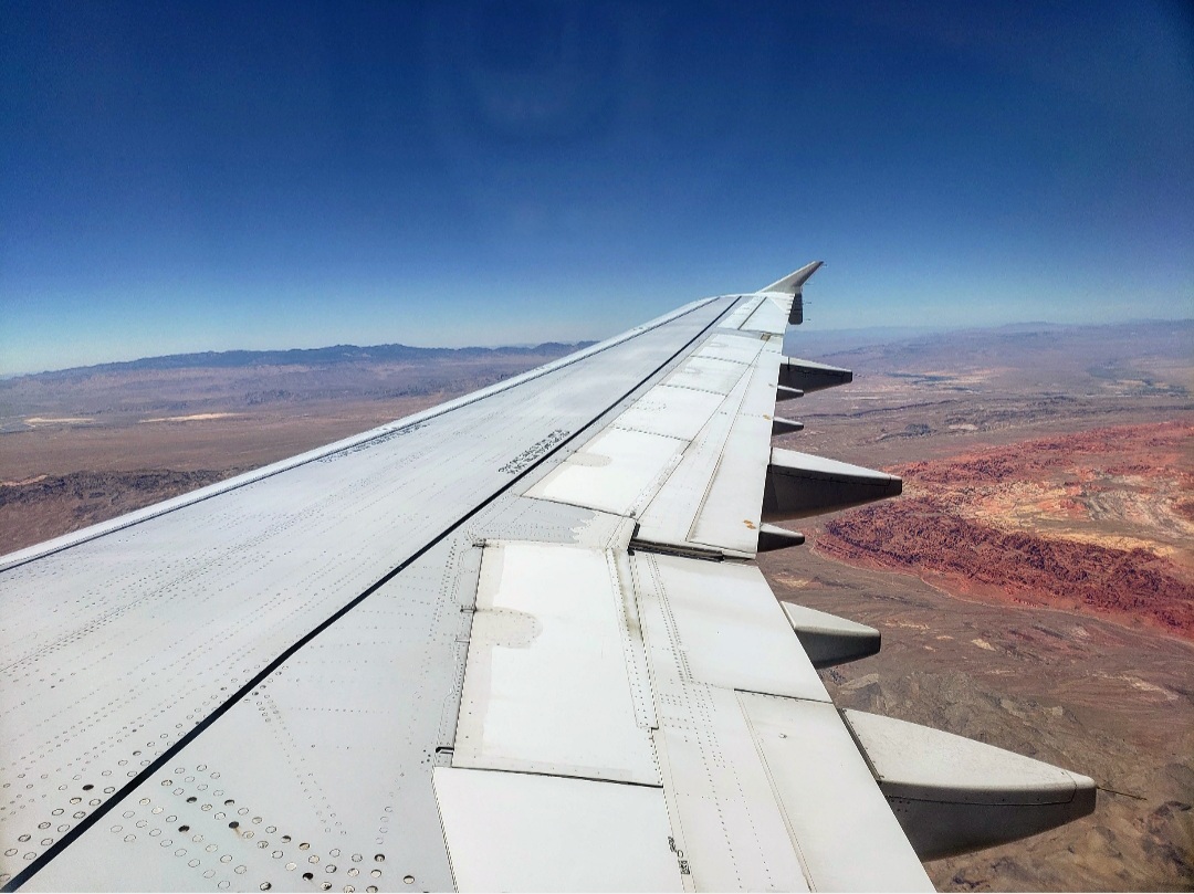
First of all, you need to plan out how you will get to southern Utah as there aren’t really any major airports there. You can fly into some of the small towns in the area, but it will be much more expensive. The three major airports in close proximity to the Mighty 5 are Grand Junction, Las Vegas, or Salt Lake City. And if you’re doing the Grand Circle Roadtrip, Phoenix could also be an option. Each one of these will be about a 2-hour drive from the closest park. If you’re planning to fly in and out of the same airport, just know there will be a long drive at some point, so you may want to plan whether that will be at the beginning or end of your trip. The beginning and ending points of the trip will be Moab and Springdale, depending on which direction you’re going, unless you do the Grand Circle, in which case you can start and end in the same town. You will also want to rent a car (assuming you’re flying in and not driving there).
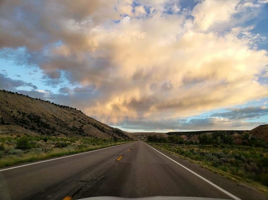
When renting a car, I’d highly recommend renting a car with good gas mileage. Many of the drives you will make on this trip will be through the middle of nowhere where you won’t see gas stations, and because of how remote these roads are, it would take time for someone to reach you, plus cell reception is very limited. I didn’t have any reception at all on most of my drives. You will want to make sure you fill the gas tank up before you go anywhere because that could be the last gas station you see for hours. I started in Moab and worked my way to Springdale, but you can do it the other way around as well. I’ll explain why I did it this way later. But this route will look like this: Moab>Torrey>Bryce>Springdale, or the other way around.
Preparations to Make
Before you ever visit the first park, there are a few things you need to get to be prepared. First of all, you will need lots of water! The temperatures in Utah during the summer are very high. I experienced temperatures in the 110s, and I went through a lot of water! At the least, I’d recommend bringing a gallon of water if you’re planning to spend the whole day hiking. When I visited the first gas station to fill up, I went ahead and bought a huge pack of bottled water to take with me into the parks. I would refrigerate them over night in the hotel rooms and then bring them with me when I went hiking. Fortunately, insects aren’t really a problem in southern Utah, so I didn’t need to worry about insect repellant, but you will also want to pack sunscreen because the sun is very intense there. During the summer, make sure to bring clothes that are light and will keep you cool, but if you plan to be out after dark or early in the morning, you may need a jacket because it does get cool at night.
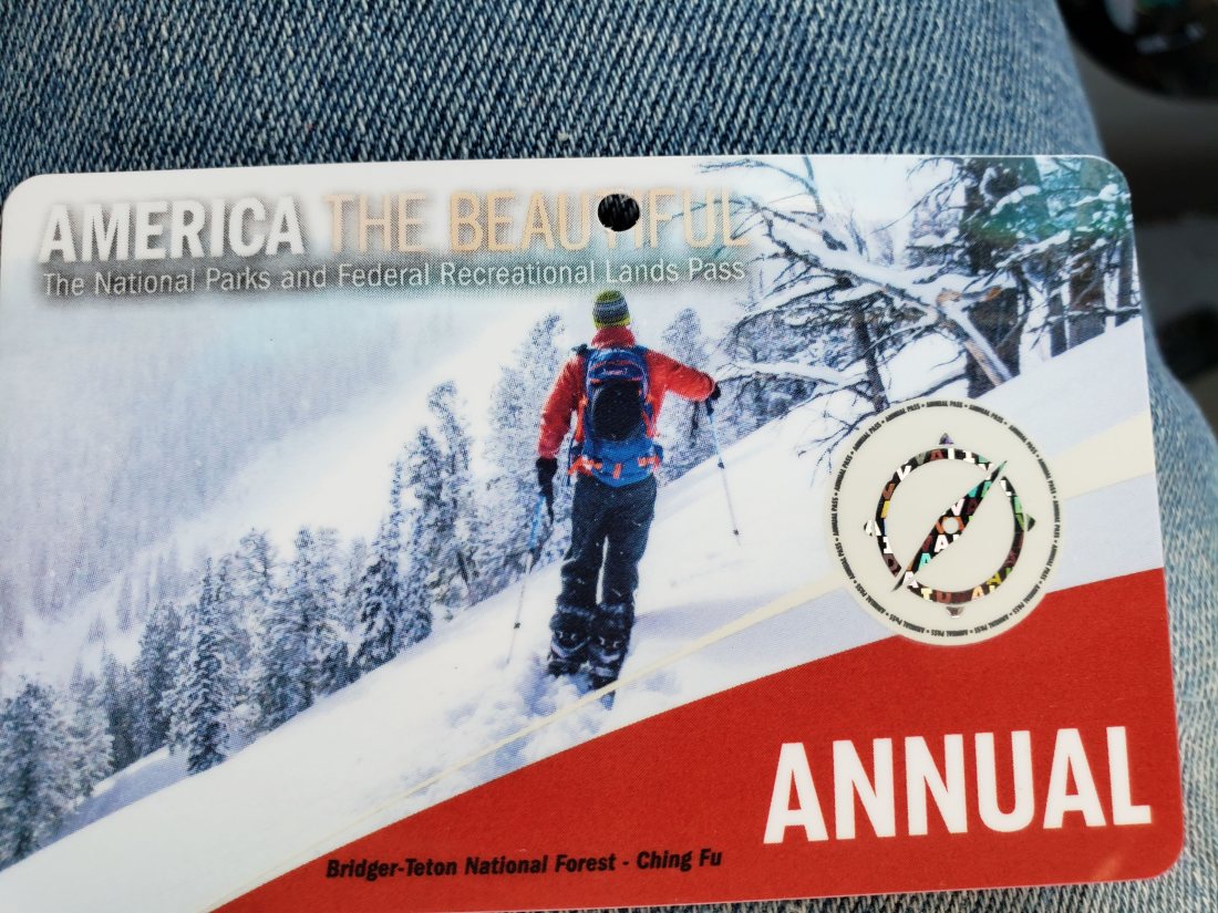
During the winter, definitely pack warm because it does snow. One thing I didn’t have that I wish I did is a first aid kit. I ended up falling and cutting my leg up on my last day, and I didn’t have access to any bandaids or antibacterial ointment, and I had to hike 6 miles through a river to get anywhere. Also make sure to look at the weather forecast. If it looks like there might be rain when you’re planning to visit, many trails could be shut down due to flash flood potential. Because it’s a desert, even a little bit of rain could be dangerous, so make sure to watch out for that. My last recommendation would be to buy an annual America the Beautiful park pass. It is $80, but it will save you money on entrance into all the parks, plus you can use it at any national park site in the country within the next year. [Note: if you’re planning to do the Grand Circle, the National Park pass will not work at Monument Valley or Antelope Canyon because they are run by the Navajo Nation rather than the US government].
Arches National Park
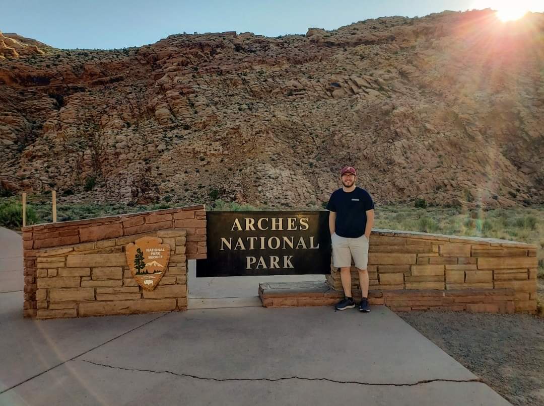
Now I’ll start giving recommendations for each individual park. The first thing I’ll mention is that you will want to pick up a map of each park when you’re first starting out. If you’re there before the entrance gates open, you can stop at the Visitor Center, and the maps will be available outside the entrance. Arches will likely be the hottest park you visit, so have a little more water for this one than the others. Moab is the town you will want to stay in as the entrance to Arches is literally in the middle of town. You will be doing a lot of driving in the park, and there are many pull-over spots to take pictures from. The main draw to Arches is Delicate Arch, so you will want to try to hike it.
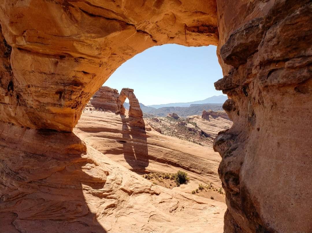
My recommendation is to either hike it early in the morning or wait until later in the day when everything cools down. I went in the middle of the day, and it was just brutal! It didn’t matter how much water I drank, I was dealing with heat exhaustion. The trail is 3 miles long, almost entirely uphill in direct sunlight. There are very few places along the trail where you can find shade. I hear it’s really popular at sunset, but if you plan to do that, you will need a flashlight on the way back, which I didn’t have, so I didn’t attempt it. Once you reach Delicate Arch, there will likely be swarms of people around it, but there should be a line for pictures if you want one without people in it. This is also a good place to rest before making the hike back down. Hiking at sunrise is a less-crowded option, but the sun won’t have the same effect on the arch, so it may not be ideal for pictures. The other two popular hikes in the park are Landscape Arch and Double Arch.
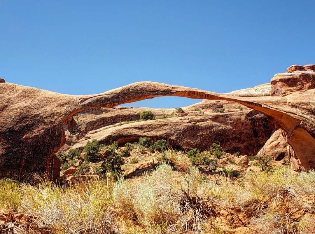
Landscape Arch is about a 2-mile hike, and part of it goes through sand, which can be difficult to walk on. And Double Arch is only a half mile round trip from the parking lot. Each of these hikes has a parking lot by its trailhead for easy access. You can easily visit Arches in a day, but if you’re wanting to do additional hikes, you could definitely spend 2-3 days here. It just depends on what you want to accomplish there.
Canyonlands National Park
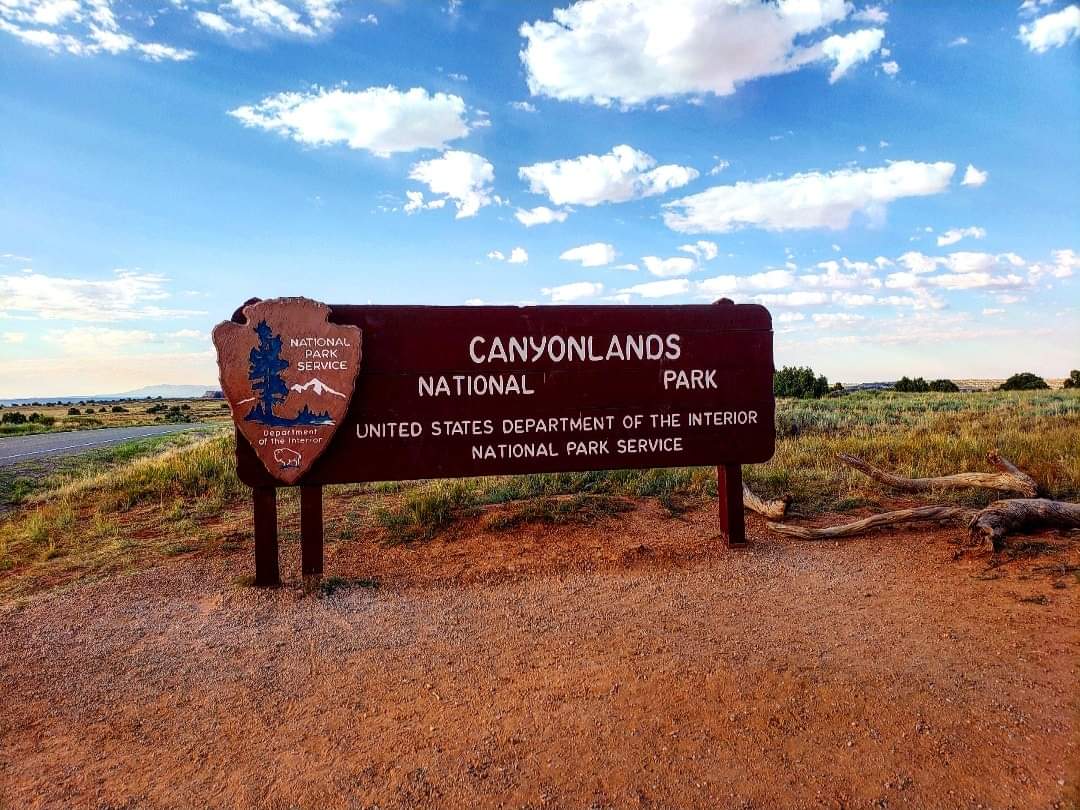
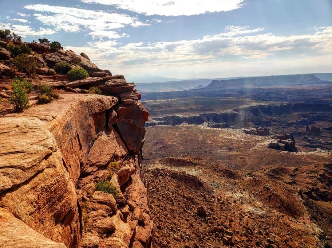
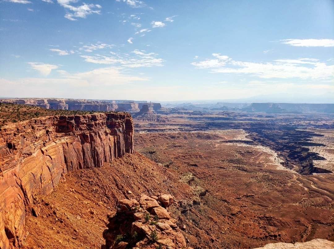
As with Arches, Moab is where you want to be to visit Canyonlands. Now there are three different sections of Canyonlands: Island in the Sky, The Needles, and The Maze. The Needles and The Maze are more remote and require a lot more planning to visit, so I will mostly be focusing on Island in the Sky, where I visited. It is located a little outside the city. There is about a 35-mile drive from Moab straight up to the top of a plateau, which is why it’s called “Island in the Sky.” This park offers some great views of the surrounding canyons, and the first one you definitely want to stop at is Shafer Canyon, literally right across from the Visitor Center. The next place you’ll want to stop at is Mesa Arch. This is best seen either at sunrise or a couple hours after sunrise as the sun creates an orange glow in the arch.
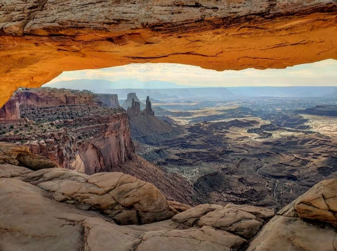
The hike to reach Mesa Arch is only a half mile, and the view is amazing! Because of its popularity and easy access, there will likely be a lot of people there as well, and parking is a little more limited here than it is at Arches, but you should be able to find a spot. Next, I’d recommend visiting the Grand View Point. I could’ve spent all day there. It offers amazing views, and there is a nice breeze coming up from the canyon. You can walk the trail along the rim here which goes for a couple miles, or you can just choose to relax- you can’t go wrong either way. I did a bit of both when I was here. After that, there are many other overlooks which are nice to stop at, and I’d especially recommend the Green River Overlook. There’s also a scenic drive which goes down into the canyon, but if you’re planning to do that, you will need additional fuel and will have to plan to camp there overnight. I just stayed up on the plateau and enjoyed my time there.
There are several other trails available as well, but I didn’t really attempt many hikes while there because I was trying to recover from all the hiking I did at Arches. If you get a map at the beginning of the day, it includes information about each trail which is very helpful in making plans. Again, I was happy with just a day there, but especially if you’re wanting to take the scenic drive or visit the more remote sections of the park, you will need several days.
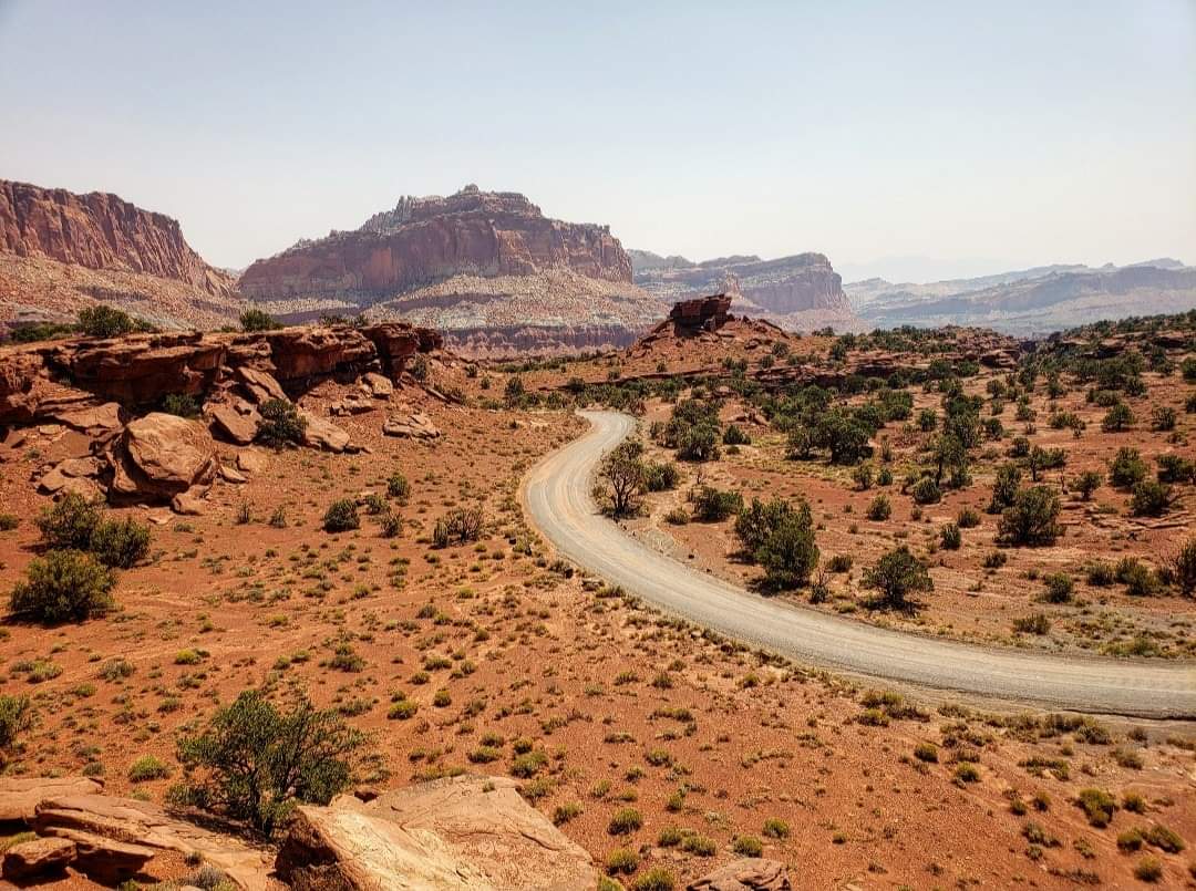
Capitol Reef National Park
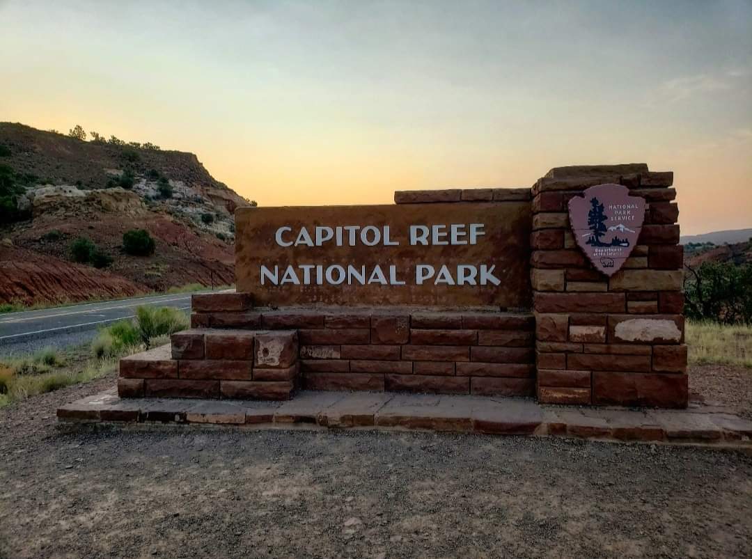
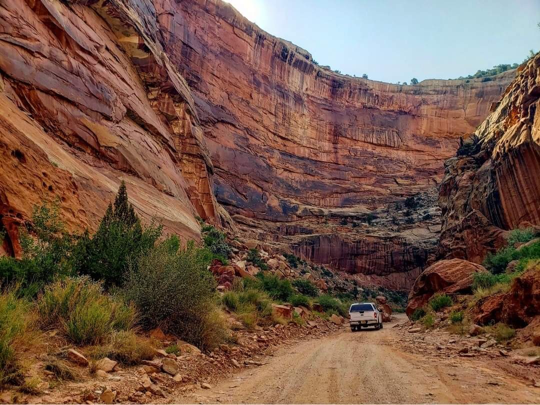
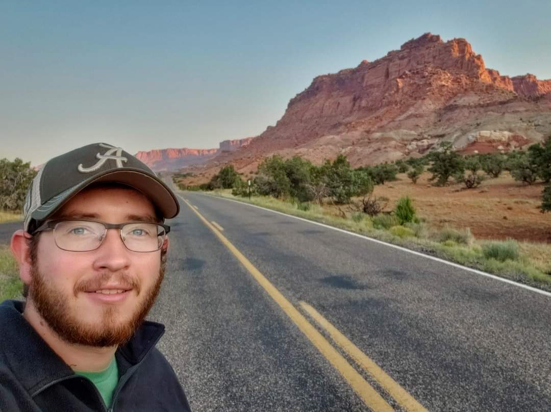
Capitol Reef is often skipped over, and I can understand why, but at the same time, I do think that the park is very underrated. It’s a beautiful area- it just doesn’t have any iconic landmarks like the other four do. The main landmark is the Waterpocket Fold which is basically a large wrinkle in the Earth’s crust. There’s also an abandoned pioneer town called Fruita within the park which includes many orchards planted by the pioneers that settled it. This park is very remote compared to the others. The small town of Torrey is located right outside the park entrance, and it is about 2 hours from both Moab and Bryce, depending on which direction you’re coming from. It’s one of those small towns where everyone knows each other, and there really aren’t any other towns close by.
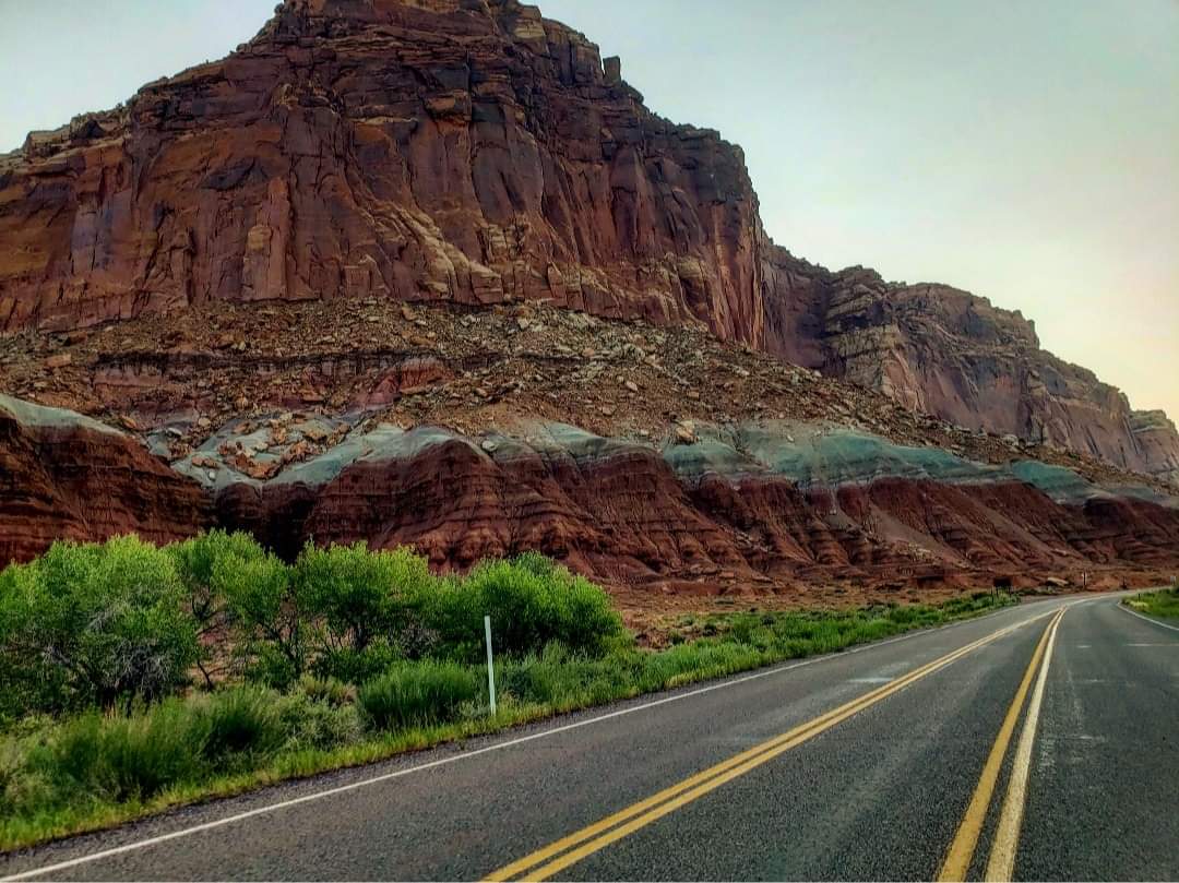
The drive from either direction is through remote areas where you won’t see many gas stations, so you’ll want to fuel up before leaving. Since Highway 24 cuts directly through the park, you can actually visit much of it without paying an entrance fee. Because this park is the least visited, there likely won’t be many other people here, so fitting everything in will be easy. I’d definitely recommend stopping by the petroglyphs and Panorama Point. They are quick stops that don’t require much hiking. And visit one of the orchards in Fruita as well. You can pay to pick the fruit if they’re in season.
The hike to Hickman Bridge is decent, but I found that it wasn’t well-marked, so you could easily get turned around. The main hike I’d recommend is Capitol Gorge. The thing to look out for here though is the weather. If there’s any chance of a flash flood, don’t attempt to visit Capitol Gorge. There’s an off-road section you have to drive through to reach it, and this area can become impassable during or after a flash flood. I also heard about a trail that isn’t really maintained by the National Park Service that is worth visiting, but I didn’t do it. It’s called the Sulphur Creek trail and includes several waterfalls. You can look into that if you want, but I won’t be much help there. You really only need a day to visit Capitol Reef.
Bryce Canyon National Park
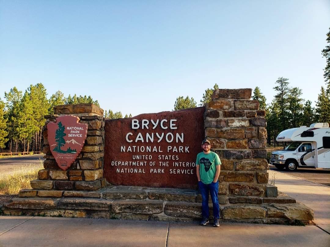
Bryce Canyon was my favorite park of the five, and Bryce, Utah is where you’ll want to be to visit it. It’s about a two-hour drive from either Torrey or Springdale, depending on which way you’re going. When driving between Bryce and Torrey, make sure to include time to make a few stops along the way because the drive is beautiful! I actually stayed in a town outside Bryce called Cannonville, but it was a bit of a drive to the park, so I’d recommend trying to stay in Bryce itself. There’s really not much planning that goes into visiting Bryce Canyon, but I’ll give a few tips. I’d recommend getting up early to watch the sunrise over Sunrise Point.
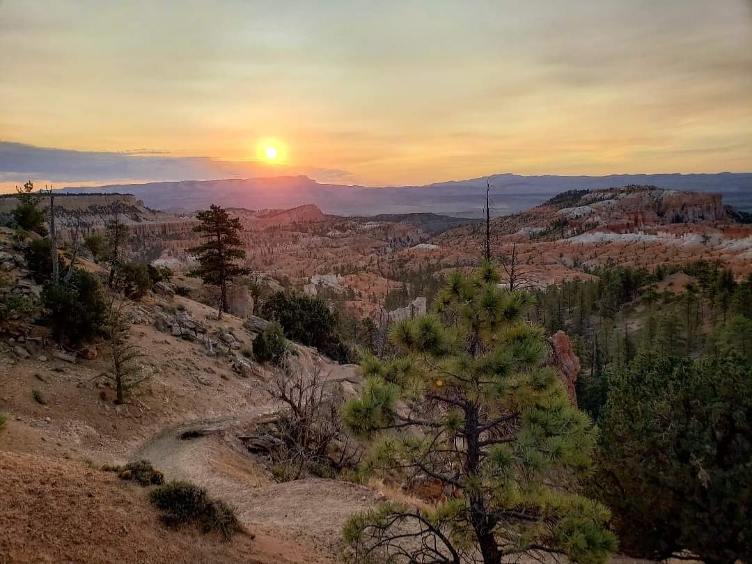
I also visited Sunset Point for the sunset, but in my opinion the sunrise was much better. When you’re there early, look for deer because they will let you get really close for pictures. And bring a jacket for the sunrise because it gets cold at night due to the high elevation. My favorite viewpoint within the park is Inspiration Point, so I’d recommend stopping there. And nearby Bryce Point is really nice too.
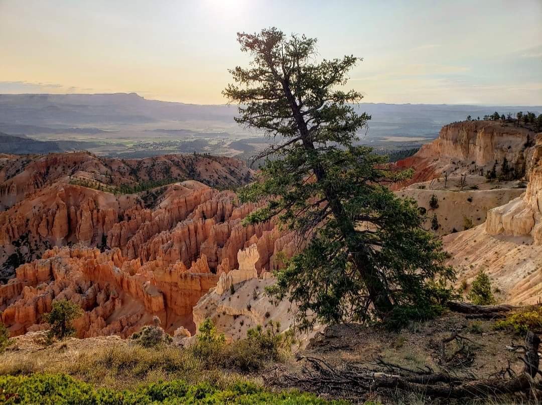
There are also several options if you want to hike down into the canyon, and I’d recommend starting at Sunrise Point, hiking down to the Queen’s Garden and then cutting over to Wall Street before coming back up to Sunset Point. This trail is about 3 miles, but just remember that what goes down must come up and bring plenty of water. There are longer hikes as well if you want to try those. You can also drive the full 38-mile scenic drive through the park, stopping at overlooks along the way. This takes several hours but is a nice drive. I mostly preferred staying in the Bryce Amphitheater area at the beginning, but I also enjoyed the drive through the rest of the park. I found that a day was enough time to fully see the park.
Zion National Park
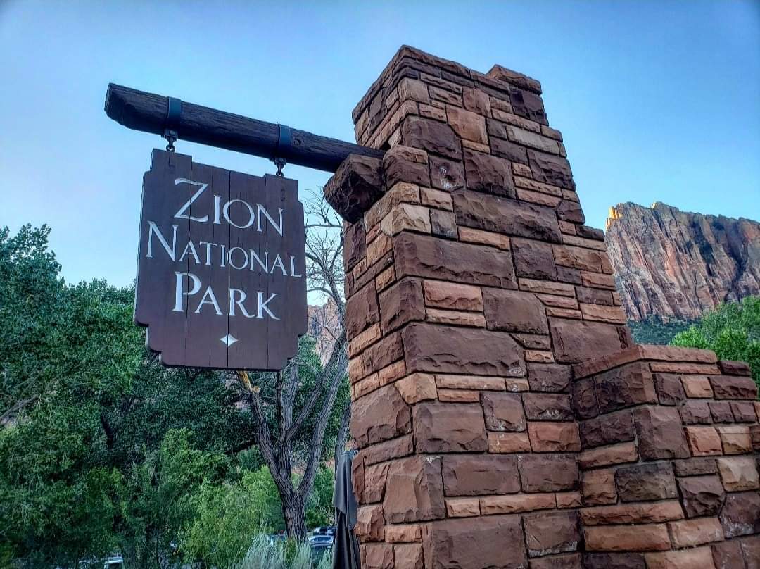
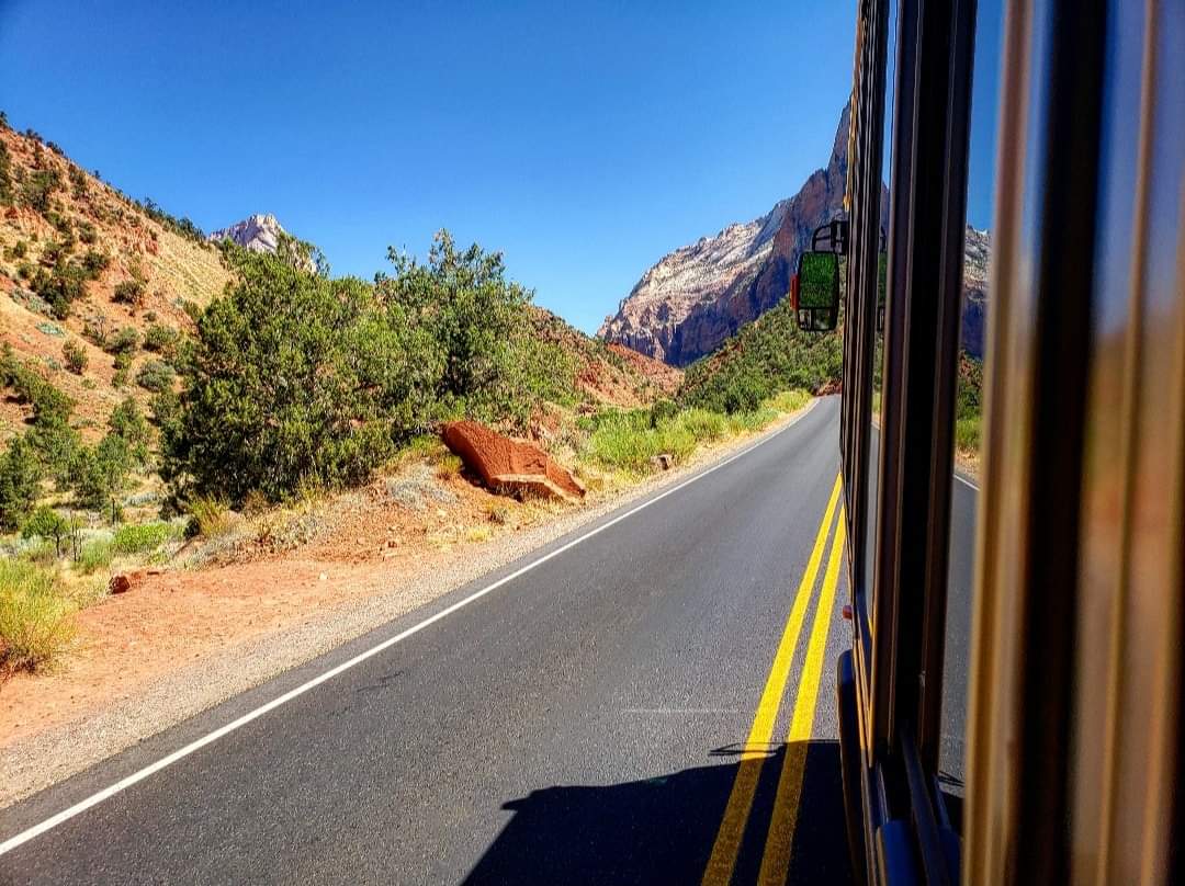
Zion, located just next to Springdale, is by far the most difficult to visit, but if you plan it right you can have a great time. Before planning your trip, try to schedule a shuttle into Zion Canyon on the date you plan to visit several weeks in advance. You can reserve your spot at recreation.gov, and several weeks out the tickets will become available. If you don’t schedule a shuttle before two weeks out, they will become unavailable! Make sure you don’t miss this deadline because it is the only way to visit Zion Canyon during the tourist season of March-September! Zion is the most visited of the five parks, and parking is extremely limited at the trailheads, so to make it fair for everyone, the shuttle is the only way to get in. There are some sections you can visit with a personal vehicle, but the main attractions are only accessible by shuttle. If you do miss the deadline like I did, you’re not completely out of luck yet. There are tour companies that will allow you to book a private shuttle into the canyon. I didn’t do this, but it’s an option. The other, more risky, option is to wait until the day before your planned arrival.
Tickets for the following day become available at 9:00 am Mountain Time, but these go extremely fast! If you’re not there right at 9:00, you won’t get an early shuttle. Because I had issues with this, I’ll go into a little more detail here. Before you attempt to schedule a shuttle, you have to have an account through recreation.gov. Make sure to set this up in advance. I attempted this while at Bryce Canyon (which had surprisingly good cell signal for Verizon) and was on right at 9. I was aiming for the 7:00 shuttle, and when I got on the website there were 230 spots available for 7:00. But it told me to open an account first, and in the two minutes it took me to create the account, they had been all sold out. At that point, the earliest I could get in was 11:00, but it was better than nothing. If you schedule this weeks in advance, you won’t have to deal with all this stress which is best case scenario. Or you can completely avoid worrying about a shuttle by visiting during the winter, but parking lots may fill up fast.
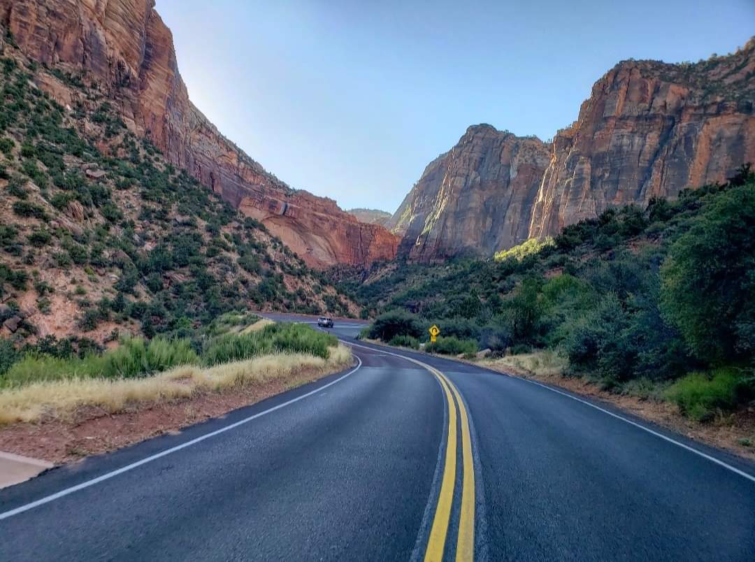
After arriving at the park before your scheduled shuttle into the canyon, there is a section you can drive yourself. There’s a popular Canyon Overlook Trail right after the tunnel that I’ve heard great things about, but I was never able to hike it because the parking lot is only big enough for like 12 cars. If that’s full, there are some nice trails near the Visitor Center that are worth checking out while you wait. And if you’re planning to drive the scenic drive with an RV, you’ll need a permit ahead of time due to complications with the tunnel. My next recommendation is to park at the Visitor Center before 10:00 when the parking lot usually fills up. If the parking lot at the Visitor Center is filled up, there is nowhere else for you to park in Zion! At that point, you would have to drive back into Springdale, pay for parking somewhere in the city, and hop on the free shuttle into the park. This could be very frustrating, but luckily I got a spot before it was too late. Also make sure to have your shuttle ticket either printed out or take a screenshot of it because signal isn’t great in the park. Once on the shuttle, it will take you to several different stops, and make sure to know which one you want to get off at.
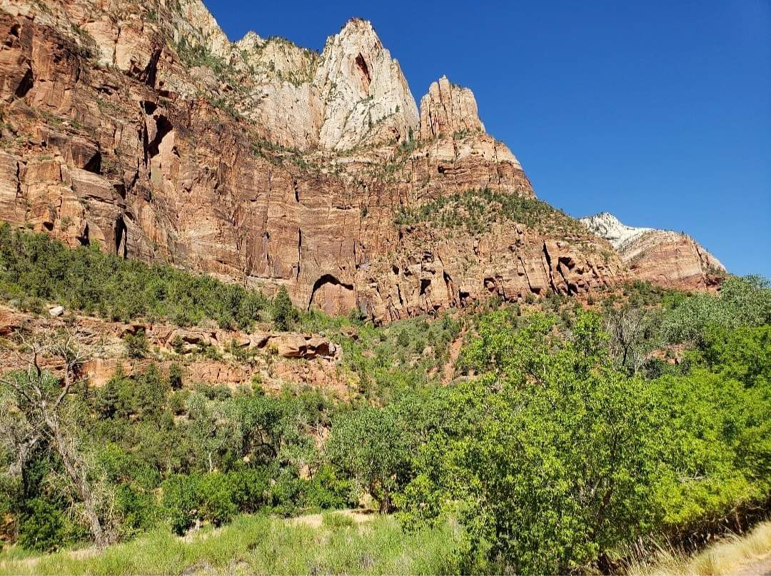
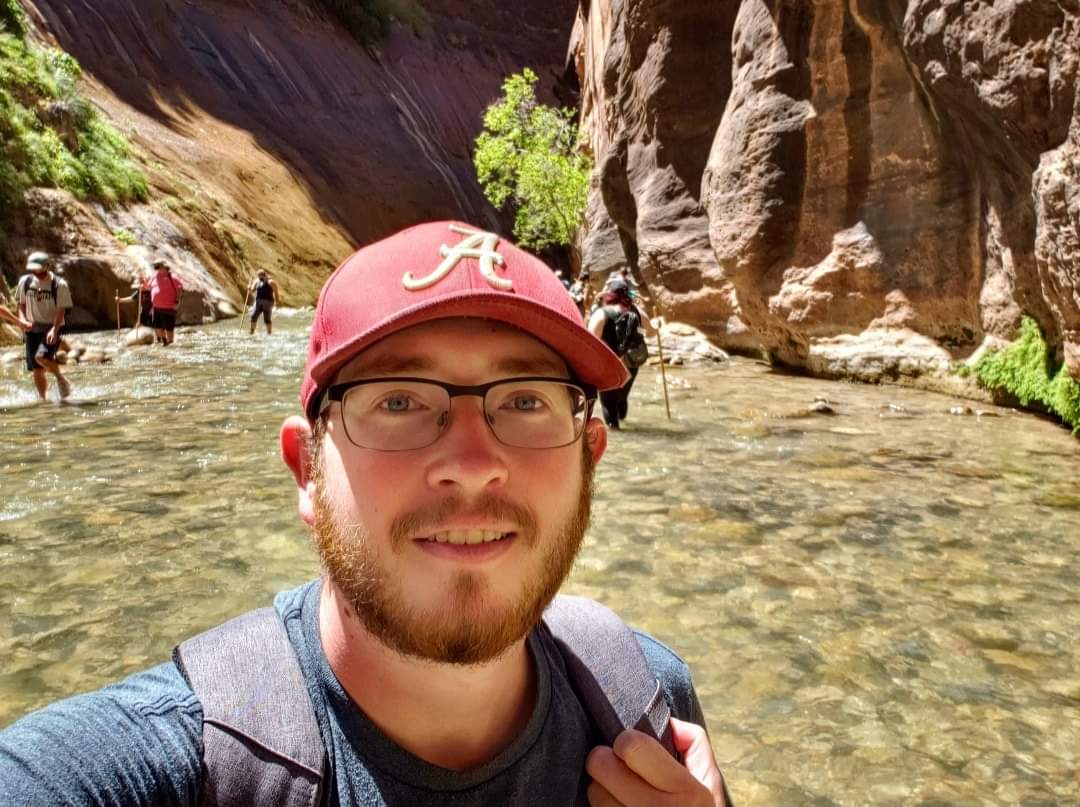
The two most popular hikes are Angel’s Landing and The Narrows, but you can choose another hike as well. I chose to hike The Narrows, and I loved it, but I’ve heard good things about Angel’s Landing as well. Similar to other parks, check the weather before making plans because these trails will likely shut down if there is any rain. Flow rates in the river will shut down The Narrows, and rockfalls regularly shut down other trails like Weeping Rock. When I visited, there really weren’t many trails to choose from because of many different factors. Also, make sure to watch the time. The last shuttle leaves the Temple of Sinawava (The Narrows) at 8:15 pm. If you’re not on that shuttle, you’ll have to walk 8 miles back to the Visitor Center in the dark because they won’t come back for you. I didn’t do Angel’s Landing, but from what I’ve heard, you will need a lot of water because it’s straight uphill. Don’t rush yourself and take breaks if you need to. Because I did hike The Narrows, I’ll give advice on that.
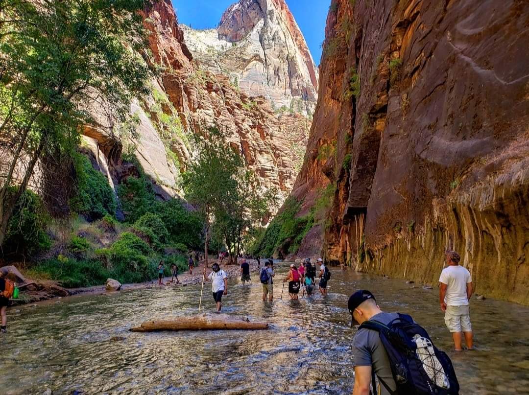
You can rent special shoes, neoprene socks, walking sticks, waterproof backpacks, and wetsuits through nearby companies before going in, and they can even shuttle you into the canyon. I went without any of that, but if I were to recommend any of it, it would be the walking stick! It’s doable without one, but I probably could’ve prevented a painful fall if I had one. During the colder months, obviously you would want to be more prepared with a wetsuit to keep yourself warm. Also make sure to wear close-toed shoes. I’d recommend an old pair of tennis shoes. If you wear flip flops or sandals, you will cut your feet up. Of all these parks, Zion is the one I could see you spending the most time at. I only had a day, so I really only had time to hike The Narrows, which will take up a majority of the day depending on how far you go. But if you’re wanting to do several different hikes, you will want more than one day (and make sure to schedule a shuttle for each day).
*As of April 2022, Zion will start requiring permits to hike Angel’s Landing in order to limit crowds. In order to obtain a permit, you will need to register at recreation.gov at least 3 months in advance to be added to an online lottery system. Registration costs $6 per person and is nonrefundable. You will be assigned a time slot for your specific dates and will be required to pay an additional $3 per person. If you miss this deadline, there will be another opportunity the day before you visit, but you will be much less likely to get your permit approved.
Overall, there is so much planning that goes into this trip, but this guide should help you make your plans. If you’re wanting to go camping or back country hiking at any park, you will need to obtain permits, and you can do that through each park’s website. This can all seem a little intimidating at first, but I found it wasn’t as complicated as I first thought it would be. You just need a little patience. Because I missed the shuttle reservation before the deadline, I entirely flipped my original itinerary so I wouldn’t get stuck trying to book a shuttle from the plane. I didn’t give any advice on hotels or restaurants within each town in this guide, but everyone has different tastes and budgets, and I tend to be cheaper than normal with those. If you find a hotel in the towns I mentioned you’ll be fine. I know this is a lot of information, but it will tremendously help if you’re planning a Mighty 5 roadtrip or even Grand Circle trip. I hope this helps, and if you have any additional questions, feel free to DM me on Instagram at @tylersgerman. Thanks for reading!

Tyler, your trip looks like it was super cool! This is definitely a trip I am planning to take in the next year or two, so your experiences are super helpful. Thanks for sharing!
LikeLiked by 1 person