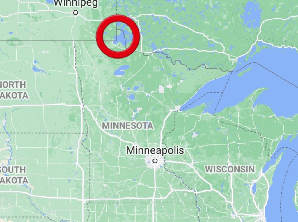
As I was finishing my goal of visiting the Four Corners of the United States, one place I came across that really interested me is this place called the Northwest Angle in the north of Minnesota. It’s the northernmost point in the contiguous United States, but it’s separated from the rest of Minnesota and is completely surrounded by Canada. It was given to the United States accidentally during the signing of the Treaty of Paris. The map that Benjamin Franklin used was incorrect, so when the official borders were determined, this small section of land was considered US territory. The only way to reach this part of the state is to drive through Canada and then drive back into the Northwest Angle.
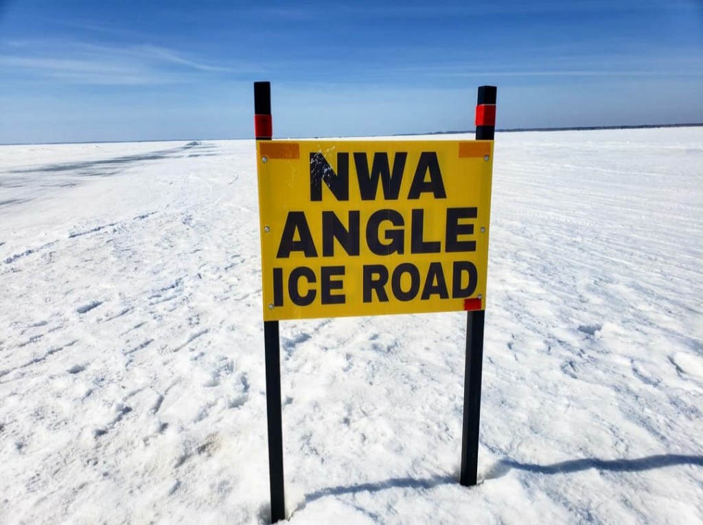
Instantly I became interested in visiting it and always kept it in the back of my head as a possible trip to take in the future. But then Covid struck, and the US-Canada border was closed down. No one has been allowed to cross the border for a year now, and this town has been completely cut off from its own country. Due to this situation, the local businesses have been struggling to stay afloat because they have always relied heavily on tourism. (There are many fishing resorts in the town). Desperate to get tourists in, the business owners got together and decided to plow an ice road 22 miles across the frozen Lake of the Woods, allowing Americans to drive into town without ever crossing the border. I have been following this story closely ever since the border officially shut down, and when I found out that the ice road had been finished, I immediately booked a plane ticket up to Minnesota because I had to see it for myself. I contacted my friend Sarah in Minnesota and somehow convinced her to go with me, and this very spontaneous trip was put together.
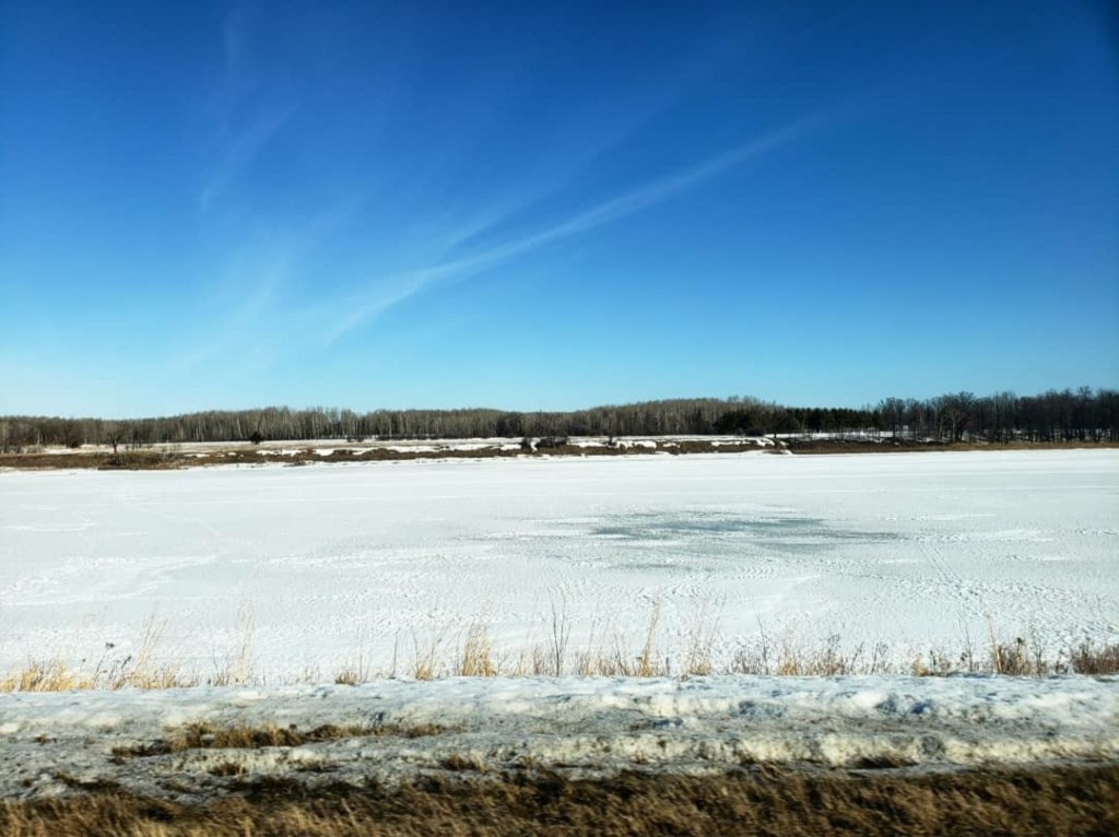
After flying into Minneapolis, Sarah picked me up from the airport, and then we drove 3 hours north to Chisholm where her brother lives. We stayed at his house and then continued driving north the next morning. Warroad was another 3 hours away, and we started driving all the way up to the top of Minnesota. Eventually, we reached the top where there was a frozen river with Ontario on the other side. It was cool just seeing another country since it had been over a year for me since I had last left the United States.
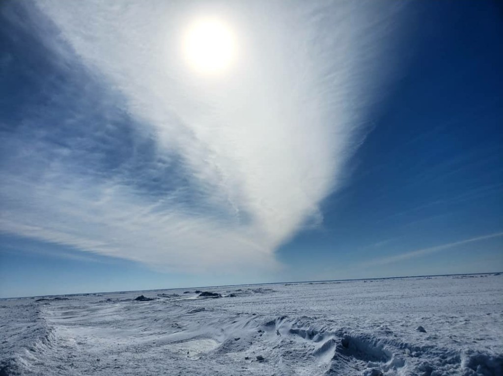
We followed the river until we reached Warroad, the starting point for the ice road. When we first drove onto the lake, there were many fishermen out ice fishing. They bring these little ice fishing houses and park them over the spot where they will drill their hole. Once we passed the popular fishing areas, we could see more of the lake. It was very cool to experience as all I could see in every direction was white. It felt like I was on another planet.
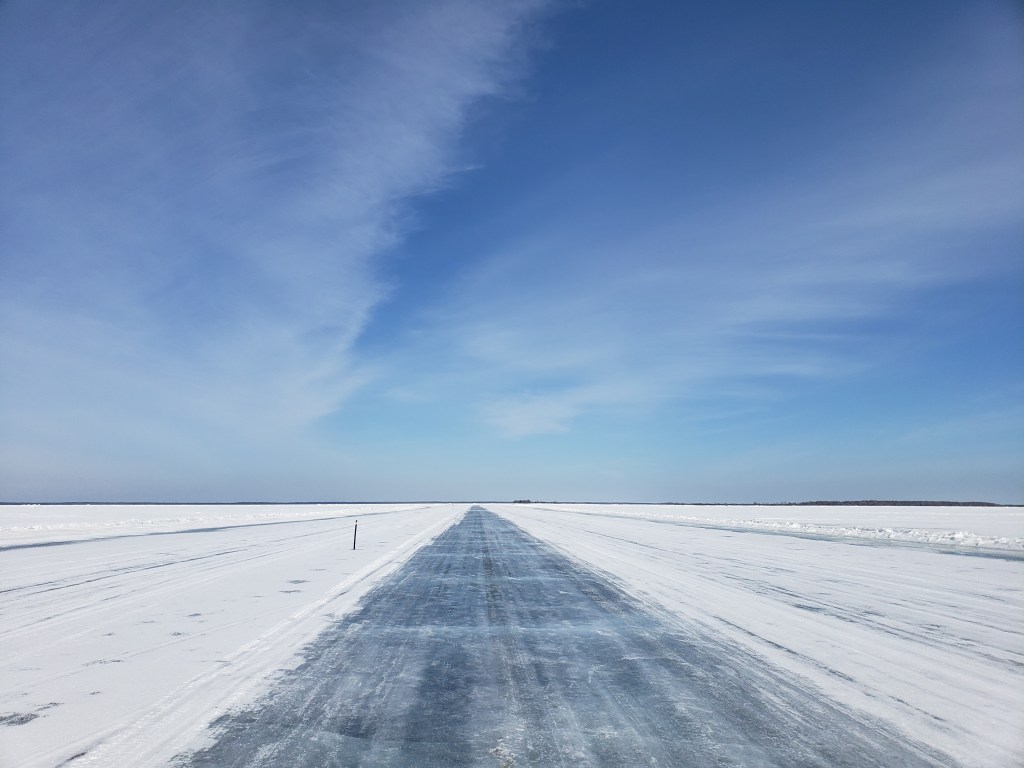
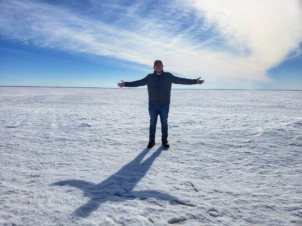
We were both a little nervous because we realized that we were literally driving on a frozen lake with miles to shore in either direction. The lake reaches 210 feet deep, so it’s not something you want to fall through. Ice road safety teaches that it’s safest to drive with your seat belt off and windows barely cracked in case of emergency. Eventually the fishermen disappeared, and it was just us driving on this frozen lake with no one else in sight. We found a nice spot to stop and take pictures, and I tried flying my new drone to get an aerial view of the frozen Lake of the Woods.
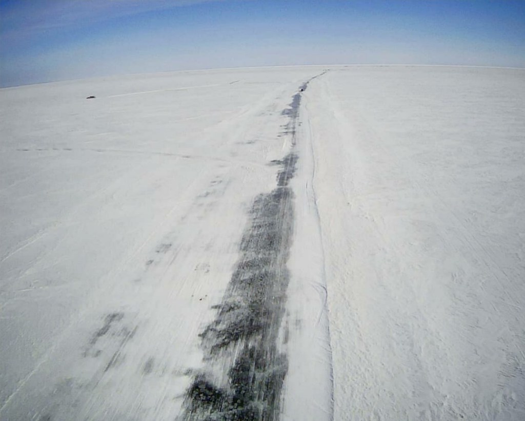
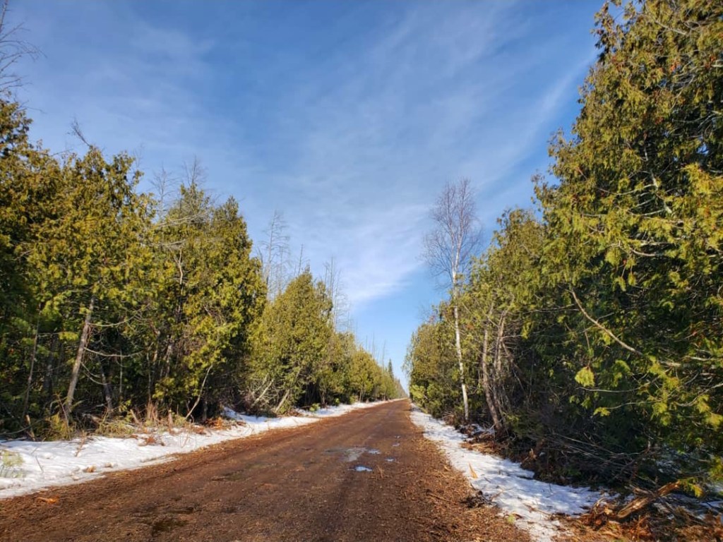
For the most part, the road was very smooth, but there were a few areas that we could see were starting to melt, so we learned to avoid those. As we neared the far end of the ice road, there was a large crack in the ice, and someone made a sketchy bridge over it, but it was better than nothing. We finally reached the shore and were both relieved we safely made it 22 miles across a frozen lake. We then started driving up the Border Trail which literally follows the Canadian border. Half the road was in Manitoba, and the other half was in Northwest Angle. It was a very rough road that we had to follow for another 8 miles before it finally cleared out. We technically stepped foot in Canada, but this far from civilization, it’s not really that big of a deal.
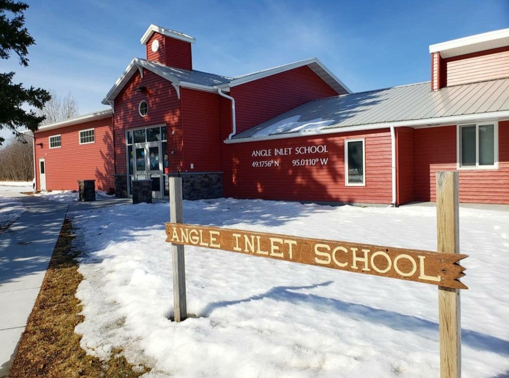
After taking pictures of the Welcome to Manitoba and Welcome to United States signs, we drove up into the town of Angle Inlet, the northernmost town in the contiguous United States. This is a small town of 60 people, but it sees tourists because of all the fishing resorts on the lake. We asked one lady in the General Store what there was to do in Angle Inlet, and she basically told us there’s nothing other than the resorts. But there were a few landmarks I had to see. The post office here is the most northerly post office the 48 states. Then we wanted to see the one-room schoolhouse which fits kindergarten through 6th grade all in the same room. Seventh grade and older have to drive down to Warroad for school every day, crossing through customs 4 times along the way. (Obviously this was before Covid).
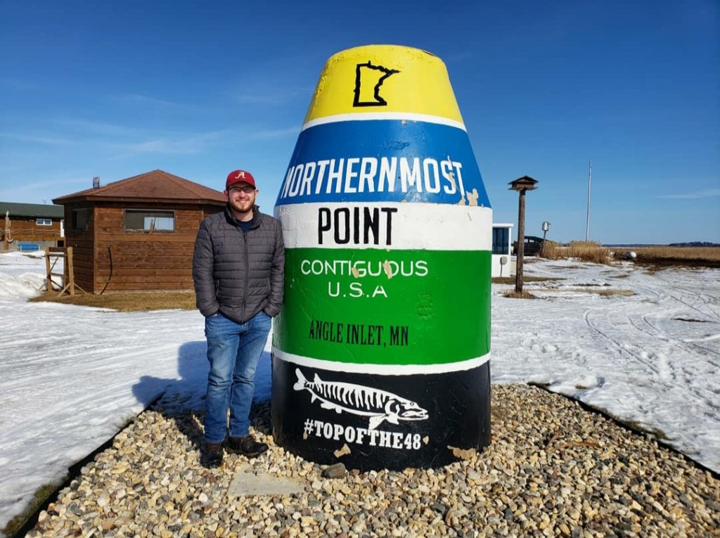
From there, we headed over to Jake’s restaurant where we found the Northernmost Point buoy. There were also these little customs stations with a phone, where those coming to the Angle call the embassy to let them know they have entered. After driving through the entire town, we headed back down to the ice road.
The way back was a little different because the temperature had risen while at the Angle. The ice was starting to melt some more, but it was still solid and was predicted to be safe through the following week at least. [Edit: It didn’t even last a full week after I visited!] We drove back down the 22 miles on the frozen lake until we reached Warroad again. Speaking of monitoring the ice and predicting how long it will be safe to drive on, Sarah told me of this lake called Cass Lake in the middle of the state where every year they park a Ford Escort on the ice and make bets on when it will fall through!
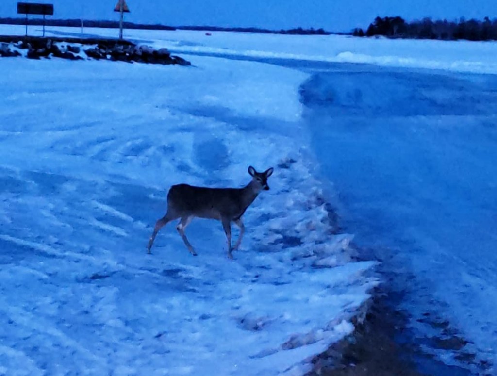
On the way back down to Chisholm, we were passing by Voyageurs National Park, so we decided to stop real quick. The sun had set, but if I’m passing by a national park, why not visit? We visited the Kabetogama Lake section of the park, and it was a really cool experience. The lake was frozen, and there were a lot of deer on the ice. As we were taking pictures of them, one slowly walked closer to me until it was not too far away. We watched the deer for a while before heading back to Chisholm for the night. When I visit national parks, I always try to visit them correctly, but it wasn’t really possible in this situation. Voyageurs is a park with a lot of lakes and islands that you can camp on. Because of this, winter isn’t really the best time to go, especially when you only have about 30 minutes after the sunset. But I couldn’t just pass by without checking it out in the limited time I had.
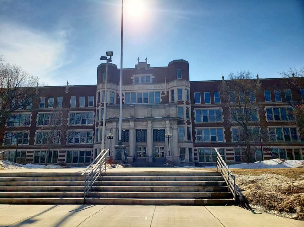
On Sunday morning, we attended a church service and then drove around the town of Hibbing for a few minutes. It’s a town known for iron mines and was once located on a mountain. But then the government found out there was a valuable amount of iron in that mountain and paid them to move the city somewhere else. After moving the city, they had so much money left over that the local high school has a marble staircase with gold handrails.
From there we headed to Duluth, Minnesota, located on Lake Superior, the largest lake in the US. (If you Google it, the largest lake is Lake Michigan combined with Lake Huron since they technically connect, but Superior is the largest single lake in the country). We walked along the Lakewalk for awhile, and I was amazed at how large this lake really was. I couldn’t see the other side and had to keep reminding myself it wasn’t salt water.
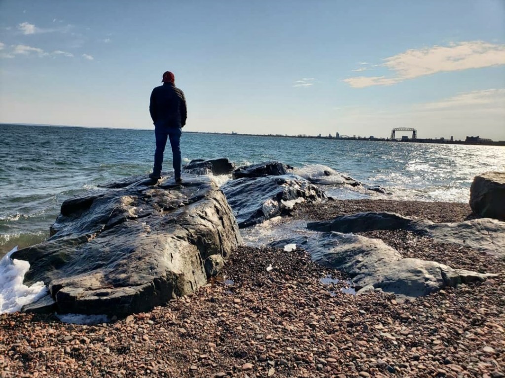
Duluth is very cold because of the wind that comes off the lake, and this Lakewalk was the coldest area. We followed the Lakewalk all the way into downtown and walked around there for awhile. This city is very underrated in my opinion. I never hear anyone talk about it, but it’s definitely worth visiting. It’s not a place I’d spend an entire week in, but it’s definitely a place that should get more attention. We then drove over the Aerial Lift Bridge onto Point Park, a narrow strip of land in the lake. There were beaches there, but obviously not like the ones in Florida: These beaches had ice all over them. And it was really cold, so we didn’t stay long.
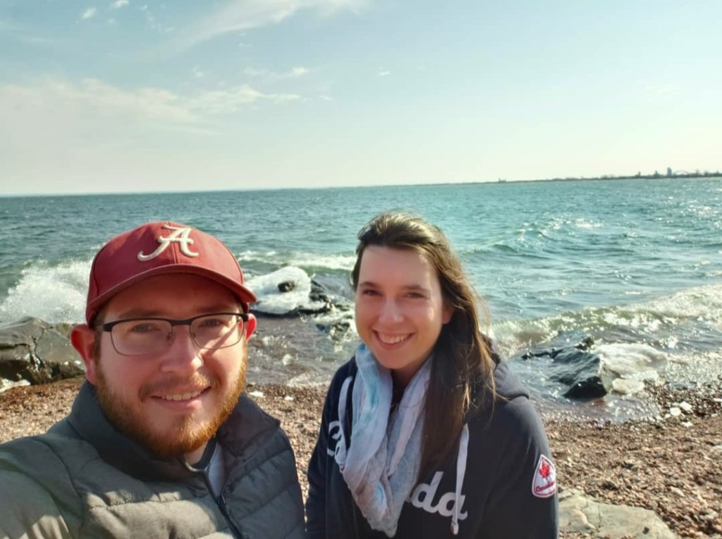
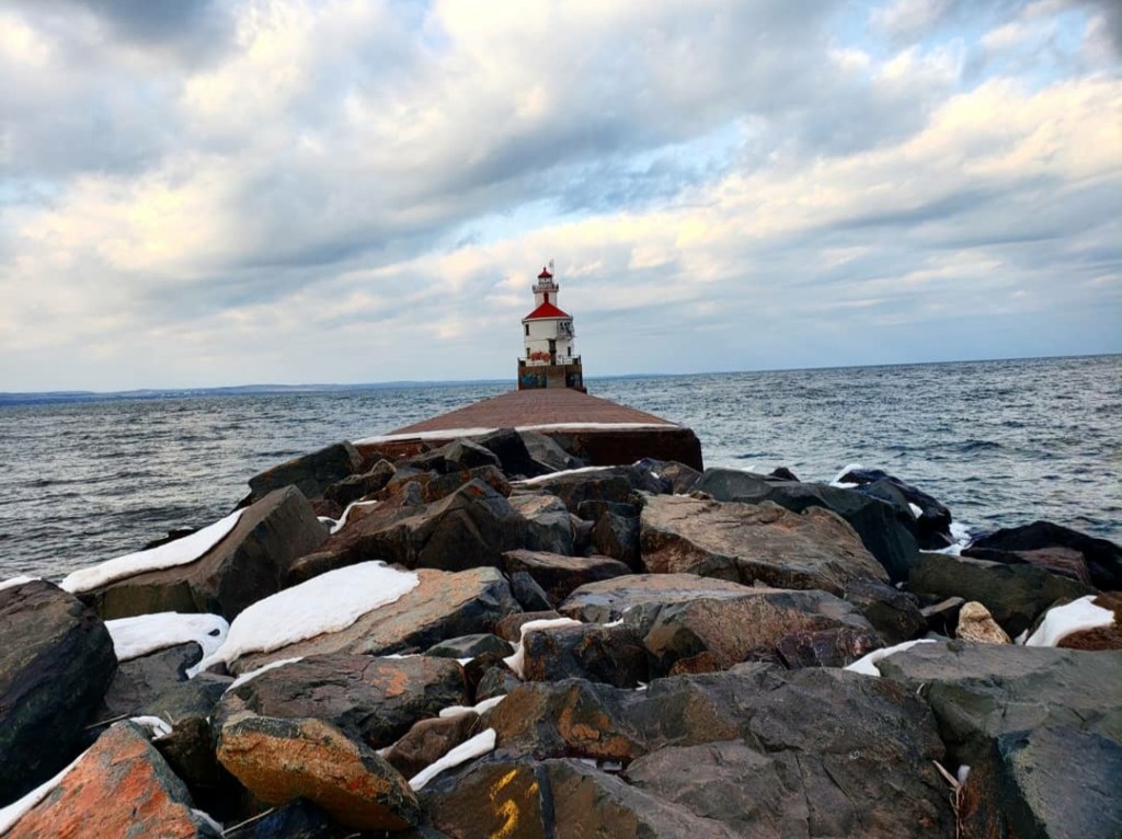
Our last stop was in Wisconsin, my 36th state. Here, we drove into Superior, Wisconsin, to a place called Wisconsin Point. There’s a lighthouse at the end of the point that is very picturesque. In order to reach it, you have to walk along a rock bar which was very cold. The lighthouse was cool to see, but it also had graffiti all over it. From there, we drove back down through Wisconsin until we eventually crossed back into Minnesota farther south. I did get to see a bald eagle on the side of the road too, but I wasn’t quick enough when pulling my camera out. Overall, this was a great trip, and I really enjoyed getting to see this part of the country. I got to (technically) step foot in another country, reach the northernmost point of the contiguous US, visit my 10th national park, and visit my 36th state. Thanks for reading!
(Read below for an explanation of why this is considered the northernmost point in the contiguous US).
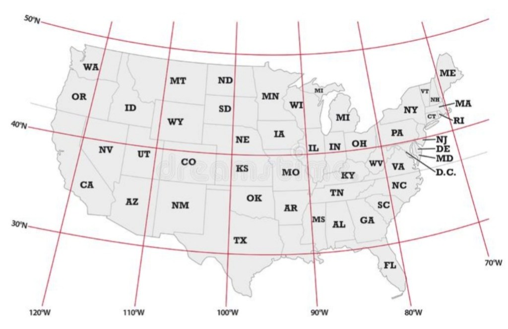
*There has been some confusion over what the northernmost point in the contiguous United States means. “Contiguous United States” is a geographic term for the lower 48 states. I have incorrectly used the term “continental United States” in the past, which refers to the 48 states plus Alaska. With that in mind, after looking at the latitudes, Madawaska is on the 47th parallel, making it the farthest north in Maine. Blaine is the farthest north in Washington on the 48th parallel. Then Angle Inlet, Minnesota is at a higher latitude than either of those, on the 49th parallel. There is no place in the lower 48 states that is located at a higher latitude than 49N. We’re used to looking at flat maps which distort the United States to make Maine look farther north, but when you take into account the curvature of the Earth, it’s more clearly seen that the tip of Minnesota is actually the farthest north. (See the illustration below).