One of my dreams is to visit places as far away as possible and keep pushing the boundaries of where I’ve been. With that in mind, I try to keep up with every location I’ve stepped foot in and track how far I’ve gone in every direction. To determine my farthest points north, south, east, and west, I use the geographic coordinate system (longitude and latitude). Then to determine my highest and lowest points, I keep up with the elevation of every place I’ve been. This gives me the best possible idea of how far I’ve really gone from home. Below, I’ll share some of my experiences at each of these far points and what I think of them altogether. I’ll keep this list updated as I visit new places that fit on this list.
North [50.4501°N]
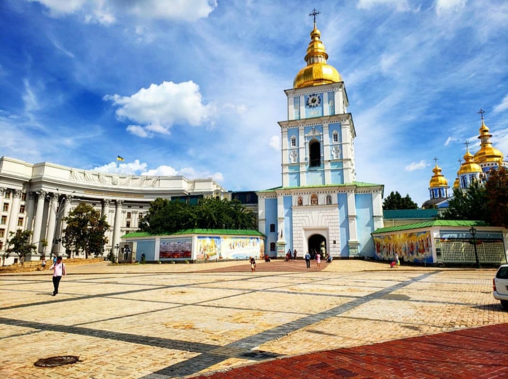
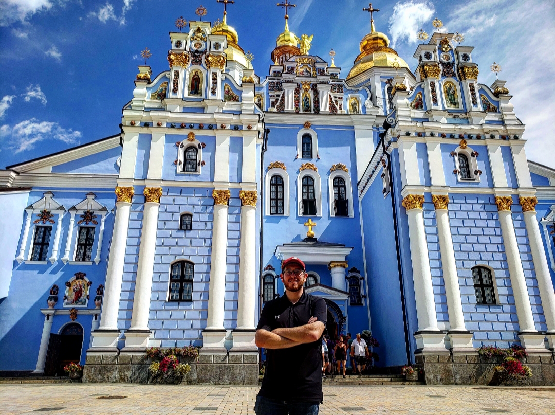
Though I’ve been to Canada many times and have stepped foot in 5 different provinces, my northernmost point isn’t actually in Canada: it’s in Ukraine. (Note: I’m not counting airports. Otherwise, my northernmost point would be Amsterdam). At almost 50.5 degrees north, Kyiv beats out my northernmost point in Canada, which is Vancouver, by over a whole degree. On my way to Moldova, I had a 12-hour layover in Kyiv, the capital city of Ukraine and took advantage of my time there. I explored the whole city on foot, and it quickly became one of my favorite cities in the world. If you’d like to see more about my time there, you can find that here.
East [107.5298°E]
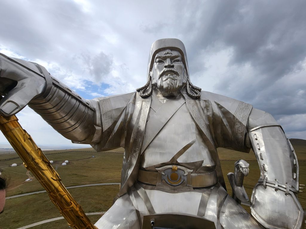
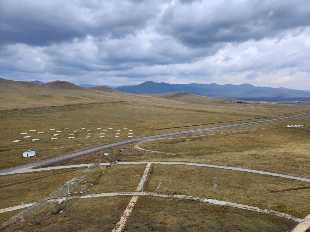
I had a little difficulty determining whether or not I would include this as farthest east or west. On one hand, if you look at the direction I traveled to get here, I went west. But on the other, when paying attention to geographic coordinates, because I passed the international date line, I’ll consider it my farthest east. Also because I never left the airport in Incheon, I can’t count that. My farthest east actually visited would be the town of Tsonjin Boldog in Mongolia. Here, there’s a massive statue of Genghis Khan in what feels like the middle of nowhere. It’s a huge, imposing structure that can be seen for miles, surrounded by beautiful mountains. My story about visiting Genghis Khan will be coming soon, and I’ll update this with the link as soon as it’s available.

South [15.3875°S]
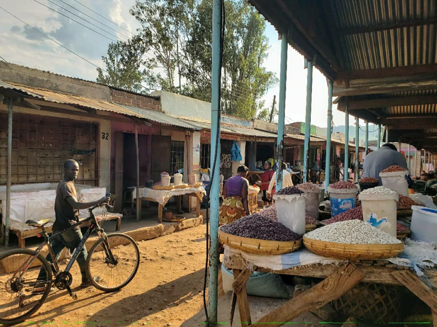
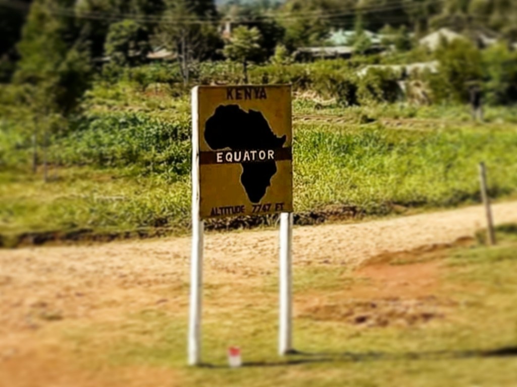
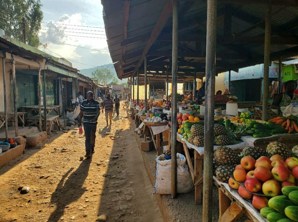
I have been below the equator three times: twice in Africa and once in South America. My southernmost point is Lusaka, the capital city of Zambia. I really didn’t spend much time in Lusaka at all. I flew in and then drove across the country to Chipata, which is slightly farther north. I visited a grocery store and a KFC in Lusaka and then sat at a police checkpoint when leaving the city for a little bit, but that’s about all I did there. I would have liked to spend more time in Lusaka, but I really didn’t have the time for it while I was there. It looks like a nice city from the little bit I saw. If you want to read more about that, click here.

West [157.9972°W]
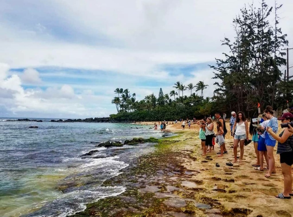
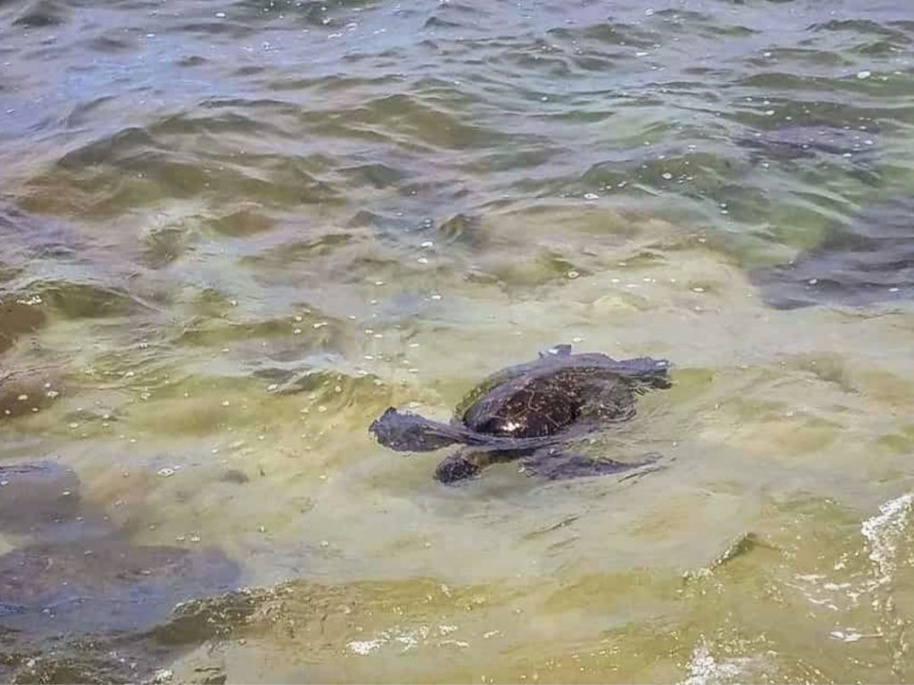
My westernmost point is really no surprise. The farthest I’ve gone into the Pacific is Oahu, and my westernmost point on the island is Turtle Beach in Haleiwa. I haven’t really had an opportunity to cross the Pacific yet, but I’d like to one day. Turtle Beach was a really cool stop to make on Oahu’s North Shore. Every day, many sea turtles come to rest here, though they show up at different times each day, so seeing them involves luck. I enjoyed getting to see them while I was there, but the rain forced me to leave earlier than I wanted to. I haven’t written about my time in Hawaii yet, though I plan to someday. And I’ll update this with the link after I do.
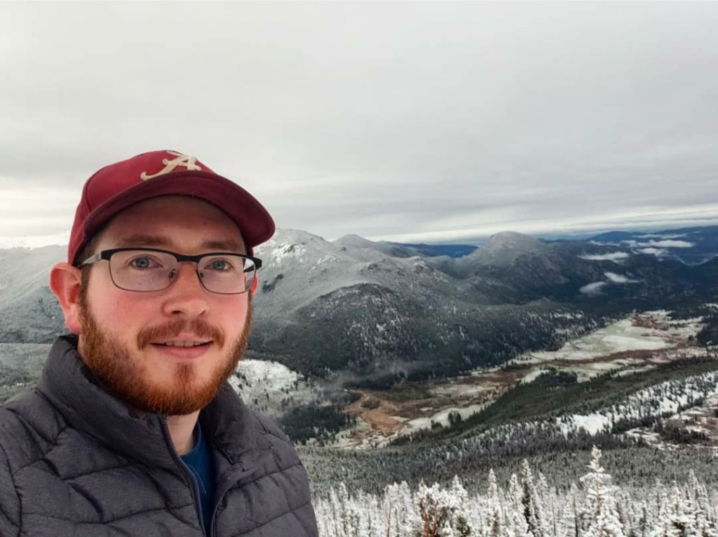
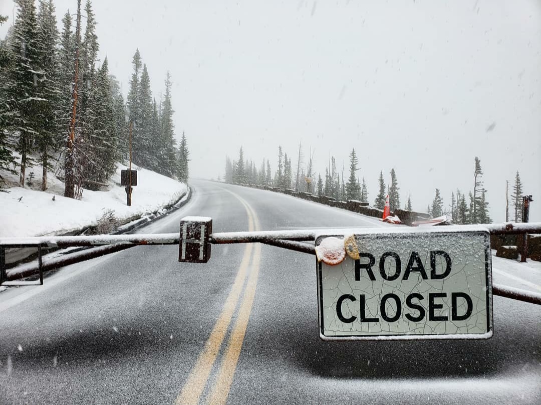
High [10,824 ft] (3,299 m)
I shared an older version of this in 2020 and claimed that my highest point visited was the Sun Spot in Winter Park Resort, Colorado. While it was my highest point visited at the time, the elevation that I said I had visited was wrong. The Sun Spot in Winter Park Resort is only at 10,718 feet rather than the 12,000+ that I previously thought. (And I’m obviously not counting elevations reached while flying). When I returned to Colorado earlier this year, I planned to reach an elevation of over 11,000 feet, but bad weather led to road closures limiting how high I could actually go. I did pass my old high point by reaching an elevation of 10,824 feet while driving the Trail Ridge Road in Rocky Mountain National Park up to the Rainbow Curve Overlook, after which the road was closed off. To read more about that trip, you can click here.
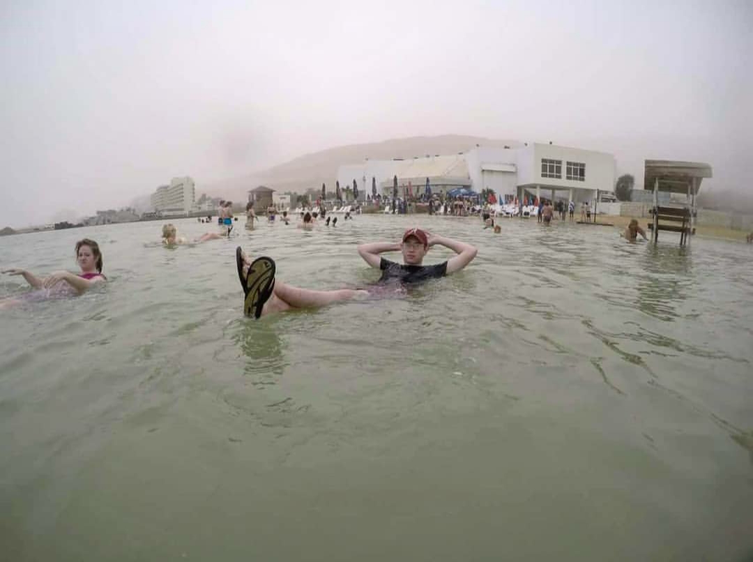
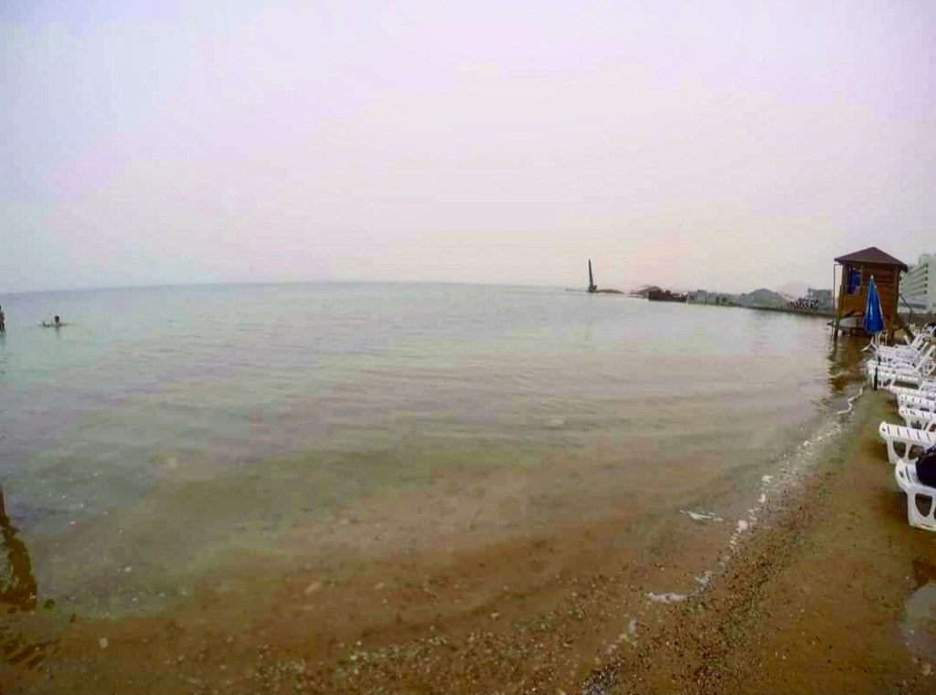
Low [-1,410 ft] (-430 m)
I’ve been to the lowest spot on the earth’s surface, so there’s no question where my lowest point visited is. The only way I’ll ever beat this is if I explore caves that reach a lower elevation or visit the bottom of the oceans. The Dead Sea is one of the most iconic locations in the world and is one of the coolest places I’ve ever been. It doesn’t necessarily feel any different than a regular lake when you first walk into it, but the second you lean back, you realize this isn’t a normal body of water. I did have an unfortunate accident there which greatly affects my memory of this place, but it’s a place I’d love to return to someday, except maybe from the Jordan side. If you want to read more about my time there, you can see that here.
Farthest Overall [8,460 mi] (13,615 km)
Just for fun, I wanted to determine what location is the farthest overall that I’ve been from home. It wasn’t really a contest as one was much farther than all the others. In a straight line from Pensacola, Chipata, Zambia is about 8,460 miles away. I also compared it to the distance between Khatgal, Mongolia, and McDonough, Georgia, and Chipata is still farther away. Getting there took forever: I flew out from Pensacola at noon on Wednesday and didn’t arrive at my hotel until midnight Saturday morning (considering time zones). I loved Chipata as it’s a unique city in a remote region of Zambia that has seen recent growth due to its position on the Zambia-Malawi border. I took every chance I had to see more of the city, and I really enjoyed what I saw. Click here to see more from Chipata.