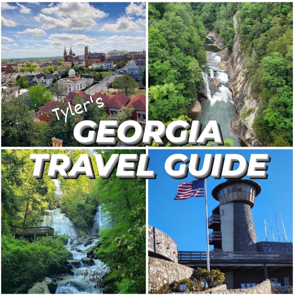
Georgia isn’t always the first state that comes to mind when planning a vacation. But what many don’t realize is that Georgia is filled with amazing places, including mountains, beaches, canyons, swamps, and historic cities. From Rabun Gap to Tybee Light, there is so much to do in this diverse state! After living in Georgia for several years and thoroughly exploring every corner of the state, I have decided to create my own Georgia Travel Guide. I have tried to include everywhere that a tourist may be interested in visiting for various reasons. If it’s on a list, such as the Seven Wonders of Georgia, you’ll find it here. And if it’s a place that is notable for any reason, I have included it here as well. I don’t necessarily recommend visiting every place on this list! But I will let you know whether or not I recommend each one in its own section.
Before I start, I’m going to clarify that this guide is for the US state of Georgia – not the country found in the Caucasus of Eurasia! As I’ve researched all the best places to visit across the state, I’ve been amazed at how terrible many travel sites are with geography and get the two mixed up. I saw a US Travel YouTube channel share a Georgia travel guide where the first shot of the video was a map of Georgia, surrounded by Turkey, Armenia, Azerbaijan, and Russia, rather than Alabama, Florida, Tennessee, and the Carolinas. I’ve even seen Atlanta-based travel websites lose all credibility by promoting places like Tbilisi and Tsalka Canyon, which proves they don’t have any experience or knowledge of the places they’re promoting. I have personally visited each place in this guide and will be giving tips and suggestions based on my first-hand experience in each. While there is an official Georgia Travel Guide, I have read through it and found that it’s way too comprehensive. That is partially why I decided to make my own, which includes all you need to know without the extra details. With that said, this is still a very long guide, so I would not recommend trying to read it all in one sitting. Rather, find the places you’re most interested in and focus on those.
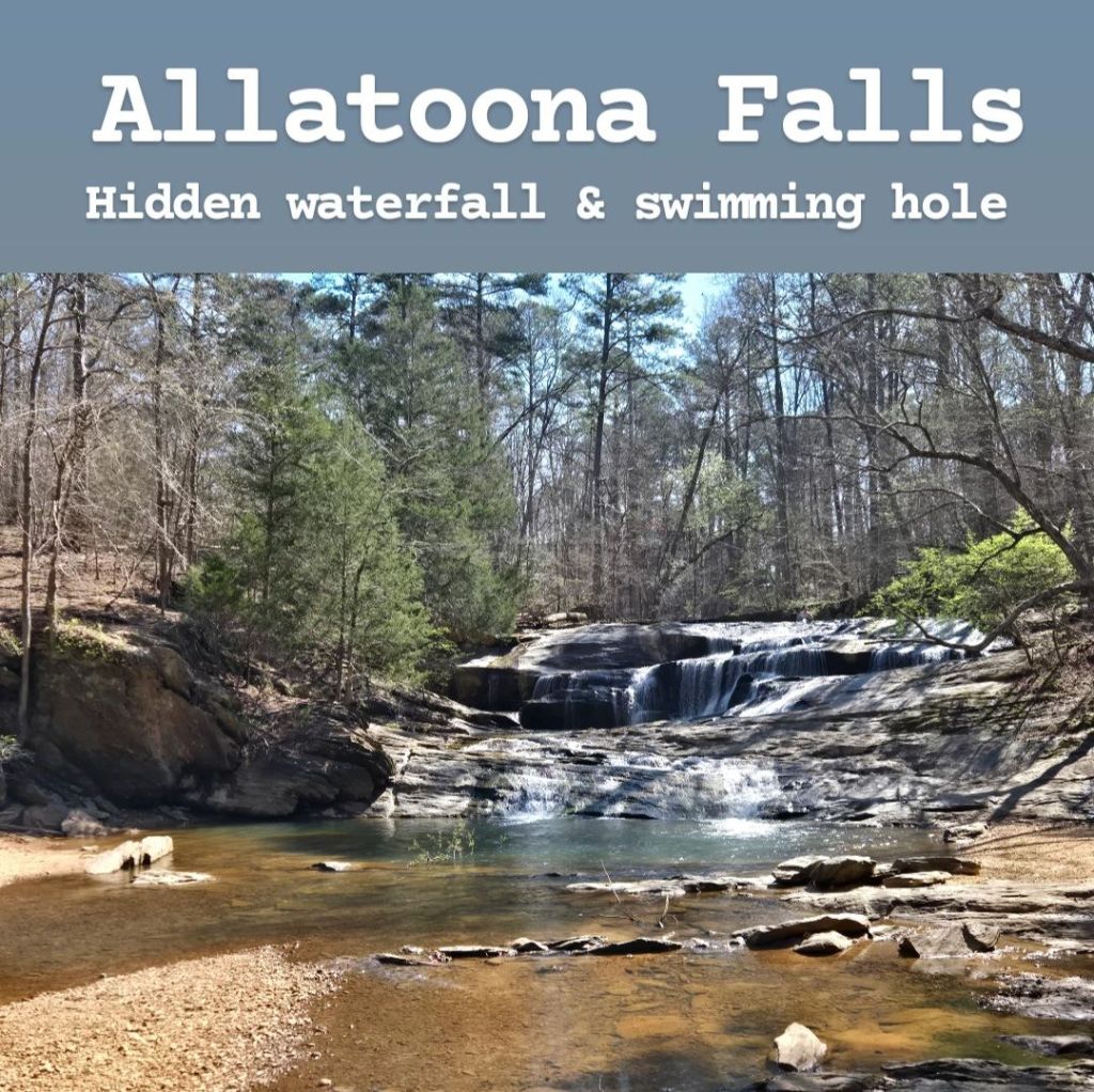
Allatoona Falls (also known as Toonigh Creek Falls) is a hidden secret in Holly Springs, just north of Marietta. It’s a beautiful waterfall with a swimming hole, and a large hangout space. While it is still somewhat unknown, the secret is getting out, and it’s starting to become more popular, so you will want to plan to visit it early to claim your spot before it becomes too crowded, especially on weekends. While the majority of the creek at its base is ankle-to-knee height, it does get deeper in one spot, right by a small cliff, making it the perfect spot for some minor cliff jumping! There are two trailheads to reach this waterfall. The first trailhead is at Olde Rope Mill Park, and this will take you 3 miles to reach the falls. Alternatively, there’s another trail entrance at the Cherokee County Aquatic Center, which only takes you 1.6 miles. The trail at the aquatic center can be tricky to find, but if you park all the way in the back of the property, you’ll find it (unmarked) going down a steep hill into the woods. It’s easy to find using AllTrails, if you’re still having trouble finding it. For the most part, the trail is easy to follow, though there are a couple confusing spots, so you’ll want to have AllTrails pulled up. While at the falls, there is a private residence not too far away, so make sure you don’t disturb them while you’re there. Cell phone signal is great here, so there’s nothing to worry about there. This is a really cool hangout spot that I’d highly recommend for families during the summer!
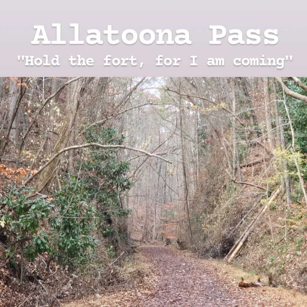
Allatoona Pass is the location of an important Civil War battle. It was here along the shores of Lake Allatoona where the Confederates launched an attack on the Union Army over control of the nearby railroad. The Union Army hid in trenches in order to withstand this attack. After hours of nonstop attacks from the Confederates, they were about to give up. They signaled to the Union troops on the opposite side of the lake and alerted them they were about to surrender when General Sherman sent a message back that would change the course of the battle: “Hold the fort, for I am coming!” The Union Army, though outgunned and outmanned, withstood the attacks and defeated the Confederates leading to a key victory that prevented the Confederates from reclaiming Atlanta. Of the 5,000 men involved in this battle, over 1,500 of them died. Then a few years later in 1870, General Sherman’s words inspired a man named P. P. Bliss to write a gospel hymn that would be sung for generations to follow.
“See the mighty host advancing, Satan leading on. Mighty men around us falling, courage almost gone: Hold the fort, for I am coming, Jesus signals still. Wave the answer back to heaven, by thy grace, we will!”
When visiting this battlefield, there’s not much that remains from the battle. There are earthworks and trenches left over, but that’s about it. Still, these are cool to see! Usually when you think about trench warfare, you think of World War I, not Georgia! There are many branching paths to explore here, and signs all over the place illustrating what took place during this battle. You could spend just a few minutes here or hours, depending on how interested you are in the story. Then right on the shores of the lake, there are several monuments honoring those who died during the battle. Entrance to this site is free, and there’s a parking lot on the side of the road in a residential area near the entrance of the trails. This seems to be a popular place to go fishing too, if that interests you. I enjoyed this, and there was a lot more to it than I expected. I’d recommend a stop if you’re in the area if this seems interesting to you.
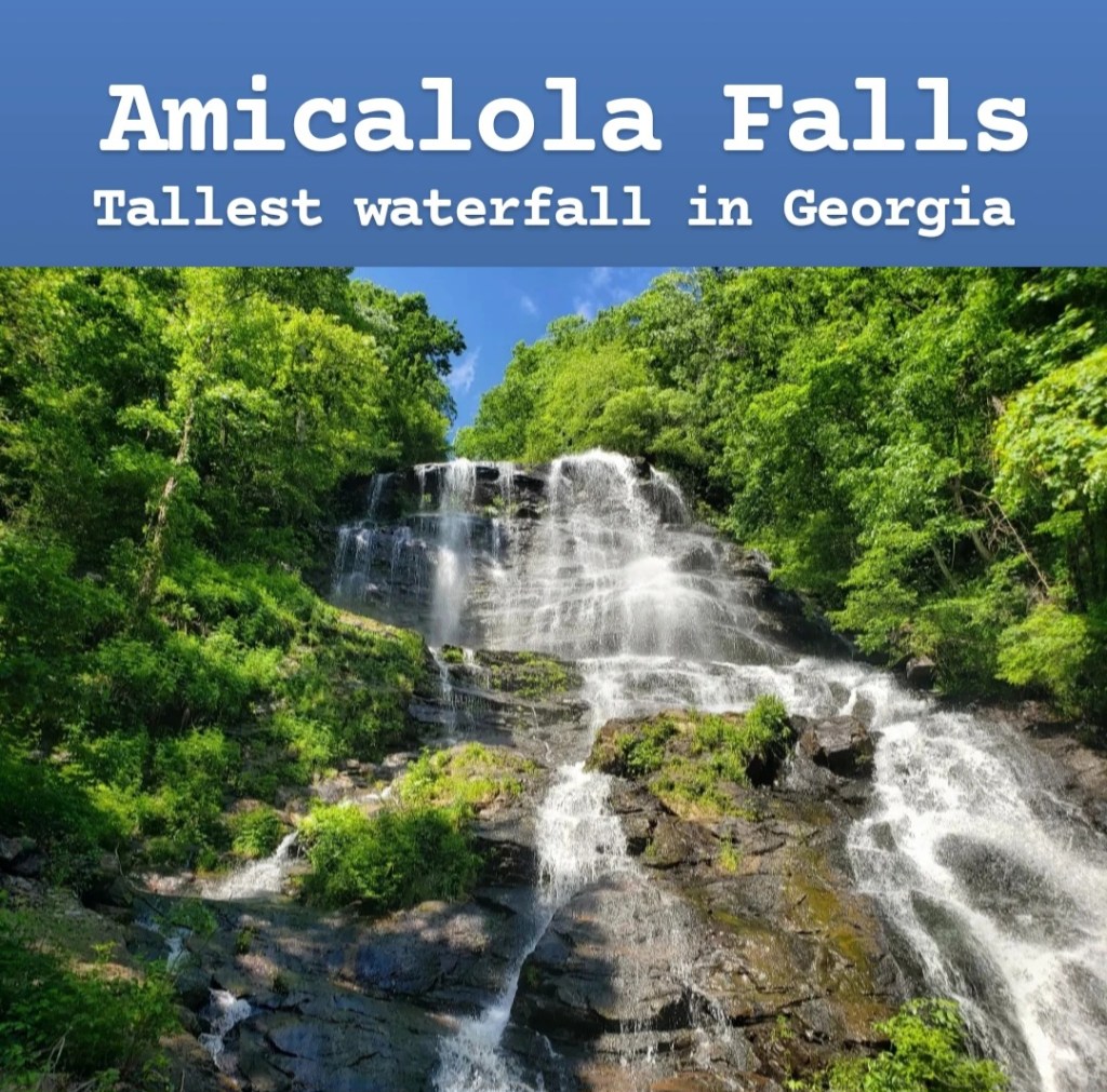
Amicalola Falls is one of the seven wonders of Georgia and the highest waterfall in the state. At 729 feet tall, it’s over twice the height of Niagara, though you should know that you won’t be able to see the entire waterfall from any one spot as there’s an observation bridge that passes right in front of it, offering up-close views. This waterfall can be found within Amicalola Falls State Park near Dawsonville in North Georgia. Due to its somewhat-remote location in the North Georgia mountains, GPS signal can be low, though you shouldn’t really have any trouble finding the entrance to the park. There is an entrance fee of $5, unless you have the $50 annual state park pass. The layout of the park can be confusing for first-time guests, so I’ll try to explain it. It seems that there are many different trails throughout the park, but they are all connected. Each one leads to the falls, which means some require that you hike longer distances than others. You can actually park very close to the falls to avoid a long hike. If you turn left right before reaching the visitor center, you will take a road that bypasses most of the trails and takes you right to the falls. If you park at the closest parking lot to the falls, you will have to descend a tall, strenuous staircase in order to reach the observation bridge. Going down is simple, but coming back up is a different story. However, if you park at the small parking lot a mile before the last one, there’s a much easier handicap-accessible trail that takes you directly to the observation bridge. Just understand that this is a small parking lot that fills up quickly, especially in the middle of the day. If you’re anywhere near this park, it’s one of my top recommendations in Georgia, so I’d highly recommend visiting!
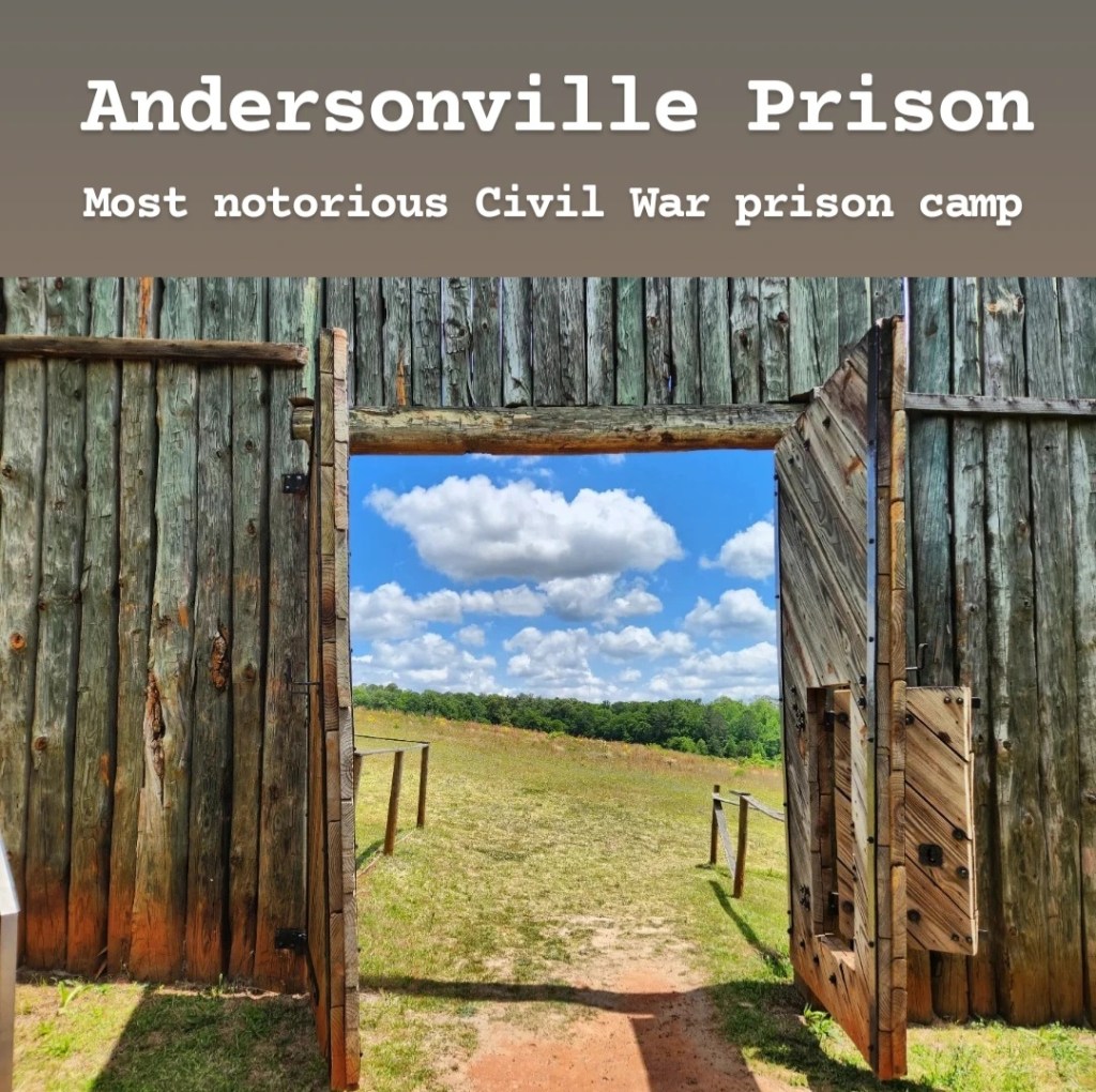
Andersonville Prison was the most notorious POW prison camp during the Civil War. Over the course of its existence, 45,000 Union soldiers were kept here with over 13,000 dying horrible deaths. The living conditions within the prison camp were some of the worst imaginable, and due to poor water quality, many died of disease, dehydration, and starvation. It’s located in Andersonville, in Middle Georgia, and is honestly in the middle of nowhere; however, it’s easily found by GPS. Along with the remains of the prison camp itself are the National Prisoner of War Museum and Andersonville National Cemetery, both of which I’d recommend checking out if you visit. At first, it may seem like there’s nothing to see here, but if you take time to read about the events that took place and walk through the museum before entering the prison grounds, it will have a lot more meaning to you. It’s a heartbreaking place to visit and shines a light on the part of war that many either don’t know about or don’t want to think about. The entire site is free to visit, and that includes the museum and cemetery as well. If you actually take time to read everything, this could be a lengthy stop, so make sure to plan your time wisely. I would also recommend bringing sunscreen during the summer months as you will be in direct sunlight for a majority of your visit (except in the museum). You can choose to walk or drive around the prison, and there are occasional parking lots along the loop, allowing you to park and get out. If you’re interested in American history, this is a must-visit for sure, and you likely won’t run into many other people while you’re there.
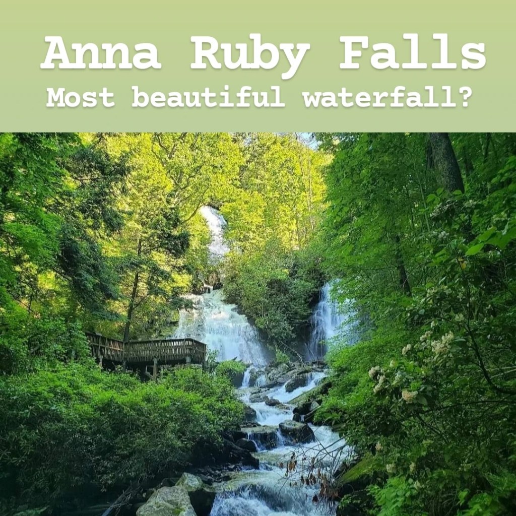
Anna Ruby Falls is potentially one of the most beautiful locations within the state of Georgia. It’s located right outside Helen and is surrounded by Unicoi State Park, though it’s not actually a part of the park. It’s very easily found from Helen, though signal can be low in the surrounding areas. Once in the park, there is a $5 per person fee; however, a $25 annual pass is available if you think you might come multiple times throughout the year. The hike is very easy and starts right behind the visitor’s center. The trail is less than half a mile one-way and is paved. It follows a beautiful river and has a slight elevation gain on the way to the observation decks. At the end, there’s a pair of twin waterfalls that are beautiful to witness in person. There are several decks to view the falls from, and each offers a unique perspective worth checking out. The trail is very dog-friendly, and you will see many dogs along the trail. If you’re anywhere near Helen, this is a must-see in my opinion.
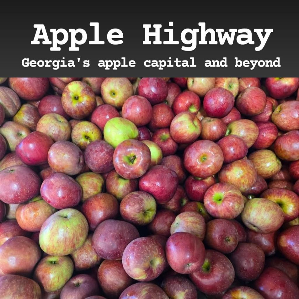
A popular family fall activity in Georgia is apple picking, and the most common area to visit for that is Ellijay, which considers itself the Apple Capital of Georgia. The town itself is nice to walk around, but most people really come here for the apples. The most common apple orchard to visit is the BJ Reece Orchards. This has many activities for families in addition to the apple picking, but because of its popularity, it can become extremely busy this time of year! Other popular locations include R & A Orchards and Red Apple Barn. During the fall, just expect anywhere you go within Ellijay to be very busy with slow-moving traffic. The popular items to try here are fresh apple cider, fried apple pies, and apple donuts, and I’d recommend trying all of these! These can even be found in random stands on the side of the road. There is also an annual Apple Festival held in Ellijay each year, so make sure to look out for that! If you’re trying to avoid the busyness of Ellijay, you can head up to Blue Ridge to visit Mercier Orchards. It’s also a nice place to check out, though there won’t be as many activities here as you’d find in Ellijay. Another area to check out if you’re avoiding Ellijay would be over near Cornelia, with Jaemor Farms offering many of the same activities with a much smaller crowd. All of these places can be pretty costly, but they’re fun family activities that will likely be worth it for you.
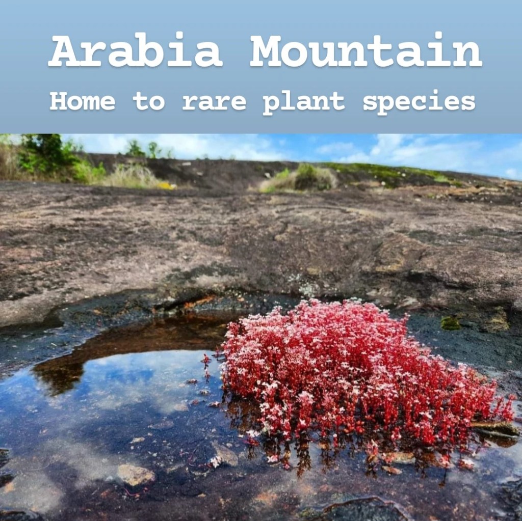
Arabia Mountain is a large granite monadnock near Lithonia in Middle Georgia. It’s one of three monadnocks, along with Stone Mountain and Panola Mountain. Home to endangered plant species, it’s an important site in Georgia, and it was once quarried for stone known as tidal grey which was used in the construction of the Brooklyn Bridge in New York City. Finding it can be a little confusing, so I’ll give a little more information there. There’s a small nature center with a parking lot for Arabia Mountain next to it, but if you just search for nearby nature centers, your GPS typically tries to take you to a different one. The exact address you want to drive to is 4158 Klondike Road, Stonecrest, GA 30038. Once there, you’ll notice a boardwalk trail by the road, but that is not where you want to go. The boardwalk leads to a network of trails nearby but does not go up the mountain at all. The actual trailhead starts behind the information signs and is partially blocked by a couple large rocks in order to keep bikes out. Arabia Mountain is free to visit! The parking lot is small, but I’ve never seen it completely fill up, so you should be able to find a spot. I have recently heard reports that you should not keep anything valuable in your vehicle here as break-ins have occurred. The trail to the top is not too difficult, but you do need to expect some steeper areas leading to the top. If there’s one rule you need to follow when visiting Arabia Mountain, it’s to avoid stepping in puddles. While it might not look like there’s anything in them, they actually house the endangered diamorpha plants which only bloom in March. Because of that, I’d recommend visiting in March over any other time of the year. You may also notice that there’s a trail circling a lake on the map. This can be difficult to find, but you should see it off to the right just before the ascent to the peak. If you plan to follow the trail all the way around the lake, the second half is more difficult than the first, and at times, it can be difficult to determine where the trail actually goes. In that case, you can just follow the woods to get back to an area you recognize. Another cool section to explore is found at the far end of the mountain. After reaching the peak, continue walking straight until you find a small opening in the trees. Go through that to find that actual quarry that was once in use here. It’s a cool place to explore, and you’ll likely have the whole place to yourself, but be careful because there are some sharp edges and things you can trip over here. Overall, I’d recommend coming if you’re nearby, but it’s not somewhere to plan a trip around. I recommended coming during the spring earlier, though it’s great most of the year. Summer and fall are great times to come too, and they each have their own seasonal blooming flowers to check out! I’d avoid winter though… I came here on a date during a snow storm and developed frostnip (the beginning stages of frostbite) on my lips. If it’s cold outside, Arabia Mountain will be much colder due to the strong winds!
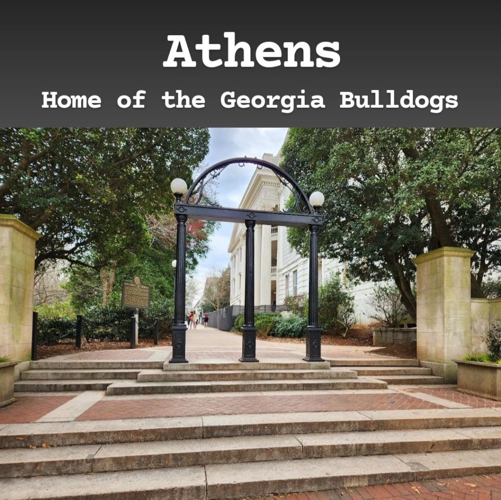
Athens is a college town known for the University of Georgia, and everything here seems to revolve around the school year. If you’re a fan of college towns or UGA, then you’ll likely enjoy visiting, but if college towns aren’t your thing, then you may want to avoid it. For the most part, the best part of the city is the area immediately surrounding North Campus. If you visit, parking can be difficult to find. There are many parking spots, but they seem to fill up quickly. Once you do find a spot, though, the whole area is very walkable. There are plenty of cool shops and restaurants to explore in this area, and there are a few odd things to see, like the Double-Barrelled Cannon. North Campus is worth checking out as well. It’s home to the oldest buildings on campus, and considering UGA is the oldest public university in the United States, these can be kinda cool to see. And make sure to check out the UGA Arch at the entrance of North Campus! Local superstition says that if you walk under the arch but haven’t graduated yet, you never will graduate. So it’s fun to watch students actively avoid walking under it. I visited during graduation, and there was a huge line of graduating seniors waiting to get their picture under the arch, showing just how serious this tradition is. From what I saw, the outer parts of the city aren’t as nice, but there are still things to do. If you do decide to visit other parts of the city, you may read about the fiberglass bulldogs spread throughout. This can be a fun scavenger hunt for the family, but many of them are no longer on display due to looting. Another landmark Athens is known for is the Tree That Owns Itself. This is a very fun and interesting story that may leave you underwhelmed when you visit. It’s very cramped in an already-tight neighborhood, which makes visiting it more of a burden than it’s worth. There’s also the Bear Hollow Zoo which seems underfunded and somewhat run-down. It has potential though, and there are some expansion plans, so I’d recommend visiting within the next few years. The State Botanical Garden of Georgia is also found in Athens. It’s nice, but it was smaller than I expected. Then there’s also the Sandy Creek Nature Center, which is a good place to go to escape the city and get in nature some. Overall, I think Athens is worth a visit, but unless you’re a huge Georgia fan, then I think a day would be good enough.
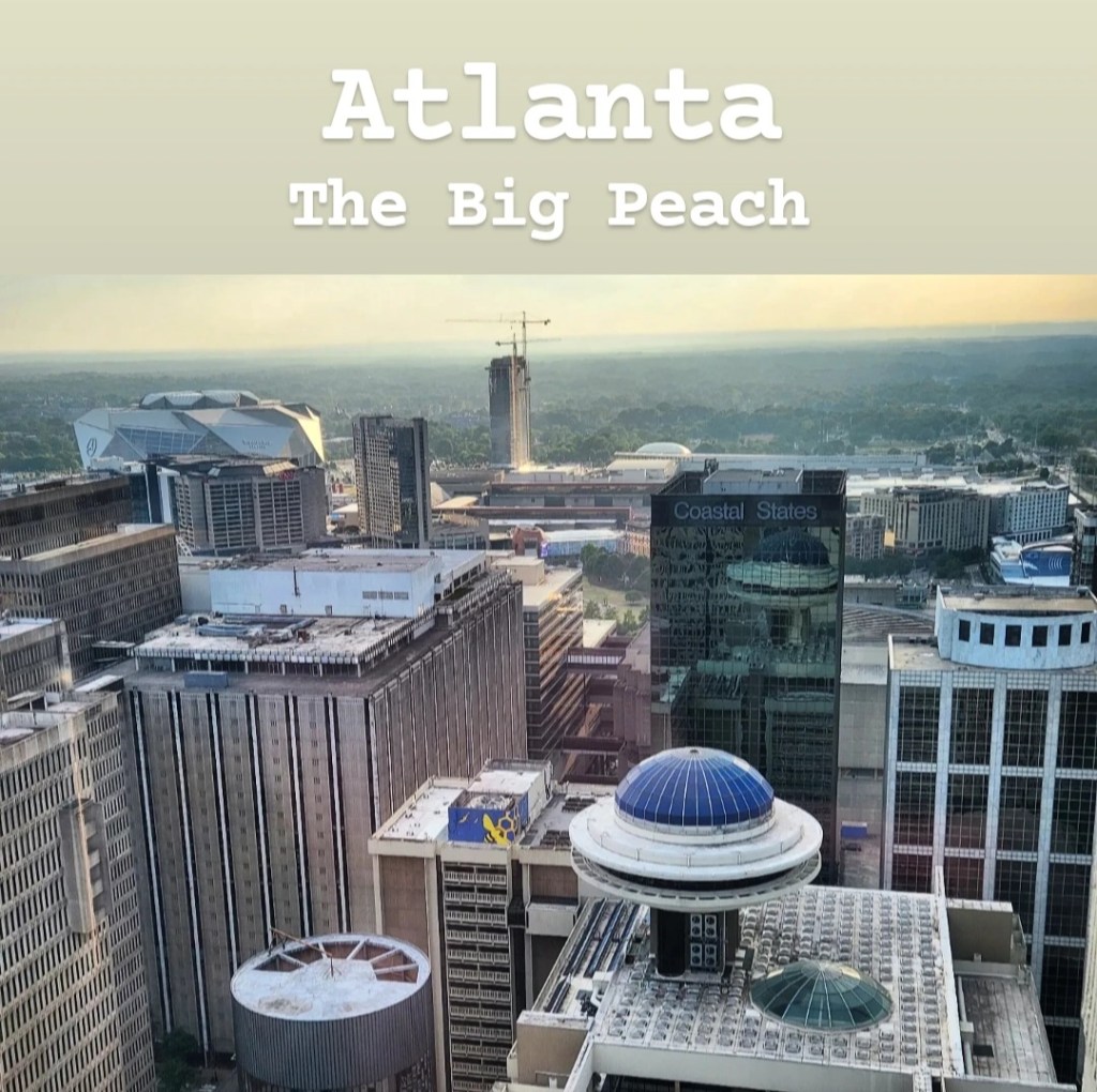
Atlanta is the capital and largest city of Georgia, and it’s also home to the busiest airport in the world. It has been nicknamed the “City in a Forest” due to the abundance of trees found within the city center, and it’s estimated that the tree coverage extends to around 50% of the city. Before getting to my recommendations, there are a few things I have to point out first. First of all, the traffic in Atlanta can be a nightmare. It has some of the worst traffic I’ve seen anywhere in the United States, and it can take forever to get from one part of the city to another. Second, I need to mention the safety concerns. While in the more touristy parts of the city, you should be fine, but things can change quickly from street to street. You’ll typically know when you’re in a bad part of town, but these areas can be right next to areas that are fine. Just be aware of your surroundings when you visit, and if it feels like an area you shouldn’t be in, it probably is. My top recommendations in Atlanta include the Georgia Aquarium, World of Coca-Cola, Piedmont Park, the Centennial Park area, Atlanta Botanical Gardens, Ponce City Market, Krog Street Market, Martin Luther King, Jr. National Historical Park, the Beltline, and other nearby sites that I’ll expand on throughout this guide. There are also many museums, Topgolf, great restaurants, baseball games at Truist Park, College Football Hall of Fame, many filming locations, Museum of Illusions, Puttshack, Six Flags Over Georgia, and temporary events like the Stranger Things Experience, Harry Potter Experience, or Van Gogh Interactive Experience. While I have read reports that Underground Atlanta is being renovated, I would still recommend staying away from that area. Also, if you’re looking for cool skyline photo opportunities, head to Stone Mountain, Kennesaw Mountain, Jackson Street Bridge, or Atlanta Marriott Marquis. For most of the popular attractions in Atlanta, you will need to book online ahead of time, so make sure to look into that before coming. Atlanta has a lot to offer, so I definitely recommend visiting, but I also want to emphasize the traffic and safety issues before you come. It’s a great city, but there are definitely downsides as well.
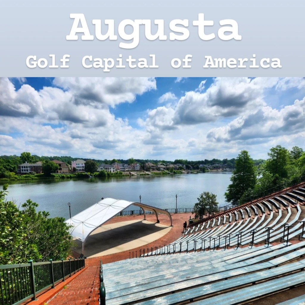
Augusta is a major city on the South Carolina line. It’s primarily known for one thing: golf. The city is home to Augusta National Golf Club, a super-exclusive golf club that hosts the world-renowned Masters Tournament on the first week of April every year. However, golf fans would be disappointed to know that Augusta National does not allow non-members to visit, and membership is only given via invitation. If you’re lucky enough to get an invitation, the initiation fee costs anywhere from $40,000-$200,000, and annual fees are in the ballpark of $7,000-$10,000. The only way for non-members to access Augusta National is to attend the Masters Tournament. Even this is a tricky situation as tickets are granted based on a lottery system where applicants are chosen at random. Tickets can also be purchased second hand (it’s illegal to sell them but not illegal to purchase them) and will cost on average more than a super bowl ticket. But there’s more to do in Augusta than just the Masters. Augusta has a nice riverwalk along the Savannah River and a Canal Trail system that runs throughout the city. There are also some nice museums and other golf-related activities throughout. My main issue with Augusta is the parking situation as there are often very few options throughout the city. You’d expect there to be a better parking system with the number of guests that come to the city for the Masters each year, but parking can be very hard to find. One recommendation I have is to check out Phinizy Swamp. There are some walking trails along levees in the wetlands, and you can spot many alligators throughout. If you decide to do this, I’d recommend going either early in the morning or late in the afternoon as the trails have very little shade and can be very hot in direct sunlight. Overall, I don’t think Augusta is really worth visiting unless you’re lucky enough to get Masters tickets. I’d love to get ahold of some, but that has not happened yet unfortunately.
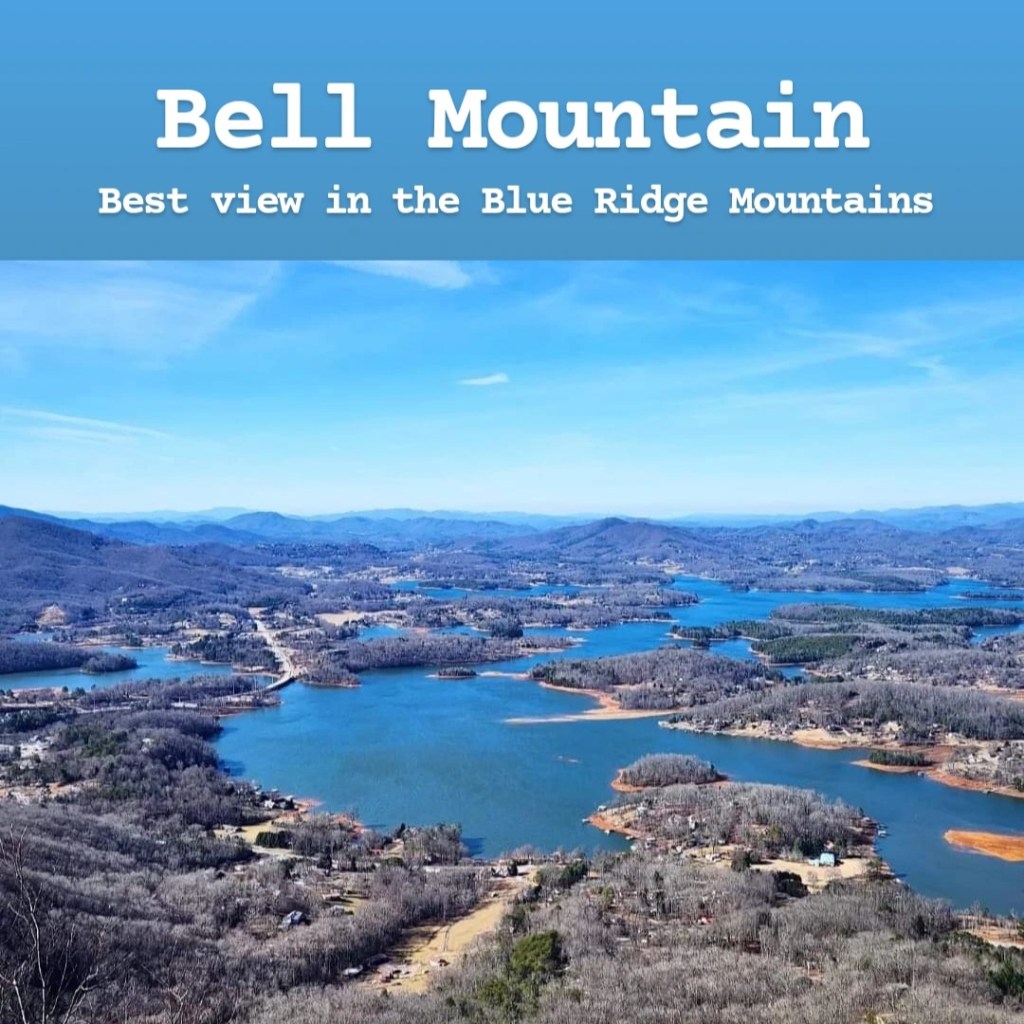
Bell Mountain is one of those hidden sites that only locals know about, though it has been gaining more attention in recent years. It offers some of the best views in all of Georgia, but it does take some effort to visit. In the past, Bell Mountain has only been accessible by determined hikers and those with 4×4 vehicles, but now there is a paved road to the top. That doesn’t mean that anyone can go visit it though. While it’s easily found by GPS, the road is very steep and somewhat dangerous. There’s a cliff on one side, and the road itself is so steep that you can only see sky in your rear-view mirrors on the way down. If you get nervous around steep drop-offs, then I’d recommend you avoid this road entirely. It’s really only wide enough for one vehicle at a time, so things become complicated when one person is driving up and another is driving down. Once at the parking lot at the top, there’s a short, very steep walk to the observation deck. However, there is also a small handicap parking lot at the top for those that need it. The observation deck offers breathtaking views of the surrounding Blue Ridge Mountains, the town of Hiawassee, and Lake Chatuge. There are some stairs to an even higher observation deck, which is also definitely worth checking out. While the views are incredible, I do have one major complaint about the site overall. The observation decks and rocks at the top of the mountain are all covered in layer upon layer of graffiti. For some reason, rumors once spread that graffiti is legal here, but it is not and never has been. This makes the entire area feel somewhat trashy, which is a shame considering it’s a such a beautiful place. If you’re up for an adventure, this is definitely a place I’d recommend visiting: just be careful on the way up/down and make sure your tires are good before attempting it. There’s also no restroom nearby, so if that’s important to you, then, there you go.

Berry College is a private college located right outside Rome, Georgia. Founded in 1902 by Martha Berry, the campus quickly grew after a donation from Henry Ford, which saw it increase to a size of around 30,000 acres. In fact, today Berry College is known as the largest college campus in the world. It’s a Christian college, though it does not take any denominational stance and allows all Christian faiths to attend. The campus has many historic Gothic-style buildings and was called one of the most beautiful college campuses in the world by Travel + Leisure. The campus is also home to a wildlife refuge and many miles of hiking trails and has a notably high deer population, with deer being spotted all over campus. When entering the campus, you will be asked to provide your ID to be scanned. This is where you will want to ask for information where they will be happy to give you a map and show you where all you will want to go. The campus is large and easy to get turned around in, but utilizing the map plus the various signs throughout, you should be able to find your way around. For the most part, you’re welcome to explore on your own, and many of the facilities may be at use even during the summer due to the college’s WinShape camp. If you take the 3-mile road through the wildlife refuge, you will reach Mountain Campus, and continuing on from there will take you to the Old Mill, which is one of the most popular stops for visitors. It’s definitely a cool campus to visit if you’re in the area!
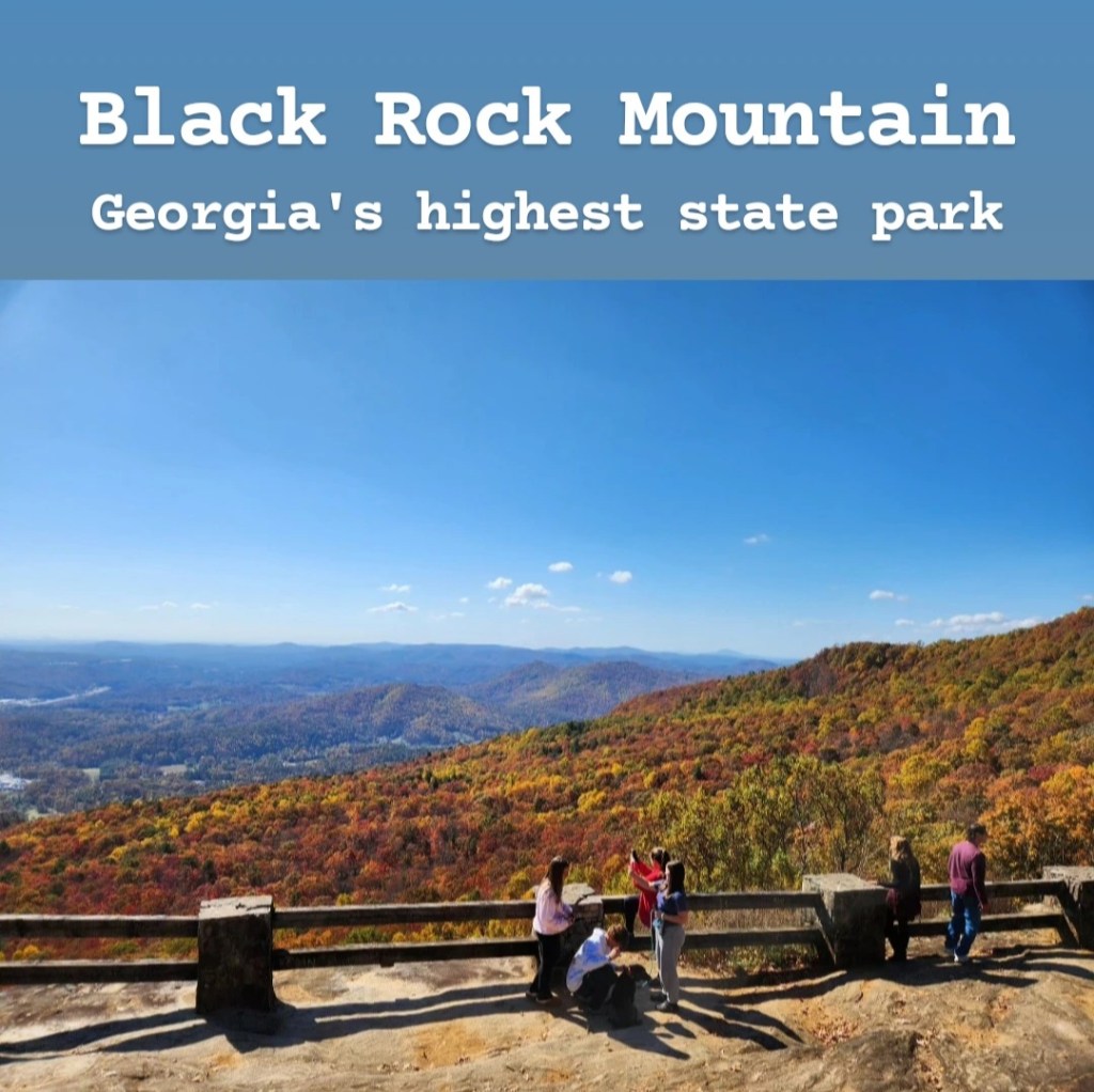
Back Rock Mountain State Park is the highest state park in Georgia. It’s located in Rabun County, near the North Carolina line by a town called Mountain City. The park is very easy to find by GPS, and the drive into the park is beautiful, especially during the fall when the leaves are changing colors. There are 2 overlooks before reaching the park gates, but both have an extremely small parking lot, making them difficult to visit on busier days. There’s also a hike that seems popular, but the parking lot (larger than the overlooks) fills up very quickly, so you have to make sure you arrive early if you want to hike it. There’s also a short but strenuous hike to a waterfall that leaves from the second overlook. Once in the park gates ($5 to enter), you arrive at the visitor center. The main overlook of the park is located right here by the visitor center. There are plenty of picnic tables here, making it a great place to come for lunch with a family. The view from this spot is the best in the park and is breathtaking, but parking is severely limited on busy days. There’s nothing else to do within the park, unless you’re staying at one of the cabins located farther down the road. Cell signal is also surprisingly good within the park. While this park is nice, I would not recommend driving all the way out here just for the park itself as it’s much smaller than I was expecting with limited things to do. But it’s a great stop when combined with other nearby sites (Tallulah Gorge isn’t too far away, and depending on the direction you’re going, the Helen and Hiawassee areas are good options).
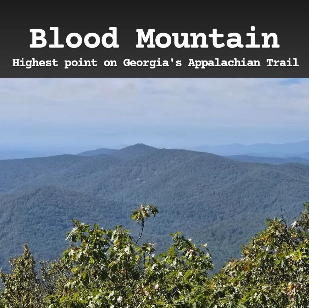
Blood Mountain is the highest point along Georgia’s stretch of the Appalachian Trail. The mountain’s name is believed to come from a legendary battle between the Cherokee and Creek tribes that took place here (or it could also be named after the red rhododendrons along the trail, but that’s a bit more boring). It’s an enjoyable hike that can be somewhat strenuous due to the steep inclines. The views from the top are incredible and definitely make the climb worth it! The trailhead (called the B.H. Reece Trail) can be a bit difficult to find as Google Maps led me to the wrong location. It doesn’t help that there is very little signal in this area, so you’ll have to rely on others if you get lost. Fortunately, there’s a landmark to help you find it. There’s a hiking/camping store just down the road from the trailhead called Mountain Crossings at Walasi-Yi. You can find all kinds of supplies here if you accidentally left something behind. They will be happy to point you in the right direction, though they will not let you use their parking lot during your hike. The Appalachian Trail actually passes right through this store, so it can become a popular stop for those hiking it who need to stop and restock their supplies. The trailhead’s parking lot is pretty small, so if it fills up, you’re out of luck. This fills up very quickly on weekends, so plan accordingly! It’s also popular with campers who hike up the mountain with their tents and stay overnight. If you do that, just note that fires are prohibited on the mountain. There are a couple points along the trail where you could get turned around, so you may want to download a map of it ahead of time. This is a nice trail, though it can be difficult to visit for several reasons, but I think it’s definitely worth doing it!
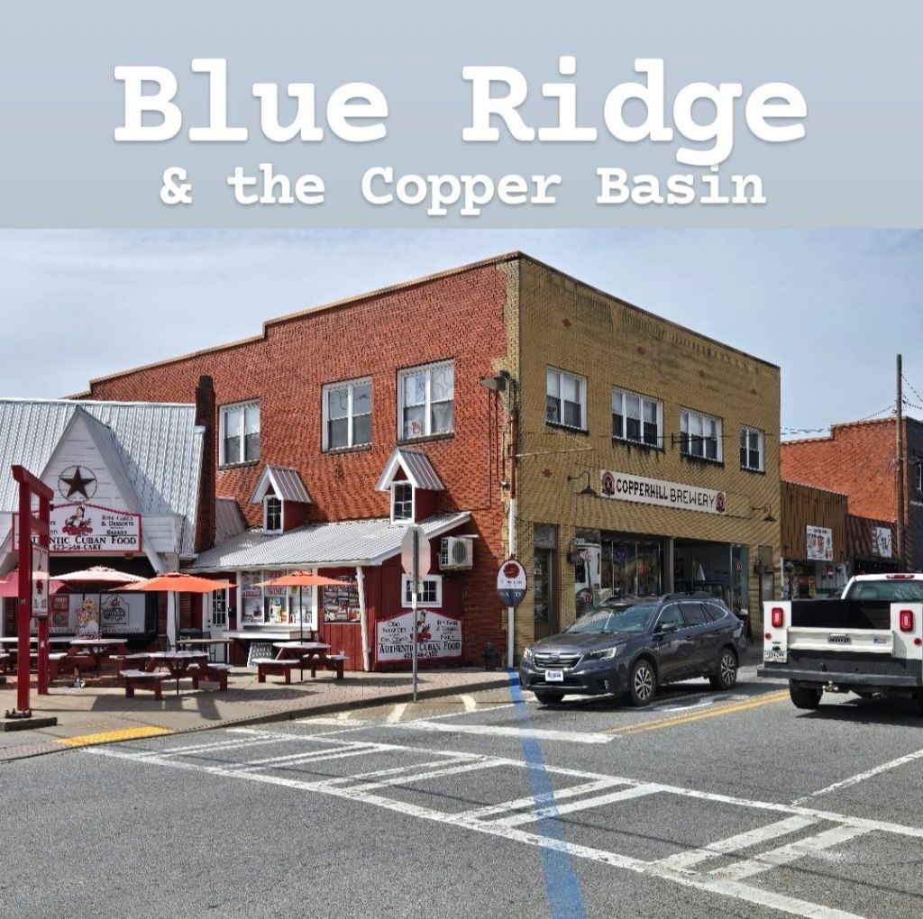
Blue Ridge is a popular vacation spot in the Blue Ridge Mountains of North Georgia. Most visitors choose to rent a cabin in the mountains for their stay. The town itself is nice and charming with some unique places to check out. The main strip of the town is small and only stretches for about a mile, but it’s fun to explore all the random shops found along it. Finding parking usually isn’t an issue, though I’d recommend avoiding driving along the main strip as it gets very congested and only goes one way. The main parking lot can be found near the Coca-Cola mural (which is actually a location on your GPS), and it costs $10 for the entire day. There are parking lots for less, but they’re a little farther away. Alternatively, there are some nearby businesses with free parking lots that may let you park there. (I didn’t check to see if there were signs saying only customers could use them). Along this main strip, you can find many random shops, antique stores, fudge shops, coffee shops, etc. Just a couple blocks away is Rum Cake Lady, an authentic Cuban restaurant with some great food and rum cake! Outside the main strip, you can find the Bigfoot Museum, which is as weird as it sounds and Mercier Orchards, which allows you to pick apples during the right times of the year. During the off-season you can still visit their store which contains all the apple products you could want. The Blue Ridge Scenic Railway is another popular activity, and this train takes you up to the Copper Basin, along the Georgia/Tennessee line. You can purchase train tickets in person or online, but make sure to pay attention to its schedule as it changes depending on the time of year you go. The Copper Basin (which can be reached either by train or by a 20-minute drive) is a unique area as it feels like one town but is separated in two by the state line. The Georgia side is known as McCaysville while the Tennessee side is Copperhill. Even the river changes names based on which side you’re on (Toccoa in Georgia and Ocoee in Tennessee). There’s a blue line across town signifying the state line, and it makes for some fun pictures. Both sides have some fun shops and restaurants to explore (and another Rum Cake Lady), though I felt as though I saw everything I wanted to within just a couple hours. There’s actually an active border dispute between Georgia and Tennessee, which makes this area interesting to visit if you’re into that kind of history! This is a unique area of the state to visit overall, but I probably wouldn’t recommend you plan a whole vacation around it unless you’re coming to relax in a cabin. (That’s not my style, but I know a lot of people enjoy it).
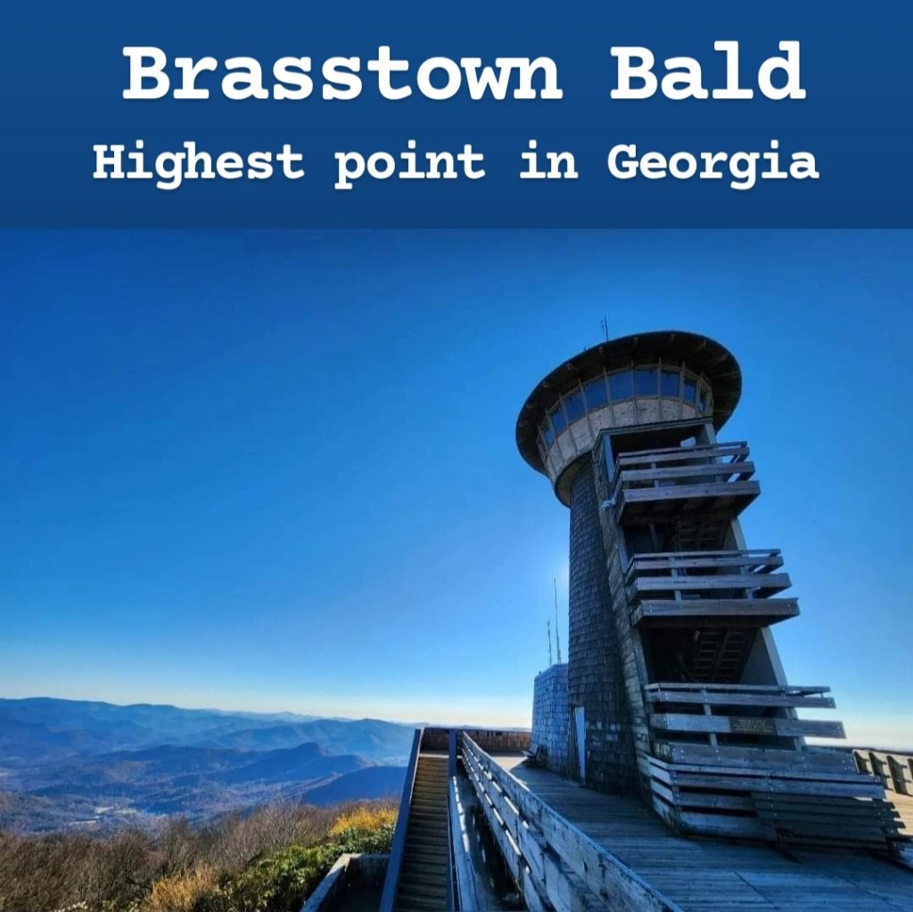
Brasstown Bald is the highest point in Georgia. It’s located in the Blue Ridge Mountains and gives stunning views of the surrounding area. From the observation deck at the top of the mountain, you can actually see 4 different states (Georgia, Tennessee, North Carolina, and South Carolina). The park is easily found via GPS, and I had surprisingly good signal from the main parking lot (but there’s no signal at all on the road to get there). The road to get there is a winding mountain road, so make sure to be alert when driving. Entrance to the park costs $8 a person, with kids 15 and under getting in for free. There is a shuttle service that takes guests to the observation deck, but there’s also a 0.6-mile trail leading to the top as well if you’d prefer to walk. While short, this trail is very steep! Once at the top, there’s a small museum with stairs to the top across from the museum’s main entrance. You’ll also notice a lookout tower, but don’t expect to be allowed inside. This is also a popular place to come in the fall to see fall colors, but getting the timing just right can be tricky. If you’re waiting for the fall colors to be at their peak, make sure to check out the live webcam online at the U.S. Department of Agriculture website to get the most up-to-date look at its current status. When peak fall colors arrive, this park becomes extremely crowded. It’s by far the best place to see fall colors in Georgia, but the line to get into the park can be 2 hours or longer if you don’t time your visit perfectly. I would definitely recommend visiting Brasstown Bald, though there’s not much else to do here besides enjoying the view from the main overlook. I’d recommend pairing it with other nearby sites if you come.
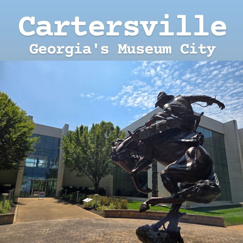
Cartersville, Georgia, is known as the Museum City. It is home to 4 world-class museums that have been recognized by the Smithsonian. These museums were the result of a group of businessmen who wanted to invest in the city. They created the nonprofit called Georgia Museums, Inc. and started collecting items to put on display. The 4 museums the city is known for are the Tellus Science Museum, Booth Western Art Museum, Bartow History Museum, and Savoy Automobile Museum, though there are other smaller museums throughout the city as well. I personally visited the Tellus Science Museum and Booth Western Art Museum, and while I’m not a huge museum person in general, I did think these were nice. During the summer, they typically run a promotion where if you visit one of the 4 museums, you get a passport book to have stamped for a discount on your visits to the other museums. While this is only a small discount, it can still make it easier, especially when bringing a whole family. Entrance to the museums is as follows:
• Tellus Science Museum, $20
• Booth Western Art Museum, $16
• Bartow History Museum, $9
• Savoy Automobile Museum, $17
Besides the museums, the city itself is nice to walk around with plenty of shops and restaurants to check out. You can also find the world’s first Coca-Cola mural here on the side of Young Brothers Pharmacy, which is a unique photo opportunity. There’s also a place called Old Car City really close to Cartersville which is the world’s largest junkyard. It’s weird, but if that’s something you’re interested in, go check it out! There are a couple other places that are notable, but each will have its own section on this travel guide. These are Etowah Mounds and Allatoona Pass, so make sure to check those out if you plan to come to this area! If you like museums, Cartersville is a must. If not, you still may enjoy it like I did!
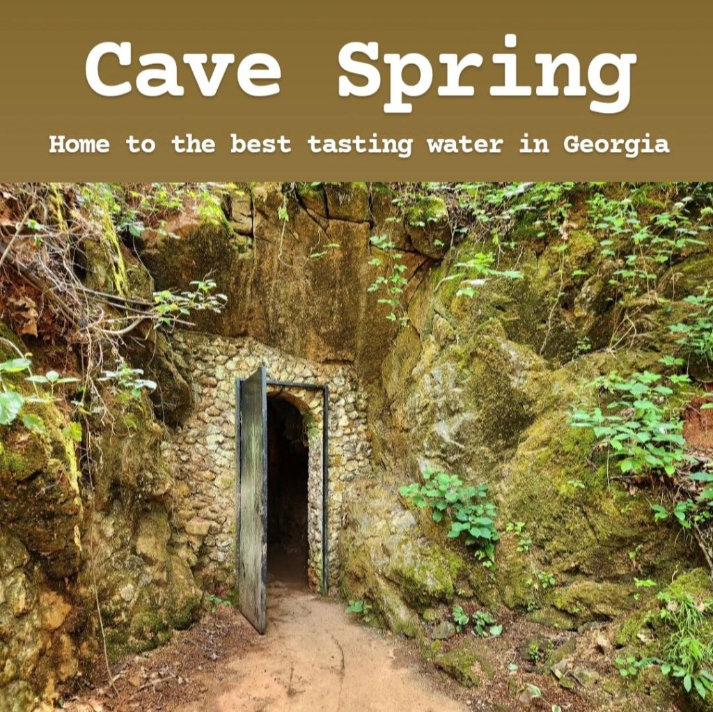
Cave Spring is a small town near the Alabama line, just south of Rome, Georgia. It’s actually one of the starting points of the Trail of Tears, where Cherokee tribes were driven out of Georgia and into western states, but that’s not really what the town is known for. It’s known for the spring in a cave that the town gets its name from, and this spring is said to have the purest, clearest, and best-tasting water in the Southeast. In fact, people come from all over Georgia and Alabama to stock up on natural spring water to use for drinking. The town itself is extremely small, and everyone knows each other. (Think Radiator Springs from the Pixar movie “Cars”). There’s a town center with several antique stores and a general store, plus a couple restaurants. Then right next to that is Rolater Park, which is where all the main attractions can be found (more on that in a minute). Aside from Rolater Park, there’s also an old cabin which was built by a Cherokee man who resisted the government’s orders to evacuate the area, and it remains in very good condition in the center of town. Most businesses in town don’t open until 10:00, with a couple opening at 9. Because it’s in Georgia, the town operates on Eastern time zone, though if you hear locals say “Alabama time,” they’re referring to Central time zone, as they’re located right by the line that separates the two. Rolater Park is technically open all day, so you can fill up water whenever you’re in town (which is free). But each of the main attractions has different operating hours. The cave itself opens at 11. It costs $2 to go inside the cave, and you’ll be completely on your own. The ground can be slippery, and it’s not handicap-accessible whatsoever. There are stairs inside, but they lead to nowhere and are difficult to climb. There’s also a small tunnel that will take you to see the spring, but you’ll have to crawl through it because it’s very low. The cave is cool, but you definitely want to be careful when visiting. Right outside the cave is the water fill-up spot, and you’ll likely see people filling up jugs to take home with them. The other attraction here is Rolater Pool, which is filled with the spring water. It costs $5 for adults, and the water is 57°F year-round, so you may want to make sure you come on a hot day to enjoy it. Note: Everything in Rolater Park is CASH ONLY, so make sure you have cash if you want to visit the cave or pool. The rest of the town accepts card. Overall, this is a unique town to visit, and because it’s in the middle of nowhere, cell phone signal can be weak in the surrounding areas, though it’s good in the town itself.
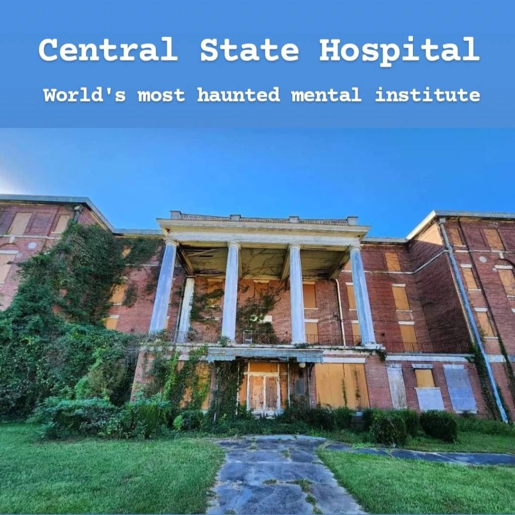
Central State Hospital, located in Milledgeville, Georgia, was once the largest mental institution in the world. It originally opened in 1842 as the Georgia State Lunatic, Idiot, and Epileptic Asylum, and as the name suggests, not much was known about mental illnesses at the time. And unfortunately, there were some unethical treatment methods being used here. In many ways, it became more of a prison than an actual hospital. Tens of thousands of patients died here with over 25,000 being buried in unmarked graves. The campus included over 200 buildings across 2,000 acres and had a population of 12,000 patients, making it a larger “city” than the city of Milledgeville. After being abandoned, all that is left are the haunting remains of a rotting city just waiting to collapse. Getting here is very easy and free as it’s located close to downtown Milledgeville. While there are some sidewalks, you’ll definitely want a vehicle to get around in. This can be a very depressing site to visit if you read up on the history ahead of time, but it can also be a spooky place as well as many claim that it is haunted. You’re allowed to get as close as you want to the buildings, but you cannot enter them! Not only is it very dangerous to do so, but it’s illegal as well. There are always police cars patrolling the streets to ensure no one tries to enter any of the buildings. And even from the outside, many of these buildings are noticeably falling apart with roofs caving in. While it’s tempting to want to know what the inside looks like, you should take your personal safety seriously here: there are plenty of videos online of Youtubers and “ghost hunters” sneaking inside, if you really have to know what it’s like in there. If you’re looking for a more exciting time to visit, Georgia College holds an annual Thriller 5K on the hospital’s campus every October where participants are chased by zombies! I would only recommend visiting if my description sounds exciting to you. There’s ultimately not much to do other than looking at old buildings, but sites like this definitely interest a lot of people.
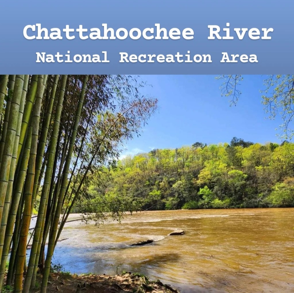
The Chattahoochee River is the most important river in Georgia and travels almost the full length of the state. In the 48-mile stretch just north of Atlanta, you’ll find the Chattahoochee River National Recreation Area. Over 15 individual parks make up this NPS site, covering 10,000 acres of green space and protecting miles of beautiful trails, old ruins, and hidden bamboo forests. Because it’s so spread out, visiting it can be a challenging process, and not every park has clear information available online. Some of the more popular areas include East Palisades, Sope Creek, Cochran Shoals, Vickery Creek, and Powers Island, though each is unique and has reasons to visit. Each park also has its own pay station in the parking lot, charging $5 per vehicle. (This can be avoided with an America the Beautiful pass). The pay station is based on the honor system, and entrance fees should cover you for all parts of the park if you were to visit more than one in a day. My two favorite parts of Chattahoochee River NRA are the East Palisades Trail and Vickery Creek. The parking lot for East Palisades was recently renovated, but there’s an older parking lot as well. Just make sure your GPS is taking you to the one on Whitewater Creek Road. It can also fill up quickly, so you will want to plan to arrive early in the day. The trail starts by following the river, and it eventually turns into the woods only to return to the river later on and take you to a beautiful bamboo forest. My biggest issue with this park in general is the fact that trail maps are very confusing. It’s easy to get turned around, even when following maps, as the directions are not always clear. I have the most experience at East Palisades, though I have visited several other units of the park as well, and I have had similar frustrations with each. Just be extra careful when referencing trail maps, and don’t attempt hiking without one! Vickery Creek, which has an awesome waterfall and swimming hole, can also be a little confusing. Depending on where you park, you’ll either have a decent hike or no hike at all. The individual parking lots all fill up very quickly though, so you have to plan to arrive early. Similar to East Palisades, trail maps can be somewhat confusing, though I think this one is easier to follow. There are some strenuous sections you must take in order to get to the falls, but it’s worth it. If you’re planning to go to Vickery Creek, the city of Roswell has recently made rule changes prohibiting access to the water from the city side of the river. This may be confusing, but the water itself is not off-limits: you just need to cross over to the national park side to enter it. This is one of my top recommendations in the Atlanta area.
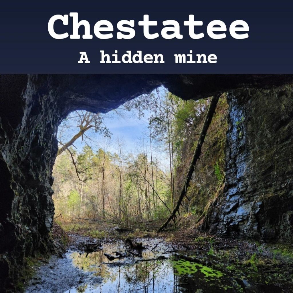
I was hesitant to include this on here. The Chestatee Pyrite Mine is an abandoned mine near the town of Garland, Georgia (and close to Dahlonega). It’s hidden pretty well along the banks of the Chestatee River. This mine was used in the late 1800s, and the height of its activity was from 1917-1919 when over 200 men worked in it. But then in 1930 the mine became abandoned, leaving it sitting unused for almost 100 years. Reaching it is a little easier now than it was when I initially visited it in 2023. If you Google “Chestatee Pyrite Mine,” you’ll find it’s exact location, but when I visited, I had to search for it for hours on a map after getting clues from a YouTube video before I discovered its actual location. The reason I was hesitant to include it on this travel guide is because it’s technically not open to the public. The property it’s attached to is private property and has very clear “No Trespassing” signs along it. What’s not clear though is whether or not the mine itself is also considered part of that private property. The fence with the “No Trespassing” signs extends almost all the way to the river, but then it stops, leaving a small foot path along the river, under a bridge. From this point, there are no more signs, and it’s clear that others have traveled it quite a bit. For these reasons, I’m not going to encourage you to visit, and I’m mostly sharing all of this for information purposes since the location is now publicly-available through Google. Its exact location is at 34° 30′ 8” N, 83° 57′ 33” W. If you go to the point where Copper Mines Road crosses over the Chestatee River and park along the side of the road, you can easily find the foot path. You would then walk along the river until you reach an old abandoned bridge. This was used heavily when the mine was still active but is no longer safe to cross. But once you reach this point, you may be able to spot the mine’s opening in the rock face to your left. It’s hidden behind many bushes and trees, so you would then have to push your way through all of that brush to reach it. Then you’re standing in front of a massive hole in the rock. The inside of the mine is very dark, so you would need flashlights and headlamps in order to safely visit. Even with proper lighting, the ground is covered in loose rock that makes it easy to trip or roll an ankle, so you have to watch your step. Also watch out for broken beer bottles and other debris. It goes back a little ways, but it’s not as deep as you’d probably expect. Also remember that you’re not really supposed to be here in the first place, and everyone who passes your vehicle parked along the side of the road likely knows exactly what you’re doing. This really shouldn’t be visited for several reasons. Use this information as you would like, but legally I won’t recommend visiting it.

Chick-fil-A is one of the most recognizable restaurants in the United States, and since 2019, it has started expanding into other countries as well. Known for its chicken sandwiches, cow mascots, and Christian values, this restaurant is an important part of Atlanta’s history. Chick-fil-A was founded by Truett Cathy in Atlanta. He famously said “We didn’t invent the chicken, just the chicken sandwich.” He first invented the chicken sandwich when Delta Air Lines (also based out of Atlanta) had an over-abundance of chicken breasts that were going to go bad if they didn’t find something to do with them. They asked Cathy, who owned a small restaurant called the Dwarf Grill, if he could use them. He took them off their hands and experimented with his grandmother’s fried chicken recipe. Because he was known for selling burgers, he decided to stick his new fried chicken on some hamburger buns and start selling them. He would later open up his first location under the name “Chick-fil-A” in the Greenbriar Mall, making this the first restaurant ever to open in a mall, which obviously started a new trend. Throughout Atlanta, there are a few unique Chick-fil-A locations that can only be experienced here. Truett’s Grill is a restaurant with a retro design, celebrating Cathy’s love of old cars. It has a regular Chick-fil-A menu, along with some unique options as well. There are only 3 locations: Griffin, McDonough, and Morrow. Truett’s Chick-fil-A is similar, except instead of a retro feel, it’s meant to honor Truett Cathy’s legacy with many pictures and quotes along the walls. This also has some unique menu items. There are 4 locations: Newnan, Rome, Stockbridge, and Woodstock. There are several Dwarf Houses, which kept the name that Cathy originally gave his restaurants. These can be found in Fayetteville, Forest Park, Jonesboro, Pleasant Hill, and Riverdale. THE Dwarf House, found at the location of Truett’s first restaurant, is in Hapeville. Truett’s Luau is unique as it’s the only Hawaiian Chick-fil-A restaurant in the world and can be found in Fayetteville. Its entire menu and decor is inspired by Hawaii. Then the Chick-fil-A Headquarters (also known as Chick-fil-A Campus or the Support Center) is located in Atlanta (College Park). This one can only be visited by either booking a tour online or by personal invite from someone who works there. To book the tour, Google “Chick-fil-A Backstage Tour.” It’s a really cool place to visit, if you get the chance. The newest restaurant opened by Chick-fil-A is a coffee shop in Hiram called Daybright. This is unique because its menu is all breakfast-themed, and there are no regular Chick-fil-A items. If you’re feeling real adventurous, there are 2 Chick-fil-A vending machines in Georgia which offer only wraps and chips. One is found on the campus of Georgia Tech in Atlanta, and the other is in the Children’s Hospital of Georgia in Augusta. Just know that the vending machine, like every other Chick-fil-A location, is not open on Sunday! Of these, I’d most recommend visiting Truett’s Luau, since it’s so unique, and if you get a chance to go to the Headquarters, I’d recommend that too. For the restaurants with traditional waiters rather than fast food-style layouts, I’d recommend making a reservation as the lines to get in can be pretty long. So whether you’re a Chick-fil-A fan or just interested in this unique history, each of these locations is fun to visit.
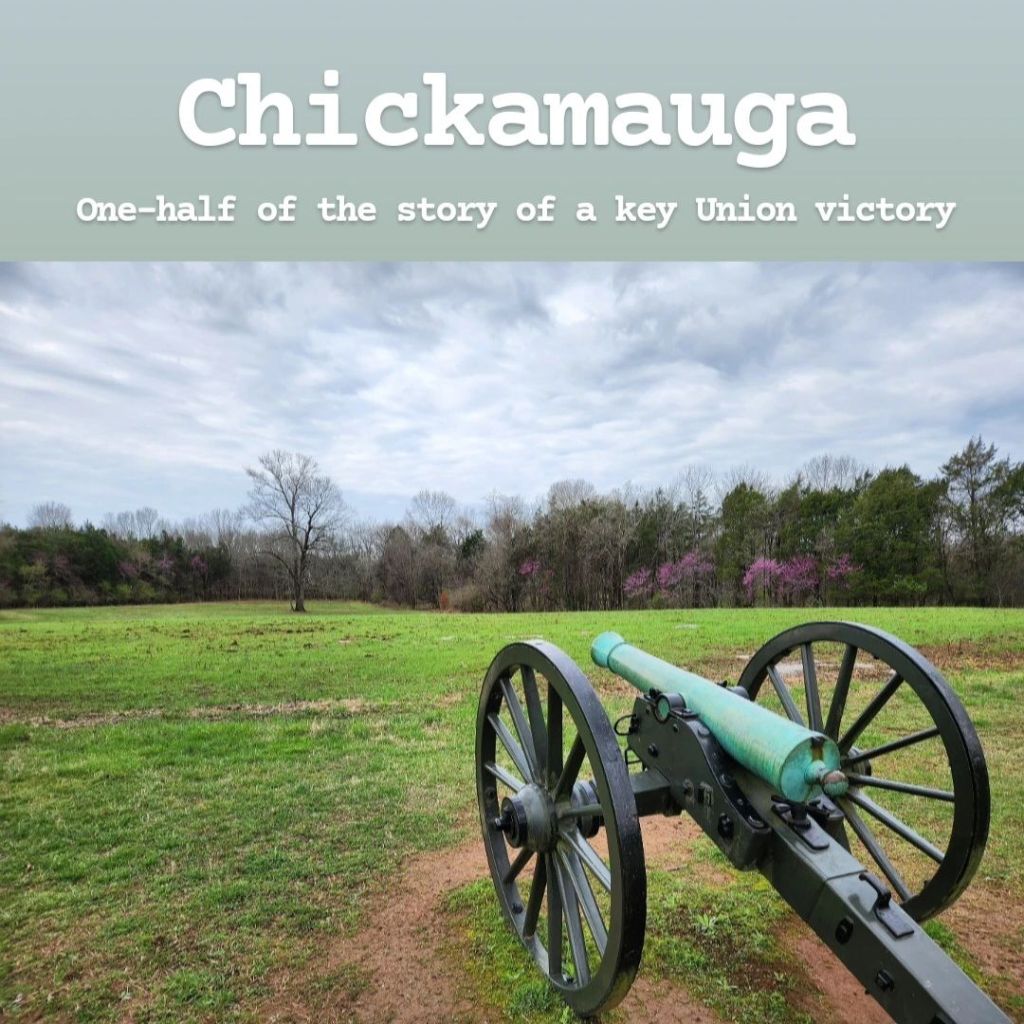
Chickamauga Battlefield in Fort Oglethorpe, Georgia, was the site of a key battle during the Civil War. As the Union Army was trying to take control of Chattanooga, the Confederates fought back in this North Georgia town at the foot of Lookout Mountain. 35,000 Union soldiers were killed, wounded, missing, or captured following this bloody battle, leaving the Confederates victorious. One key death in this battle was Abraham Lincoln’s brother-in-law, Benjamin Helm, who was a Confederate general. This park is only half of the Chickamauga and Chattanooga National Military Park and also only one half of the story. From here, the Confederates marched on to Chattanooga where they were defeated by General Sherman and Ulysses S Grant, allowing the Union to finally take control of Chattanooga, a major victory in the Civil War. Visiting Chickamauga Battlefield is free. It’s a little out of the way to get there, but it’s a fascinating place to visit if you’re interested in Civil War history. There’s a nice visitors center, and there are many monuments to see scattered across the park. One in particular is the Wilder Monument, which is an 85-foot-tall tower that visitors are allowed to climb seasonally, weather-permitting. Cell signal is decent throughout the park. If you want, you can continue on to Point Park on Lookout Mountain to visit the other half of the park, but since that’s in Tennessee, I’ll leave it off this guide. (It’s also worth visiting, and there’s a trail here that takes you to Sunset Rock, which I definitely recommend. This park is not free to enter though, as it costs $10 to visit). Another unique stop in the area is the Dolly Parton mural in nearby Ringgold, Georgia. She was married in Ringgold, and since that’s all the town is known for, there’s a huge mural- kinda neat to see!
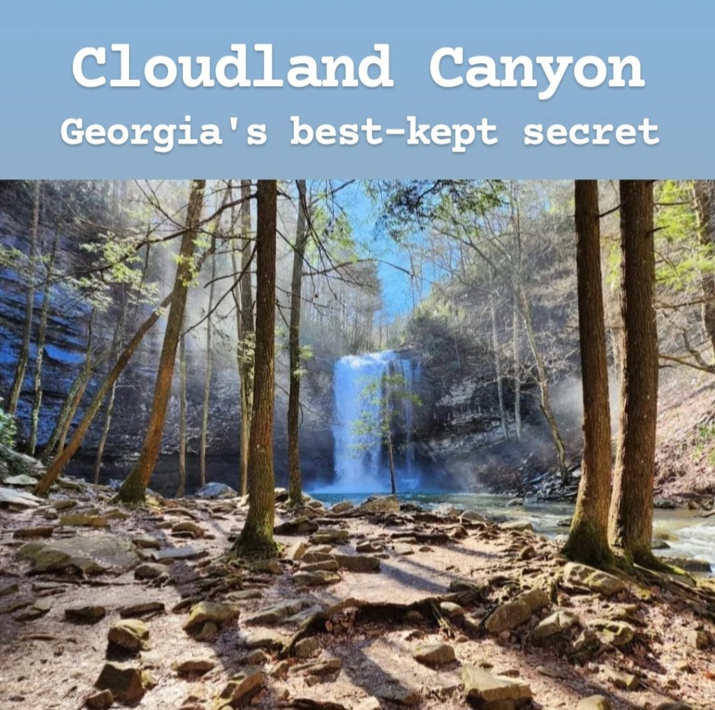
Cloudland Canyon is a beautiful canyon on the edge of Lookout Mountain across the state line from Chattanooga. Due to its distance from everywhere else in Georgia and somewhat remote location, Cloudland Canyon often gets skipped over, but I actually think it’s one of the top destinations to visit within the entire state. It’s not hard to find it by GPS, and there is signal at the visitors center, but the roads there do lead you through some pretty remote areas with very little signal. Once there, the entrance fee is $5 per vehicle, and there’s an awesome lookout right by the visitors center. You can then turn right and walk along the rim for several other cool overlooks. My recommendation, if you’re in decent shape, is to then go left from the visitors center and head down to the canyon floor. There are two incredible waterfalls that you can hike to: Cherokee Falls and Hemlock Falls. Both are some of the most impressive waterfalls in Georgia and can only be accessed by this trail. Though, before attempting, you should be aware that the trail is really a giant staircase descending down to the canyon floor. The way down is easy, but the way up can be very strenuous. The first waterfall you’ll come across is Cherokee Falls, and this one has a magical feel to it as you can see it approaching through the thin forest as you continue hiking. There are several rocks on the edge of the water that you can climb on to get even better views. The next waterfall, Hemlock Falls, doesn’t allow you to get as close, but there’s an excellent view from the observation deck. The best time of year to visit is late winter or early spring as the water volume will be the highest due to melting snow. The downside to going this time of year is that the staircases and observation decks can become iced-over, making it a little risky to visit. The pictures I’ve seen from those visiting in summer don’t compare to the pictures I got in late winter/early spring because the water volume in the falls is much lower. This is a must-visit, in my opinion, especially if you can go during the right time of year.
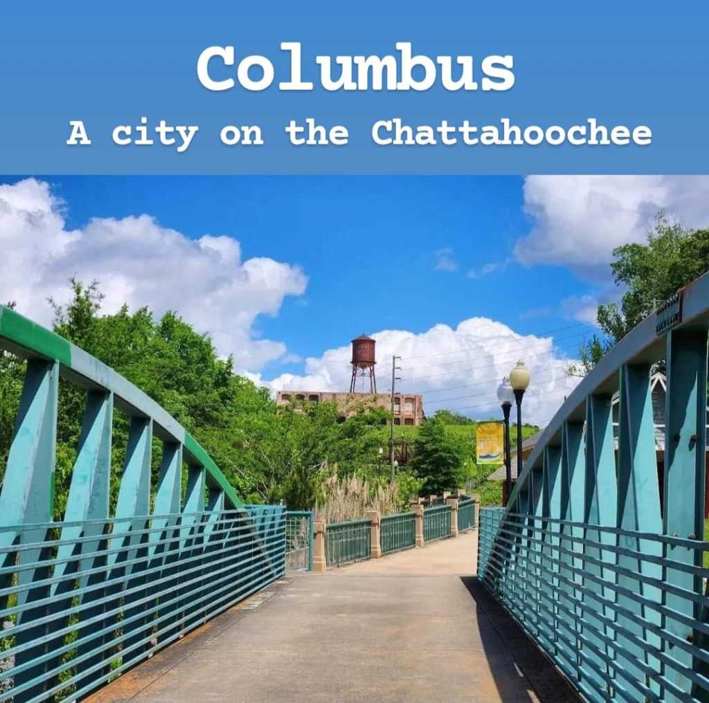
Columbus is a major city on the Chattahoochee River across from Phenix City, Alabama. It’s best known for the river itself and for its many museums. The riverwalk is a popular part of the city to explore, and rafting is a top activity within the city. In fact, it contains the world’s longest urban whitewater rafting course as the Chattahoochee passes literally right through Downtown Columbus. There are plenty of companies that rent out rafting and kayaking equipment or offer tours. There’s also a zipline that crosses the river into Alabama. Outside rafting, the top thing to do is to explore the city’s many museums, including the National Infantry Museum, Columbus Museum, National Civil War Naval Museum, and Coca-Cola Space Science Center. I’m personally not a huge fan of museums in general, so I found the city to be lacking in things to do. I would love to try whitewater rafting sometime, but that’s really the only reason I’d see myself returning to Columbus. I drove around the city, and it honestly didn’t appeal to me overall, but I know that some people do enjoy visiting, so it really depends on the person.
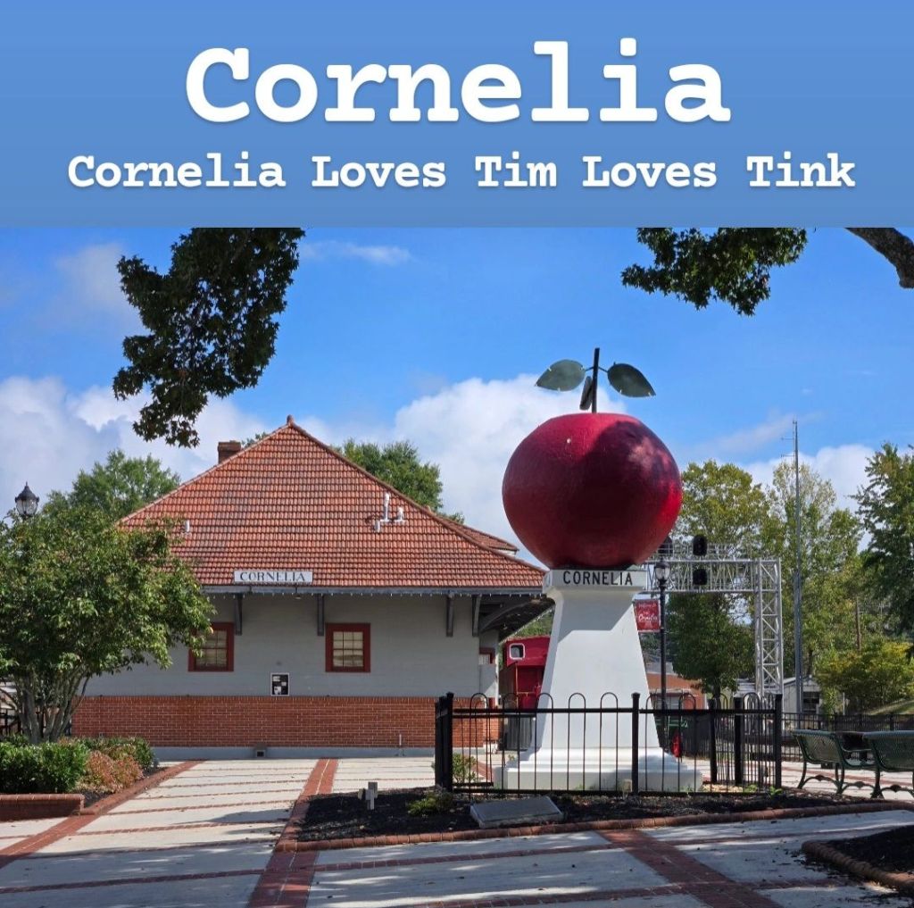
Cornelia is a small town out near Athens that has historically been known as an apple farming region. In the center of town is one of the world’s largest apple sculptures known as, fittingly, the “Big Red Apple.” Adjacent to the apple is a train depot which is important to the town’s history as well. The train depot contains a free museum, though I’ll admit, I was pretty disappointed with it. There are a couple trains you can climb on, and that was the highlight in my opinion. (Maybe I’m just not a train person?) The town contains some antique shops and cafes to check out, including Fenders Diner, a modern old-time diner, which has some incredible shrimp & grits and plays old re-runs of Family Feud on the TVs. The unique story surrounding Cornelia revolves around the sudden appearance of a phrase written in graffiti along the side of an overpass. Those words were “Tim Loves Tink.” Normally, graffiti would not be looked at fondly, but this one was different. No one knew who either Tim or Tink were, and that phrase became the talk of town: legendary even! When the city finally decided to remove it, the people were upset, and then one morning when everyone woke up, the phrase had returned! After multiple failed attempts to remove it for good, the city finally agreed to let it stay as a permanent piece of art and history. Now in addition to the grafittied phase, there is an official mural depicting this overpass with the phrase “Cornelia Loves Tim Loves Tink.” This is a fun story from a town that doesn’t have much else going on. Once you leave the downtown area, you can head over to the Chenocetah Tower, at the top of a mountain, overlooking the surrounding valleys. Unfortunately, there’s not really a legal place to park here, and you can’t go up the tower, but it’s still neat to see. If you want to hike to it, you can go to the Rhododendron Trail in nearby Mt Airy. You’ll have to go to Lake Russell Recreation Area where there is a $5 parking fee, which you need to bring cash to pay, and the parking lot is extremely small and fills up quickly on weekends. You start out by walking back out along Lake Russell Road before you actually reach the entrance of the trail. There’s a sign there, but it doesn’t even call it the Rhododendron Trail. Instead, the sign reads “Entrance to waterfall trail,” and that’s what Google Maps calls it as well. The trail is named after the rhododendrons that are found all along it, so if you visit in late spring/early summer, you should be able to see them. There’s honestly not much to do in Cornelia, but it’s a neat little town to explore if you’re looking for something different. It’s a town you’ll likely pass through when driving east from Atlanta (shortly after seeing the old schoolbuses along the side of the road), so if you have some extra time, maybe consider stopping by! The schoolbuses I’m referring to are part of the Schoolbus Graveyard, which is kinda weird, but you may be interested in seeing that too, so I’ll mention it.
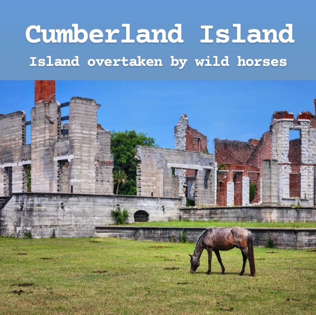
Cumberland Island is one of the most unique places in all of Georgia. It’s an island in the Atlantic Ocean, just north of Jacksonville, Florida. In fact, you can see Florida from the island. It is a very historic area that has been home to Native Americans, Spanish missionaries, British farmers, freed slaves, and the Carnegie family over the years. Since being mostly abandoned in the 1800s, the horses that were once tamed have taken over and become wild. They now freely roam the island and are 100% wild with no care provided by the National Park Service. Some of the more famous sites on the island include the Dungeness Ruins (the ruins of the Carnegie family’s old mansion) and the First African Baptist Church, where John Kennedy, Jr. was married. It’s also home to miles of beautiful white-sand beaches that feel to be almost untouched by humans. Getting to Cumberland Island, however, takes a lot of effort. It can only be accessed by boat, and if you don’t have a personal boat that you can bring, the only way to get there is by ferry. The Cumberland Queen Ferry has to be booked online ahead of time. It departs from 113 West St. Marys Street in St Marys, Georgia. There are a few things to point out here. First of all, the ferry’s schedule changes depending on the time of year you visit, and it doesn’t sail every day of the week, so make sure to look into that ahead of time! Next, when you book your ferry ride to the island, that is NOT a round-trip ticket. You must book your return ticket as well, or you will get left behind. Tickets do change depending on season, but the average ticket per adult is $28 each way. There’s also an additional $15 fee to visit the island, which you can pay in advance online or upon arrival at the visitor center when you get your official ticket. You also need to know how long you’re planning to spend on the island. The main trail tourists take is the 4-mile southern end loop, which visits the Dungeness Ruins, salt marshes and beach. This can be done in 4 hours, but you’d be pushing yourself to complete it. I’d recommend planning to spend a full day if possible. Most people that were on my ferry were actually planning to camp. This is a very popular option at Cumberland Island and must be booked in advance online. This also comes with additional fees as well, and it’s primitive camping, meaning there are no facilities on the island. If you want to visit the north side of the island, which includes the First African Baptist Church and some other ruins, you will have to book a tour online; however, this tour will take all day and add to the overall cost of your visit. Most people want to see the horses: if you take the tour, this is not a guarantee, but if you choose to explore the island on your own, it would be hard to miss them as they’re all over the south end of the island. There’s actually an active lawsuit right now to have the horses removed from the island. There are good arguments being made for the removal of the horses, but it’s hard to predict how this will end. If you want to be sure you see the horses, you may want to plan to visit sooner rather than later. Bikes are also allowed on the main roads of the island and can come over on the ferry, but only 10 bikes are allowed on the ferry at once, so you will need to make reservations online ahead of your trip. This is a top destination within Georgia that you will not want to miss!
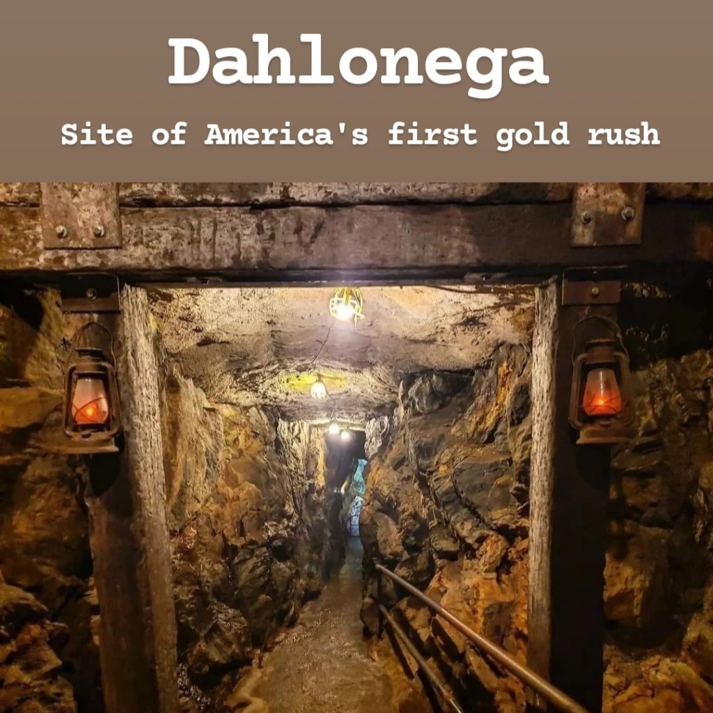
Dahlonega [pronounced Dah-LON-ega] is a small town in North Georgia that is easy to miss when driving by. But it’s a town that comes with a lot of history. This was the site of the first major gold rush in the United States when gold was discovered in the area. After gold was later discovered out west, the town was nearly abandoned as prospectors left on the next gold rush. It was during this time that Dr. Matthew Fleming Stephenson famously tried to persuade the miners to stay while giving a speech on the courthouse steps proclaiming, “Why go to California? In yonder hill lies more riches than anyone ever dreamed of. There’s millions in it!” Mark Twain was so inspired by that speech that he frequently used the phrase “There’s millions in it” in his book The Gilded Age. The phrase has popularly been misquoted as “Thar’s gold in them thar hills,” though there is no record that these words were ever said. The gold in this area is considered to be some of the purest gold in the world and was used for many things including U.S. coins and the dome of the Georgia State Capitol Building in Atlanta. In fact, the U.S. Federal Reserve even opened a mint in Dahlonega for a while to mint coins using the local gold. The gold mining continued through the Great Depression and eventually stopped when it was determined that the gold itself is not worth the effort it takes to mine for it. Now, there’s a small town left behind that has empty gold mines running beneath it. You can actually take tours of these gold mines, and it’s a fun activity that the whole family can enjoy. The Consolidated Gold Mine in particular has a fun gold mine tour that is perfect for families, and it ends with panning for gold where you can keep any gold flakes you find. It’s the largest gold mine ever built east of the Mississippi River. The old courthouse can be found in the center of downtown, and it’s actually the oldest courthouse in Georgia! If you visit it, you’ll find the Dahlonega Gold Museum which teaches about the city’s gold mining history. There’s not much to the museum itself, but there’s a 15 minute video about Georgia’s gold mining history which is very informative. While there, make sure to wander around the downtown area because there’s so many unique shops and great restaurants to check out! It’s small, but it has some of the same charm of places like Gatlinburg without being nearly as crowded. The other place I’d recommend visiting is the Crisson Gold Mine, which is the only gold mine still in use in the entire state. Because it’s still an active mine, you can’t tour the mine itself. But you can pan for gold and gems, and I was very impressed with it on my visit! It costs about $20 a person, but I collected some really cool gems with a value totaling more than $20, so visiting it was a good investment! If you or your kids are interested in rocks or gems, this is a must visit! Aside from the mining history, this is also Georgia Wine Country, and the landscape is dotted with many vineyards, like Monteluce Winery. Some of these vineyards have restaurants and wine tasting opportunities, if this is something that interests you. I will point out that phone signal is very poor throughout these areas. While signal in Dahlonega itself is fine, there’s not much once you arrive on the outskirts where many of these vineyards are found. For more adventurous travelers, you can actually find abandoned copper mines in the area, which may or may not be legal to enter. There’s a popular one to visit along the Chestatee River that is cool to see, though it is technically on private property, with conflicting reports on whether or not the owner is okay with visitors coming. I did share more about it earlier in this guide, if you’re interested in reading about it. One more place I want to mention is Cane Creek Falls. This is a beautiful waterfall that is easily accessible in Dahlonega, but you won’t actually have many opportunities to visit it. That’s because it’s located on private property that is closed to the public for most of the year. It’s located on the property of Glisson Camp and Retreat Center, a Christian camp, which is often booked for private events. The property is always closed to the public from May through July because of the annual summer camps, and during the remainder of the year, it is only open to the public when there is no visiting group on the property. (It’s almost always fully booked). If you want to find out if you can visit, make sure to call them at 706-452-5716 ahead of your potential visit to find out if it’s open. If so, it’s free! When I called, I was told I had a 3-hour window between one group leaving and one arriving, so I made sure to fit that into my schedule. If they let you visit, it’s definitely worth checking out, and you’ll likely have it all to yourself! Overall, I would definitely recommend coming to Dahlonega! I had previously not been too high on it as a tourist destination in the past, but a recent revisit has changed my mind for the better!
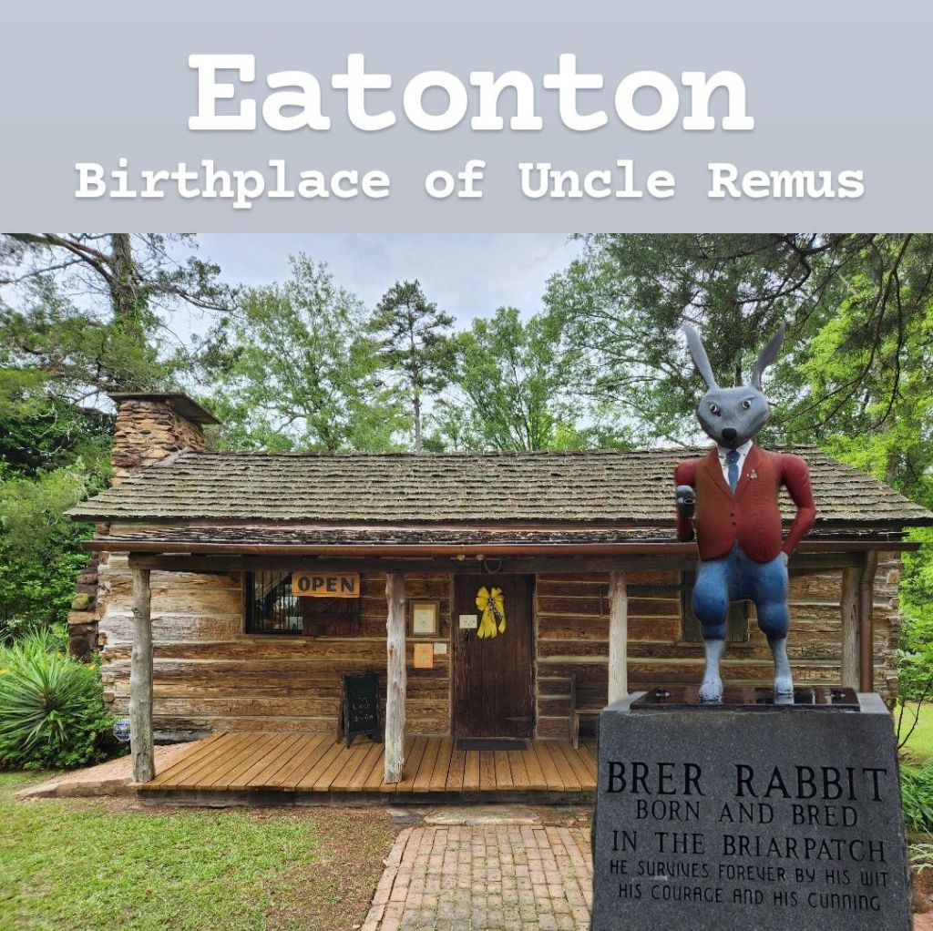
When I first drove through Eatonton in spring of 2024, I had to do a double-take when I noticed a mural on the side of a building depicting Br’er Rabbit, Br’er Bear, and Br’er Fox. These characters have become so controversial due to the 1946 Disney film Song of the South which contains harmful stereotypes of African Americans and slavery. I had seen bootleg copies of the movie being sold in small gift shops before, but never had I seen an entire town celebrate this story in such a public way! After asking around, I learned the history of Eatonton and why these characters are so important to them. Joel Chandler Harris was an American author born in Eatonton, Georgia, and he would eventually go on to write the Tales of Uncle Remus, starring the character of Br’er Rabbit. Harris quit school at the age of 14 to go to work, and the nearby Turnwold Plantation hired him to print a newspaper that circulated around the Confederacy. He often felt like he didn’t belong in society due to his illegitimate birth, so while working at the plantation, he found himself drawn to the slave quarters where he felt he fit in better and spent much of his time. Here, he heard stories from those who would become his closest friends during that time, Uncle George Terrell, Old Harbert, and Aunt Crissy. These stories would eventually be the inspiration behind Harris’s works, with the character of Uncle Remus likely being modeled after them. The stories themselves were somewhat controversial due to Harris’s use of language and inflections he picked up from the slaves, as well as its depictions of the antebellum South, and there’s also still a question surrounding who actually created these characters. But the real controversies surrounding these stories didn’t come around until Disney put their own spin on the stories. Harris isn’t the only author to come from Eatonton, Georgia, though. Alice Walker, civil rights advocate and author of “The Color Purple” and “In Love and Trouble” was also from this small town. Eatonton has become known as a literary town, with the Famous Authors Driving Tour being a popular route to take. Turnwold Plantation cannot be visited, but it can be seen from the road, along with a sign indicating its significance. There’s not really a great place to stop here, and the shoulder of the road is very soft, so I wouldn’t recommend pulling off either (speaking from experience). The biggest attractions would be the Uncle Remus Museum and Georgia Writers Museum. Entrance to the Uncle Remus Museum costs $5, while the Georgia Writers Museum is free (though donations are appreciated). The town itself is interesting to drive around as there are references to the Uncle Remus stories everywhere from the Briar Patch Park to a literal statue of Br’er Rabbit standing in front of the Putnam County Courthouse. And it’s kinda cool that my favorite Disney World ride would’ve never existed if it weren’t for Eatonton, Georgia! (Tiyana’s Bayou Adventure, of course.) There are also 2 rock effigy mounds in the Eatonton area: Rock Eagle & Rock Hawk. These are in their own section, so I’d recommend checking it out too!
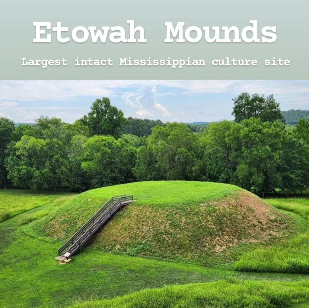
Etowah Mounds is an ancient Native American city located in Cartersville, Georgia. It’s one of three main Mississippian mound sites in the United States, with the others being Ocmulgee Mounds (Georgia) and Cahokia Mounds (Illinois). Ocmulgee Mounds, which is included farther down in this guide, was the largest archeological dig in US history, while Cahokia Mounds contains the largest mound in North America. But Etowah Mounds is considered the largest intact Mississippi culture site in the Southeast. Mound A is the largest mound in the park and the second largest in North America at the same height as a 6-story building! There’s a nice view from the top, though climbing a large staircase is required to reach it. One complaint I have with this site is that the individual steps on the staircase are a little too short. I kept accidentally overstepping and tripping on the next step because it just seems like they should be a little taller. There are two other main mounds, named Mound B and Mound C, plus a large open field where the inhabitants would play sports. It’s definitely an impressive site to visit, though I think I was a little more impressed with the other two that I mentioned above. Entrance to the park costs $6, which you pay inside the visitor center. There is sometimes a museum in the visitor center, though when I visited, all the exhibits had been taken down for some reason. I’d recommend visiting, though you wouldn’t likely spend more than a couple hours here. If you go, I’d recommend stopping by Marietta or Kennesaw Mountain afterward.
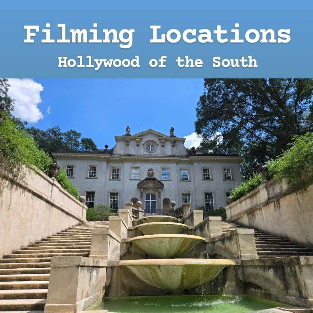
In recent years, Georgia has become the Hollywood of the South. This is because Georgia offers unmatched tax incentives to production studios that choose to film in the state. As a result, many studios film exclusively in Georgia now, and you’ve probably seen the Georgia Peach logo at the end of a movie’s credits before. That also means that there are many cool filming locations spread across the state that you can visit for yourself. I obviously can’t visit or even mention every one of them, but I’ll do my best to share some of the most popular ones with you. Though many movies and TV shows have filmed in Georgia, the most popular ones that bring in tourists include Marvel, Stranger Things, The Walking Dead, and The Hunger Games. I’ll talk about each of these below. Before getting to those, there are two other filming locations I’ll mention. The city of Covington has become a popular stop for fans of The Vampire Diaries and is prominently featured throughout the series. I haven’t seen the show, but I’ve visited the town a few times, and it’s a cool place. Then the town Juliette, which has its own section in this travel guide, was the filming location for Fried Green Tomatoes. Again, I haven’t seen the movie, but this is a cool stop for fans of it.
Marvel: Most Marvel movies and shows are filmed in Trilith Studios in Fayetteville, which tourists can’t visit. (Trilith Town, which is right next-door is fun to visit though, and there’s a small chance you may see a celebrity there). But there are plenty of filming locations that you can visit. Probably the most iconic of these is the Porsche Experience Center in Hapeville. This futuristic-looking building is used as the new Avengers headquarters and is featured in Ant-Man, Captain America: Homecoming, Avengers: Infinity War, and Avengers: Endgame. It can be seen from the road, but there’s not really a good place to pull over for a picture. It’s still really cool to see though! Another iconic location is Piedmont Park. This is used as “New York’s Central Park” in Avengers: Infinity War. For Black Panther filming locations, you can head to the High Museum of Art in Atlanta, which acts as the “Museum of Great Britain” which Killmonger stole from. Then there’s also an apartment building located right next to Ebenezer Baptist Church that Martin Luther King, Jr pastored, which was used in the beginning and end of the movie. And speaking of Black Panther, during the Battle of Wakanda in Avengers: Infinity War, there’s a scene where several Avengers are fighting by a waterfall, and this was actually shot inside Tallulah Gorge, which I mention later on in this guide. One of my favorite filming locations is the Atlanta Marriott Marquis which was used as the TVA Building in Loki and also a hotel in Spider-Man: Homecoming. This is one of the most visually-impressive buildings I’ve seen in Atlanta. One more to mention is the Georgia World Congress Center in Atlanta, which is used as the S.W.O.R.D. Headquarters in WandaVision.
The Walking Dead: By far, the most iconic location for fans of The Walking Dead to visit is the small town of Senoia, Georgia. Senoia is the town used in season 3 as Woodbury, and there are a lot of cool landmarks throughout the city that you can stop at. In fact, Norman Reedus, who plays Daryl on the show, liked the area so much that he opened a restaurant in Senoia called “Nic & Norman’s.” Another cool location to stop at is the Cobb Energy Performing Arts Centre, which was used as the CDC Building at the end of season 1. Throughout the Senoia area, you can also visit the church from season 2, along with a few smaller sites like the gas station that Rick stopped at in the pilot episode. The farm, which was a major location in season 2, is located just down the road from Senoia, but because it is private property, you cannot visit it. Many fans are also disappointed to learn that the prison from season 3 is not a real location and was instead shot in a studio. But there are a couple other places to mention- the Jackson Street Bridge in Atlanta gives an awesome view of the interstate leading into the Atlanta skyline, and this is where we saw Rick riding a horse into Atlanta on the first episode. And one last place I’ll mention is Bellwood Quarry in Atlanta’s Westside Park. This was the location of the survivors’ camp where the characters spent most of their time in season 1. It also happens to be a filming location for Stranger Things and The Hunger Games, but The Walking Dead is what it’s most recognized for.
The Hunger Games: I mentioned the Atlanta Marriott Marquis under Marvel due to its presence as the TVA Building in Loki, but it’s also an important location for Hunger Games as well. It’s used as the tribute’s quarters throughout the series, and there are scenes of Katniss, Peeta, and Haymitch riding the elevator to the top of the building. One of my favorite locations to visit is Sweetwater Creek State Park. Here, there are some ruins of an old mill used during the Civil War. But this is also where a scene between Katniss and Gale was shot, and you can see them walk through the ruins and up to the Chattahoochee River. The most iconic filming location from The Hunger Games is the Swan House in Atlanta. This is used throughout the series as President Snow’s mansion, and it’s very impressive to see it in person. To visit it, you need to get a ticket to the Atlanta Historic Center, and it’s really impressive to visit it, along with the surrounding gardens. (I’ll mention that this was also the finish line for season 19 of The Amazing Race). Another interesting stop is Chestatee Wildlife Preserve, which allows visitors to encounter many different rescue animals. This is also where Katniss and Gale saw elk while hunting in District 13.
Stranger Things: Because Stranger Things is so popular and has legitimately become a reason tourists visit Georgia, this is its own section later on in this guide.

Fort Mountain State Park is located by Chatsworth, Georgia, near the Tennessee line. At only $5 to visit, it’s a beautiful park with ties to ancient Native American history. It was named after the remnants of an 885-foot-long stone wall at the top of the mountain. While there are many legends surrounding the construction of this wall, it’s not completely known why it was built. Some believe it was built by local Native Americans for religious purposes while others believe it to be a fort built by Hernando de Soto’s conquistadors. However, the most popular belief is that it belonged to the legendary moon-eyed people. These “moon-eyed people” come from Cherokee lore and once supposedly lived throughout the Appalachia region until the Cherokees expelled them. These bearded Caucasian people could not see clearly during the day but had better night vision than everyone else. According to the legend, they retreated into Fort Mountain and built this stone wall as protection from the Cherokee during the daytime. While visiting the mountain, you can see the remains of this stone wall and read more about this people group’s history. There are also some nice overlooks and an old fire tower, which you sadly cannot go inside. The trails here can be a bit confusing, so I would recommend downloading a map online or using All Trails so you don’t get lost. The trails are short and easy for the most part. But there’s also an 8.2-mile Gahuti Trail for those looking for a longer hike. There are also some mountain bike trails according to the website, though I don’t personally remember seeing them. It’s worth a visit, and I don’t see it taking all day if you come, unless you attempt the longer hike. You could easily combine it with a trip to nearby Ellijay, the “Apple Capital of Georgia,” to visit its many apple orchards, which is best visited during the fall.
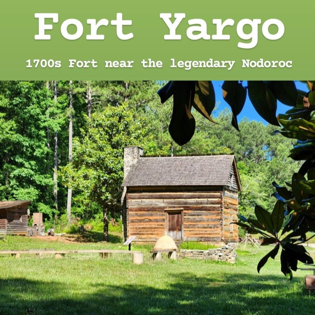
Fort Yargo is a state park located in a small town called Winder, Georgia, about halfway between Atlanta and Athens. Cell phone signal is very spotty in this area but is actually decent within the park. The fort itself was built in 1793 to protect European settlers from attacks by the local Creek population. It is surprisingly well-preserved for its age, with only the stone chimney being replicated. The fort itself is small, and the door is locked, so you can’t get inside, but it’s still cool to see. Entrance to the state park is $5, but there are annual passes available. While the fort is the most iconic part of the park and what it was named after, it’s not really what most people come here for. The park is located on a beautiful lake and has a lot more to offer than just a small historic fort. There’s a 7-mile hiking trail that circles the lake, which is really popular here. It’s also used as a bike trail, so if you’re hiking, you’ll want to watch out for the bikes. Bikes have to go clockwise on certain days and counter-clockwise on others (pay attention to the signs), so it is recommended that hikers go the opposite direction on the respective days. There’s a nice visitor center, but the only thing inside is a gift shop. They do have park maps here though, so you may want to stop by for one of those. The most popular activity I saw on my visit was fishing. There were many families out fishing on the lake, and there are many picnic tables as well, making it a great place for families on the weekends. Camping is another popular activity, though I didn’t personally explore the campground. If you research the area online, you may hear about the nearby legend of Nodoroc. This was a large bog/mud volcano that the local Creek population nicknamed the “gates of hell.” While this is a popular legend in this area, the actual location of Nodoroc is on private property, so it’s not accessible to visitors. Downtown Winder does have a small museum where you can find some information about it and spot a brick out front that is dedicated to the “Wog,” a mythical beast that guarded Nodoroc. But unless you’re really interested in the story, it’s not worth visiting Winder just for that because you won’t be able to see anything. Fort Yargo, on the other hand, IS worth visiting if you’re nearby. Don’t come from far away to see it though.
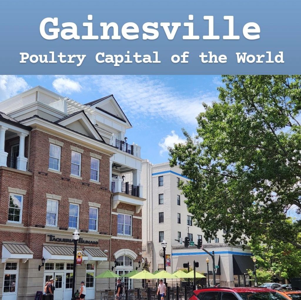
Gainesville is a nice city on Lake Lanier that I always enjoy visiting. I’ve struggled putting this Gainesville guide together because on paper it doesn’t seem like there’s much of a reason to come here, but trust me, I do really like this town! For years, it was known as Rabbittown due to the production of rabbit meat. But then during World War II, a man named Jesse Jewel started the area’s poultry business which really took off. Poultry became more popular than rabbit, and Gainesville eventually became the world’s largest producer of chicken meat, giving it the nickname “Poultry Capital of the World.” Some people don’t like this new nickname and still consider it Rabbittown. A couple fun stops to make are the chicken monument at Poultry Park and the rabbit monument in front of Rabbittown Cafe, which is meant to signify what the city is really known for. There’s nothing to do in either of these locations, but it’s a fun piece of history to explore. The Lake Lanier Olympic Park, where several water activities where held during the 1996 summer Olympics is also found in Gainesville and can be a cool place to stop. The Gainesville Square is a cool area, and it contains one of my favorite coffee shops in the state, Boarding Pass Coffee, which has a really fun travel theme to it. The square is also the start of Gainesville’s solar system walk, which is a series of trails throughout the city leading to Lake Lanier. Along it is a 4 billion-to-1 scale model of the solar system, and you can walk from the sun to Pluto, if you have time. This can take longer than expected, but the views along the way are very nice! Overall, I think Gainesville is a great place to visit. There are also many great food options in the city as well (including chicken, but ironically no rabbit that I found). I’d definitely recommend checking it out!
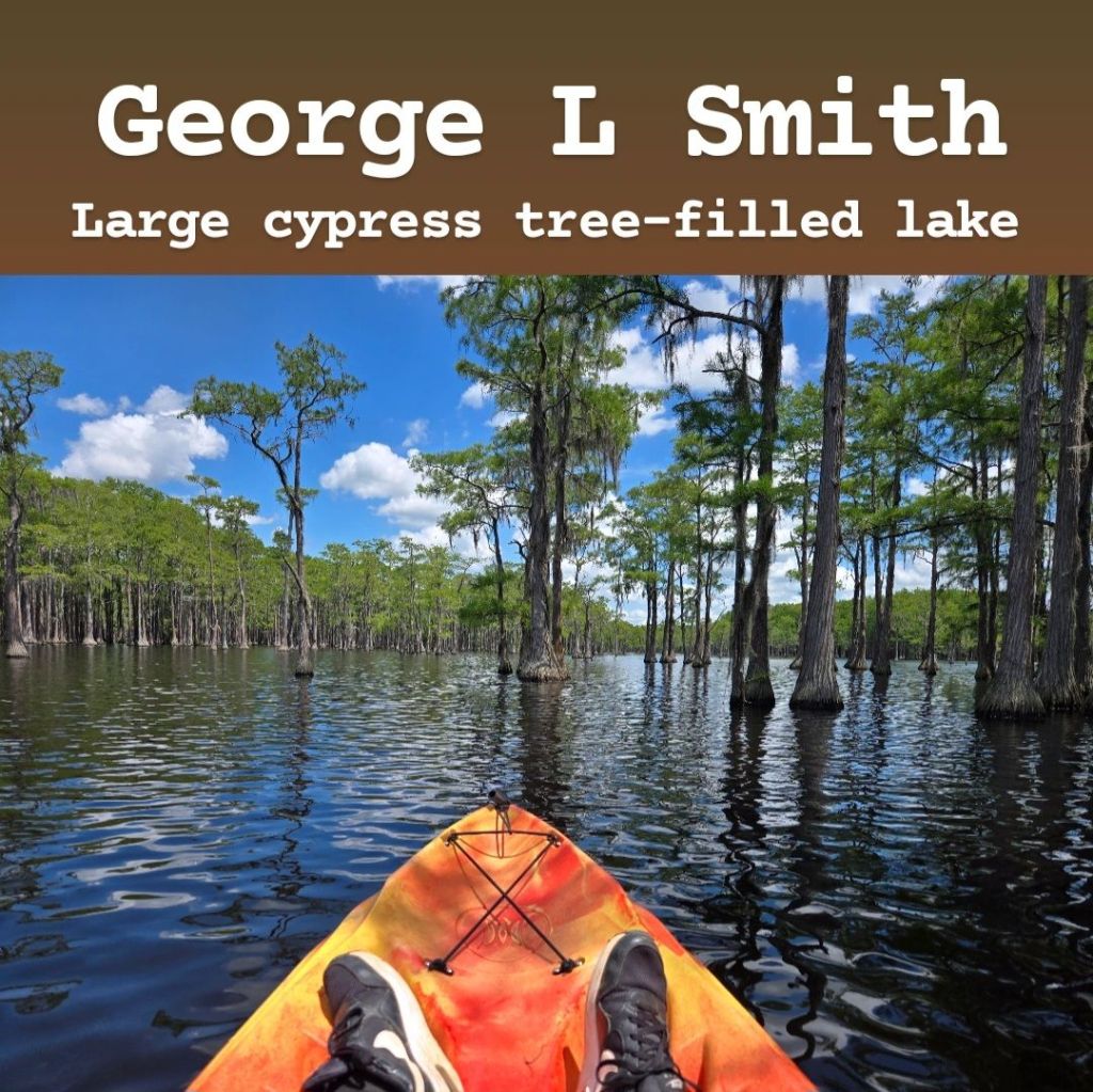
George L. Smith State Park is a state park near Twin City, Georgia, in the middle of nowhere. There are a lot of farms in the area, and the town itself is very small and rural. Getting to the park is simple by GPS, and cell phone signal was surprisingly great throughout the duration of my visit. The main feature of the park is a 412-acre lake that has many cypress trees growing in it. Entrance to the park is $5, and you can either pay in the pay station by the parking lot or in the visitor center. Right across from the visitor center is the Parrish Mill Bridge, which you can visit. It has acted as several things in the past, including a saw mill, cotton gin, and grist mill, though it is now just a dam and bridge. After passing through the bridge, you reach the park’s trail system, consisting of over 7 miles of trails. The majority of these trails are in direct sunlight, so I would suggest bringing sunscreen. And if you come in the middle of summer, expect it to be brutally hot. Bug spray would also be a good idea here. The park is home to alligators and snakes, so you will want to watch out for those. Tortoises are very common as well, and you are much more likely to see them. The best thing to do at this park, in my opinion, is kayaking. You can rent a kayak here, and it’s the best way to fully experience this lake and its many cypress trees! There are many different reports online about kayak rental costs. I’ve seen everything from $21 to $40 for a single kayak and $50 for a tandem kayak. I was charged $36 for a single kayak, and that gave me 2 hours on the lake. I can’t really speak toward the tandem kayak cost as I visited alone. The views from the kayak are incredible, and they are much better than what you would get from land. Again, watch out for alligators, and expect to be in direct sunlight for the majority of your time there. I have read that the water level fluctuates some, so during times of drought, it may not be the best time to come. Overall, I’d definitely recommend visiting this park! I drove 2.5 hours to get here, and I believe it was worth it. Just remember: sunscreen, bug spray, and plenty of water are all musts!
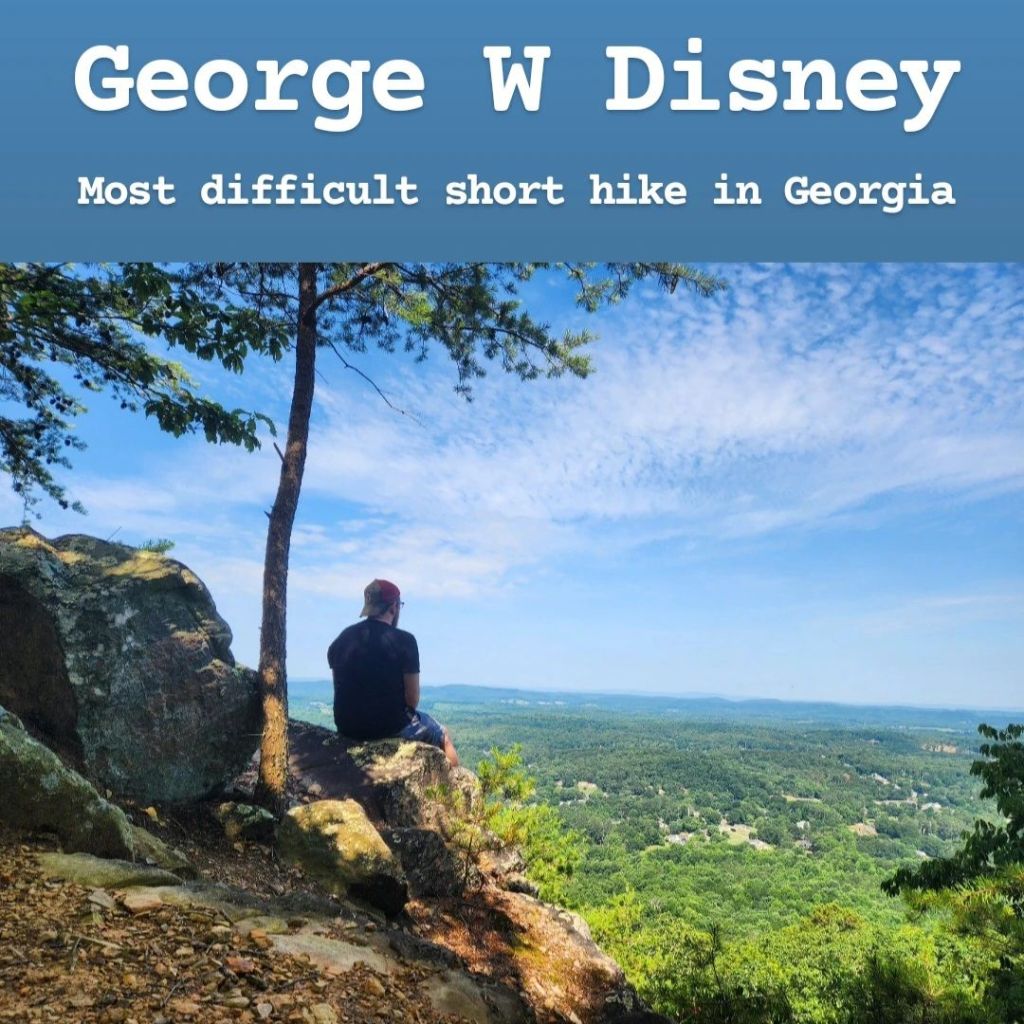
The George W Disney Trail is a trail that goes up to the top of Rocky Face Ridge in Dalton, Georgia, named after a soldier who was buried there. It’s located in the far north of Georgia, not far from Chattanooga. It’s known as the most difficult short hike in Georgia because, while it is only around 2 miles round-trip, that first mile is entirely uphill on a very steep incline. If you are not somewhat in shape, I would not recommend attempting this hike due to its difficulty. Finding the hike isn’t too difficult if you know where you’re going. Fortunately, it’s located only about a mile off the interstate, but you can’t fully rely on your GPS to get you there. Your GPS will likely lead you to a carpet store, which is ironic since the city of Dalton is known as the Carpet Capital of the World. But don’t turn into the carpet store and keep driving a little bit past it. You’ll see a sign for the First Church of the Nazarene by a steep driveway, and that’s where you want to go. The trailhead is in the back of the church’s parking lot next to their Tipton Family Life Center. There are no signs or advertisements anywhere for this trail, so you have to already know where it is to find it. It’s free to visit, and there are no restrooms available. Cell phone and internet signal were actually great throughout the whole trail. It doesn’t take long before you reach the incline, and it only becomes steeper as you go. The trail itself is difficult to follow, so I would highly recommend using AllTrails as your guide. It’s also not 100% reliable, but it will lead you to the top of the mountain. Unfortunately, it will try to get you to keep going once you’re at the top, though there’s literally nowhere to go in the direction of the trail on the screen. But you’ll know when you finally reach the top if you see a small seating area set up for presentations. One last thing I need to point out is that this trail has millions of harvestmen (a.k.a. “daddy long-legs”) all over the place. Watch your step, especially if you come early in the morning! I’m not an arachnophobe, but I was getting weirded out by how many there were. It looked like the ground itself was moving as it was literally covered in them, and they’d flee as I was approaching. It makes you want to avoid touching nearby rocks or trees out of fear of sticking your hand into a pile of them. And you can hear millions of them running along the foliage on either side of the trail. If you are scared of spiders, I’ll just tell you to avoid this place completely. Early in the morning would technically be the best time to come to beat the heat, but I’d recommend waiting until at least a few people have gone ahead of you to scare a lot of them off before you get to them. (Just know they’re likely hiding under the foliage right beside the trail, so don’t step off trail!) Overall, I’d say it was worth the visit, especially if you’re looking for a shorter but decent workout with a great payoff at the end. It’s a tough trail, but the views from the top make up for it.
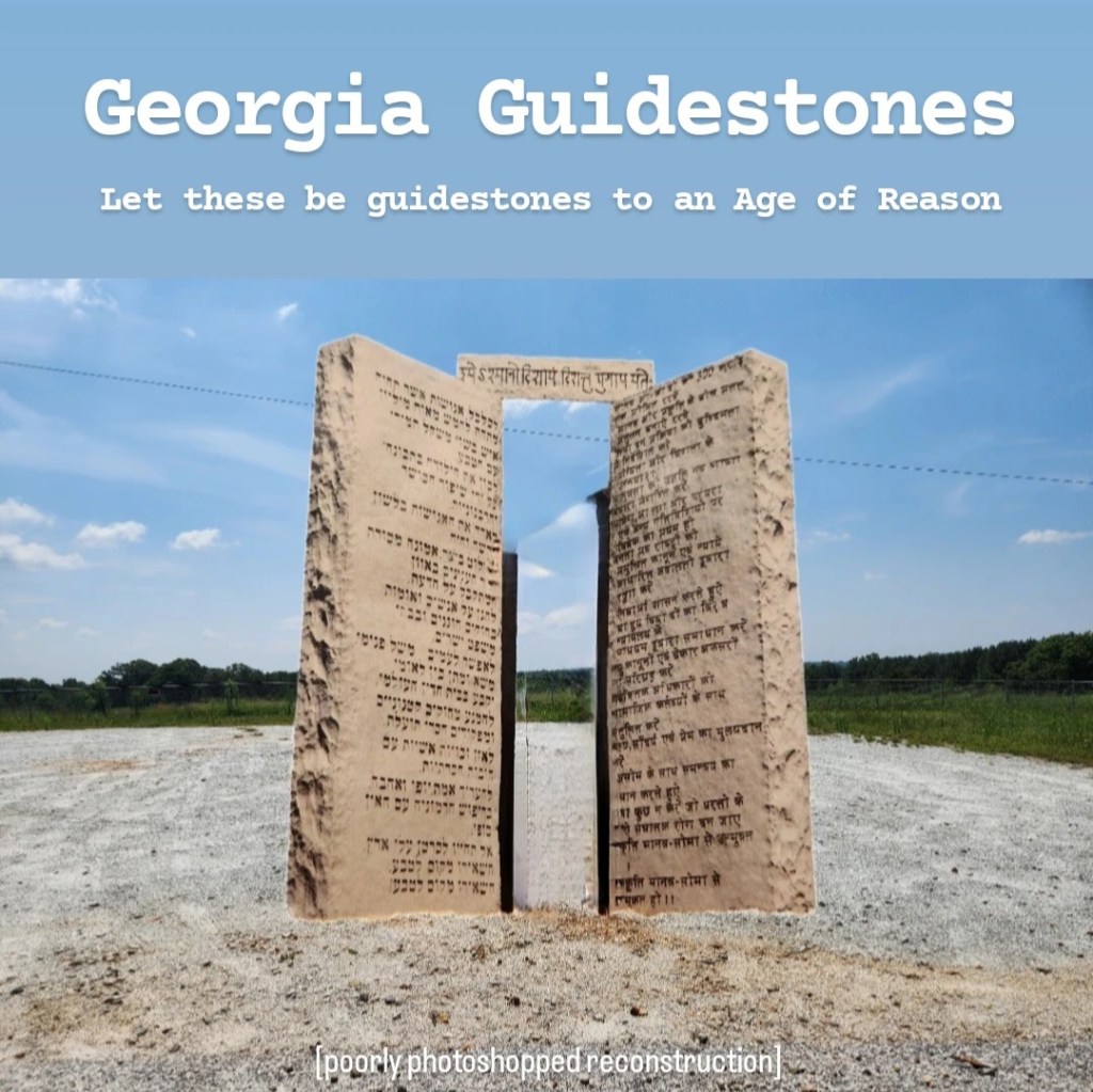
The Georgia Guidestones were known nationwide for their controversial messaging. These 19-foot tall stones were known as America’s Stonehenge and included messages about population control in multiple languages. This massive artwork was even more mysterious because no one knows who built it or what its purpose actually was. It led to many conspiracy theories stating that it was a list of rules for a future post-apocalyptic society or maybe instructions for aliens after they take over earth. Whatever the case, there were many who protested for the stones to be taken down, and in July 2022, an unknown person placed a bomb on one end of the Guidestones and destroyed them. This used to be a popular pitstop on road trips through Georgia, but now that the stones are gone, it’s obviously not quite the same. But there are still some, including myself, that find the story interesting enough to want to visit the site of the Georgia Guidestones even after they were destroyed. They were located in the small town of Elberton, Georgia, which is known as the granite capital of the world. Many granite companies exist throughout this small community, and there are countless examples of granite artwork throughout town, including many monuments, buildings, and even a football stadium made entirely of granite. The Elberton Granite Museum is also a neat stop to make and displays the Argo Spire beside it, which is the tallest known granite obelisk in the world. The remainder of the Guidestones are being protected by the Elberton Granite Association, which runs the museum, so they will likely be on display in the museum at some point. If you want to visit the spot where they once stood, head to 1031 Guidestones Rd NW, but make sure to be respectful as it’s technically private property.
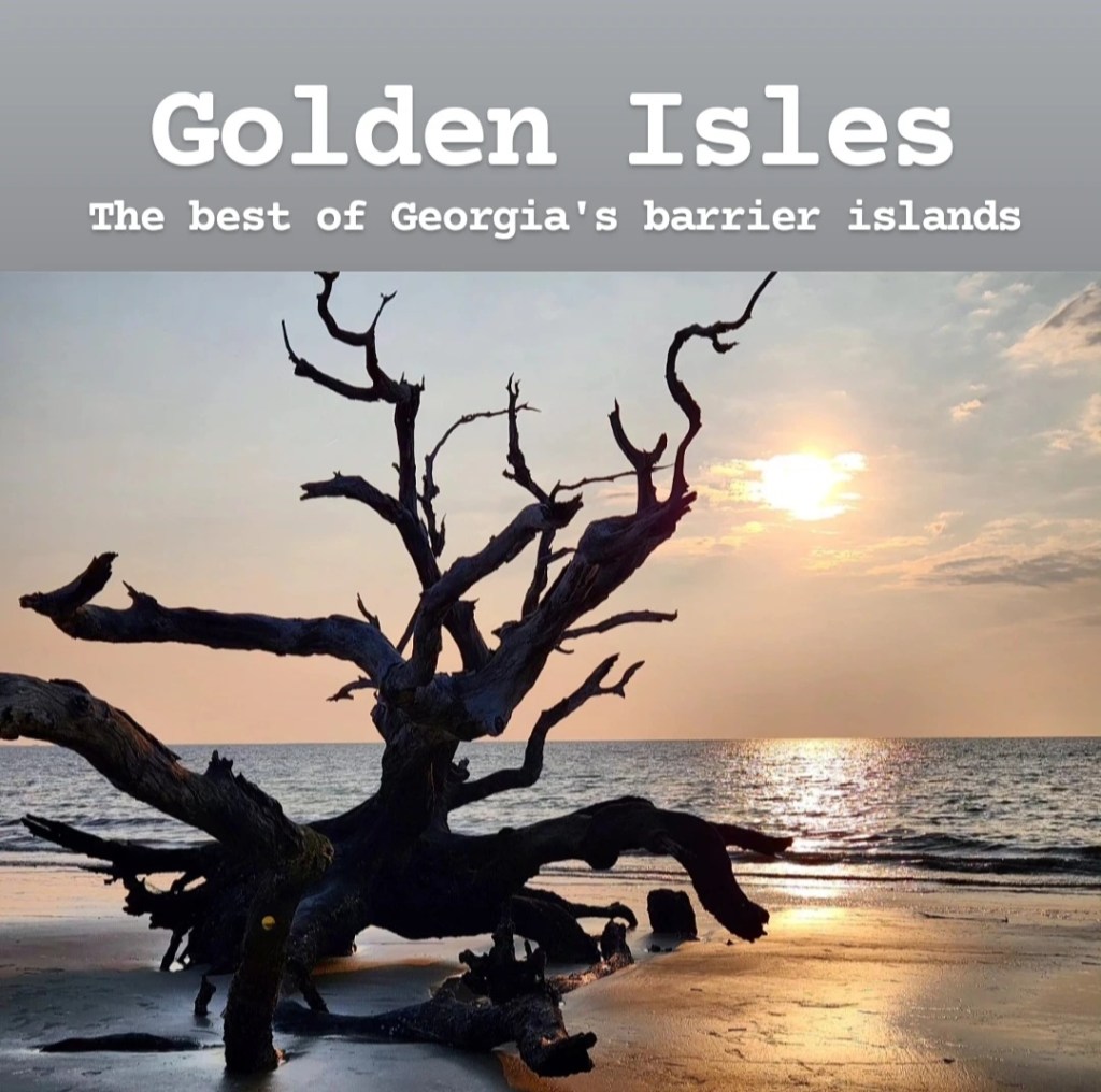
Many people don’t associate Georgia with beaches, but Georgia does have a 110-mile coastline on the Atlantic Ocean, with 15 major barrier islands, each with beautiful beaches. Of those islands, 4 of them have the distinct privilege of being called Georgia’s “Golden Isles” and are considered to be the best. These include Jekyll Island, St Simons Island, Little St Simons Island, and Sea Island. (Sometimes Salpelo Island and Blackbeard Island are included, but they’re not part of the traditional 4 Golden Isles). In order to visit Little St Simons and Sea Island, which are technically privately-owned, you either need to be staying at the islands’ respective resorts or book a tour through the resorts. This can be pricy based on the research that I have done. So, in this guide, I will focus on the two main islands, Jekyll and St Simons. To start, the mainland town of Brunswick is where you want to start in order to visit the Golden Isles as it links each of them together. Brunswick is actually considered a part of the Golden Isles even though it’s not an island because it’s a vital part of the Golden Isles region. It’s a small town for the number of tourists it sees, and there’s ultimately not much to do in the town itself. But it is known for its seafood, so you will want to find a local seafood restaurant while you’re there. Jekyll Island is the most famous of the Golden Isles, and while it’s a town itself, it’s also considered a state park. As a result, there’s an $8 entrance fee to visit the island. You will pay this at an unmanned toll booth that takes either cash or card as you’re entering the island. While Jekyll Island has several nice beaches, my main recommendation is to visit Driftwood Beach for some amazing pictures. The best times to visit are sunrise and sunset, and if you happen to be there when either of those coincides with high tide, that would be the perfect time to check it out. St Simons is the largest of the Golden Isles, and it’s honestly the perfect getaway location in my opinion. The island is so chilled and laid-back, and it makes for an ideal vacation destination if you just want to take things slow and relax. The beaches here are beautiful and on par or even better than many Florida beaches I’ve seen. You could actually forget you’re on an island because it’s so big and feels like a town on the mainland at times. If you’re into history, St Simons is also home to Fort Frederica, which is an interesting stop to make. I’d definitely recommend checking out the Golden Isles if a more relaxing vacation is what you’re after!
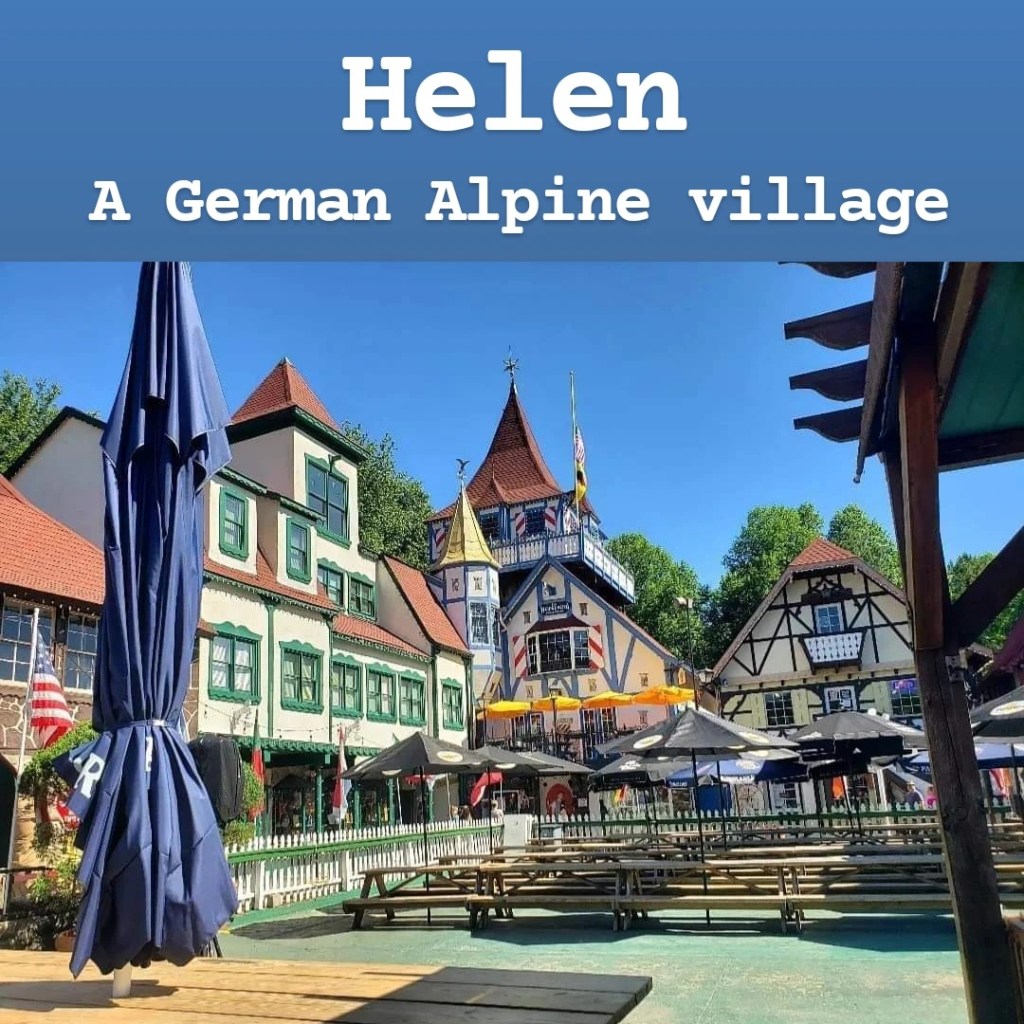
Helen is a German alpine town in North Georgia. It’s surrounded by the Blue Ridge Mountains, and the town itself is designed to look like the Bavaria region of Germany, complete with its unique architectural style and great German cuisine. When I first visited Helen in May 2022, I wasn’t too impressed with it, to be honest. But the more I visit the area and keep returning, the more it grows on me. Traffic in Helen can be a nightmare! During busier times of the year (early summer or anytime surrounding Oktoberfest) the traffic can be overwhelming. And because the town is so popular anytime of year, parking within the town can be an issue. There are plenty of overpriced parking lots though, so you’ll find one eventually. There are many great restaurants in Helen, with a couple of my favorites being The Troll Tavern and Muller’s Famous Fried Cheese Cafe. Hofer’s Bakery is a great breakfast stop, and if you’re looking for a great coffee shop, you have to check out The Mason Jar Coffee and Gelato. A few popular activities within the city include the Georgia Mountain Coaster and tubing down the Chattahoochee River. The Georgia Mountain Coaster is really fun, but the line to ride it can be hours-long, so try to plan it around a less-busy time, and if you’re with a group, put whoever wants to go the fastest in the front of your group so they don’t get slowed down by the others. Then if you’re into Cabbage Patch dolls, the BabyLand General Hospital is in nearby Cleveland. (Speaking of Cleveland, I’ll put in a recommendation for Clyde’s Table & Tavern and Farmhouse Coffee). But one of the biggest draws to Helen is the nearby hiking opportunities! Throughout this guide, I’ll give more information on Anna Ruby Falls, Panther Creek Falls, and Raven Cliffs Falls, which are all in the region, but there are many other great options as well. Dukes Creek Falls, DeSoto Falls, and Helton Creek Falls are just a few that will get my recommendation. After falling in love with the area since my initial visit, I would have to call Helen a must visit town in Georgia!
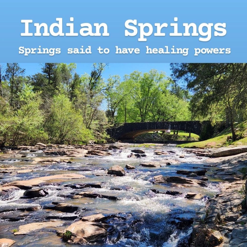
Indian Springs State Park is found in Flovilla, Georgia, in Beautiful Butts County. It’s the oldest state park in Georgia and one of the oldest in the United States. The village of Indian Springs is a small town built around the natural spring that has been used by the Creek Indians for centuries. They claimed that the water from this spring had healing properties, and some even believed it had spiritual properties and viewed it as a sacred site. In the 1820s, William McIntosh, the Lower Creek chief at the time, made a treaty with the state of Georgia to cede the land over to the government. He profited from this deal and built the Indian Springs Hotel, planning to turn this location into a tourist site. Following this deal, the Upper Creek viewed it as a fraudulent deal and had McIntosh killed, hoping the land would be returned to the Creek Nation. As you would expect, the state of Georgia did not see it the same way and decided to hold onto it. After coming to a compromise, the Creek were allowed to build other hotels and resorts throughout the area, turning Indian Springs into a mini Las Vegas of its time. It was frequented by tourists who came to gamble and party, in addition to those drawn to the area in hope of finding a miracle in these healing waters. During the Civil War, the Union Army took a caravan right down the middle of town, burning down every hotel and resort, except for one: the original Indian Springs Hotel that McIntosh had built all those years prior. In the days following the Civil War, Indian Springs has become largely forgotten. The resorts are no more, and the one remaining hotel is now a museum. For a while, the main stretch of town became a “crack town” known only for drugs and crime. Today the town mostly consists of antique shops and memories of its past glory. One thing that hasn’t changed though is the water coming from the spring that the town was named after. When visiting, there is a small spring house where you can access and collect the water flowing from this spring through a small spigot. In my 3 visits to this park, I have never seen this spring house empty! It is always accommodating locals with empty gallons and jugs waiting in line for their turn to collect this healing water. They will sit and talk and turn this into a whole afternoon activity. Before you try this yourself, I’m going to warn you: it smells horrific! This water probably has the strongest sulfur smell I’ve ever experienced, and you can’t drink it without the smell of rotten eggs attacking your nostrils. Confused as to how anyone would want to drink it, I asked the locals what they do with it. “It’s for drinking and cooking” they tell me, with one man joking that his wife wishes to bathe in it. “You’ll have to collect it yourself then” he told her, laughing. On my first 2 visits, I tasted the water but couldn’t get past the stench, but on my most recent attempt, I decided to drown out the sulfur smell and focus on the taste of the water itself, and I actually thought it was good! The locals claim that once you start drinking this water, you’ll notice a difference in your overall health, and you’ll never want to drink regular water again. They told me that the secret to getting rid of the smell is to let it sit in room temperature for several days with the cap barely cracked to allow the sulfur gas to escape. Does it have healing properties? I’m not sure. One man I was talking to thinks it can even help with cancer. But regardless, the water seems to be very popular in this area. The park also contains a campground and a pavilion used for events like weddings. Entrance to the park is $5, and you can pay that online by scanning a QR code when you arrive. Right outside the park is the village of Indian Springs itself, along with the historic Indian Springs Hotel. The hotel’s museum is only open on weekends, so if you visit during the week, it will be locked. Similarly, there’s a small museum at the entrance of the state park, but after 3 visits, I have never seen it open. There is no information about its hours either, so I’m not really able to give much advice there. The people here are very friendly, and they have several annual events that they get excited about, including a large holiday extravaganza every December. If you’re interested in hiking, the Dauset Trails are very close as well. Indian Springs is definitely small, but there’s a lot of history and some interesting places to check out that make it worth a quick stop when passing by!
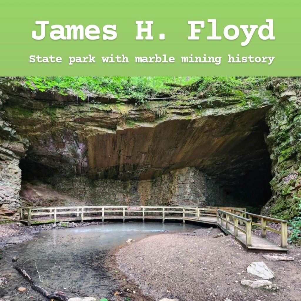
James H. “Sloppy” Floyd State Park is located near Summerville, Georgia in the northeastern part of the state. It’s known for its history of marble mining and its large lake. There are quite a few hiking trails within the park as it’s part of the larger Pinhoti Trail, which flows the southern Appalachians through Alabama and Georgia. But the two main trails of note here are the Marble Mine Trail and the Upper Lake Loop. The Marble Mine Trail is a 1.8-mile in-and-back trail to an old marble mine. This mine was abandoned in the early 1900s when it was determined that the purity of the minerals was too low, making it unprofitable. It’s a really cool mine to visit, and there’s a small waterfall trickling over the top of it. If you want to see the waterfall in its fullest form, you’ll want to visit in winter or spring. Though, one of my favorite parts of the trail was seeing all the greenery, which wouldn’t be seen those times of year. It really does have rainforest vibes. On the way, you’ll also pass a few abandoned buildings that were part of the mining operation. The trail is easy with a slight incline, and it’s made of gravel, though it wasn’t loose gravel. The Upper Lake Loop can be accessed by the same trailhead and goes around the lake with some really nice views. The last third of this trail follows a road though. One thing I appreciated about this park is that there are very clear signs along the trails, making it easy to keep track of where you’re going. There are many picnic tables and water activities provided here, and it’s a really nice park for families to hang out at. They do require you pay a $5 fee to visit, but the pay stations can be very easy to miss, so look out for those. Overall, I’d definitely recommend visiting if you’re not too far away!
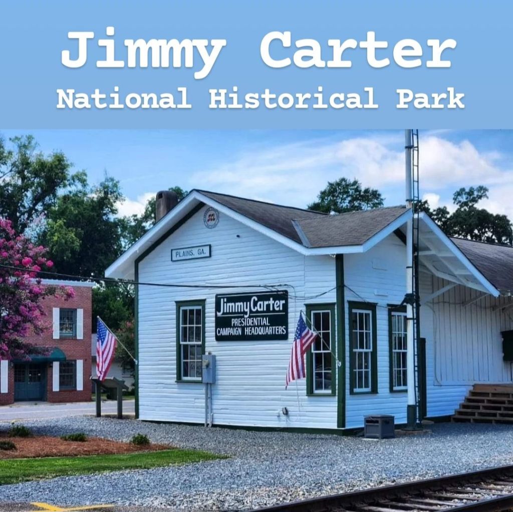
President Jimmy Carter may not be the only president with ties to Georgia, but he’s the only one originally from Georgia. The Jimmy Carter National Historical Park protects many sites that were important to the life of Jimmy Carter. For this, you will need to visit the small town of Plains. Driving into town, you’ll see signs and murals displaying “Home of Jimmy Carter” as he’s the only reason this small farming town gets any attention at all. There’s also a roadside attraction known as the Jimmy Carter Peanut that you may see in front of a gas station near the entrance of town. This peanut with a big smile was built in support of Jimmy Carter in the 1976 presidential election. This is also very close to Maranatha Baptist Church, where Carter was a member and taught Sunday school for years following his presidency. The main visitor center for the historical park is Plains High School, where Jimmy Carter attended. The auditorium here is where he gave some of his earliest campaign speeches. The school is now a museum and is interesting to walk through. It houses some personal items of Carter’s, with the coolest one being a quilt given to him on his 75th birthday with many personal messages written on it, including one from Gerald R Ford. From here, there are two other main sites to visit: Plains Depot (his campaign headquarters) and Jimmy Carter Boyhood Farm. Each of these is an interesting visit and worth checking out. They are all easily found by GPS. Carter’s personal home is technically also part of the park, though it is off-limits to tourists, even following his death. I believe there are plans to eventually open it to tourists, and I can update this when that happens. There’s a small viewpoint that you can stop at to get a glimpse of the side of his house, though when I went there was no parking lot nearby. I parked at a church down the road and then walked to it. Of course, I visited before his death, so things are slightly different now as he was buried on this property, and this has recently opened to the public. Because I haven’t been yet, here is the wording straight from the National Park Service website:
“Those wishing to visit the final resting place of the Carters may do so from 10 a.m. – 4 p.m. ET seven days a week (closed on Thanksgiving, Christmas, and New Years). Limited parking is available along Woodland Drive for passenger vehicles only (no parking is permitted for oversized vehicles, RVs, or buses). One-way traffic will be in effect on the property with entrance from U.S. 280 (Church Street).”
This is a cool place to visit that I’d recommend if you’re into presidential history. For more, you can also visit his presidential library in Atlanta, which is also a neat stop to make.
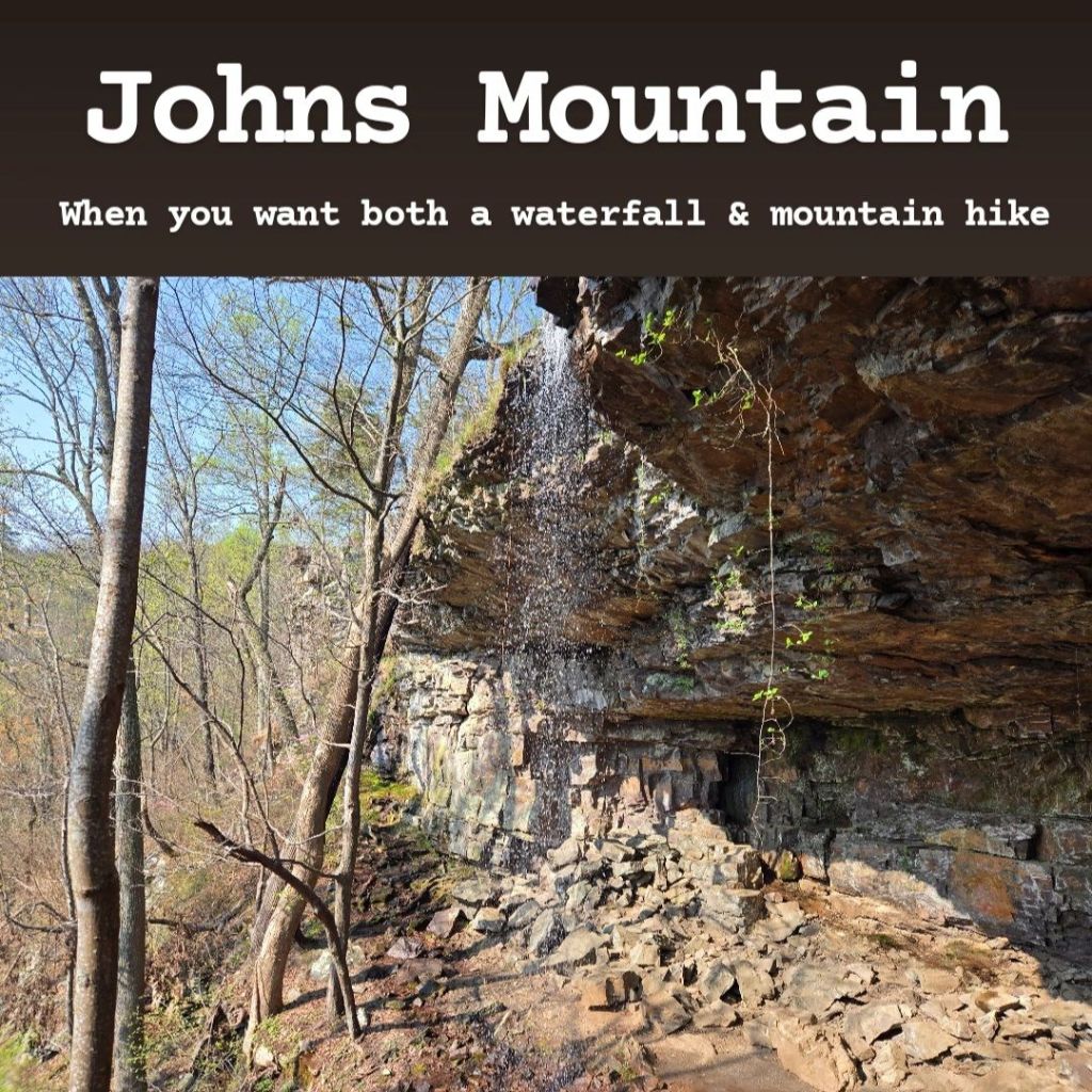
Johns Mountain is found near Dalton, Georgia, and it offers the perfect springtime hike! During certain parts of the year, there’s a waterfall called Keown Falls, which flows over a cave entrance, allowing you to view it from both outside and inside the cave. This is a really cool place to hang out! While it doesn’t show up great in pictures, it’s much more impressive in person. The catch is, you have to go at the right time of year, or you may end up just finding a trickle. Spring is the perfect time to come as melting snow and ice are feeding the creek that leads to the falls. However, the water pressure is also good after a storm passes through the area, so if you can’t go in the spring, go right after it rains. There are technically two loop hikes here, but they connect and are often hiked together as one large hike. The first is the Keown Falls Loop, and the other is the Johns Mountain Loop. Each has a parking area to start from, but my recommendation would be to park at the Keown Falls Picnic Area and Trailhead as there is a pit restroom here. Most people recommend hiking the trail clockwise, and after doing that myself, I would also recommend that. There’s a much better flow to the hike when doing it that way. The Keown Falls trail is anywhere from 1.8-2.3 miles long (I’ve seen conflicting information on the distance and didn’t measure it myself). It’s a moderate hike for sure, with some decent elevation change. Once you reach the falls, you have 3 options: 1) You can connect to the Johns Mountain Loop and do that whole trail before returning to the falls to finish the Keown Falls Loop. The Johns Mountain Loop is around 3.5 miles (in addition to the Keown Falls Loop). This hike definitely has some extra difficulty as the hike along the top of the mountain is very rocky. The main attraction here is the Johns Mountain Overlook, though you can drive to see this if you want. There are periodic views along the rest of the trail, but none are as great as the main overlook you can drive to. 2) Once at the falls, you could skip the Johns Mountain Loop and just continue the Keown Falls Loop after passing through the cave behind the falls. The remainder of this hike does increase the difficulty, but there are a couple other smaller waterfalls to see, and I actually thought they were great additions to the overall hike. 3) Once at the falls, you could just retrace your steps back to the parking lot. If you’re not comfortable with the more difficult parts of the trail, this is the easiest way to see the falls and return to your car. In the end, this is definitely a hike I’d recommend, particularly the Keown Falls Loop. The Johns Mountain Loop can be a cool addition to it, but it’s not super necessary in my eyes. Though I would recommend driving to the overlook to see that if you don’t hike there. This whole area is free to visit, though GPS & phone signal is very poor in this area, so plan accordingly!
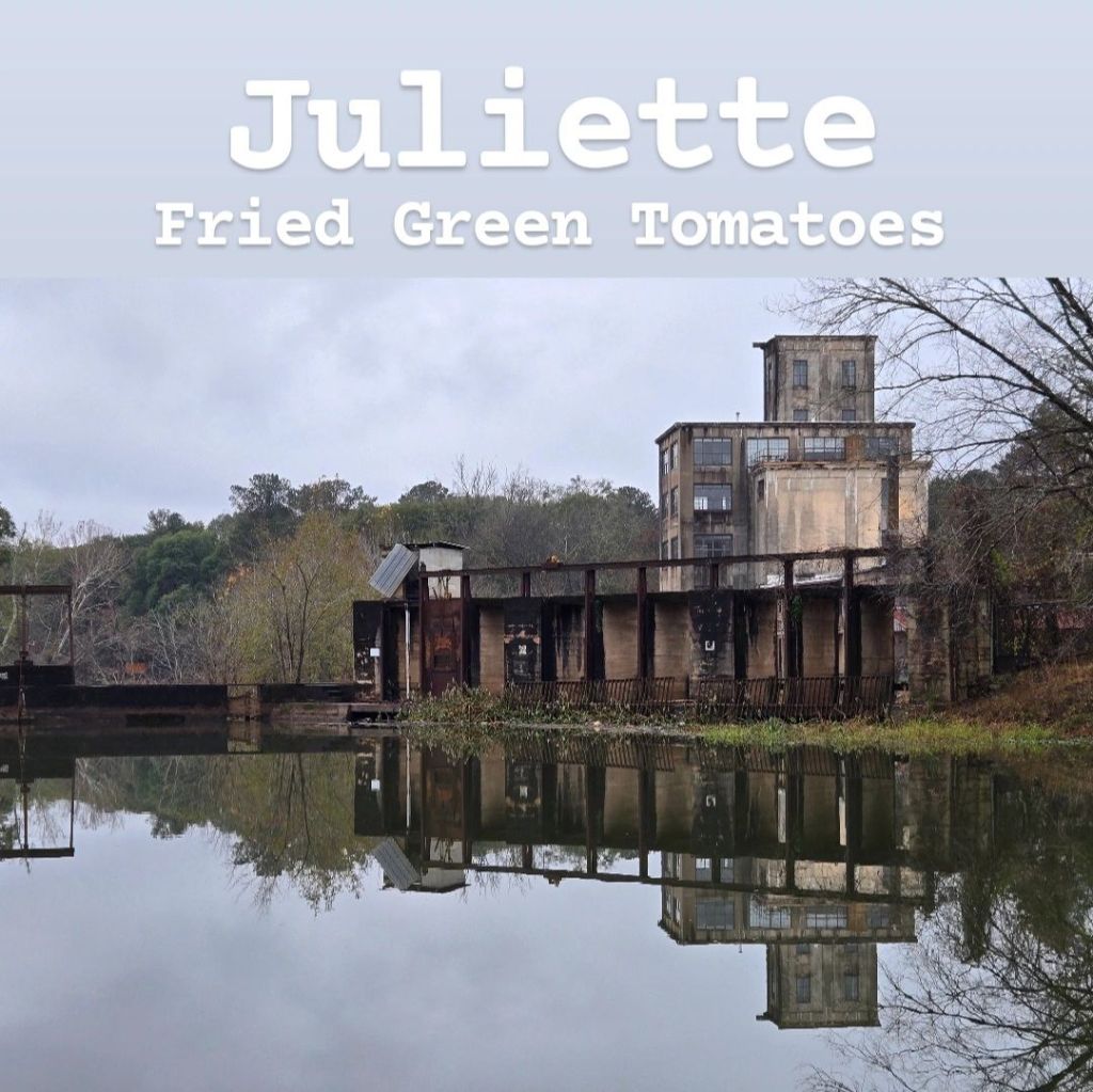
Juliette is a small town that really takes you off the beaten path. There’s one small main street alongside a train track that is very active and the Ocmulgee River. The town’s identity revolves around the one thing it’s known for: Fried Green Tomatoes; that is, the movie. The 1991 movie was filmed in a small restaurant here called the The Whistle Stop Cafe, and while the movie is somewhat controversial, this town celebrates it. The Whistle Stop Cafe is still a restaurant today that serves all kinds of Southern foods, and of course, it’s most known for its fried green tomatoes. The restaurant does get very busy as it’s really the only thing to do in town, so there’s a decent chance you’ll have to wait to get in. The shops surrounding it are all gift shops or museums about the movie and restaurant. While spending time in this town, it became evident that it’s one of those towns where everyone knows each other, and everyone knew I wasn’t from there. Each place you visit has a guest log that they ask you to sign (and they’ll point it out if you walk past it!) Right across the train tracks is a dam in the Ocmulgee River with a small park beside it. There’s not much in the park itself, but the views of the river are nice. The other noteworthy location in Juliette is Jarrell Plantation. This former cotton plantation is one of the last remaining sites of its kind as most others were destroyed by General Sherman during the Civil War. The earliest houses on this property were built in the 1800s out of heart pine. Consistent with other plantations of its kind, this one used slave labor. When visiting, you can tour the property and see the many buildings that remain. The slave quarters seem to have all been destroyed, but there is one remaining piece of one that you can see. The plantation is only open Thursday-Sunday, and it costs $7 to visit. In my opinion, Juliette is not necessary to visit, but if you’re looking to get off the beaten path in the real Deep South, this is definitely a contender to consider.
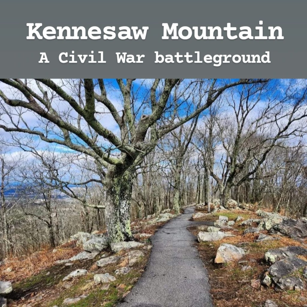
Kennesaw Mountain was the site of the Battle of Kennesaw Mountain during the Civil War. This was an important battle in the Civil War where, though General Sherman and the Union Army lost this battle, it ultimately failed at keeping them from advancing to Atlanta. The battle was fought on the mountainside among the trees, giving the Confederates who knew the area a big advantage. The mountain is located just outside Marietta, Georgia, which is a cool town to explore on its own. It costs $5 to visit, and the trail to the top of the mountain starts just behind the visitor center. The hike up the mountain is a scenic one, and it’s obviously all uphill. There are several points along the trail where you get a great view of Atlanta in the distance. However, if you don’t want to hike the entire way up, there’s actually a parking lot near the top that you can drive to. There’s not a whole lot to do at Kennesaw Mountain, but it’s an important historic site. After visiting, I’d recommend checking out Marietta and looking for the Big Chicken while you’re there. Kennesaw Mountain is worth visiting if you’re interested in Civil War history.
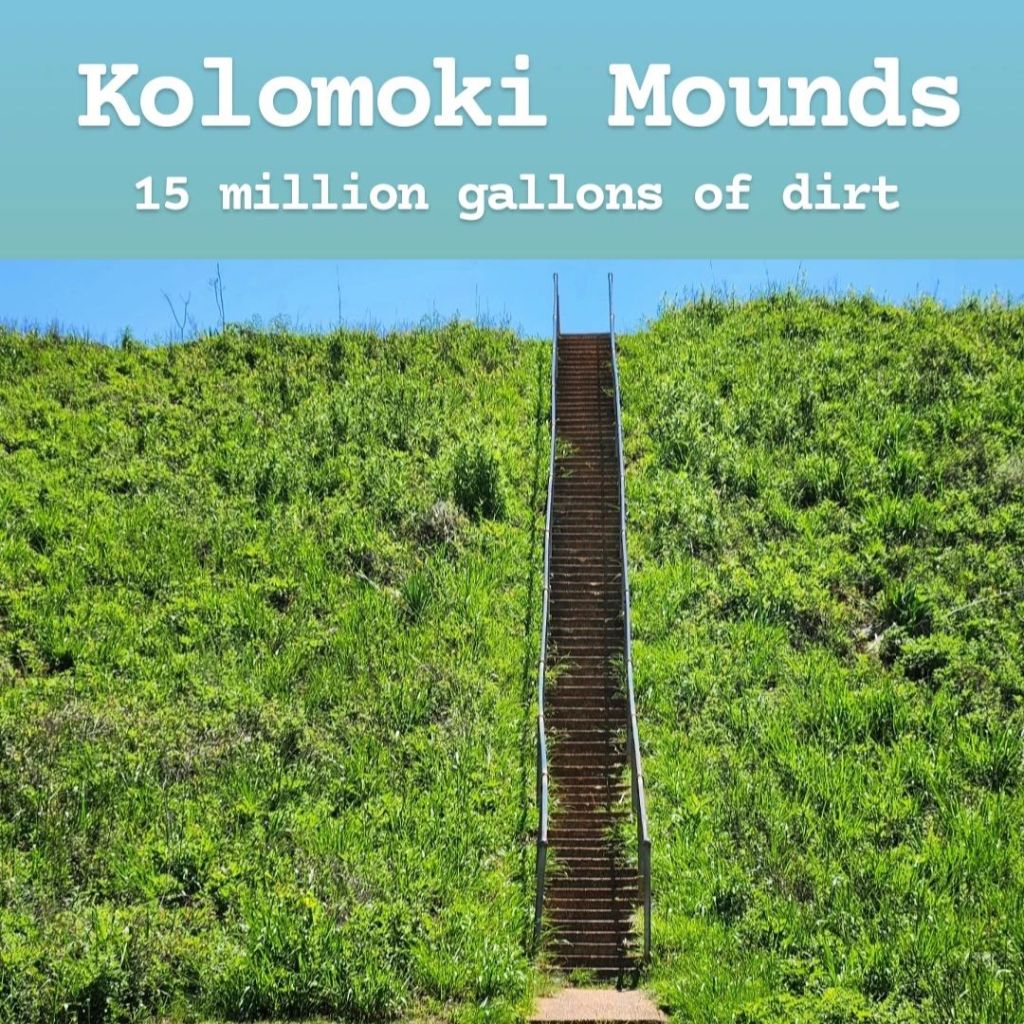
Kolomoki Mounds is one of the 5 mound sites in Georgia. With over 15 million gallons of dirt being carried one bucket at a time over a thousand years ago, this is considered the largest built landscape in the Southeast. It’s located in Blakely, Georgia in the extreme southwest of the state. In fact, the closest city to Blakely is Dothan, Alabama, which is about 40 minutes away. It’s a very remote area with pretty much nothing surrounding it except for miles and miles of farmland in every direction. Due to its remote location, there likely won’t be many visitors if you go, making it feel like you’ve got the entire park to yourself. But, also due to the location, cell phone signal is very spotty here, though it is possible to find a little bit of signal in the park. Entry is free, which is nice since you’ll likely spend a decent amount on gas to get here. The park itself is nice. While there are 8 mounds on the site, there’s really only one that you want to see: the Temple Mound. It’s very impressive to see in person as it towers over the surrounding landscape, and you can climb the steep staircase to the top. One thing to note before visiting is that there is very little shade, if any, in this park. You will be in direct sunlight for 98% of your visit, and in the summer, it can get brutally hot here. Then besides the main mound, there’s really not much else to see. There are some hiking trails, but they do seem to be basic trails through the woods. There are no mounds to see along those trails. So this leads to the main question: Is it worth visiting? My answer is yes, with an asterisk by it. Yes, it’s really cool to see and is a unique historic site. BUT, if you’re closer to Ocmulgee Mounds or Etowah Mounds, I’d recommend going to either of those over this one. Etowah Mounds is a more impressive “city” while Ocmulgee Mounds has a more impressive mound by its grand size. The Temple Mound at Kolomoki, while still impressive, seems to be a little less impressive than the others. But if you’re ever passing through Blakely for some reason, then I’d definitely recommend checking out Kolomoki Mounds! The problem is, you’ll likely never find yourself in Blakely unless you intentionally decided to come to Blakely. If you wanted to find a nearby place to visit to make it a larger day trip, nearby Dothan is definitely worth a visit, but because it’s in Alabama, I’ll leave it off this list.
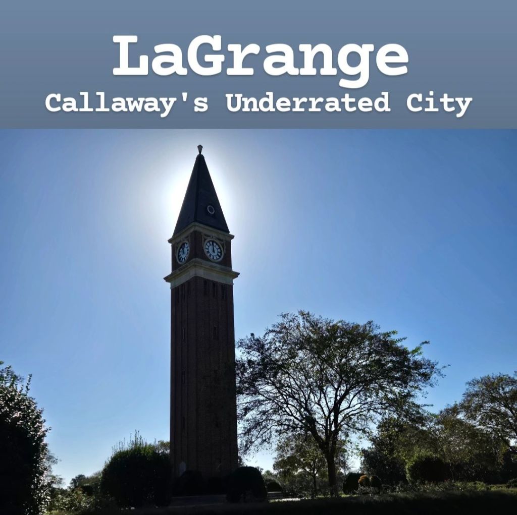
LaGrange is a city that I knew very little about before visiting, but I was pleasantly surprised with it! It’s found right off I-85 just minutes before crossing the state line into Alabama. It’s a very friendly town with a lot to see and do, and it’s the only city in Georgia that I have visited where I was offered a free Travel Guide when I arrived! Most of my recommendations will be coming from my own experience, though I’ll also refer to their official guide as well. The city was named after a country estate in Paris owned by the wife of Revolutionary War hero Marquis de La Fayette, who was reminded of his wife’s property when visiting the area. It became an industrial city and was a key location along the railroad for many years. But the man credited with building up much of the city is Fuller E. Callaway. (If you’ve heard of Callaway Gardens, that was named after his son). Callaway lived in a mansion called the Hills & Dales Estate, and you can tour it, along with its surrounding gardens. The garden tour is self-guided, while there is a guided tour if you want to go inside the mansion. Admission to the garden only is $10, and admission to both the garden and mansion is $25. It’s a nice place to walk around if you enjoy that kind of thing. There is also a monument dedicated to Callaway in a different part of the city that was modeled after the campanile of St Mark’s Square in Venice, Italy. The park is free to visit, and it’s a really nice place to come hang out, though you can’t go up the tower unfortunately. The downtown area near Lafayette Square is a nice area to walk around, and there are plenty of restaurants and antique shops to look around. The art museum here is also supposed to be nice, though I didn’t check it out myself. LaGrange College is the oldest private college in Georgia, and it can be found in the middle of the city. It’s nice, though I wouldn’t suggest going out of your way to visit it. There’s a restaurant nearby that many people seem to love called Charlie Joseph’s. They claim to have the world’s best burgers and hotdogs. I don’t want to be too harsh, but I definitely disagree with that statement. They’re fine, but you can tell this restaurant is popular for nostalgia reasons. Visiting it during peak hours can be a very chaotic experience to say the least! But the decor is neat as the restaurant is covered in old Coca-Cola memorabilia. One interesting location in LaGrange is the Biblical History Center which makes you feel like you’re walking throughout the streets of Israel during Jesus’ time. It’s a cool place to wander around, and there’s a manuscript room that was neat to see (though pictures aren’t allowed). It did feel a bit like Epcot, but I still enjoyed it. Admission is a bit pricey in my opinion at over $30 a person. They offer biblical meals as well, and for that the price jumps up to around $70 after tax. As a Christian, it’s neat to see, but if you’ve been to Israel before, it may be a little disappointing. Another popular place to visit in LaGrange is the Great Wolf Lodge, though it’s not worth visiting unless you’re staying there as the day pass is very expensive. There’s an indoor water park and other unique activities to do here that make it a fun place for the whole family, though the vibe I got while walking through it was that it was geared more toward younger kids. It’s very difficult to visit if you’re not staying or buying a day pass, so I wouldn’t recommend trying to just check it out like I did. The last place I’ll mention is West Point Lake, which is a popular location for locals to go fishing, hiking, or picnicking along the shores. There are several parks that you can check out, with some even requiring you to drive through part of Alabama to reach. Overall, I’d definitely recommend visiting LaGrange, and I left with a high opinion of the city!
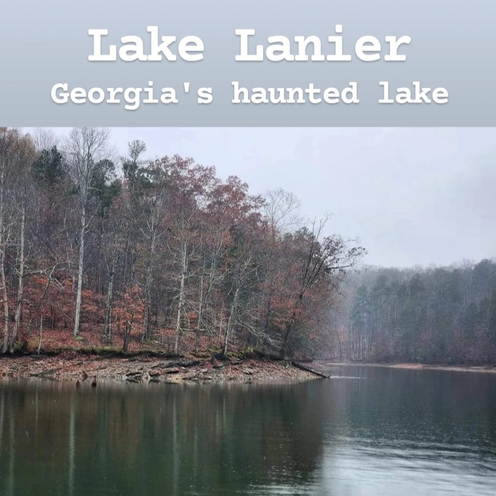
Lake Lanier is a tough one to recommend. The story of Lake Lanier is one of tragedy and violence, while at the same time being a symbol of provision and protection. At first glance, Lake Lanier is a beautiful lake, and at about 58 square miles, it’s the largest lake in Georgia. It contains an impressive coastline with towering lake houses and great water sports options. But beneath the surface (literally) lies one of the most depressing stories imaginable. This was once known as the town of Oscarville. Oscarville was a thriving black community during a time of segregation and extreme racism. The town was often the target of racists who would burn down houses and kill innocent citizens. Those who lived in Oscarville dealt with constant racial profiling and lynching. Eventually, after flooding issues in Atlanta and the need for a new water source began to arise, it became clear that a new lake would be to be formed nearby. Of all the areas that could have been considered, Oscarville was the town chosen to be forcefully evacuated in order to create this new lake. Lake Lanier was soon formed by the Buford Dam, and the town known as Oscarville became submerged. To this day, the town lies intact on the bottom of the lake, complete with buildings, streets, and even cemeteries. Today, the lake has become a vacation destination for many. Boating and fishing are common activities, and Margaritaville even has a water park on the shores of the lake. (The waterpark is called “Lanier Islands” – if you don’t want to visit the waterpark or camp, then avoid Lanier Islands or you’ll have to pay $20 to enter, and that doesn’t even include waterpark admission.) But though it seems like a perfect summer spot to take the family, the lake has claimed an unusually high death count with many unexplained occurrences and disappearances taking place. It has become so bad that in the past couple months, Margaritaville made the decision to fence off the water at their waterpark’s beach. This has led many to claim that it’s haunted. Whether or not you believe that, it’s still true that the risks are higher on Lake Lanier than on other normal lakes as you could unknowingly drive your boat into a submerged building. If the legends surrounding the lake don’t scare you away, there are a ton of water activities and boat rentals you can enjoy, and tens of millions of visitors enjoy the lake each year. One place I’d specifically recommend checking out is Lake Lanier Olympic Park in Gainesville, where several Olympic events were held on the lake during the 1996 summer Olympics. I also recently found a small park called Little Ridge Park, which has a really nice loop trail that follows the lake, which I’d recommend. It’s not some highly underrated spot, but it’s a nice lake trail if that’s what you’re looking for. Would I recommend Lake Lanier as a whole? I’m not sure- I’ll leave it up to you whether or not you’d visit.
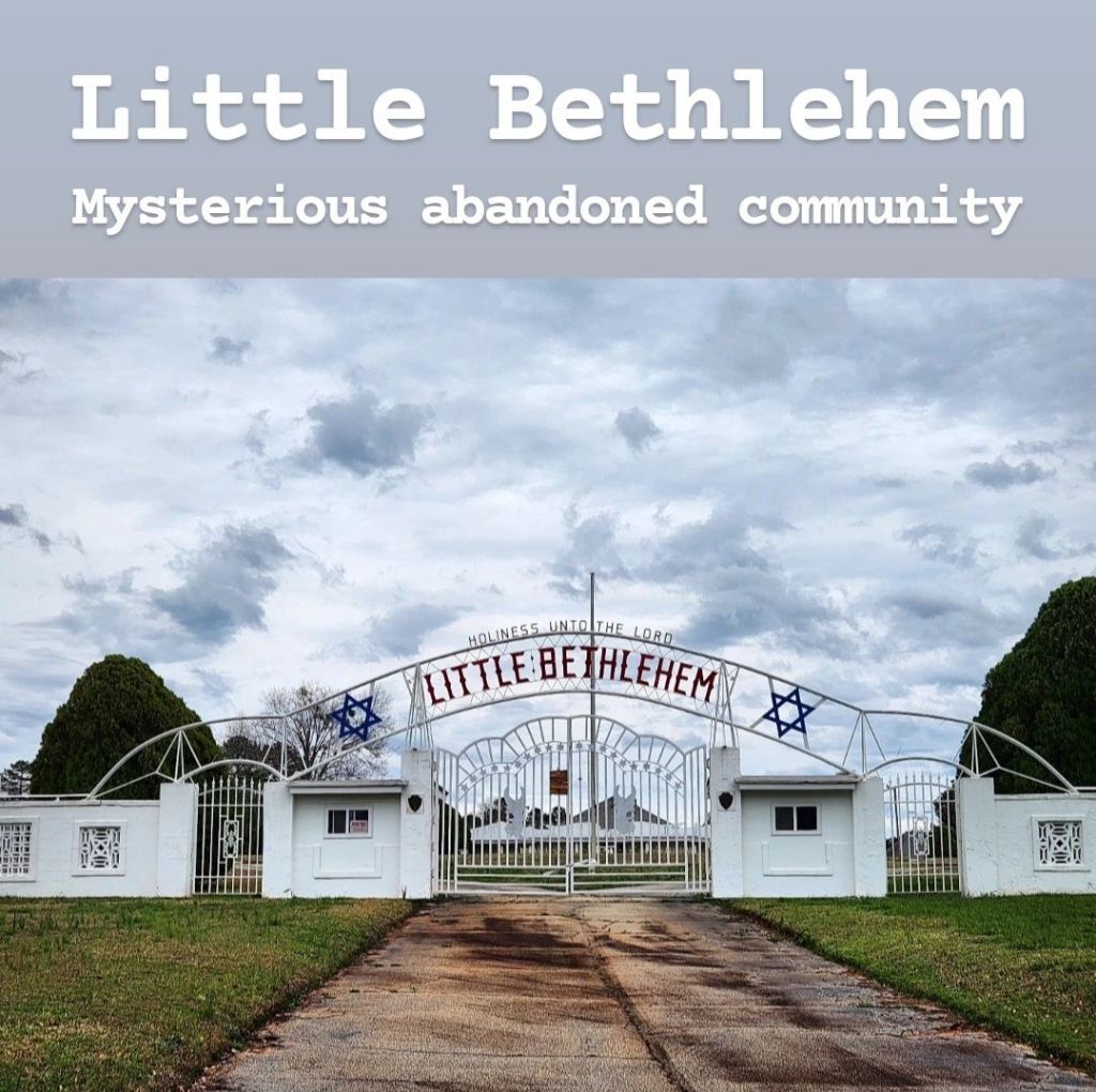
Little Bethlehem has become somewhat well-known recently because of some TikTok videos about it, but it’s very difficult to find information about its location online. So I did the research and spent time exploring Google Earth until I finally found it. To start, if you’re not familiar with Little Bethlehem, it is an abandoned religious community built by Reverend George Pike. He had some extreme religious views, including his belief that men and women should not interact outside the church. He had extremely loyal followers who moved from around the world to be a part of his community. He was considered to be a prophet by many, and they built a mansion for him on the property, which he never actually moved into. He built a bank and issued his own currency called “Script” which could only be purchased by members of the church. Many believe this to be a cult, but calling it one online often leads to his followers passionately defending him. He died in 1996 and was buried in an on-site mausoleum shaped like the Star of David. Many of his unique designs were inspired by symbolism from the Book of Revelation, but getting access to these buildings is illegal, unless you have permission. After being abandoned for some time, the property was purchased by David Pike, his son, who currency owns it. Because it is private property, sneaking in would be considered trespassing, and his son lives on property. But you can drive around the outside without invading his privacy. If you put Love Tabernacle Church in your GPS (located on George Leon Pike Sr Parkway, Monroe, GA), you will find this complex. It feels like it’s in the middle of nowhere and is surrounded by residential areas. If you want more information about this property or to see pictures of the inside, I’d recommend checking out the Abandoned Southeast website, which has the most information about it that I could find. There are a few videos on YouTube about it, along with news stories and even old recordings of his sermons. If you do decide to visit, please be respectful and avoid causing any problems as I know the family has dealt with a lot over the years.
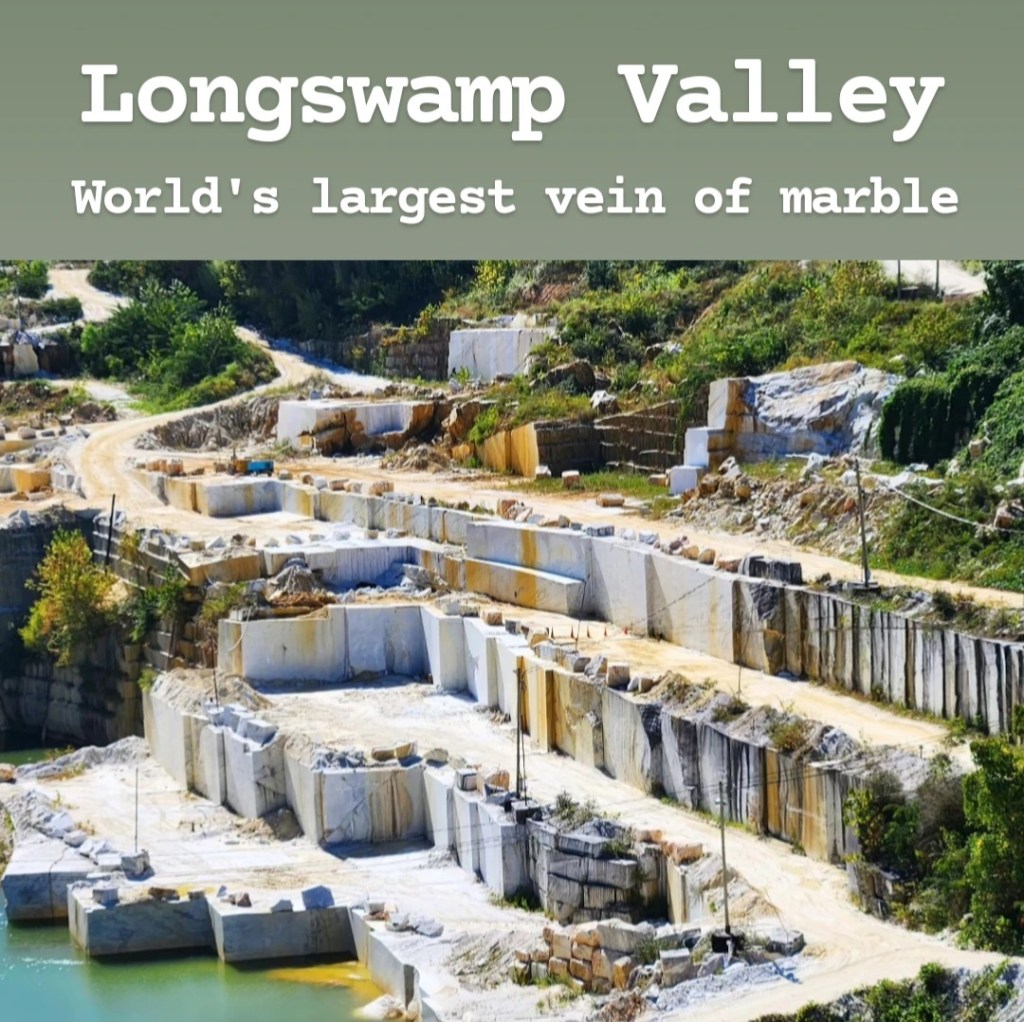
I mention the Seven Wonders of Georgia a few times throughout this guide because it’s a popular list of places to visit. But there was an older list of seven wonders before the current list. One place that was included on that old list but then removed for the current one was Longswamp Valley. If you try to Google it, you won’t find much as the area doesn’t really go by that name much anymore. (They still do, but you’e more likely to see the name “Marble Hill.”) But it was part of the list, so I was determined to visit it, wherever it might be. The reason for its initial inclusion on the list was because of the large vein of marble found here. In fact, at 7 miles long, 2 miles wide, and 2,000 feet deep, it was the largest vein of marble in the world, but it has been quarried for over 100 years now, so it’s not nearly the same size today. The marble taken from here was used to create some iconic buildings throughout New York and DC, as well as governmental buildings in Minnesota, Ohio, Rhode Island, and Puerto Rico. In fact, 60% of the marble seen throughout DC came from right here in Tate, Georgia. If you come hoping to see the marble, you’ll be disappointed. The quarry itself is owned by Georgia Marble Company and a few other companies, and visitors are strictly forbidden from entering. But if you want to see some evidence of the marble, you can visit the small towns of Tate and Jasper where several buildings are made with the marble, and you’ll likely see many truckloads of marble going to and from the many processing plants throughout the area. There’s not much to see in Tate overall, other than the Tate House and Tate Elementary School, which are both made of marble and off-limits to visitors without prior approval. Jasper has a lot more to offer visitors. The downtown area is filled with cool marble buildings and even an old jail that you can tour. But if you’re going to come to Longswamp Valley, there is really only one weekend a year that I would recommend targeting: the first weekend of October. The Georgia Marble Festival is held on the first full weekend of October every year in Jasper, and the county allows for a limited number of quarry tours. This is the only way you can get inside the quarries to see this marble up close. It’s a really fun tour, and seeing the marble is definitely worth it. In order to participate in this tour, you will want to contact the Pickens County Chamber of Commerce, either over the phone, through their website, or via email. Tell them the time slot you want your reservation for and pay $20. (I actually forgot to tell them my time slot when I paid for mine originally, but they hunted me down on Facebook to get ahold of me). This tour also includes a stop at the Old Pickens Jail, which is usually $5 to enter, and gives you access to the festival, which also costs $5. So in the end, the actual marble quarry tour costs you around $10. My tour was 2.5 hours long and had us crowded tightly into an old school bus, but from what I understand, the tours are slightly different each year. Try to arrive at the school bus early to get a good seat before everyone else crowds on. I have previously said Longswamp Valley is not worth visiting, but if you come for the festival and tour, it’s definitely worth it, or if you just want to visit Jasper on a regular day, it’s a neat town to see as well.
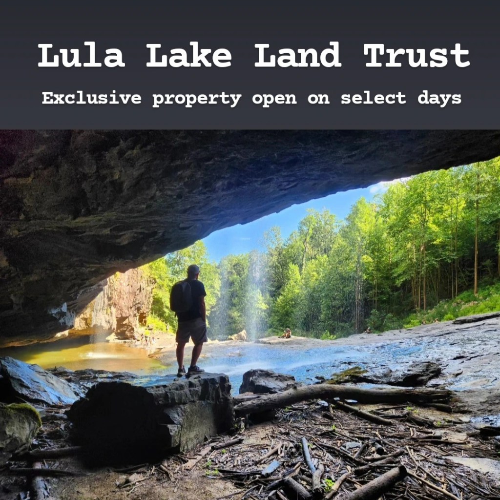
Lula Lake Land Trust, located on Georgia’s side of Lookout Mountain, is not the easiest place to visit as it’s located on private property. It is only open to the public on the first and last weekends of every month, and you must have an advanced reservation in order to visit as they strictly limit the number of people that can visit per day. But if you follow along, I’ll give all the tips you need to know to plan this trip properly. First of all, I do believe that Lula Lake is worth the effort to visit. It’s a beautiful 8,000-acre protected forest with an incredible 150-foot tall waterfall. Swimming is prohibited, but wading near the waterfall is allowed, and dogs are allowed as well. Due to its increasing popularity; however, it’s getting more and more difficult to secure a reservation. To start making your reservation, visit their website at lulalake.org. From there, navigate over to their “Visit” page and scroll down to where the upcoming events are located and find an “Open Gate Day” with the date you want to visit. Click the Eventbrite link listed beside it (this can be easy to overlook). This will take you to Eventbrite’s website where it will either tell you your selected date is unavailable or offer an option to get tickets. After clicking “Get Tickets,” select an arrival time slot and tell them how many tickets you need. Note: tickets are per vehicle, not per person. From there, they will ask for the make, model, and color of your vehicle and an estimate of how many people will be with you. There are multiple places on the website that say it costs $40 per person to visit, but this is only the case if you book a group hike! If you are visiting alone or with a few friends, all you have to pay is the $16 (plus tax) conservation fee for parking your vehicle on their property. It’s easy to find the park by GPS, and I found signal to be surprisingly great the entire time I was there. Once on property, make sure to stop and get a map because it would be easy to get turned around without one. There are signs marking trails, but they don’t include arrows, so I had to rely on the maps instead. Some hikes are much more strenuous than others, so make sure you find the ones that fit your experience level. Restrooms are scarce at Lula Lake, and they are basically outhouses, where you have to scoop wood chips in after using the restroom in order to prevent it from smelling bad. Lula Lake does get busy, but because it’s so spread out, you wouldn’t realize how busy it actually is. The area right by the waterfall can get a little crowded, but even then, it’s a great place to sit down for a while and wait for crowds to clear out before taking pictures. The best time to visit would either be fall or spring and not just for the cooler weather: the waterfall is its strongest in early spring, while the entire hike would be incredible during peak fall colors. But those are also the most difficult times of year to get reservations. It would really be a beautiful hike anytime of the year though. Bring plenty of water and something for lunch, and enjoy this awesome place!
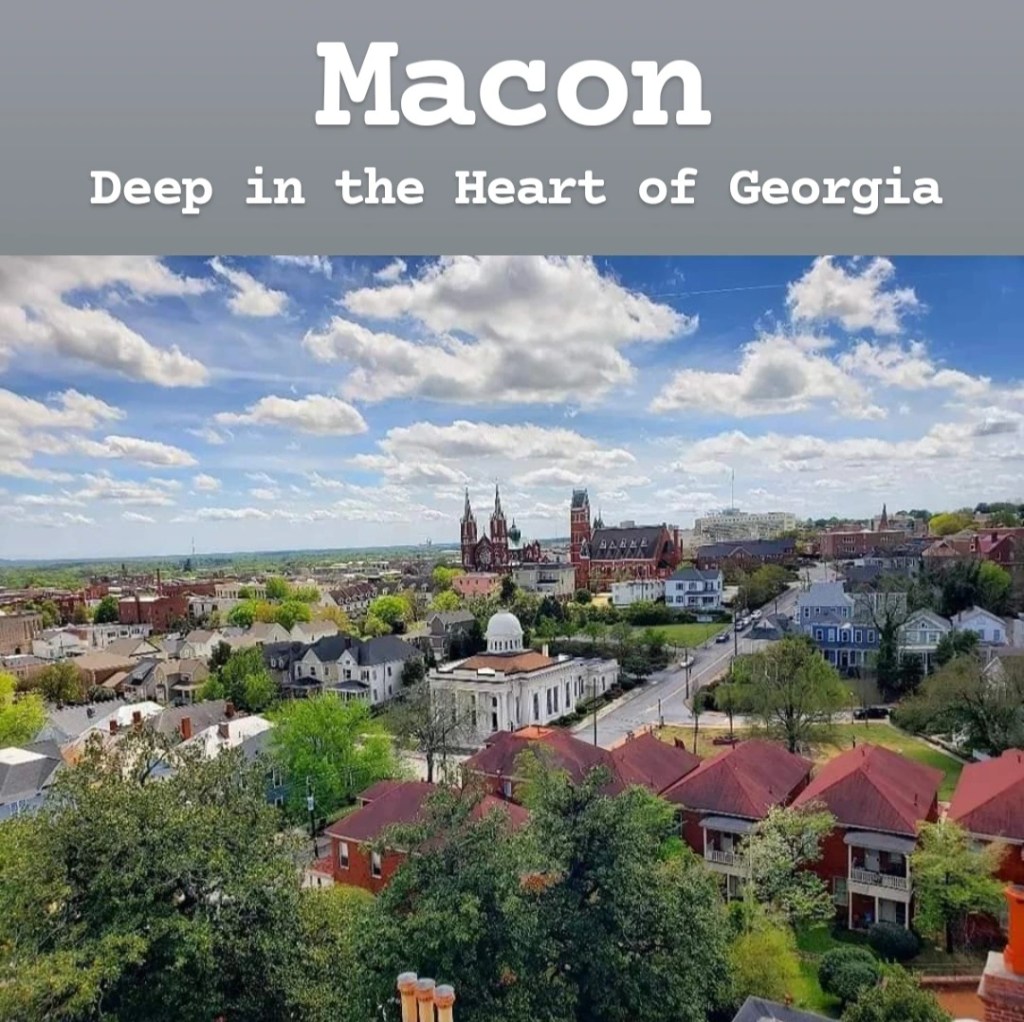
Macon is a historic town in Middle Georgia. It’s got small town vibes, and it’s definitely a pretty city to drive through with many historic buildings and large mansions. Some of the more popular places to visit in Macon are the historic mansions, with Hay House and Cannonball House being a couple of the more famous ones. The Georgia Sports Hall of Fame and Tubman Museum are also found here. Rock fans also enjoy visiting places relating to the Allman Brothers who lived in Macon in the ’70s. One thing that Macon is known for is that it has 300,000-350,000 Yoshino cherry trees throughout the city that typically bloom in late March. This is actually ninety times more than Washington DC has! Because of this, Macon has become known as the Cherry Blossom Capital of the World. The annual International Cherry Blossom Festival is held in spring each year and coincides with the predicted cherry blossom season, though it doesn’t always line up perfectly. If you’re wanting to visit Macon while the cherry blossoms are in bloom, you can check the BloomCam online for live footage of the popular cherry trees to check to see if they are in bloom. If you put “Macon Cherry Blossom Festival” in your GPS, it will take you to a park with some fair rides. Entry is $10 a person, but you won’t see many cherry trees here. There’s a driving tour you can find on their website which takes you around the city to where some of the cherry trees are. But the place you really want to go is Third Street, right in the middle of downtown, where the actual festival is held. The cherry trees line the streets here and allow for some beautiful pictures. If you’ve been to the DC cherry blossom festival, this will not compare. The trees are spread out over Macon-Bibb County, so it won’t feel like there are more trees than in DC, unfortunately. If you do come to Macon, I’d also recommend checking out Ocmulgee Mounds, which I’ll give more information on below. Overall, I’d recommend visiting Macon, though I wouldn’t plan to spend more than a day or two.
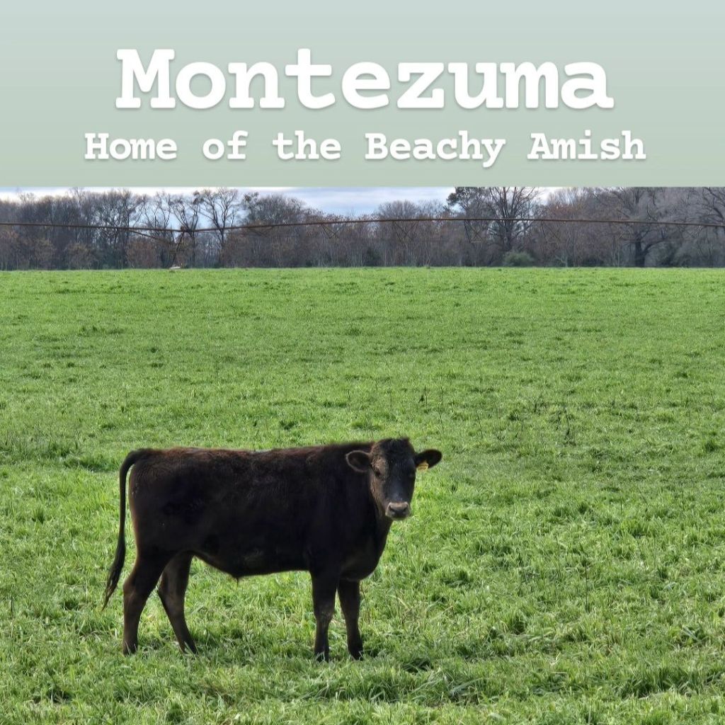
Did you know there are Amish communities in Georgia? Usually when you hear about the Amish, your mind goes to Lancaster, Pennsylvania, but there’s an Amish community in the town of Montezuma, Georgia. Montezuma is a town named after the famous Aztec leader, and it was given this name by soldiers returning from the Mexican American War. It’s a small town with really just one main street, and many of the houses here date back to the early 1900s. Troy’s Snack Shack is really the only place in Montezuma where I saw crowds as it’s the town’s local burger restaurant. But once you leave the downtown area of Montezuma, you’ll find yourself surrounded by nothing but farmland as far as you can see. Most businesses around here are called some variation of “Yoder’s” as the Yoder family was one of only a couple families that settled this area. So you’ll see Yoder’s butcher shop, Yoder’s Country Market, Yoder’s Insurance Company, Yoder’s Accounting Services, etc. (You get the idea). This particular community is known as “Beachy Amish” which is a more progressive group that split off from the Old Order Amish. They still dress like Amish people and refrain from using TV or radio, but they do allow for some minor electricity usage. While you may still see an occasional horse-and-buggy, the majority of them do drive cars. You’ll also see power lines running throughout and more modern farming practices. There are several markets and restaurants to stop at to get some Amish goods as you wander around. The Amish in this area are primarily dairy farmers, so there are many cows. Phone signal is very spotty in this area, but you can still find it, and the best way to visit is really to just drive around and try to get lost among all the dirt roads and farms. This is definitely an interesting place to come to learn about a community you likely didn’t even know existed!
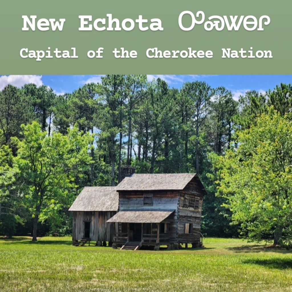
New Echota (Ꭴꮝꮤꮎꮅ in Cherokee) was the capital of the Cherokee Nation. When the US government started ordering the evacuation of Native Americans to the West, the Cherokee established this town, along with several others, that mimicked the towns of the white settlers, in hopes of gaining favor with them. New Echota was designated as the capital of the Cherokee Nation in 1825 and became the center of their newly-established Republican government. Within the town, they had a courthouse, farms, businesses, an inn, and even a printing press. The printing press was significant because it was here where the Cherokee started publishing the first ever newspaper for Native Americans and the first ever newspaper written exclusively in a Native American tongue. This was called the ᏣᎳᎩ ᏧᎴᎯᏌᏅᎯ (Cherokee Phoenix). However, as much as they tried to gain favor with the European settlers, Georgia ordered their evacuation in 1830, forcibly removing and arresting those who refused. The town was later destroyed with only one original building remaining. Today, what remains of the town can be found in an area of Calhoun, Georgia, known as “New Town,” which is a reference to the nickname given to New Echota. Entrance costs $8 for adults and $6 for seniors and children. It contains many restored and reconstructed buildings and informative signs about what this town was like, as well as a small museum about the Cherokee Nation. If you do come, touring this site involves a lot of walking, and the majority of the time, you’ll be in direct sunlight, though there are areas with shade. Some of the buildings allow you to enter while others do not. It’s an interesting historic place to visit that highlights an area of history that is often forgotten. I’d recommend visiting if you’re in the area, though if more of the buildings were original, then I’d consider it a must-visit.
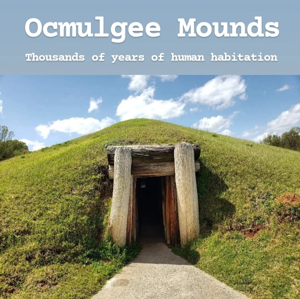
Ocmulgee Mounds is often rumored to become the next national park. I made a full review on this, which you can read here. In that review, I stated that I don’t think it should become a national park, but after a second visit a couple years later, I have started to warm up to the idea of its inclusion. It’s a nice park, but while it can’t compare to places like the Grand Canyon or Zion, I could see it being ranked alongside places like Congaree or Biscayne. This park, located right next to Macon, contains evidence of thousands of years of human habitation. The mounds that the park is known for are impressive, especially considering how they would have been built by carrying buckets of dirt by hand. The two most famous mounds within the park are the Earth Lodge and Great Temple Mound. The park and museum are free to visit, and you can either choose to walk from mound to mound via sidewalks or drive. There are parking lots near each of the main sights, but if you do decide to walk, everything is very easy. You are not allowed to climb on most mounds as that could damage them. But the Great Temple Mound is different, and there’s even a staircase leading up to the top. In addition, there are some nice hiking trails along the Ocmulgee River and throughout the adjacent forests. Ocmulgee Mounds is definitely worth a visit, especially if you’re into Native American history. It’s also a great option to add onto a day trip to Macon since it’s right there.
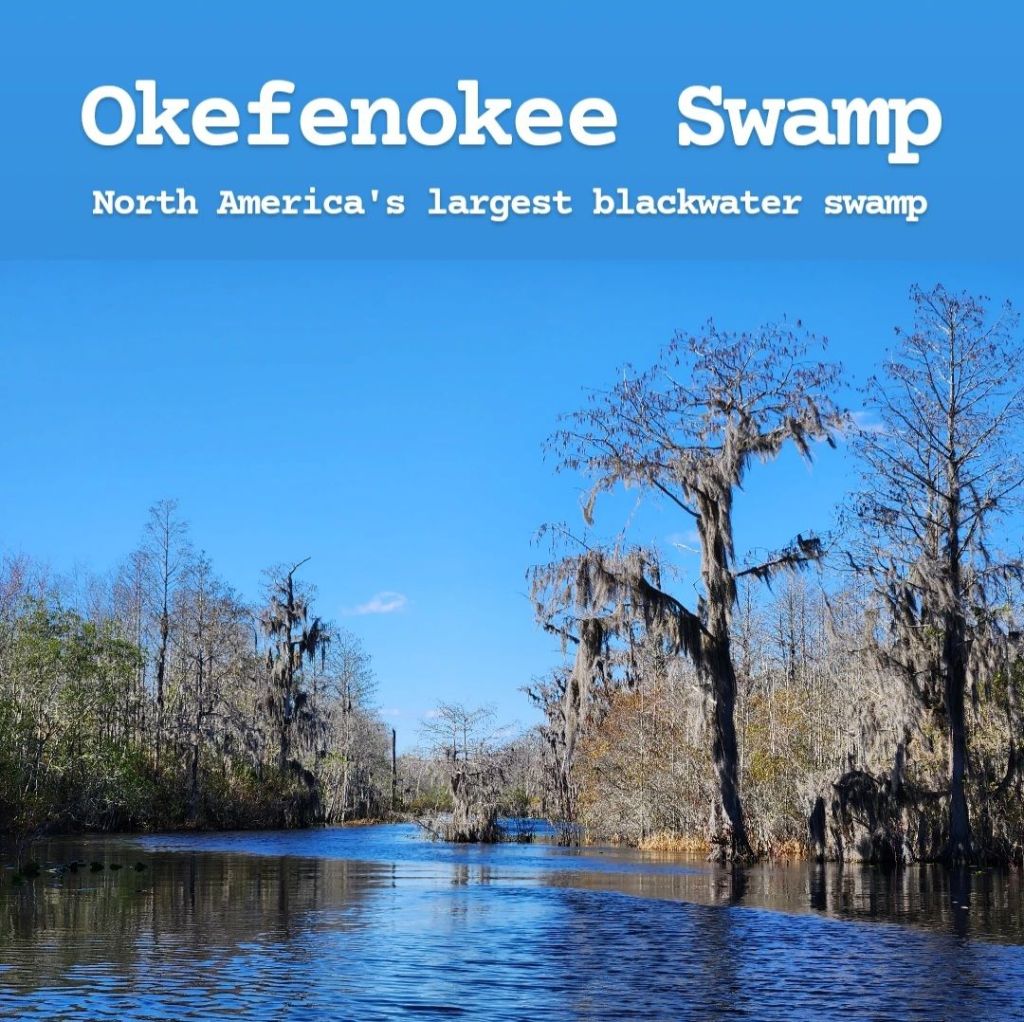
Okefenokee Swamp is one of the seven wonders of Georgia and the largest blackwater swamp in North America. (I have to specify “blackwater swamp” because the Everglades and Atchafalaya Basin are both larger, but they’re not “blackwater swamps.”) The swamp is so big that it can fit both the New York City and Chicago metro areas inside simultaneously. It is technically part of both Georgia and Florida, but the majority of the swamp is located in Georgia. This is a very large place to visit, and you could spend several days at the swamp and not see it all. While you can take your own boat out on the swamp, I’m going to focus on the places to visit if you don’t have a boat. There are three main entrances to the swamp: Okefenokee Swamp Park in Waycross, Okefenokee National Wildlife Refuge in Folkston, and Stephen C Foster State Park in Fargo. These are all different, but they’re all so far from each other that you can’t visit all 3 in one day- Just fitting 2 in one day is difficult! If you can only visit one, my recommendation would be to either visit the wildlife refuge in Folkston or Stephen C Foster in Fargo. I’ll go over each of the three below:
1) Okefenokee Swamp Park in Waycross can be more expensive to visit and feels more artificial to me. It’s a nonprofit that seems mostly meant for school field trips and has that kid-friendly vibe to it. If you want to take a boat tour, which is my main recommendation, the ticket to get in will at least cost you $30 a person. The boat tour is nice but can feel like a theme park attraction rather than an actual swamp tour. There is also a train tour and a wildlife show included with that ticket. Your tour times will be selected for you when you purchase your tickets, so you don’t really have the freedom to do what you want when you want, and you could end up having to sit around with nothing to do while waiting for your next tour.
2) If you go to the main entrance for the wildlife refuge in Folkston, it’s a much more natural, “swampy” vibe. Here, you can take boat tours and rent kayaks. This park also includes the Swamp Island Drive, which I highly recommend. There are multiple trails branching off from the main road, but the biggest draw for me is the Chesser Island Boardwalk. This boardwalk leads through the swamp to a lookout tower, which I was able to spot some alligators from. The entrance fee is $5 a person, and from what I’ve read, the boat tours here are an additional $25 a person. That $5 entrance fee is good for seven days and will also give you access to Stephen C Foster State Park.
3) Stephen C Foster State Park is the most remote of the parks by far. It’s located about 18 miles from the small town of Fargo, which itself is extremely remote. The drive to the park will take you through miles of nothing, which can be a little intimidating at first. Fortunately, I found cell signal to be decent on many of these roads, though it disappears completely once inside the park. (The trading post does have wifi). There’s a really nice boardwalk trail behind the trading post, which I definitely recommend. There are also some other trails, though these can become flooded after rain. Entrance to the park is $5, but just like the Folkston side, it is valid for 7 days and gives you access to both parks. If you come to this park though, I highly recommend renting a jon boat to explore the swamp. Boat rentals cost $50 for 2 hours, $75 for 4 hours, $100 for 6 hours, and $115 for 8 hours. Unless you’re planning to go fishing, I found that 2-4 hours is plenty of time. You are restricted to certain areas when renting a boat, so you can’t go too far away. Canoe and kayak rentals are also available and are quite cheaper, but I do want to warn that I saw some pretty big alligators in the swamp and would hesitate to get in a kayak with them: I even saw a large gator in the dock area where you get your boat. Boat tours here are available as well, but I’d recommend calling ahead to reserve your spot as there aren’t many spots and they fill up quickly.
Overall, Okefenokee Swamp is definitely worth visiting, and it’s a place I’d love to spend more time exploring. Just bring bug spray if you come during warmer months: you’ll need it!
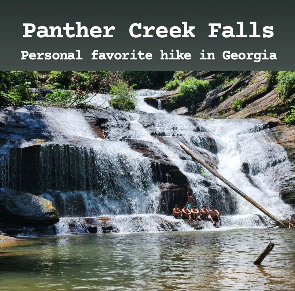
Panther Creek Falls is located in Clarkesville, Georgia, near the South Carolina line. It is, in my opinion, the best all-around hike in Georgia, but it’s definitely not one for beginners. In fact, if you check their website, it’s only open to experienced hikers, though there’s no one there checking to see if you’re experienced or not. The trail itself starts off simple enough with the most difficult stretches being creek crossings where you will get wet. There used to be bridges here, but they were destroyed in a recent storm. But once you reach the last fourth of the hike, the difficulty really steps up. There are sections that require good balance, and there’s one spot where you have to use a rope to pull yourself up. The trail is not always clearly marked, and it’s easy to get turned around, but if you follow the creek, you should be fine. There are also “mile markers,” but these are not accurate at all. They’re nice for keeping track of where you are along the trail, as long as you know that mile marker 21 is at the falls. The hike to the falls is around 4 miles, making the full hike 8 miles round-trip. At the falls, there’s a natural pool that you can swim in, and you can even go stand under the falls. Warning: the water here is freezing! There’s also a nice picnic area as well. If you decide to come, I’d recommend trying to get there early in the morning in order to get a decent parking spot. It’s free, and it’s a popular trail that will fill up quickly. The time of year I’d recommend the most is spring. The hike could be miserable during the hot summer, but during cooler months, you wouldn’t want to get in that cold water. I also just want to repeat that it’s not an easy trail, so if you’re unsure of your abilities, you may want to reconsider visiting.
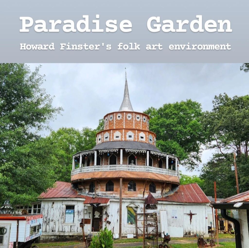
Paradise Garden is a fantastical folk art environment created by Howard Finster, one of the most prolific artists in American history. Finster was a former Baptist preacher who suddenly decided to become an artist one day, claiming God had instructed him to. He initially planned to create 5,000 pieces of art, but when he reached that, he couldn’t stop and continued until he reached 46,991 individually-numbered works of art! He is now considered to be the grandfather of Southern folk art, and he later displayed his art on his property in Summerville, Georgia, for art fans to enjoy. It’s not hard to find as there are signs everywhere for it, and entry costs $15. (I think that’s a little high and would prefer it to be around $10). If you’re not a folk art fan, you may be as confused as I was when I visited. It’s not my thing, but I tried to keep an open mind. There are a lot of unique art pieces around, along with large collections of bicycle parts and Coke bottles, etc. The most impressive part, in my opinion, is the World Folk Art Church building (which can actually be seen from the road, before paying to enter the garden). The mirror room is kinda cool too. If you’re a folk art fan, you’ll love this place, and if you’re not, you might find it interesting to walk through. I will say that there are a lot of cool photo opportunities if you like doing that. One thing I did appreciate is his dedication to posting Bible verses and biblical imagery everywhere. The sign that really helped me understand the purpose of this place included the words of Matthew 5:6, which says, “Let your light so shine before men, that they may see your good works, and glorify your Father which is in heaven.” He had a talent and decided to dedicate it to God, which I like. Whether or not I’d recommend you visit this place is entirely dependent on your interest in folk art. I personally don’t understand the appeal, but I get that a lot of people do like it, which is why I felt it appropriate to include here.
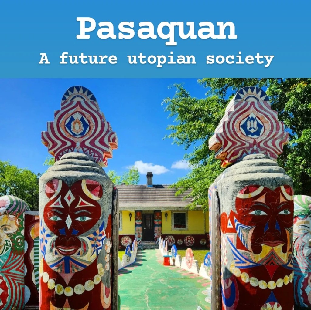
Pasaquan may just be the weirdest place in all of Georgia and is currently maintained by Columbus State University. It’s not for everyone (myself included), but it definitely attracts a lot of people, so I needed to include it in here. Pasaquan was meant to be a future utopian society. Eddie Owens Martin was a flamboyant fortune teller and drug dealer who trained snakes and wore a headdress everywhere. One day, while living in New York, he claimed to have a vision from future beings called Pasaquoyans who instructed him to come to the middle of nowhere in Buena Vista, Georgia, to build this city. They allegedly changed his name to St EOM and called him the world’s first Pasaquoyan. He then spent 30 years constructing this city and hand painting everything with inspiration from different architectural designs across the globe. When the Pasaquoyans decide to populate the earth in the distant future (after the extinction of humans), Pasaquan will become their capital city. It’s definitely unique, and visiting it is interesting. But for those who are on the fence about visiting, I’ll give a few tips. First of all, it’s in the middle of nowhere and takes time to drive to it. Fortunately, visiting is free, though they do ask for voluntary donations if you enjoy it. Next, it somewhat felt like I was visiting a cult. On the day I visited, there were people there setting up for a “poetry night,” and I just got some weird vibes. (Not that poetry nights are cult-like, but the way in which they were going about it felt cult-like.) The last thing I’ll point out is that it’s not necessarily family friendly. A lot of the artwork here could be considered inappropriate. To quote a friend who was there with me, “I wasn’t expecting to see so many [anatomical features] today…” I’ll admit, a lot of the structures here are very colorful and impressive, anatomy aside, and there are some cool places you can climb on and explore. Overall, if my description of this place interests you, then visit it. If not, it’s definitely something you can skip.
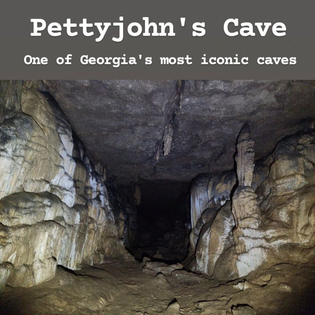
NOTE: DO NOT ATTEMPT TO VISIT PETTYJOHN’S CAVE ON YOUR OWN!
Pettyjohn’s Cave is located on the side of Pigeon Mountain in Northern Georgia near the town of Chickamauga. It’s a karst limestone cave that is 6.5 miles long and 235 feet deep. In order to enter the Crockford-Pigeon Mountain Wildlife Management Area, you must possess a valid WMA license of some sort. This can be a Georgia fishing or hunting license, and you can even purchase a daily license, if you’re just looking to visit for the day. To do this, go to the Georgia Department of Natural Resources website and visit the Licenses & Permits section. A list of all licenses and permits you can purchase will show up. The cheapest option would be a day fishing pass which costs $10 plus a $3 fee, and for only $3.50, you can add a day to that, if you’re looking to visit on back-to-back days. I’m not sure how often game wardens go around checking for valid permits, but I was stopped twice in one day, so I’d recommend having one. Now, I’m not a caving expert and will never claim to be, so I would recommend seeking out advice from actual experts in addition to mine. I am only going to give my personal observations and the basic things you need to know before visiting. Finding the entrance to Pettyjohn’s Cave is easy as there’s a small parking lot for it which your GPS can lead you to, but signal in the area is very poor, so you may have trouble putting in your next stop. Before going to the cave, you must fill out a yellow form that can be found at the trailhead, with all your information, along with plans for the day and planned exit time. You then tear off a smaller portion of the form to keep with you and fill out upon exit. This is for your safety, so if you get stuck inside the cave, you can be located. When you first arrive at the cave’s entrance, it’s literally just a hole in the ground, which you have to maneuver your way through. The cave stays at 58°F. (14°C) all year round. While it’s cold to begin with, trust me when I say it doesn’t feel cold for long! Inside the cave is very muggy, and I was sweating constantly! In addition to someone with experience, the things you need to bring with you include a helmet, headlamp, backup lights and batteries, water, knee pads, shoes with good grip, and clothing that you don’t mind getting all muddy. A headlamp is much more practical than a handheld flashlight here because you need your hands to be free for climbing. And try to pack everything in the smallest and lightest backpack possible. This cave is not really a horizontal cave, meaning there’s a LOT of climbing and squeezing through holes in the ground. If you’re even slightly claustrophobic, it would be a good idea to avoid the cave altogether. And even the climbing portions can be tricky because everything is coated in a thin layer of slippery mud, making one wrong step very dangerous. If this doesn’t sound like it’s for you, then don’t attempt it. There are other places within Pigeon Mountain that are worth checking out that don’t involve caving, including the Lost Wall and Rocktown. But I will point out that the road conditions throughout this park are very bad once you pass Pettyjohn’s Cave, so it takes time to drive from one place to the other. The other famous cave within Pigeon Mountain is Ellison’s Cave which contains the deepest pit cave in America. (The trailhead to reach Ellison’s Cave can be found at the Blue Hole within Crockford-Pigeon Mountain WMA, if you’re interested in seeing it). This one should only be attempted by experts as it requires rappelling down extremely deep pits and is responsible for many deaths over the years. Caving is an activity that needs to be taken seriously, and if you’re not comfortable with it, it’s best to just leave it alone. Pettyjohn’s Cave has some incredible views and cool points of interest throughout, but know your limits and what you’re comfortable with before unnecessarily putting yourself at risk to see it.
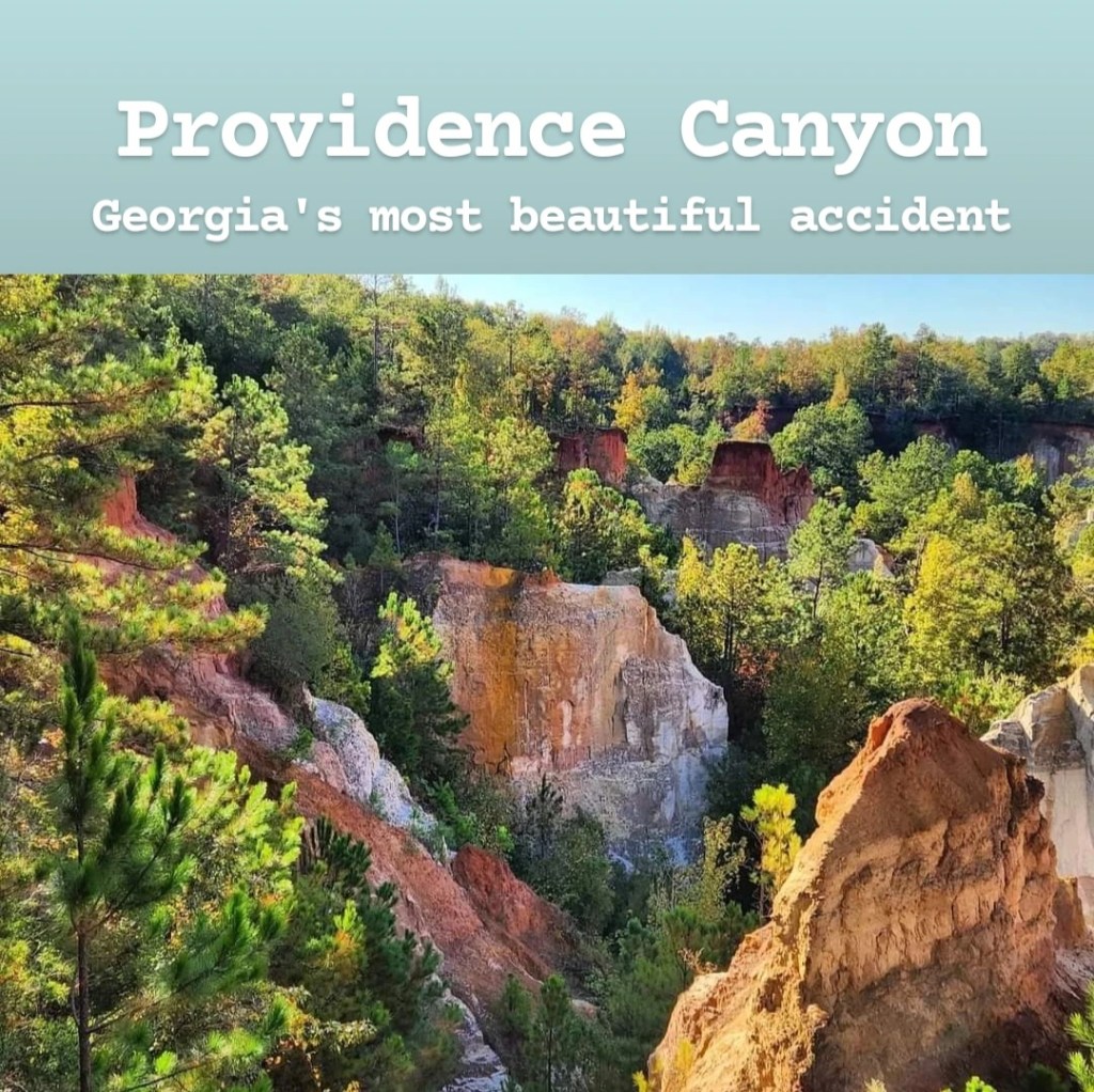
Providence Canyon is one of the seven wonders of Georgia and feels like a place you might find out West rather than a state on the East Coast. It’s located in Lumpkin, Georgia, about 45 minutes south of Columbus, and was formed by accident due to poor farming practices in the region. Entrance to the park is $5 per vehicle, though annual passes are available, and there is decent signal from the visitor center. From the visitor center, you can either go right or left, and the maps aren’t particularly clear here. Either way, it’s a giant loop trail, so it really depends on the order you prefer to go. I went left, which took me to a few overlooks first, then through the woods where you can find old cars that have become an important part of the ecosystem over time, and then you reach the trails to the bottom of the canyon. Obviously, if you take a right at the visitor center, you’ll do all of that in reverse order. The highlight is definitely hiking to the bottom of the canyon, so you may want to just do that (go right) or save it for the finale (go left). I’ll also point out that if you have young kids, there are areas along the rim where the fencing has large gaps, so you’ll want to watch them closely. When you do hike to the bottom, the trails you follow are actually small riverbeds. There is some water trickling through it, though it is possible to keep your feet dry if you pay close attention to where you’re stepping. None of these trails are strenuous, but I’d recommend wearing boots or something you’re fine getting wet, so you can enjoy the scenery a bit more. There are 9 different canyons you can hike up into, and each one is unique and worth checking out. My favorites are canyon 8 and canyons 4-5, if you’re looking for specific recommendations. It’s also important to note that you’re not allowed to hike up the canyon walls. There are certain areas that look like trails, but if it includes a steep incline, stay off of it! If you want to quickly view it from the top and then hike to the bottom instead of doing the full loop trail, the best viewing area is called Providence Canyon Observation Area on Google Maps, and you can parallel park along the street in this area. Camping is also allowed in this park, and you can reach the campsites by hiking the backcountry trail. The visitor center does sell frozen food, snacks, and drinks, but it closes at 5 (or a little before if they feel like it), so make sure to stock up on everything you need before then. (There’s a microwave for the frozen stuff). Overall, I’d definitely recommend checking out Providence Canyon! It’s unique to the state, but that makes it stand out.
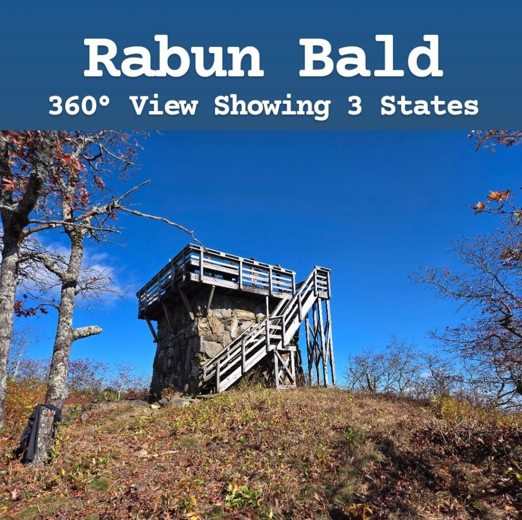
Rabun Bald is the second-highest peak in Georgia after Brasstown Bald. It’s located in the far northeastern corner of the state in Rabun County. To get there, you actually have to drive through a bit of North Carolina as the windy roads cross back and forth across the state line. There are some nice overlooks along this road, so make sure to stop if you have some extra time. This area receives peak fall colors too, so you may want to time your visit around that! Cell phone signal is spotty all throughout this area, though there are portions of the trail that actually have pretty decent service. The trailhead is odd because there’s not really a parking lot anywhere nearby. Instead, you’re parking in front of private homes, so make sure you’re not blocking anyone’s driveway! It’s not the widest road either, so you’ll have to park off the road a little bit so others can get by. And there’s really not much room here, which means during busy times, you may not find any free parking spots. The majority of the trail is shaded as there are thick bushes/branches arching over it for most of the hike. This is great during the hot summer but can make it really cold during cooler months. There are some steep parts of this trail as you make your way up the mountain, and large portions of it are basically long switchbacks. At the beginning of the trail, you’ll want a map of some kind, but once you get farther into the trail, it’s not needed. Once at the top, there is an overlook offering an incredible 360° view of the surrounding area! From the top you can see 3 different states, and it’s definitely worth the hike up. The steps to the top of the overlook aren’t the greatest, and they can freeze over during colder times, so make sure to watch your step. This is probably the best view from a hike you can find in Georgia, so it’s not one to miss out on! After your hike, the towns of Sky Valley and Dillard can be interesting places to stop and look around. This is one of my favorite hikes I’ve done in Georgia!
Radium Springs is one of the seven wonders of Georgia and the largest spring in the state, flowing at a rate of 70,000 gallons per minute. From the top, it’s not very clear how big the spring is because the majority of it is located underground in an extensive cave system. Unfortunately, diving here is not an option unless you’re part of a scientific research team. The cave system is way too narrow and confusing to allow the average person to explore them. If you visit, all you really get to see is a large natural pool, where swimming is no longer permitted, and the ruins of an old resort/casino from the 1920s that was abandoned during the Great Depression. To be honest, there’s not much to see here, but it’s pretty. It’s easily found by GPS right outside Albany and is free to visit. If you do come, you can pair it with a visit to Albany, where you can visit the Flint RiverQuarium and Ray Charles Plaza. While I don’t really recommend going out of your way to visit either Radium Springs or Albany, I know a lot of people want to come because it’s a wonder of Georgia. If you don’t really care about visiting all of them, then this can be skipped entirely, in my opinion.
Raven Cliffs Falls is found in the Blue Ridge Mountains, right outside Helen. The trailhead is easily found by GPS, but signal is very poor, both at the trailhead and in the surrounding areas. It does cost $5 per vehicle, and you’ll need to bring a pen to fill out the form that you put your cash payment in. The trail is about 5 miles round-trip and is rated moderate. If you’re uncomfortable hiking over a lot of tree roots and occasional slippery rocks, then you may want to avoid this one. There is also one point where you either have to cross a river or balance across some fallen logs. There are a couple things I like about this trail. First of all, the trail to the falls is mostly uphill and shaded, meaning you get to hike downhill on the way back. Second, there are many cool stops to make along the way with smaller waterfalls and rapids to look at. One major thing I don’t like about the trail is that there are no trail markings, and there are a few places where you could easily get turned around. Even online trail maps aren’t fully accurate. The waterfall at the end is definitely worth the effort to visit, but I do have to warn you that pictures don’t do it justice. I’ve said that about many places before, but I can’t think of any single location where that is more true than it is here. It looks so small in pictures, but seeing the waterfall in person is impressive. You can continue hiking past the waterfall, but it’s a very steep climb. If you’re up for it, it will take you to a ledge above the waterfall, and there’s an even bigger, more impressive waterfall within view that you don’t get to see from the ground. If you decide to come, I’d recommend wearing shoes that you don’t mind getting wet. The trail is perfectly doable without getting wet, but there are several areas you may want to explore that would require wading through, at times, waist-deep water. This is one of my favorite hikes in Georgia, so I definitely recommend it! It’s similar to Panther Creek Falls, except shorter and easier, with a less-impressive finale.
Over 40,000 refugees have come to Georgia from all over the world, and the first stop for most of them is the small town of Clarkston. In fact, many of the Afghan refugees from 2022 ended up here. Clarkston has become known as the most diverse square mile in America and has earned the nickname “Ellis Island of the South.” And over 50% of the population of Clarkston was born outside the United States. As a result, visiting this area of the state is very unique because of the blend of so many different cultures coming together. Driving through town is exciting as there are signs for businesses along every street written in different languages. You can visit an Ethiopian market then go next door to a Vietnamese market, cross the street for an African restaurant and then go a few doors down to a Nepali restaurant. And while there are some cool shops and restaurants in Clarkston that make you feel like you’re in a different country, it’s still a very small town. So after seeing Clarkston itself, I’d recommend driving into the surrounding communities to see even more. Nearby Doraville and Chamblee both have several international markets, carrying foods and items from all over the world. Buford Highway Farmers Market in Doraville would be my biggest recommendation for an international market, as it carries almost everything you could think of. But if you’re looking for a more Latin American market, then the best place to check out is Plaza Fiesta in Chamblee. There’s also a China Town in Chamblee, though it’s not as impressive as the others, in my opinion. Over in Decatur, you’ll find one of the coolest international markets to visit, Your DeKalb Farmers Market, which is always very busy. If you head over to Duluth and Suwanee, there is a large Korean population, so Korean food is very abundant. There’s a decent Indian population here as well. And Suwanee itself is worth a visit to explore its local parks, which are really nice. The area is also home to some very impressive religious sites. While Clarkston does have a mosque and Ethiopian Orthodox church, you’ll have to travel to a few nearby towns for the really impressive ones. By far, the most impressive religious site in the area is BAPS Shri Swaminarayan Mandir in Lilburn. It was the largest Hindu temple in the world outside India, until October 2023 when a slightly larger one opened up in New Jersey. The temple is made up of 34,450 individual pieces of hand-carved Italian marble, Turkish limestone, and Indian pink sandstone that were carved in India before being shipped to Georgia to be assembled. The building is breathtaking, especially once you get inside where pictures are not allowed. Driving into Atlanta, you can visit the largest mosque in the area, Al-Farooq Masjid, which also requests that no pictures be taken inside. And if you’re willing to drive just a little farther, the town of Conley has an impressive Lao Buddhist temple called Wat Lao Buddha Phothisaram. As someone who loves visiting other countries and experiencing unique cultures, this region of Georgia is a place I personally enjoy visiting and one I’d recommend if that interests you too.
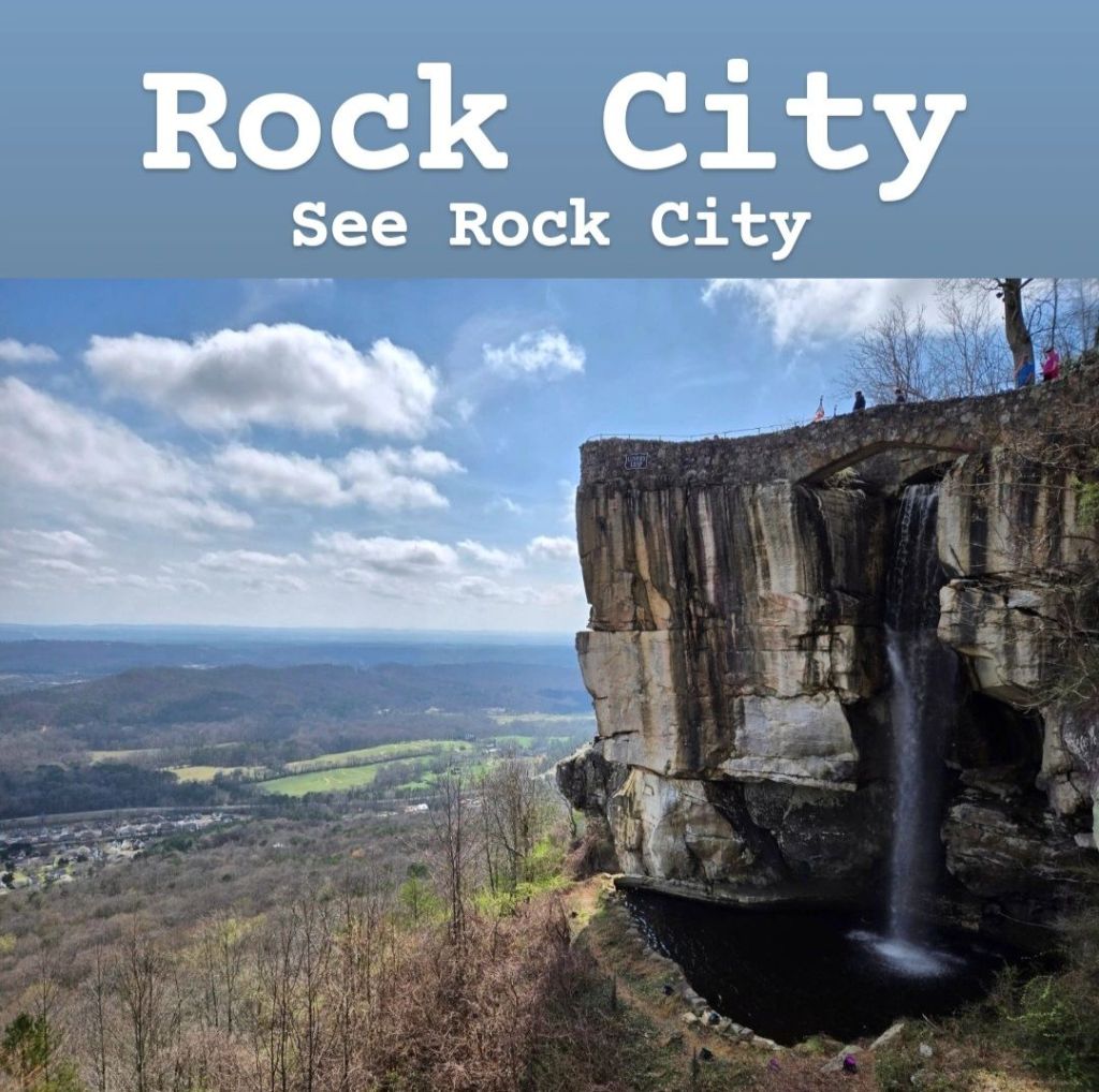
If you spend any time traveling around the Chattanooga area, you’ve likely seen the signs for Rock City and Ruby Falls. Both of these are iconic locations within Lookout Mountain, but while Ruby Falls is on the Tennessee side, Rock City is on the Georgia side of the mountain. Because their marketing strategy is so recognizable, this has become a super touristy area and thing to do. Rock City is found in an area with a lot of cool unique rock formations and lookouts that it gets its name from. Tickets to visit vary based on when you’re visiting. Days with higher visitation will be more expensive, but you can expect to pay $24 and up for an adult and $14 for a kid. Prices will be better if you book online the day before. When I booked my ticket the day of my visit, it was a busier day, so I ended up paying $39. When you book your ticket, you also have to select a time slot, so keep that in mind when planning your trip. Once there, expect a lot of walking, climbing steps, etc. There are also a few areas that are very narrow, so if you’re claustrophobic, you may want to avoid. Some of the views here are incredible, but my enjoyment of it is definitely affected by the over-touristy feel and cheesy decorations put up in many places. Instead of feeling like I’m exploring unique rock formations, I often felt like I was in a fairytale land, and to me, that really draws me away from places like this. Obviously, many people still like it, but if that annoys you like it does me, you may want to take that into consideration before braving the crowds of people to visit. The most famous part of Rock City is Lover’s Leap. From here, they claim you can see seven states on a clear day. (That’s heavily questioned though, so don’t take that as 100% factual). While this is a touristy area, my cell phone signal was very spotty, so you may want to have your next stop already loaded into your GPS just to be safe. Overall, this is iconic and worth visiting if for no other reason than that. If this sounds like your thing, go for it!
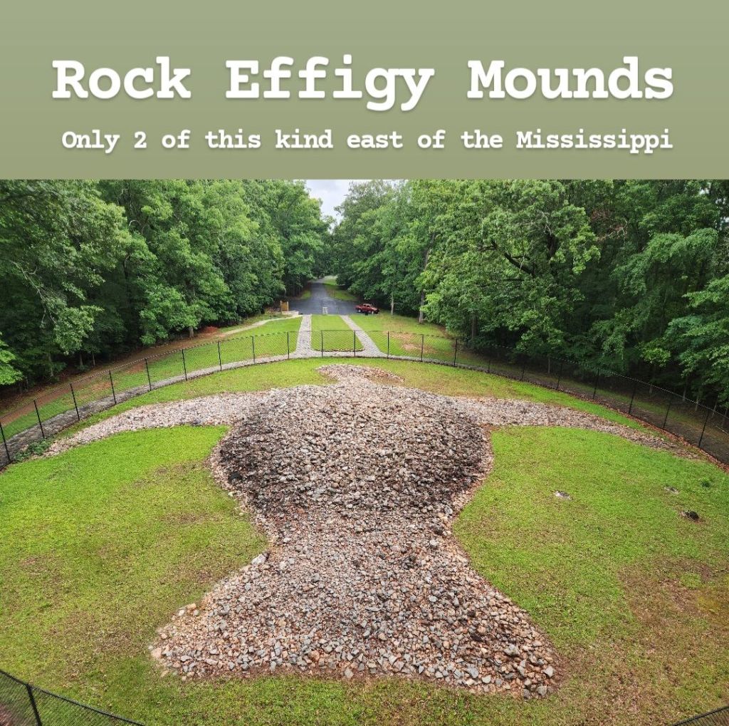
Georgia is home to two different effigy mound sites that date back thousands of years ago. These are the only two mounds of this kind east of the Mississippi River, and both are in the shape of birds. These are Rock Eagle and Rock Hawk. Both are free to visit: there’s a park at Rock Hawk, that requires an entrance fee, but the actual mound is not inside the park, so there’s no fee to see it. Rock Eagle is the more popular of the two, though neither one gets very many visitors due to being largely unheard of. Getting to either requires driving through miles of remote farmland and the Oconee National Forest, meaning cell phone signal is very spotty. Once at Rock Eagle, your GPS may actually try to take you somewhere else, so make sure to pay attention as you’re getting closer. When you see a stone tower, that’s where you want to be! The rock mound doesn’t look like much from the ground, but once you climb the tower, you’ll be able to see the eagle shape. There are trails in the area, but they are off limits unless you’re a registered guest at the adjacent 4-H Center. Rock Hawk feels even more remote, but it’s actually more developed as a tourist site and has restrooms as well. The hawk is much less defined than the eagle, so it’s difficult to make out its shape. There are plenty of trails here, which are open to anyone. While driving between the two sites, you’ll pass through the small town of Eatonton, which I’m including in its own section on this guide, so I’d recommend reading that in addition to this. I’m not sure if racism is still a problem here- the only reason I’m bringing this up is because I saw signs at the entrance of Rock Hawk stating that they don’t discriminate so everyone is welcome. It makes me wonder if there’s a story behind why they had to put those signs up in the first place, but I don’t have any proof that there is a reason. If this makes you feel uncomfortable, it’s a site that could definitely be skipped, in my opinion. Overall, I’d say that Rock Eagle is worth a visit as I found the mound to be really interesting! This isn’t the type of thing you see in this part of the country, so that alone makes it unique. Rock Hawk isn’t nearly as impressive, but if you enjoy walks through the forest, then you may enjoy it too.
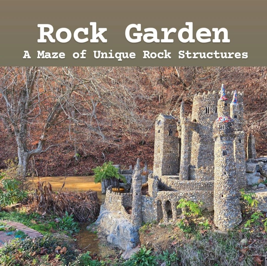
“Come to God’s garden sanctuary and experience a little bit of Heaven on Earth.” (That’s the description of this place in their information book). The Rock Garden is a place that I have seen several reels on social media about. Originally designed to be a prayer garden, it’s essentially a garden with many artistic rock structures found throughout. It’s located in Calhoun, Georgia, and is hidden behind Calhoun Seventh-Day Adventist Church. From the parking lot this looks very small, but once inside, you realize it’s larger than you initially thought. The rock structures are pretty cool with many medieval castles found throughout. Some of the more impressive structures include replicas of the Notre Dame Cathedral in Paris and the Coliseum in Rome, which are both really cool to see. There’s also a very strong biblical theme throughout with many verses found painted on rocks along the path and structures of Bethlehem and Jerusalem. There’s a cross visible from the parking lot as well. Some of the walkways are a little unsteady, especially near the river, so I’d recommend watching your step when you come. I was shocked at how busy this place was when I visited, though I don’t think you’ll have to worry about the parking lot filling up since it doesn’t take too long to visit it. The garden is free to visit, though you’re welcome to leave tips if you want. There’s also a one-mile walking trail next to the bridge if that’s something you’re interested in. This was nice, and I’m glad I came, though I probably wouldn’t recommend going too far out of your way to visit it. Just wait until you’re in the area for something else and then visit it.
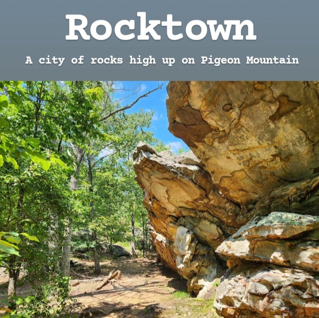
Rocktown is a trail located at the top of Pigeon Mountain in North Georgia. It’s a very unique landscape that is dominated by towering boulders everywhere you look. If you like Rock City, this is a toned-down, less touristy (and more natural-feeling) version of that. In order to enter the Crockford-Pigeon Mountain Wildlife Management Area, you must possess a valid WMA license of some sort. This can be a Georgia fishing or hunting license, and you can even purchase a daily license, if you’re just looking to visit for the day. To do this, go to the Georgia Department of Natural Resources website and visit the Licenses & Permits section. A list of all licenses and permits you can purchase will show up. The cheapest option would be a day fishing pass which costs $10 plus a $3 fee, and for only $3.50, you can add a day to that, if you’re looking to visit on back-to-back days. I’m not sure how often game wardens go around checking for valid permits, but I was stopped twice in one day, so I’d recommend having one. Getting to the trailhead for Rocktown isn’t too difficult as it’s easily found by GPS, but cell phone signal is very poor throughout the park, so you will want to have your next stop entered before arriving. I will also point out that the road conditions within the park are terrible. Because Rocktown is pretty deep into the park, it will take a while to reach it due to road conditions. With that said, you should definitely be careful when driving these roads as there are many hidden potholes. I would also recommend downloading a trail map before entering the park. The trail is not the easiest to follow if you don’t know where you’re going. There are a few branching paths early on, and once you reach the main “Rocktown” area, it is extremely easy to get turned around. I found AllTrails to be good enough to keep me from getting lost, but it’s not perfect once you get further in, so you can’t fully rely on it. Once you reach the main area with all the boulders, there are so many places you can go, and they each offer cool views of the boulders, so don’t just stick to the main path. The trail is pretty easy to hike and is only around 2 miles long, though you’ll want to allow extra time to spend there to explore. I’d say it’s definitely worth visiting if you’re in the area!
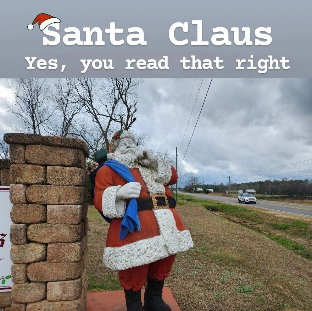
As strange as it sounds, there is a small town of around 200 people in South Georgia called Santa Claus. Back in the 1930s, Calvin “Farmer” Greene owned a pecan orchard in Toomes County along Highway 1, and he turned it into a small town. He wanted a way to attract visitors to his pecan stand, so he decided on a very unique marketing strategy: naming the town after Santa Claus. State Representative Thomas F. Fuller was asked about the city while addressing the Georgia General Assembly in 1941 and described it as “ten people, forty dogs, and no reindeer.” As you drive through this town, you’ll encounter fun street names, such as Reindeer Street, Candy Cane Road, Rudolph Way, Noel Street, and Sleigh Street. This marketing tactic worked for a while, and the town started to become more developed. At the time, Highway 1 was the primary route to take while traveling up the East Coast. But everything changed with the introduction of the interstate, which bypassed Santa Claus and took all the tourists with it. Today, it almost feels like a ghost town, and there are very few visitors for most of the year. But for those that do drive out into the middle of nowhere to see it, there are things to see and do that may be of interest. You’ll likely want to start your trip by stopping by the “Welcome to Santa Claus” sign upon entering the town for a quick photo opportunity. Then from there, I’d recommend heading to the Santa Claus City Hall, located at 25 December Street. Once here, if you knock on the door of the mayor’s office, you may be able to get a free tour of the city! When I visited, I met Sue Grisham, who has served as the city clerk since 2015, and she gladly gave me a tour of the city. (It was a walking tour since the city is very small). Right across from the city hall is the Santa Claus Welcome Center and gift shop. You may need Mrs. Grisham to unlock it for you as it’s not always staffed. Then out front of the city hall is a mailbox where you can send your letters directly to Santa himself. There are directional signs throughout town pointing you to places like Whoville, Santa’s Workshop, the Grinch’s Lair, and the Wish List Processing Center. There’s also a small chapel with a garden out front that is pleasant to walk around. It’s a fun stop to make to see the city, but if I’m being fully honest, seeing the entire city takes less than 30 minutes, even when taking your time. It’s truly a town that if you blink you might miss it. For that reason, I can’t really recommend coming unless you’re already in the area and want to quickly stop by. If you’re looking for a reason to visit, I’d recommend going around Christmas time when the entire city transforms into its true identity. Everything lights up on the Thursday before Thanksgiving, and these lights stay up through the New Year. I’ll also mention that cell phone signal is pretty weak here, so plan accordingly if you come. While there still aren’t a ton of actual visitors, the town does become more popular this time of year because many people like to bring their mail here in order to get their Christmas cards postmarked from “Santa Claus, GA.” Whatever your reason for coming, this is definitely a unique town to see.
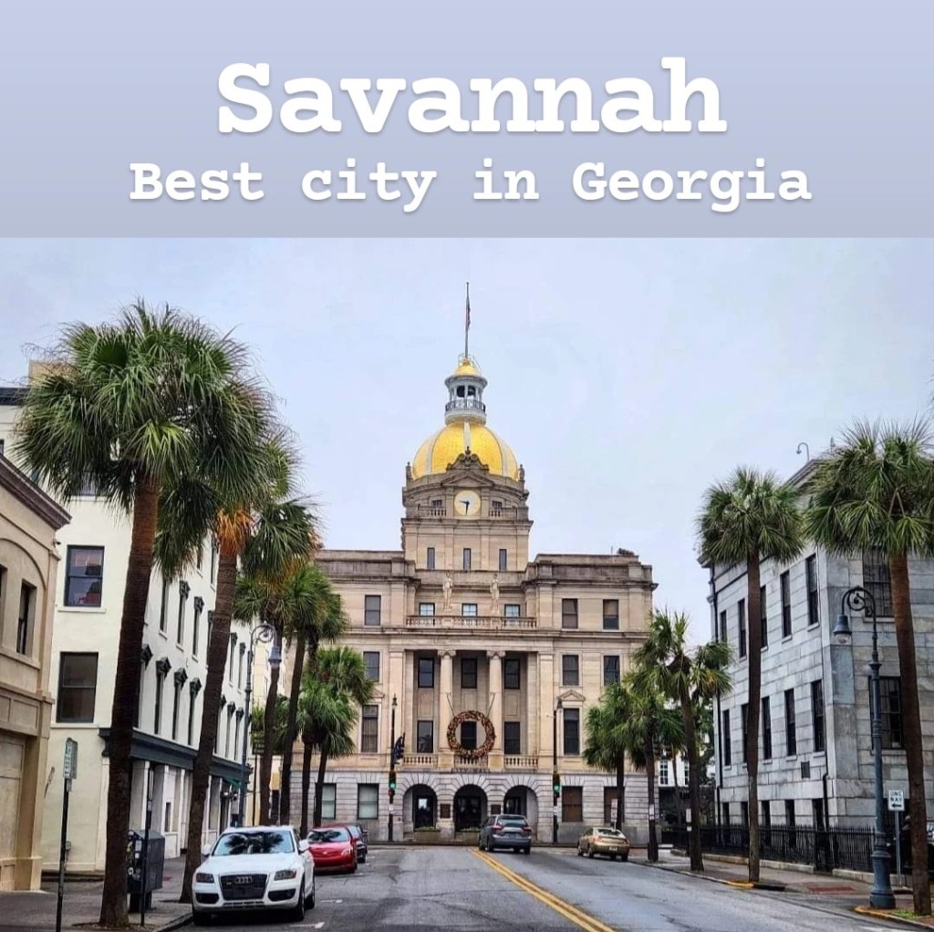
Savannah is the oldest city in Georgia and, in my opinion, the best city in Georgia. There’s so much history in Savannah, and the city as a whole is just beautiful to drive around! Many of its streets are lined with tall oak trees that have Spanish moss draping from their branches. The architecture is very colorful and historic. The food throughout the city is some of the best you’ll find anywhere. Savannah is a top vacation spot in the entire United States! One thing I’d recommend doing is finding a parking spot somewhere downtown and then walking through the many random squares throughout the city. It’s very picturesque, and you’ll find plenty of cool things to stop and look at. Forsyth Park is the most popular, and I’d definitely recommend visiting it. But even throughout the historic part of the city, you’ll come across one park after another, each with its own monument in the center. My favorite part of the city is River Street, down by the Savannah River. This street is a perfect place to spend an afternoon as it contains many cool shops, restaurants, and candy stores. Stop by Huey’s for some great seafood and then hop over to a candy store for some fresh pralines. My biggest complaint for River Street is that it gets so crowded in the middle of the day! While there are many paid parking lots lining the street, these almost always fill up. And the one-way cobblestone street is uncomfortable to drive on, so it can get frustrating when you’re looking for a parking spot that doesn’t seem to exist. If you want to avoid that, there are nearby parking lots within walking distance of River Street, but I found that these fill up quickly as well. Wormsloe State Historic Site is another cool stop to make right outside the city. It costs $10 per adult and $4.50 per kid 17 and under to visit. While some may not think that it is worth the price of admission, it really depends on your interests. There are some small trails to walk after driving through the oak tree canopy, but these trails aren’t anything to get too excited about. Savannah also contains Tybee Island, a popular beach town with some great beaches to relax on. If you happen to be here around New Year, there’s an annual polar plunge into the Atlantic, which is fun to be a part of. But anytime of year that you come, expect traffic to be crazy and parking to be very limited. Also, right between Savannah and Tybee Island is Fort Pulaski, which is actually a pretty cool place to visit. Overall, I can’t recommend visiting Savannah enough! It’s an awesome city.
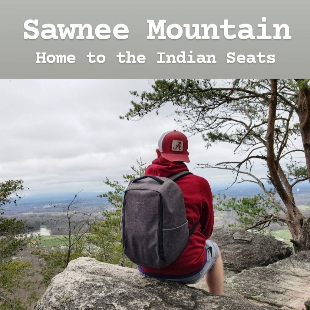
Sawnee Mountain is located in Cumming, Georgia, along the Appalachian foothills. It’s most known for the “Indian Seats” at the peak of the mountain which offers incredible views of the surrounding area. The Indian Seats area got its name because it was believed that the Cherokee who inhabited the area used the rocks on the edge of the cliff as seats during different ceremonies. There are natural indentions in the rock, creating the perfect spot to sit and enjoy the view. Getting to the top is pretty easy. The trail is rated moderately difficult, but I disagree with that. The full loop is 4 miles long and goes up the side of the mountain, but the incline isn’t too strenuous, and the only difficulty one might have is at the top where it’s all boulders. My recommendation is to avoid the visitor center and park at the Bettis Tribble Gap Parking Lot instead. Your GPS may be off a little bit when taking you there, but it’s close enough for you to easily find it. Parking here will give you the closest path to the top. That’s really all there is to it. Parking and park entrance are free, and the signs along the trail give very clear directions. Cell phone signal is very good as well. I definitely recommend checking out Sawnee Mountain and the Indian Seats!
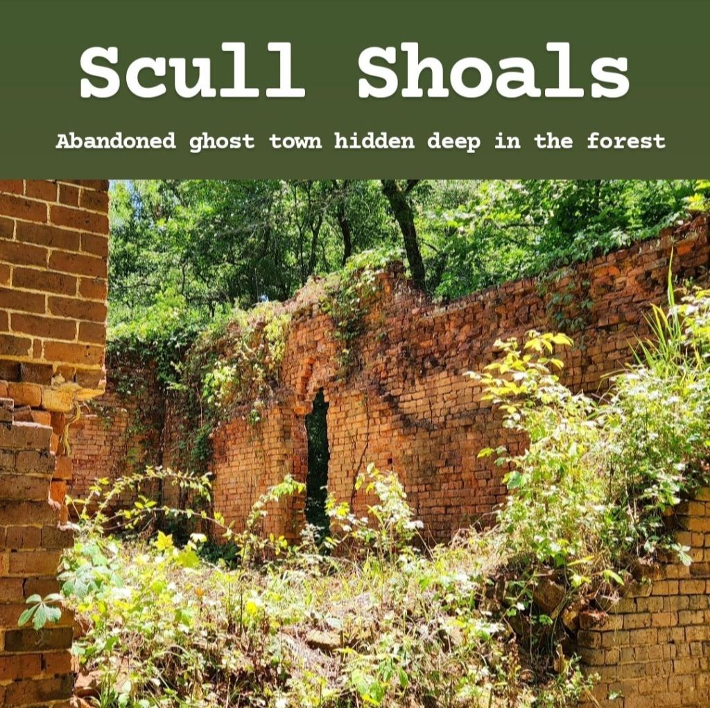
Scull Shoals is a ghost town deep within Oconee National Forest. The town was first settled in the early 1800s with the first mills being established in 1809. However, after several major floods destroying the town and poor irrigation from nearby farms making water-powered mills infeasible, the town was abandoned around the time of the Civil War. Today, these ruins can be reached at the end of a several-mile-long gravel road through the forest. It’s not far from the town of Greensboro and Lake Oconee, so it’s really not that difficult to find. Cell phone signal is very weak within the forest, but I did find a little bit of signal in the parking lot once I finally reached the ruins. The main ruins are the most interesting thing to see here while the rest are scattered throughout the forest and must be reached by hiking. The problem is that the US Forest Service doesn’t maintain the area like they should. Everything is very overgrown, making the trails nonexistent. If you’re going to try to find the other ruins, you’ll have to find your way by hiking through overgrown brush and thick mud. I would not recommend trying this unless you have a lot of experience in similar conditions. Hiking boots are a must, and snake chaps would probably be a good idea too. Due to this, I would only recommend seeing the main ruins, but even then, it could probably be skipped, unless you’re really into old abandoned buildings. If you do come, the town of Greensboro is a nice little town, and Lake Oconee is beautiful, so I’d recommend combining your trip with a visit to them.

I don’t know who Dale was or what shady thing he did to get a town named after it… Ok, actually it’s an old Cherokee settlement that was named that because it was a dale, or a valley, that contains a lot of shade. Shady Dale is a small town of less than 300 people that should never be found on a travel guide like this. There aren’t any tourist attractions, and to be honest, aside from a Dollar General and a tiny city hall/library, there’s not much of a “town” to see either. The reason I’m including it here is because it’s home to the annual Shady Dale Rodeo, which has been voted the #1 outdoor rodeo in the Southeast many times. In fact, for such a small place, it has received the Top Five Rodeo Award by the International Finals Rodeo in Oklahoma. It’s the one big annual event that the rest of the year revolves around for this tiny community. Bull riders and cowboys from all over the country come to Shady Dale every June to participate in this rodeo, and it’s a huge production put on in the most unlikely location. The energy at this rodeo is unmatched for a small town like this, and you can feel the excitement in the air. Tickets cost $25 a person, $10 for kids, and is free for kids 6 and under. No dogs or alcohol is allowed. It’s a crowded, loud event, and tickets sell out in advance, so you will want to secure yours while you can. Parking can be a little confusing considering a small town like this wasn’t designed to accommodate this many vehicles. Once you arrive, local volunteers will direct you to a parking spot, but you will want to remember this location as it can be confusing after the rodeo is over. Come with cash if you want to purchase food or drinks. This is a fun time, especially if you love rodeos, so don’t forget to come by Shady Dale next June!
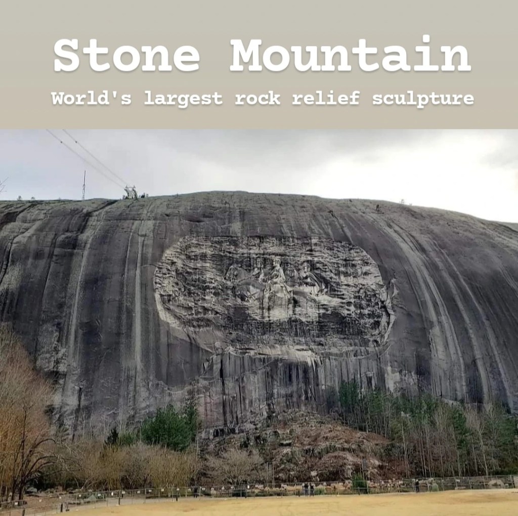
Stone Mountain is one of the seven wonders of Georgia and the #1 most visited attraction in the state. Stone Mountain can be seen for miles as it’s the only thing standing in an otherwise-flat area. It’s a large quartz dome monadnock that stands 825 feet above the surrounding area. It also contains the largest rock-relief artwork in the world, a 90×190 feet long carving of 3 Confederate leaders. Due to the fact that it’s basically a monument to the Confederacy, this has become a highly controversial site. However, it has become an iconic part of the Atlanta area, and climbing to the top of it is seen as a rite of passage for those moving or living in Georgia. Getting to Stone Mountain is easy, and it costs $15 a person to visit. But once inside the park, you may be a little confused about where to go from there. If you want to hike up the mountain, you will head to the right, and if you want to visit the village or take the cable car up, you will head left. (Most of the touristy stuff is to the left after entering the park). The hike up is very steep and strenuous, but it’s definitely worth it. Of course, you can also take the cable car if you don’t want to hike. At the top, there’s an incredible view of the surrounding area and the Atlanta skyline. There always seems to be something going on at Stone Mountain, so make sure to follow them on social media for the latest updates. They also have a light show that you can attend on certain nights throughout the year. Their light show calendar is available on their website, if you want more information. I would especially recommend the July 4th Celebration, which contains a cool light show followed by fireworks, and it’s all done very well in my opinion. Though you can get tickets in person, it’s recommended that you book them online ahead of time in order to ensure you have a spot, and on busy nights like July 4th, the lines to get tickets in person are miles long. I definitely recommend visiting Stone Mountain. It’s a little more touristy than I’d like, but I know many people enjoy places like this.
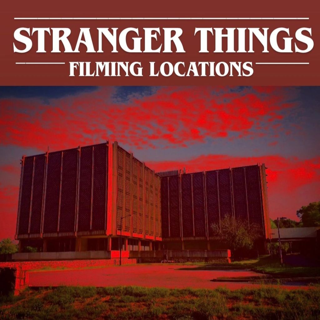
Stranger Things is a very popular Netflix series about a group of kids in Hawkins, Indiana, who find themselves fighting creatures from the Upside Down. While the show is set in Indiana, it’s actually filmed all over the Atlanta area, and it has become a popular reason for tourists to visit Atlanta. I’ll share all that you need to know in order to visit these locations below. Warning: If you don’t want spoilers, then don’t continue reading!
Some of the most iconic locations within the show are Hawkins Middle School and Hawkins High School. In reality, these are the same building, though you can’t really tell from the show. The location where all of these scenes were filmed was the Stockbridge Senior High School in Stockbridge. Unfortunately, the school was demolished in 2025 and can no longer be visited, but if you want to visit that location for some reason, the address is 109 South Lee Street.
Another location that is popular throughout the entire show is Hawkins Lab. This is found on the Emory University Briarcliff Campus in Atlanta. It’s located at 1256 Briarcliff Road. When I visited, there were many “No Trespassing” signs everywhere. You can enter the parking lot; just don’t get too close to the building itself.
Much of season 3 took place inside Starcourt Mall. The actual mall used for this is the abandoned Gwinnett Place Mall in Duluth. While you can see the outside of the building, unfortunately the inside is completely off limits with signs reading “No Trespassing: Violators will be Prosecuted” all over the place. The address for this is 2100 Mount Pleasant Road.
The main characters’ houses are also found scattered throughout the Atlanta area. These are all private residences, so when visiting, please be respectful! The one notable exception to this is the Wheeler house as that was recently sold in 2025, and the plans are to turn it into a Stranger Things-themed Airbnb! Also, Will’s home can’t be seen from the road, but I will include that address anyway. These addresses are as follows:
Mike: 2530 Piney Wood Lane, East Point
Lucas: 2550 Piney Wood Lane, East Point
Dustin: 2886 Piney Wood Drive, East Point
Barb: 2980 Piney Wood Drive, East Point
Will: 149 Coastline Road, Fayetteville
The Jackson Square is used in the background of the entire series as Downtown Hawkins. In season 5 especially, it is heavily used as this is where the military-control area is set up. In the center of the square is the Butts County Chamber of Commerce, which is used as the Hawkins Library in the show. You can even find “Public Library” written over the entrance facing Mulberry Street. Around the square you’ll find many other landmarks, including Bradley’s Olde Tavern (Hawkins movie theater), Melvald’s General Store (Joyce’s employer from early seasons), and the alley where Steve and Jonathan fought in season 1. The scene where Will discovers his powers was also based right in the center of town. There are Stranger Things murals around the square, including a “Welcome to Hawkins” mural and a Surfer Boy Pizza delivery van. Hawkins Headquarters is a Stranger Things and 80’s-themed gift shop that also offers Stranger Things tours. They also have an 80’s-style arcade on the inside, as well as several fun photo stations. Across the street from that is Lucy Lu’s, a coffee shop with a life-size Max being lifted by Vecna, and immediately next to that is Buddy Blu’s Cool Licks, an ice cream shop featuring murals of the Stranger Things characters, posters, and the Radio Shack sign. Jackson Escape Games is a Stranger Things escape room inside the old Radio Shack building where Bob worked in season 2. And there’s even a Stranger Things-inspired burger at Bradley’s Olde Tavern. You will definitely get your share of Stranger Things when visiting Jackson! If you need an address to put into your GPS, start with putting in Hawkins Headquarters, 101 E 2nd Street.
Here are a few more locations to note:
• Bradley’s Big Buy is a Piggly Wiggly found at 504 Center Street, Palmetto – make sure to notice the Eggos in the same spot as in the show!
• Hawkins Cemetery, where the iconic “Running Up That Hill” scene was shot, is actually the Stone Mountain Cemetery, found at 1025 Silver Hill Road, Stone Mountain.
• Sattler Quarry, where Will’s “body” was found in season 1 (and where Mike was being pressured to jump) is found in Westside Park in Atlanta. Its address is 1660 Johnson Road Northwest.
• Benny’s Burgers is where Eleven visited on the first episode of season 1. This was filmed at Tiffany’s Kitchen, 7413 Lee Road, Lithia Springs.
• The Creel House is a major location in seasons 4 and 5 as it is Vecna’s house. As with the other houses, this is private property, but it can be found at 906 E 2nd Avenue, Rome.
• Palace Arcade and Family Video are found at 6501 E Church Street, Douglasville.
• Hawkins Police Station is an actual police station at 45 Pray Street, Douglasville.
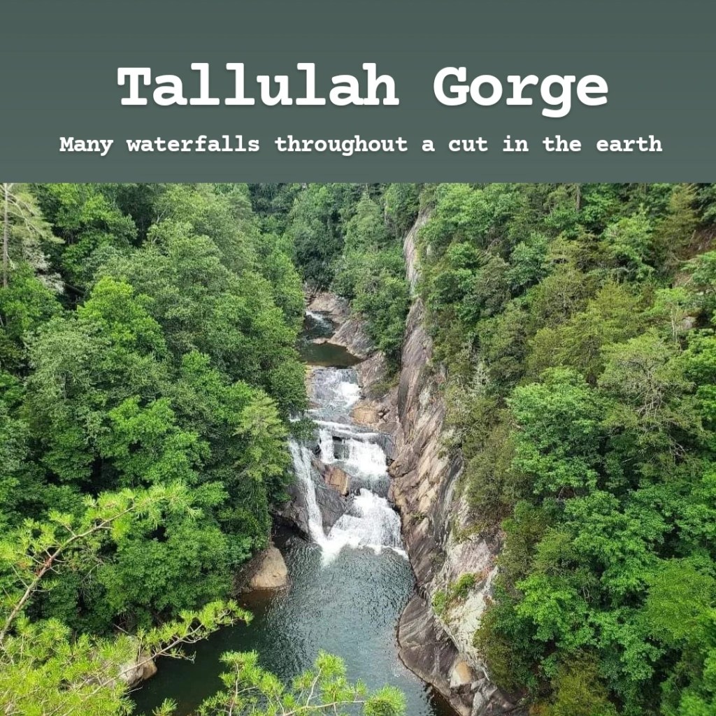
Tallulah Gorge is one of the seven wonders of Georgia and feels like it belongs in a different state. This two-mile-long canyon drops over 1,000 feet to the bottom and contains six waterfalls. It may just be the most beautiful place in Georgia. It’s easily found by GPS, and entrance to the park costs $5 per vehicle, with annual passes available. There’s a rim trail that follows the edge of the gorge and offers stunning views. Then there’s a staircase down into the gorge that takes you across a suspension bridge and to a lookout at the bottom that displays a beautiful waterfall. (If you looked at my Marvel filming locations section, this was used as a background during the Battle of Wakanda in Avengers: Infinity War.) You can then either climb a staircase up the other side of the gorge for more overlooks or hike down into the gorge for a really unique hiking experience. However, if you want to continue hiking into the gorge, you would need to secure a gorge floor permit first. Permits are free and are offered on a first-come first-served basis. You cannot reserve a permit in advance, and you will not be given a permit if you are wearing flip flops or Crocs. In order to secure a permit, you have to be one of the first 100 people in line after the park opens at 8:00 AM on the morning you want to visit. If you get a permit, you will have to sign a waiver and attend a safety presentation first because the hike to the gorge floor can be dangerous. If you can’t make it at 8, they also issue permits at 10 AM, noon, and 2 PM if there are any left, though I’d recommend trying to get there as early as possible, especially on weekends. This hike requires different strenuous activities such as hopping from one rock to another over river rapids, walking across slippery rock slopes, and even minimal rock climbing to ascend back up the other side of the gorge. This is an incredible hike though, so if you’re comfortable with your abilities, I’d highly recommend it. The biggest draw to this hike is the Sliding Rock, a small waterfall that you can slide down. This is a very fun activity, but it’s somewhat dangerous, especially when trying to climb the rope back up out of the water. I’d also recommend bringing water shoes if you have them. They recommend keeping your tennis shoes dry for the hike back up, but there are sections along the bottom where your feet will get wet. If an emergency were to happen at the bottom of the gorge, cell phone signal is surprisingly decent (I may know this from experience.) If you’re planning to visit, check the website ahead of time. Occasionally, the dam is shut down for maintenance, which limits the flow of water through the gorge. The website will let you know when this is going on, but if it is, then the views will not be as great. Also, whether planning to do the full hike or not, I’d recommend getting here early, as the parking lot fills up quickly, forcing a long line at the entrance. If you’re an experienced hiker, Tallulah Gorge is one of my top recommendations in Georgia. Even if you’re not, the hike along the rim offers stunning views that are worth coming for. I will warn, though, that the staircase is strenuous. You can visit without using it, but you’d be missing out on some of the cooler overlooks.
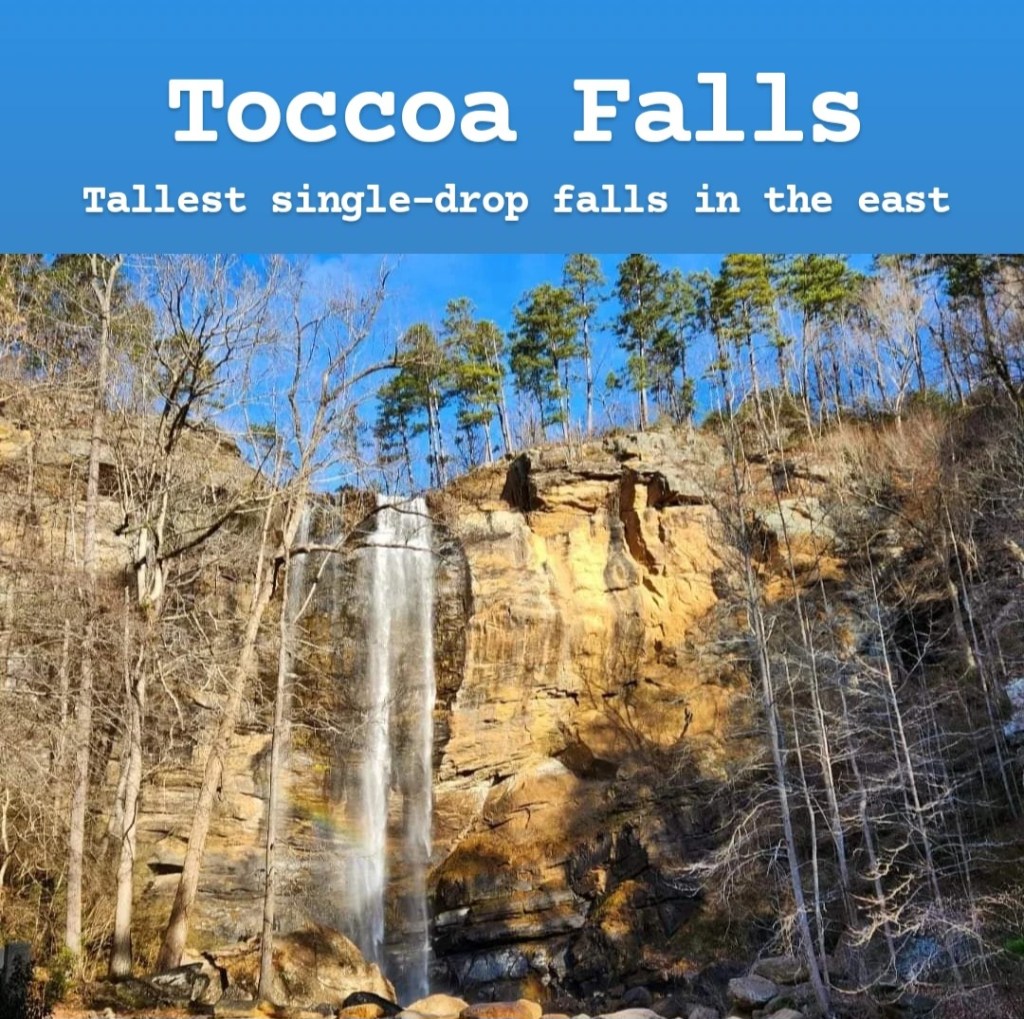
Toccoa Falls is an incredible waterfall in North Georgia on the campus of Toccoa Falls College. At 186 feet tall, it’s taller than Niagara Falls and is claimed to be the tallest single-drop waterfall east of the Mississippi River. There are actually many legends surrounding the waterfall with Cherokee mythology telling stories of spirits leading men over the falls to their deaths. It was also the site of a dam break in 1977 that destroyed the college campus and killed 37 people. But today, it’s one of the most impressive views in the entire state. Considering it’s on a college campus, visiting Toccoa Falls is different than visiting the other waterfalls on this list. First of all, there’s no hike to reach it. There’s a small 0.4-mile path that leads to it from the gift shop where you pay $2 a person. Second, it’s not always open to visitors. It’s only open when the college campus is open, so forget trying to go during winter break or on holidays. Before making the drive out to Toccoa Falls, make sure to visit their Instagram account @toccoafallscollege in order to get the latest updates. The first highlighted story on their account is titled “The Falls,” and it will tell you whether or not Toccoa Falls is open to guests that day, as well as the hours you can visit. This changes throughout the year, so make sure to look there before planning your trip. It’s usually accurate; however, it does not let you know when special events are taking place. Weddings are very popular here, and the entire waterfall will be closed to visitors during one of these events, regardless of what Instagram says. Toccoa Falls is one of the best places to visit in Georgia, but it’s also a quick stop. Pair it with other nearby sites (Tallulah Gorge is really close) if you do have to drive a ways to get there.
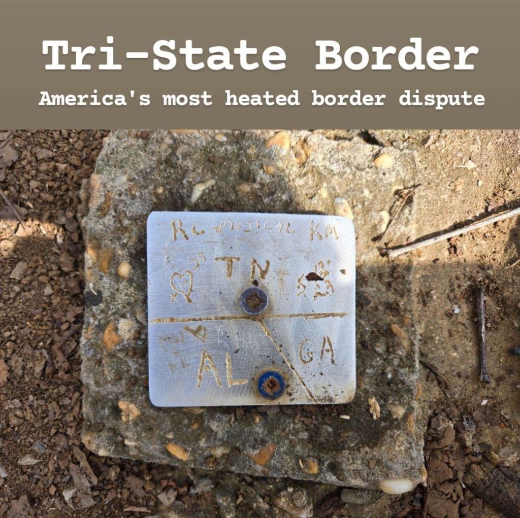
Many people don’t realize it, but Georgia is home to the most heated border dispute in the country. For context, Tennessee became a state in 1796, and Congress declared its southern border to follow the 35th parallel. However, when the first official survey occurred in 1818, they used outdated equipment, drawing the state line one mile south of where it should have been. Georgia initially didn’t fight this mistake until the late 1800s when a major drought took place. Due to this border mistake, Georgia barely misses out on controlling a portion of the Tennessee River, which is fed by several Georgia rivers, meaning Georgia’s water is freely going into Tennessee but is then restricted from being used by Georgia. Georgia has taken the issue to the Supreme Court; however, this has gone nowhere. The border dispute is still ongoing, with Georgia officials still to this day trying to reverse this mistake. The land within a mile of the official border on Tennessee’s side is now referred to as “Occupied Georgia,” and this even includes a small portion of Chattanooga. Tennessee obviously refuses to give in and has even mocked Georgia on occasion. (Technically, Georgia is right, though it is kinda petty at this point). With all that said, the official tri-state border is disputed, but you can still visit it if you want to. To get there, you’ll actually have to go to Tennessee (or “Occupied Georgia”) and drive to State Line Cemetery on Huckabee Lane. From there, you’ll park and then start walking into the woods. There is a small trail here that you will want to follow. If you’re looking at your phone GPS to try to find the actual tripoint, the signal here isn’t great, so I wouldn’t recommend relying fully on that. Instead, look for an arch. There’s an arch that reads “Tristate Corner” right over the actual border marker. The marker itself is a tiny square nailed into a rock on the ground, and you could easily miss it. Technically, the land on the Alabama side is private property, so you will want to be careful when visiting. Paradise Pointe Resort owns the land in Alabama, and they have No Trespassing signs up. Realistically, there’s no reason for you to come here. There’s nothing to do, and it’s a pain to reach because it’s in the middle of nowhere. I enjoyed coming because I like odd borders like this, and I found the border dispute to be interesting. If you do come, make sure to make a quick stop at Nickajack Lake, as it’s really at the center of this centuries-long border dispute.
Uhuburg is a medieval Renaissance castle in the mountains surrounding Helen. It was built over the course of 15 years and is still an ongoing project, though officially opened to visitors in summer 2023. Uhuburg has a four-part mission: philosophy, food production, nature, and celebration, with the philosophical side being a major focus. It was built by Bob Marthai, an ex-psychologist and retired tall ship captain/naval architect who had a dream of building this castle in order to share what he believes to be most important for living a good life. Visiting it is interesting: the ground level has many murals depicting Eastern religions. There are also many plants and statues, though many of these statues could be considered inappropriate for younger visitors, and they get a little too detailed with some. You can also walk along the castle walls and climb several lookout towers, with the primary lookout tower being part of the main building in the center. I do need to point out that getting to the upper levels requires climbing staircases that are a little sketchy at times. It is definitely not ADA-compliant! A guesthouse will be opening up sometime in the future, so renting a room will one day be a possibility. You can also rent out the Great Hall for events. When visiting, there are occasional tours offered (usually with Bob Marthai as the guide), and these are free. In order to visit Uhuburg, you must first purchase tickets online ahead of time at $35 a person. Currently, they are only open on Saturdays and Sundays, and I’m not sure if that is going to change anytime soon. Once you have purchased your ticket, they will send you an email with a waiver to sign, partly because of those sketchy staircases I mentioned. And each person in your group will have to sign their own waiver individually. Getting there is very easy by GPS, and it is located right outside Helen, about 6 minutes from Hofer’s Bakery. Cell signal in the area is poor, though within the castle, it’s actually pretty good. Usually when you arrive, you would be directed to park and take a shuttle to the castle; however, when it’s raining, they may ask you to drive to the castle yourself. This involves taking a narrow road that is not normally 2-way traffic, both ways. Overall, I’d recommend visiting if this interests you. It’s a little weird, but the views from the top are awesome, and there are many cool photo opportunities.

South Georgia is known for its farmland. While the north part of the state is mountainous, the southern part is very flat and empty, making it the perfect location for miles of farmland. However, the most famous crop in all of Georgia is the Vidalia Onion. Vidalia onions are sweet onions that can only be grown in this very particular part of the world. They are often considered to be the best onions in the world. In order to protect the Vidalia Onion name, US law was passed stating that Vidalia onions can only be grown in the 20 counties surrounding the city of Vidalia. This makes sense as no other place in the world has the right combination of low-sulfur soil and warm year-round weather to create the perfect environment for Vidalia onions to grow. It’s definitely an interesting place to visit and learn about farming practices for this specific crop, but don’t expect to be allowed to visit any Vidalia onion farms. The best way to learn about them is to visit the Vidalia Onion Museum in Vidalia itself. If you want to taste the onions, you can buy them during certain parts of the year in the many farmers markets throughout the region, but make sure you’re buying actual Vidalia onions. When the supply is gone, sweet onions from Peru will be sold instead. While these are similar, they’re not quite the same. The town itself doesn’t have a ton going on as everything revolves around the onions. The parts of the city I explored felt very run-down, though I think there’s potential it could become nicer. There’s a Vidalia Onion fountain in the middle of a park in the downtown area, which can be neat to see. I also liked seeing the police cars and water towers which all depicted Vidalia onions as well. Once you leave the main city though, the small towns surrounding it almost feel like foreign countries- not due to the demographics but due to the poorer, more back-country feel. For example, I stopped at a gas station that had dirt floors, where I had to step over a dog to reach the restroom, and boxes of sweet onions created a wall between the dirt parking lot and the dirt gas station floor. If you want to get way off the beaten path, this is where you’ll want to go. Overall, Vidalia is not really worth visiting unless you enjoy learning about the farming practices of the region. There’s really not much going on in the city itself as its entire economy revolves around the onion harvest. There is an annual Vidalia Onion Festival in spring each year, so that may be a reason to go if you’re looking for one.

Warm Springs is a small town in Middle Georgia and one of the seven wonders of the state. It’s named after the naturally warm springs that flow in the area which drew President Franklin Roosevelt to move here. He originally came in search of a cure for polio and found that the warm spring water was able to offer relief from the pain. He then opened a rehabilitation center and some pool houses to help those with the illness. He also built a house in Warm Springs where he lived on and off during and after his time as governor of New York and president of the United States. The main attraction to visit in Warm Springs is the Little White House where FDR lived. It costs $12 per adult and $7 per child under 17 years old to visit. There’s a small museum and the house itself, and it’s a cool stop to make to learn about the life and death of FDR. However, if you’re hoping to see the warm springs themselves, you’re out of luck. They are only accessible now through the rehabilitation institute which is only visited by staff and patients. There is also a historic pool house opened by FDR, but it was closed when I tried to visit due to low staffing. Even if the pool house opens back up, the water has all been drained. Warm Springs is a fascinating place to visit for history buffs, but it doesn’t have much more to offer. FD Roosevelt State Park is nearby, and it has a lot of hiking trails, so that is a good option in this area if you do decide to come.
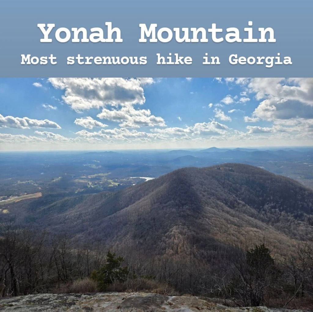
Yonah Mountain is one of the most popular hiking trails in all of Georgia. It’s located between Helen and Cleveland, and the hike takes you straight up the side of the mountain. The mountain is 3,166 feet tall, and in about 2.4 miles, you climb 1,600 feet in elevation. It’s a moderately strenuous hike as it’s very steep at parts, and some sections require climbing over boulders. The full trail up and back is a little over 4 miles, though you may end up hiking more than that if you take some of the side trails. Many like to refer to this trail as the most strenuous hike in Georgia. I’m not sure if that’s true, but it’s probably the most strenuous I’ve done, and the popular Instagram page called Georgia Hikes recently called it the most strenuous, so maybe it is true… All I know is I got passed by a group of boy scouts and felt a little embarrassed by that. To get there, you can easily find the trailhead in your GPS. There is a decent sized parking lot, though I could see it filling up on popular days, so I’d recommend trying to start fairly early. Visiting is free, and there’s no need to pay for parking either. I’ve already mentioned the difficulty of this trail, but I wanted to repeat that this is not a trail for beginners! There’s a loop once you reach the top, and I’d recommend completing the full loop. As you do, look for side trails that take you to overlooks. These are where the best views can be found (not necessarily right at the peak). But if you do go to these overlooks, there are no rails, so make sure you’re very careful not to trip! The best time of year to come is spring, followed by fall. In the springtime, the trail has many wildflowers, making it a beautiful hike. Summer is very hot, so this hike might not be as fun, and winter comes with its own challenges as many parts of the trail can become covered in ice! While most of the trail is easy to follow, there were a couple spots where I was confused, so I’d recommend having an app like AllTrails available in case it’s needed. The majority of the trail actually had decent cell phone signal, so I wouldn’t worry about being in a dead zone. There is actually a restroom located a little over halfway up the mountain in case that’s important to you! I would definitely recommend this hike if this sounds interesting to you. The hike up is tough, but the views from the top more than make up for it!

Very impressive Tyler! ✨
LikeLiked by 1 person
Thanks!
LikeLike