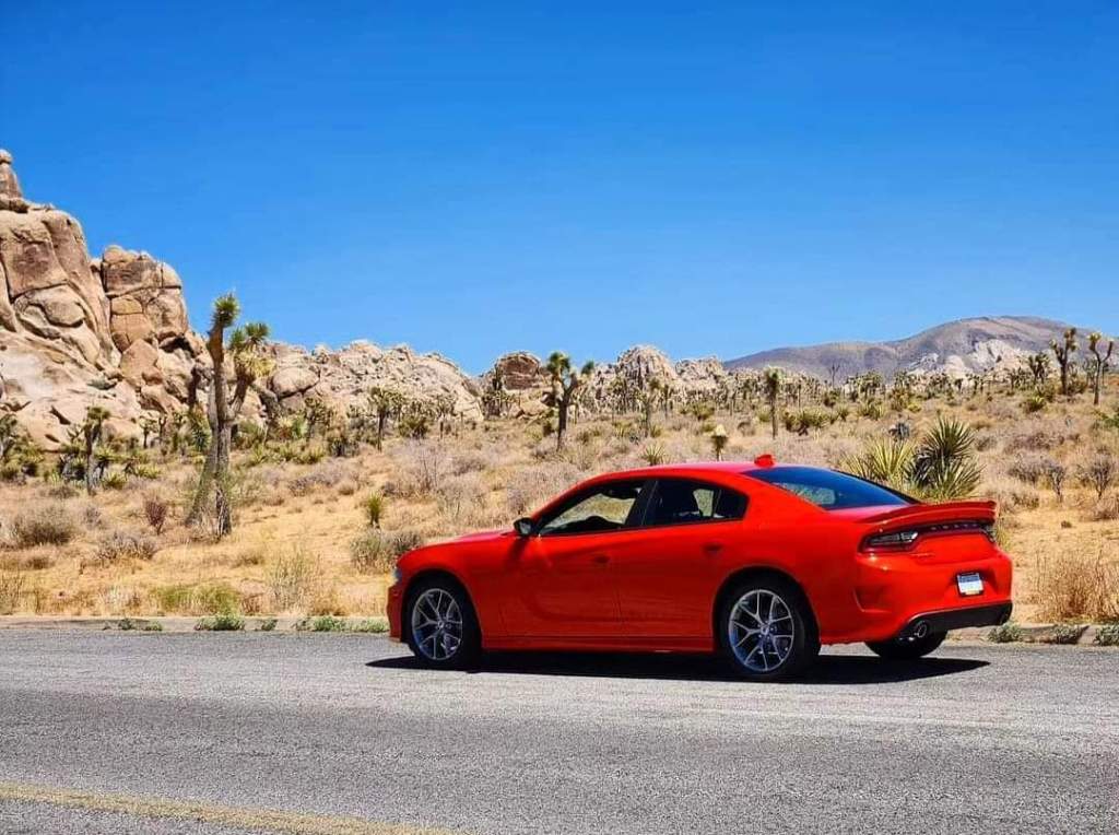
Because my dad had a scheduled conference to attend in Long Beach, my family had been planning a vacation around it for a while. But I knew that with a baby and with limited time due to scheduling around the conference, there were a few places in the area I wanted to visit that the rest of the family would not be able to visit. These were places that I had at the top of my list if I were to ever return to this part of California, so I decided to fly out a day and a half early to make it happen. I had to get out into the California deserts. The day finally came, and after landing in LAX, I grabbed a rental car and started driving east toward Palm Springs. Palm Springs is a resort town that I had heard a lot about, and it’s a central location to the places I wanted to visit without being too far from LA. So that’s where I ended up booking my hotel.
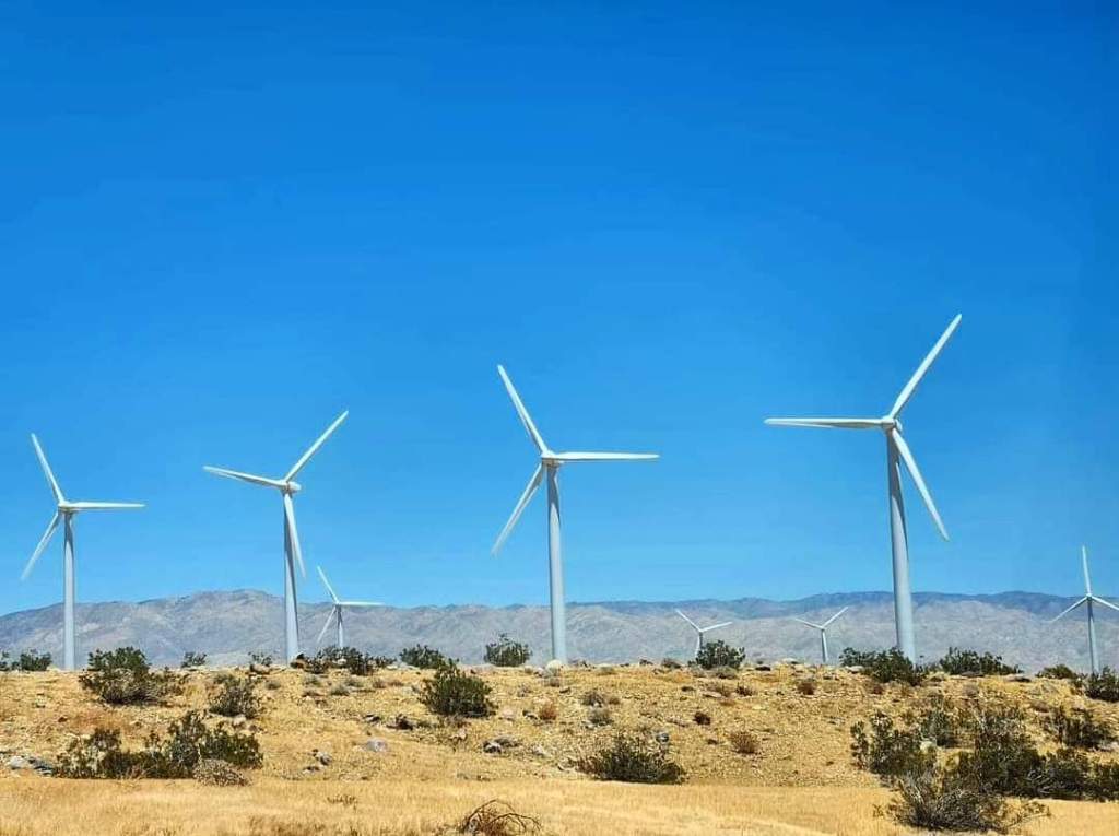
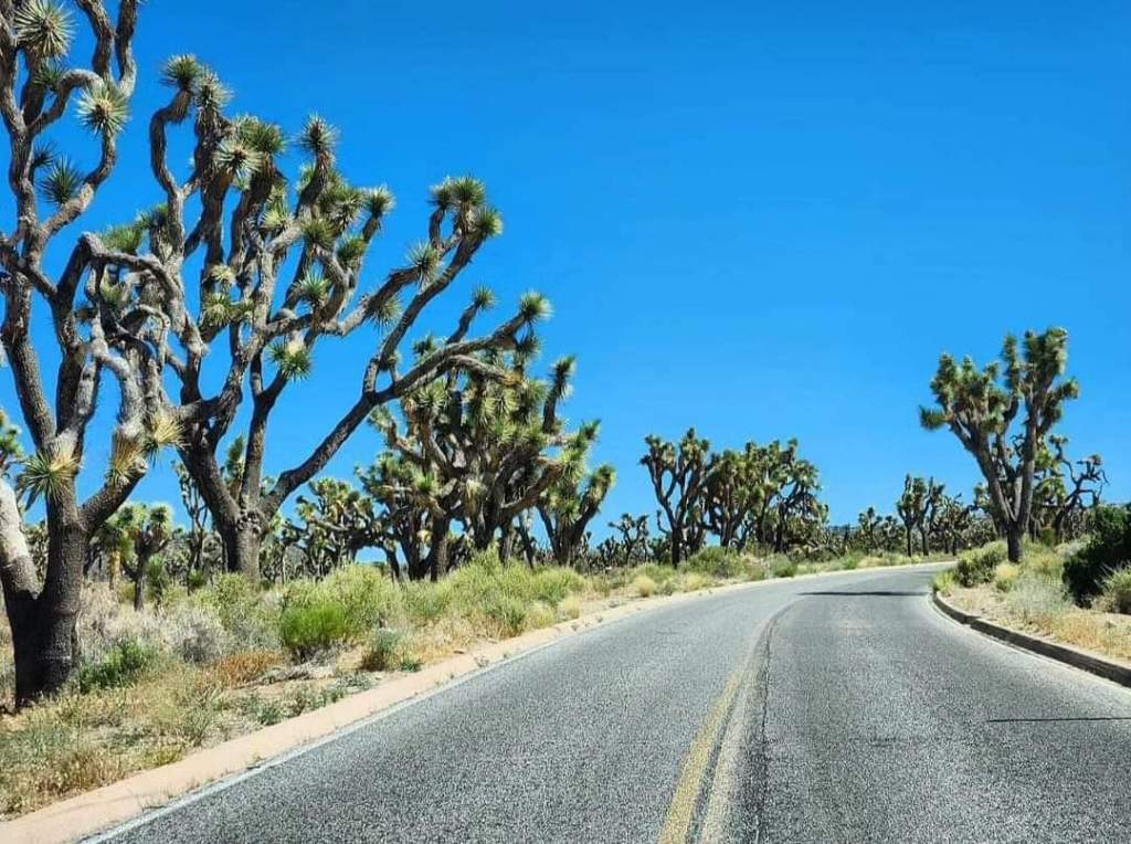
As I approached the Palm Springs area, the scenery became very beautiful. There were mountains and deserts, and then there were large open fields filled with windmills. Palm Springs is known for its wind farms, using windmills to convert wind into energy. And there are thousands of these windmills throughout the area. Another thing I noticed as I approached the area was the abundance of palm trees. Of course, with a name like Palm Springs, you’d expect to see palm trees everywhere. It was too early to check in to my hotel, so I continued to drive past Palm Springs to my first planned location: Joshua Tree. Now, Joshua Tree is actually a small town, but it’s mostly known for Joshua Tree National Park, which is located right outside the town. And both the town and adjacent national park are named after the Joshua trees that dominate this region. (If you want to see the Joshua trees, you don’t have to visit the national park as they are everywhere here). Joshua Trees, or Yucca brevifolia, are native only to the Mojave Desert of the southwestern United States. They are technically shrubs, rather than trees, but because of their tree-like appearance, they are considered by many to be trees.

Entering the park was unique. I found the visitor center which is in the middle of town and thought that the park might be in the middle of an urban area. But then I started following the signs to the park itself, and they led me several miles into the middle of nowhere! I kept driving deeper and deeper into the Mojave Desert, as civilization started to disappear, until I finally got the confirmation that I was in the right place when the “Joshua Tree National Park” sign appeared, along with a pay station to get in. From there, I continued to drive for miles through this desert with no real notable landmarks to stop at. All I could see in every direction was a desert filled with thousands and thousands of Joshua trees. And in the distance on all sides were mountains. That was it! It was a beautiful, otherworldly landscape, but it’s so inhospitable at the same time! I would occasionally pull over on the side of the road to get out and take a few pictures, but I could only stand to be outside for a few minutes at a time as the intense heat made it almost unbearable. My eyes would literally burn from the heat. Though the temperature stayed at around 89-90° F., the complete lack of any wind or shade made the heat index shoot up to levels I’m not accustomed to.
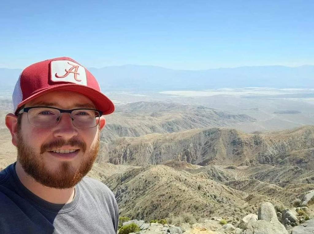
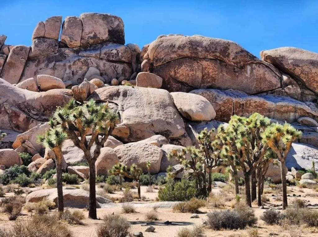
After driving for a while, I finally reached the first landmark that I could recognize: Cap Rock. I pulled over to get a few pictures and intended to hike, but the heat index had me turning around real quickly to jump back in that rental car with the A/C turned up to the max. I still wanted to hike at some point, but I knew that if I had to endure the heat for an entire hike, it had better be a hike that was worth the pain and effort. From there, I drove south, to one of the most southernmost points in the park, Keys View. Now Keys View is an overlook that gives great views of the surrounding Coachella Valley. On a clear day, you can see all the way to Mexico, which realistically isn’t very far away. The only reason Mexico can’t be seen some days is because of bad air quality, but on the day I was there, I could see forever. There was a very short but steep hike here to the overlook. It was tough in the direct sunlight, but it wasn’t completely miserable because there was actually a breeze at the top.
Dehydration started to set in quickly, but I had stopped ahead of time to stock up on water, and I couldn’t stop drinking it. I turned around and started driving back north toward Cap Rock again and then turned east to visit the main area I wanted to hike. This area is known as the Hall of Horrors. All I knew from the little research I did ahead of time is that there’s a narrow natural hallway here. That’s it. Turns out, you actually have to know where to look to find it because it’s not on an established trail. There were two large piles of boulders in front of me that resembled mountains, and the trails seems to go around these “mountains,” so I started walking, stopping what felt like every five minutes for more water and sunscreen. After making a complete two-mile loop, I started to wonder where the Hall of Horrors was. So I started making the loop a second time, being more observant of my surroundings. I then noticed that there were a lot of footprints leading off the trails, so I started following those, and they seemed to lead right to these “mountains” and then disappear.
I started following these boulders very closely, checking for narrow passageways through the “mountain” until I ran into a man and his two sons who told me they had been looking for the Hall of Horrors as well. That’s when I found out that you actually have to climb to find it! That would explain why the footprints led to the boulders and then disappeared… So I joined them to look for this natural hallway. We started climbing up boulders and squeezing through prickly plants that may or may not house venomous snakes. There’s no signal out here; otherwise, we’d just look it up online. Then we finally came across what looks like a tunnel and started climbing through it. This was definitely a tunnel that led straight through the “mountain” underneath hundreds of these giant boulders to the other side. It was cool, but it wasn’t the famed Hall of Horrors we were looking for.
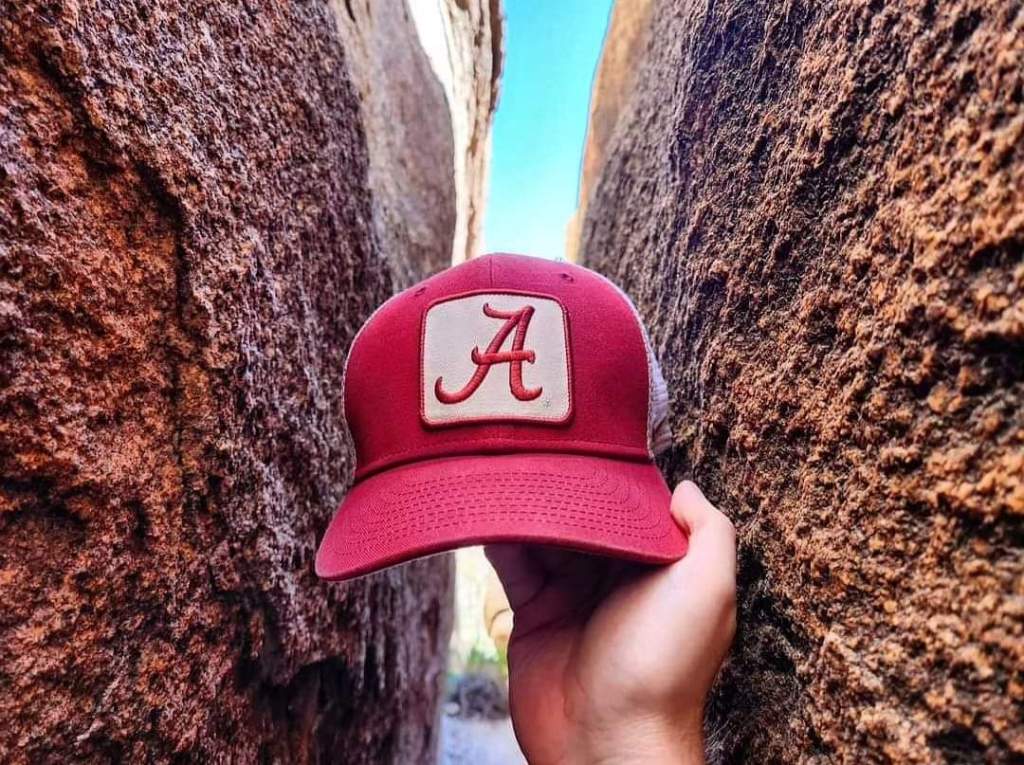
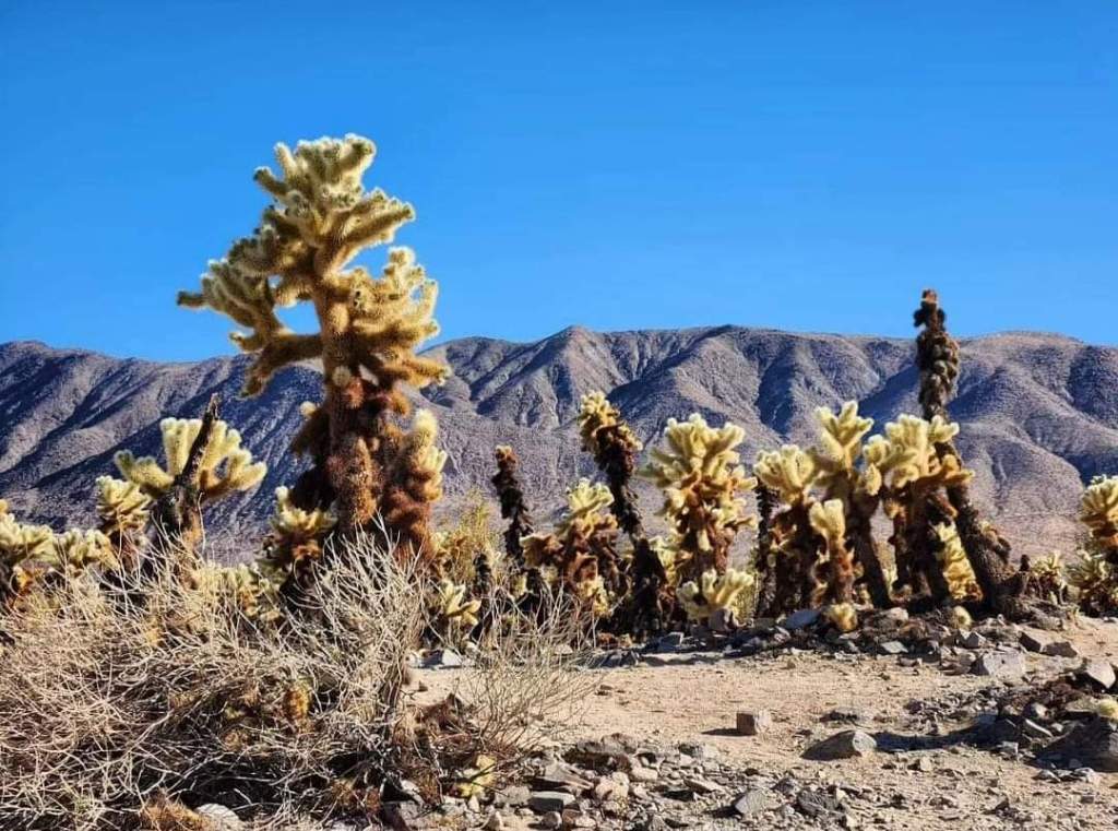
We then continued climbing rocks until we eventually split ways. Soon after, I finally stumbled upon the real Hall of Horrors while jumping from one boulder to another. It was so narrow that it was just wide enough for my hat to fit with the walls on either side touching the sides of it. I pushed my way through it for a while to get some pictures and then forced my way back out. I tried to find that one family to let them know where it is, but they were gone. After making it back to the rental car, completely exhausted, and dealing with early signs of heat stroke, I knew I was done hiking for the day. I made a couple quick stops at Skull Rock and the Cholla Cactus Garden on the Colorado Desert side of the park before leaving to head back to Palm Springs.
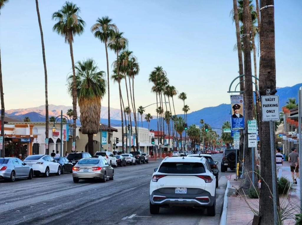
In Palm Springs, I headed to Palm Canyon Drive, the main street through downtown, to walk for a while. At this point, the sun was starting to set, and I actually got cold. The temperatures in the desert can go from one extreme to the other quickly. This city is really cool, and I loved the palm trees everywhere. I walked around for a while but finally determined I just needed to get to the hotel and settle down for the night. I made a quick stop at In-N-Out on the way to the hotel (because, California) and finally got some rest. I had plans to get up early the next morning, though, because there was a lot to fit in before meeting my family in LA later that day.
I woke up as the sun was just starting to appear on the far side of the horizon and started driving south, even deeper into the desert than I had gone in Joshua Tree. I drove through several small towns: Coachella, Indio, and Mecca, before civilization as a whole had become a distant memory. Signal came and went, and I was driving this long straight road through nothing but empty Sonoran Desert as far as I could see in either direction. This was truly the middle of nowhere! Eventually, a large body of water appeared within sight. It had bright blue water and beautiful mountains on the other side. It looks like a paradise, but I knew that this mirage was very deceiving as I had plans to explore it more on the way back to Palm Springs. At least I had a view now!

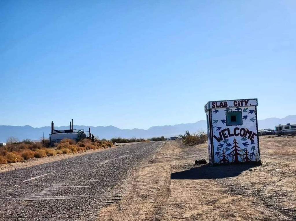
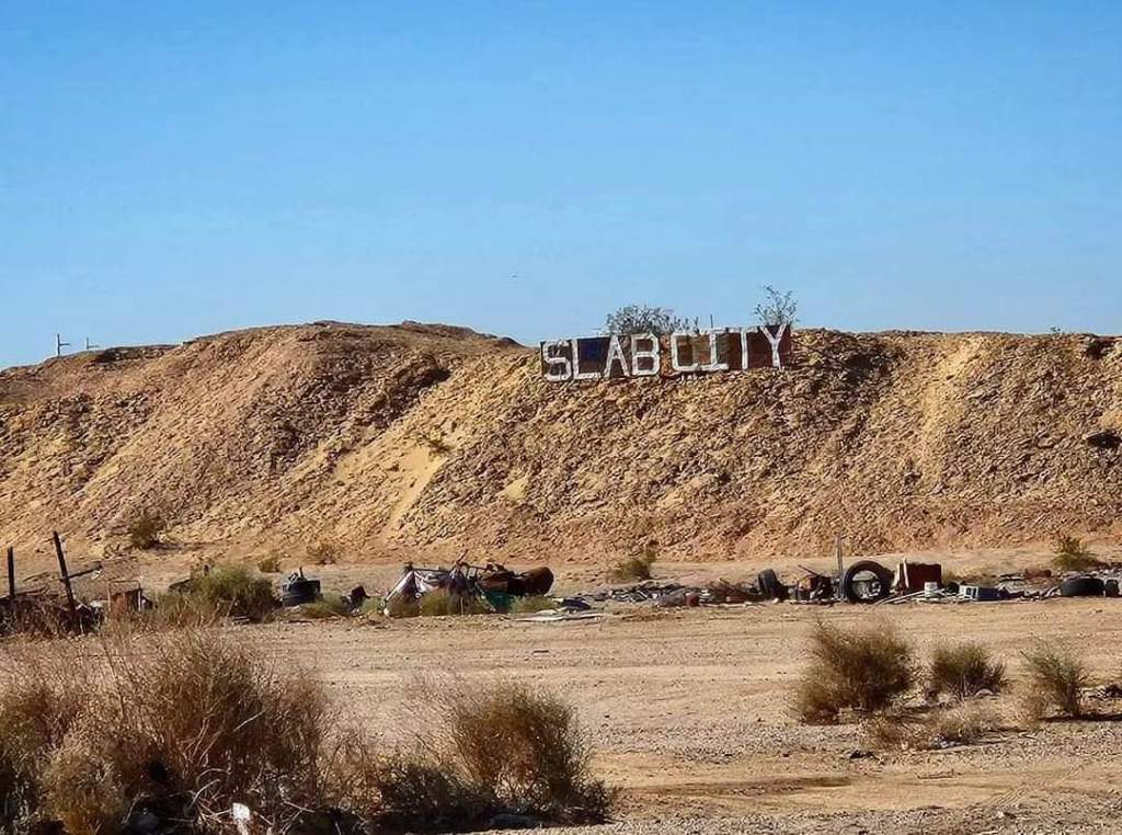
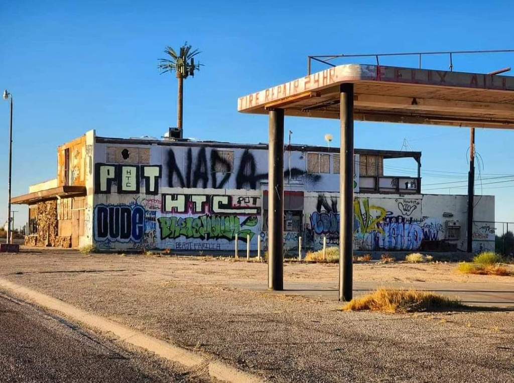
I kept driving south for what felt like an eternity, passing crumbling buildings and ghost towns along the way. Soon, I even passed a large border patrol checkpoint that I knew I’d have to stop at on the way back. Eventually, I saw the sign I had been waiting on: Niland. Niland is a small isolated community in the desert, but it almost felt like a ghost town as well. Everything was falling apart, and if you had blindfolded me and dropped me off here, I’d assume I was in another country. This did not feel like the United States at all. But I wasn’t coming all this way for Niland: I came here for an even more remote town that was even deeper into the desert, and the sketchy gravel road that leads there departs from Niland. After driving down this gravel road for a while, I eventually reached a sign that said “Welcome to Slab City.”
Slab City is a town far removed from civilization that is made up of those who consider themselves outcasts from society. It was once known as Camp Dunlap and was a training camp for the Marines during World War II. It was eventually abandoned, and several retired Marines decided to return to live there, away from the modern world. Others, mainly hippies, started finding out about this place and coming to join. Soon, a community was formed here in the middle of nowhere, where many see it as an opportunity to start a new life. Ex-convicts, drug addicts, and squatters have made their way here, hoping to leave their troubled past behind. Retirees come, looking to take advantage of the free accommodations. Snowbirds regularly set up camp here during the cooler months to escape harsh winters and then decide to never leave. And in recent years, it has also attracted more of the artistic community and political activists who believe that any form of government is bad.
Life is practically free in Slab City: there’s no rent, no taxes, and no bills. If you can handle living in 100°+ weather with no electricity or running water, then Slab City may be the place for you! It is also unique in that there are no laws. Slab City would technically fall under the jurisdiction of the nearby Niland Police Station; however, the police completely avoid Slab City and respect their desire to live without restrictions. They only come if there’s an emergency. For the most part, those in Slab City are respectful of each other. When you think of a lawless city, images of the Wild West come to mind. And in some ways, that’s correct! Slab City reminded me of the Wild West, and not just because of the landscapes. But the second you cross someone, then it REALLY becomes lawless. There are signs everywhere warning others not to approach or get shot. I’ve watched documentaries about Slab City, and if you hurt someone, there’s no limit to what that person might do in return, including burning down everything you own. And as much as some slabbers (what they call themselves) want to erase this image of the city, drugs are a major problem here.

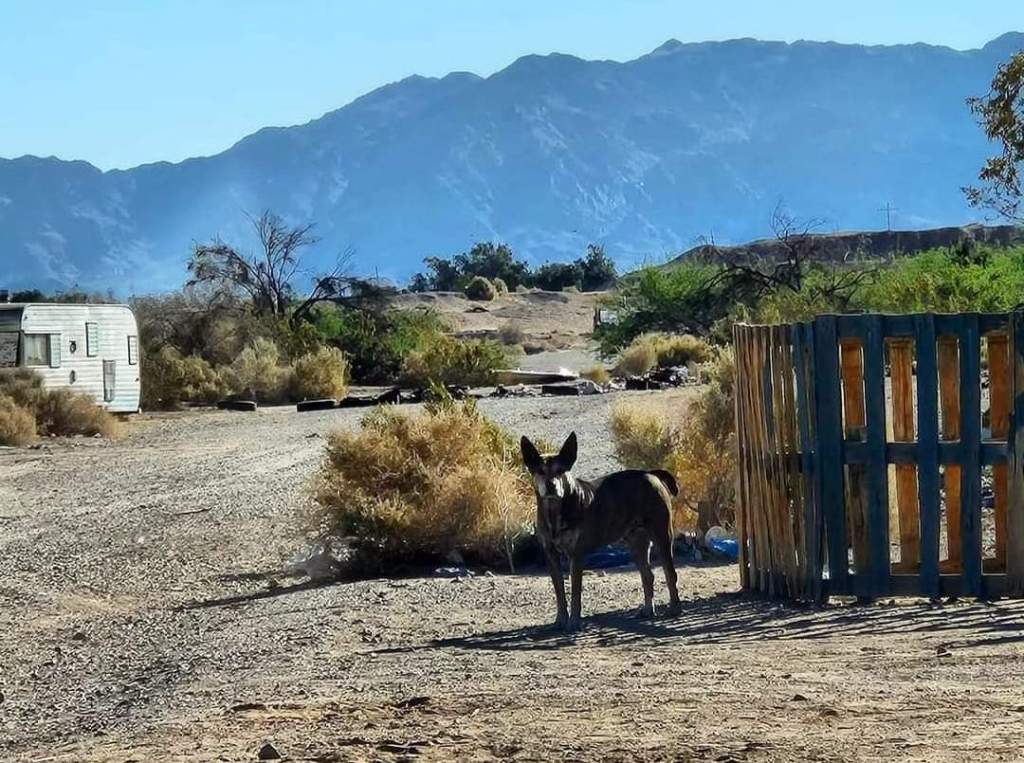
As I drove the dirt roads of Slab City, I couldn’t help but feel as if I were in a post-apocalyptic world. You watch these movies that take place after a world-ending event or nuclear holocaust, and tiny communities spring up that develop their own rules and society. That’s exactly what this place feels like. Dogs roam free and would occasionally chase me. Everyone decorates their properties with whatever they can find: trash, scrap metal, old toilets (which can’t be used since there’s no running water), and even old cars and planes. There’s no limit to what you might find in Slab City! It’s also located right next to an active military testing facility, so bombs occasionally go off in the deserts surrounding town, and if you were to cross the fences, you’d risk coming up on unexploded land mines. I did get a few unwelcoming stares as I drove through, which did kinda make me nervous at times, and I decided to start making my way back toward modern civilization. But as I was leaving town, I had to make a stop at the most iconic landmark of Slab City: Salvation Mountain.

Salvation Mountain is an art installation that was built by Leonard Knight. It’s made of hay, adobe bricks, broken glass, old car parts, tires, and thousands of gallons of paint, and it towers over the surrounding area. Painted in large letters across the front of it are the words “God is Love.” Knight was a Christian and wanted to create this monument by the entrance of Slab City to let everyone know about his beliefs. He spent 30 years constructing it, and it has since been named a historic site worth preserving. Written all over it are Bible verses, including John 3:16, as well as a version of the sinner’s prayer. Biblical imagery is found all over it, and though most slabbers are not Christian, they all appreciate the artwork on display and agree to protect the monument.
I left, feeling even more confused than I was before I came. I can’t explain this community, no matter how hard I try! It’s something that has to be seen to be believed. While I don’t get the appeal whatsoever, I understand that many do dream of coming to live in Slab City where there are no restrictions allowing you to live exactly as you want. After all, they call it “the last free place in America.” It sounds nice on paper, but after seeing it for myself, it’s not a lifestyle I have any interest in. They can’t even get mail here because the postal service doesn’t include it on any map. There are cities in the US that get their mail delivered by boat, and even some so remote that mail is delivered by donkey; yet, Slab City is so off-grid that the postal service refuses to deliver mail entirely. That’s the type of place this is.
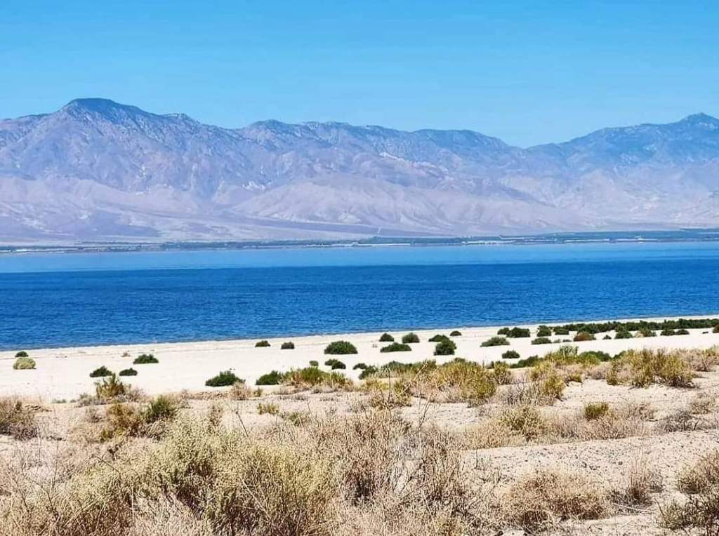
After leaving Slab City, I passed through a mandatory border patrol check where they determined that I was a legal American and wasn’t smuggling drugs or doing anything sketchy. I then started heading north back toward Palm Springs, but I had one last stop I wanted to make on the way. I mentioned that huge body of water that I passed on the way down. That isn’t just any body of water: it’s the largest body of water in California! This is known as the Salton Sea. On the outside, it’s a beautiful, bright-blue sea with desert mountains on the other side – a literal paradise! But beneath its surface lies a troubled history that you wouldn’t know from its exterior. This is the second lowest point in California, after Badwater Basin in Death Valley. In fact, it’s 227 feet below sea level. This area sits right atop the iconic San Andreas Fault and used to be an empty desert. But in 1905, a combination of flooding from the Colorado River and the mishandling of farming irrigation canals led to a disaster where this empty desert became flooded.
They expected that it would eventually evaporate, but as time went on, that never happened. Eventually, people saw the potential of the Salton Sea and started building resorts along its shores. They labeled it the “Miracle in the Desert” and started promoting tourism in the area. They even stocked the sea with fish, and reportedly, at one point, there were so many fish that you didn’t even have to have bait on your hook for them to bite. The Salton Sea tourism industry soon exploded in the 1950s as people came from all over the world to relax on the shores of this desert oasis. It was heaven on earth for many people who moved to the area to start a life in an area that had previously been considered too inhospitable. For about 20 years, this was one of the top tourism destinations in California until scientists started issuing warnings that the lake would soon become toxic. This was caused by farm runoff from nearby farms bringing salt and other toxins into the area. Being the lowest spot anywhere around, there was nowhere for the water to go, so it would just collect and then evaporate, leaving behind the salt and slowly increasing the salinity in the lake.
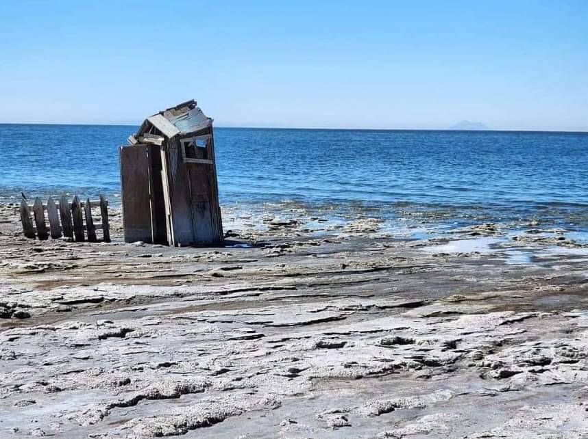
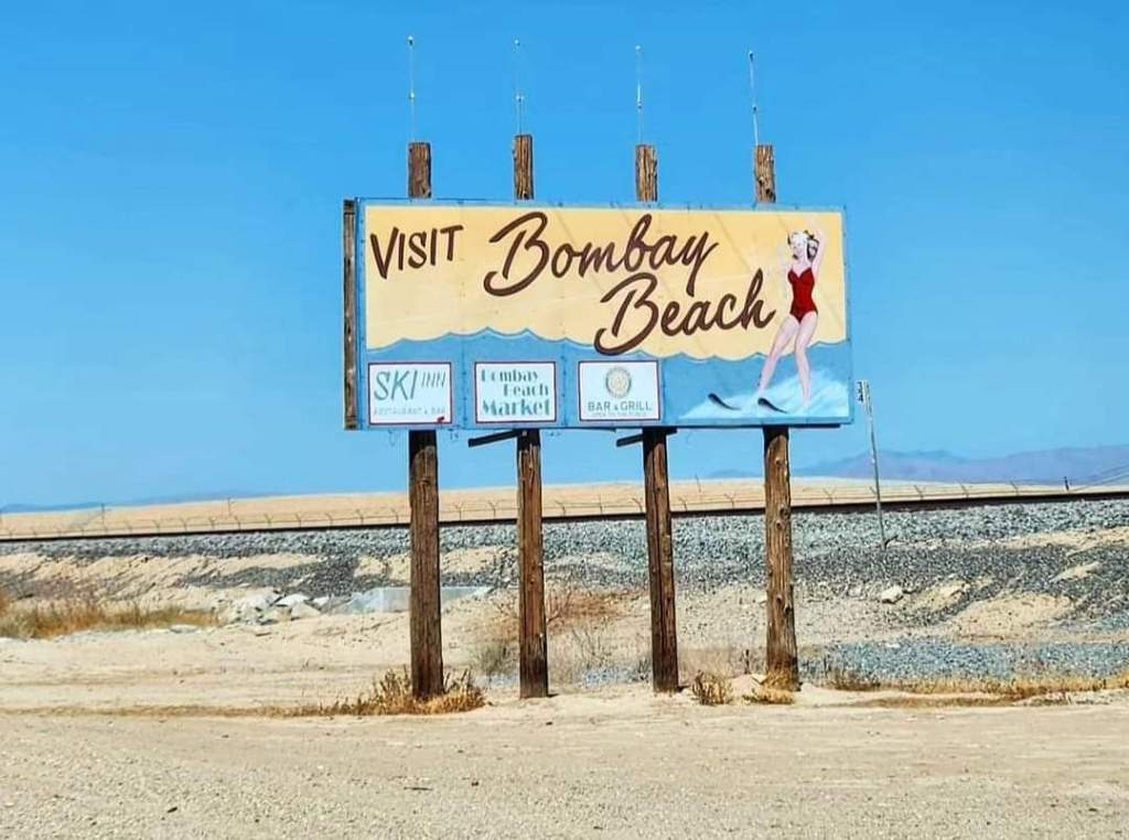
Soon, those warnings became a reality when fish and birds started dying off at alarming rates. The salinity rose to a higher level than even the oceans, and the Salton Sea became a toxic wasteland that can no longer sustain life. Resorts and entire cities were abandoned, leaving behind shells of what they once were. This has since been called the biggest environmental disaster in California’s history. As I approached the Salton Sea, and specifically the old resort city of Bombay Beach, the stench of dead fish immediately became noticeable. In fact, the beaches seen today are not made of sand but rather the crushed bones of millions of dead fish. Flies were rampant, and I had to constantly keep swatting them away. The beach was hard to walk on, as my feet started to sink into the crunchy bone/seafoam mix that gave the illusion of solid ground. Old resort decorations dotted the landscape. Slab City felt like a post-apocalyptic world where some humans survived… This feels like one where they didn’t.
I continued to drive around the Salton Sea and saw many abandoned buildings. I call it a ghost town because, for the most part, it is. But in reality, there are still a few families living amongst these ruins. I would see one house that appears to still be lived in right next to the dilapidated, graffiti-covered wreck of what was once someone else’s home. I couldn’t imagine living here! The stench alone would be enough to drive me away, but the isolation could drive anyone mad. What I later found out and thought was interesting is that the Salton Sea has more species of birds than anywhere else in the United States, other than Big Bend in Texas. This is because it’s a common stopping point for them as they’re migrating, considering there’s no water source anywhere else in the area. I guess something good really did come from this disaster… I really enjoyed exploring this once-great tourism haven known as the Salton Sea! At times, it felt like a movie, and at times, it felt like a time capsule, dropping me into the 1950s. But it was definitely interesting!

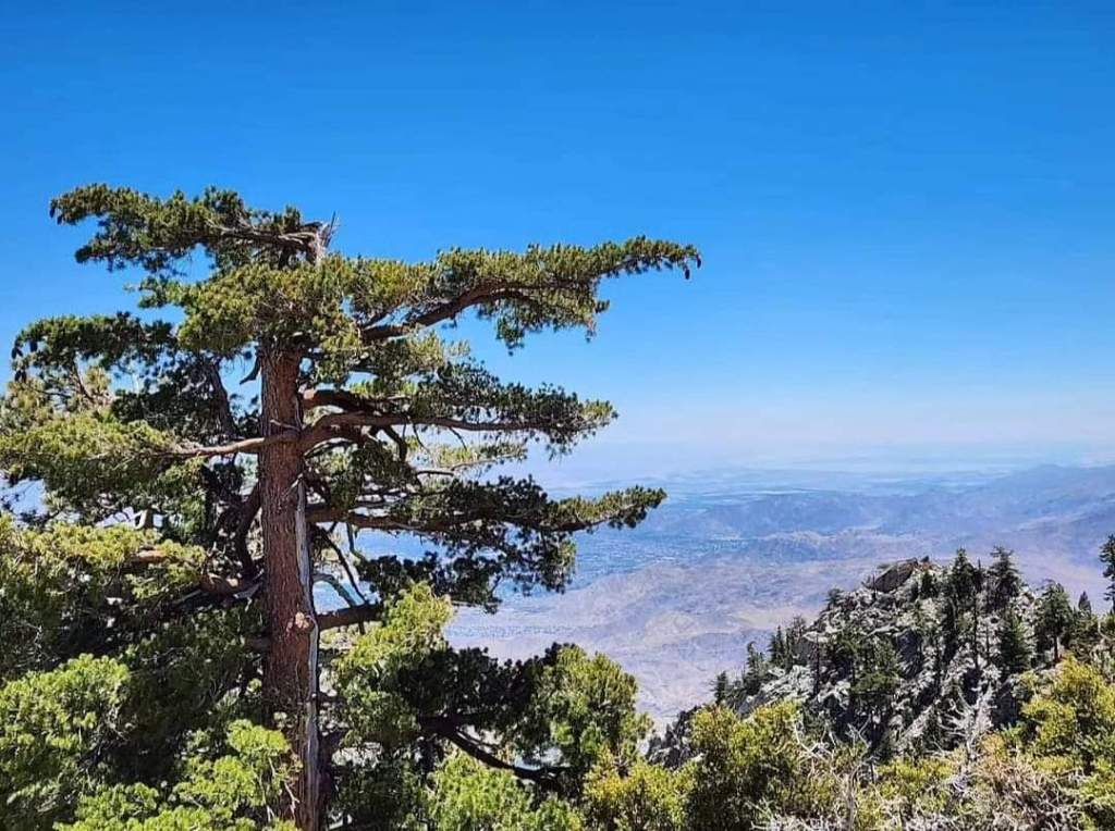
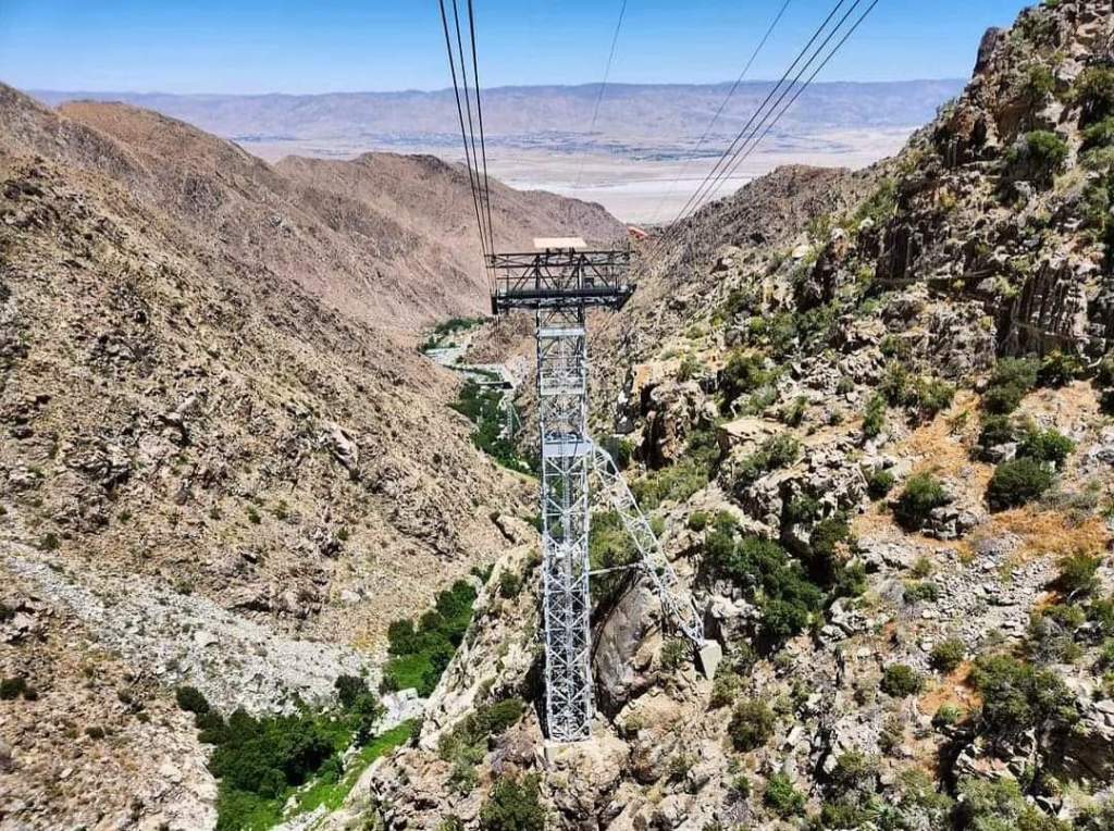
I finally made it back to Palm Springs and had time to do one last thing before heading to LAX to meet my family. I drove up into the San Jacinto Mountains to take the Palm Springs Aerial Tramway to the top. This is the largest rotating tramway in the world, and it’s pretty cool! In addition, it’s one of the largest elevation gains over such a small horizontal area in the United States. It takes guests from the low Sonoran Desert to over 8500 feet above sea level! They first cram as many people as they can into this circular capsule, and then it takes off, following the cables to the top of San Jacinto Mountain. As it ascends, the floor rotates, giving its passengers 360° views of the mountain range and surrounding deserts. The views from this were incredible! At the top, there’s a restaurant, gift shop, and many hiking trails. It was also much cooler here, and I could see snow on the tops of nearby mountains. I walked around near the main building for a while, taking in the breathtaking views of the region. I wish I could’ve spent more time here, but my family’s arrival time was quickly approaching, so it was time to take the tramway back down and head to LA.
I hope you enjoyed reading about my time in the California deserts. This is such a unique and strange part of the world that I’m so glad I had the opportunity to experience. I love visiting unique places like this and telling their stories. While I didn’t spend as much time as I’d like in Palm Springs, I do want to recommend the area as it was such a pleasant place to visit. I do plan to continue writing about California, but I can’t guarantee when that will be completed- hopefully soon. Thanks for reading!